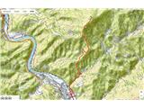
 | Dolina Sopote (Zagrad) - Kum
Kum, at 1,220 metres, is the highest peak in the Posavje Hills. As it rises above the Zasavje region, some call it the Zasavje Triglav. At the su...
3 h 10 min |
 | Hudajužna - Porezen
Porezen is a 1,630 m high mountain situated between Davča and Baška Grapa. From the summit, where a large Partisan monument stands, a beautiful v...
3 h 15 min |
 | Gornji Grad - Lepenatka (via Kal)
Lepenatka is a grassy peak located south of the 1557-metre-high Rogatec. From the summit, which has a summit register box and stamp, there is a b...
3 h |
 | Gornji Grad - Lepenatka (on ridge)
Lepenatka is a grassy peak located south of the 1557-metre-high Rogatec. From the summit, which has a summit register box and stamp, there is a b...
3 h |
 | Gornji Grad - Vivodnik (via Semprimožnik and Ovčji stan)
Vivodnik, at 1508 meters, is the highest peak of Menina planina, a plateau rising south of Gornji Grad. From the summit, which has a small observ...
3 h 30 min |
 | Gornji Grad - Vivodnik (past Strmčnik and cave Jespa)
Vivodnik, at 1508 meters, is the highest peak of Menina planina, a plateau rising south of Gornji Grad. From the summit, which has a small observ...
3 h 30 min |
| Gornji Grad - Vivodnik (via Borovnica and Ovčji stan)
Vivodnik, at 1508 meters, is the highest peak of Menina planina, a plateau rising south of Gornji Grad. From the summit, which has a small observ...
3 h 15 min |
| Gornji Grad - Vivodnik (via Borovnica and cave Jespa)
Vivodnik, at 1508 meters, is the highest peak of Menina planina, a plateau rising south of Gornji Grad. From the summit, which has a small observ...
3 h 25 min |
| Gornji Grad - Vivodnik (past Semprimožnik and cave Jespa)
Vivodnik, at 1508 meters, is the highest peak of Menina planina, a plateau rising south of Gornji Grad. From the summit, which has a small observ...
3 h 40 min |
 | Lozice - Vojkova koča na Nanosu
Vojkova koča is located on the southern edge of the high karst Nanos plateau, near Pleša. This is the prominent peak with television transmitters...
3 h |
 | Vrtovin - Kucelj (on Čaven)
Kucelj is located on the southern slopes of the Trnovski Forest, northwest of the Vipava Valley. From the bare summit, where a cross stands, ther...
2 h 20 min |
 | Stomaž - Kucelj (on Čaven) (mimo Koče na Čavnu)
Kucelj is located on the southern slopes of the Trnovski Forest, northwest of the Vipava Valley. From the bare summit, where a cross stands, ther...
3 h |
 | Vrtovin - Kucelj (on Čaven) (via Koča na Mali gori)
Kucelj is located on the southern slopes of the Trnovski Forest, northwest of the Vipava Valley. From the bare summit, where a cross stands, ther...
3 h 5 min |
 | Stomaž - Veliki Modrasovec
Veliki Modrasovec is located on the southern part of the Trnovski Forest near Predmeja. On the summit stands an old military building, which we m...
2 h 40 min |
| Vrtovin - Veliki Modrasovec
Veliki Modrasovec is located on the southern part of the Trnovski Forest near Predmeja. On the summit stands an old military building, which we m...
3 h 15 min |
 | Zreče (church of St. Egidij) - Rogla (via Gorenje)
Rogla is a peak in the middle of the eponymous ski resort. The peak is forested with a small clearing on which stands a lookout tower. The tower ...
3 h 50 min |
 | Vitanje - Basališče (Paški Kozjak)
Basališče is the highest peak of Paški Kozjak. A bench and a summit register have been placed on the summit. However, due to the forest, there is...
2 h 30 min |
 | Trnje / Dornach - Singerberg / Žingarica
Žingarica / Singerberg is a peak on the Austrian side of the Karawanks above the village of Slovenji Plajberk / Windisch Bleiberg. From the summi...
3 h 20 min |
 | Ruše - Žigartov vrh
Žigartov vrh, at 1,346 meters, is the highest peak in the eastern part of Pohorje. An "observation" tower once stood on the summit, erected solel...
3 h 15 min |
 | Log - Žigartov vrh
Žigartov vrh, at 1,346 meters, is the highest peak in the eastern part of Pohorje. An "observation" tower once stood on the summit, erected solel...
3 h 35 min |
 | Kotišina - Vošac
Vošac (1,422 m) is a peak on the southern side of Biokovo above Makarska. From the summit, where a mountain hut stands, there are excellent views...
3 h |
 | Činžat - Klopni vrh (northern path)
From the northwest, Klopni vrh closes off the lower-lying extensive plateau on eastern Pohorje. The horizontal cross-sectional area at 1300 m is ...
2 h 45 min |
| Činžat - Klopni vrh (eastern path)
From the northwest, Klopni vrh closes off the lower-lying extensive plateau on eastern Pohorje. The horizontal cross-sectional area at 1300 m is ...
2 h 45 min |
| Lovrenc na Pohorju - Klopni vrh (via Spodnji trg and on northern path)
From the northwest, Klopni vrh closes off the lower-lying extensive plateau on eastern Pohorje. The horizontal cross-sectional area at 1300 m is ...
3 h 5 min |
| Lovrenc na Pohorju - Klopni vrh (via Spodnji trg and on eastern path)
From the northwest, Klopni vrh closes off the lower-lying extensive plateau on eastern Pohorje. The horizontal cross-sectional area at 1300 m is ...
3 h 5 min |
| Lovrenc na Pohorju - Klopni vrh (via Zgornji trg and on northern path)
From the northwest, Klopni vrh closes off the lower-lying extensive plateau on eastern Pohorje. The horizontal cross-sectional area at 1300 m is ...
2 h 30 min |
| Lovrenc na Pohorju - Klopni vrh (via Zgornji trg and on eastern path)
From the northwest, Klopni vrh closes off the lower-lying extensive plateau on eastern Pohorje. The horizontal cross-sectional area at 1300 m is ...
2 h 30 min |
| Ruše - Klopni vrh (northern path)
From the northwest, Klopni vrh closes off the lower-lying extensive plateau on eastern Pohorje. The horizontal cross-sectional area at 1300 m is ...
3 h 40 min |
 | Vitovlje - Veliki Rob
Veliki Rob is a panoramic peak situated between Kuclj (1237 m) and Čaven (1185 m). From the summit, where there is a cross, there is a nice view ...
3 h |
 | Vrtovin - Veliki Rob
Veliki Rob is a panoramic peak situated between Kuclj (1237 m) and Čaven (1185 m). From the summit, where there is a cross, there is a nice view ...
2 h 55 min |
| Vitovlje - Veliki Rob (via Vitovlje Lake and over Sekulak)
Veliki Rob is a panoramic peak situated between Kuclj (1237 m) and Čaven (1185 m). From the summit, where there is a cross, there is a nice view ...
3 h 10 min |
 | Gornji Grad - Špic (via Semprimožnik)
Špic is a 1,499-meter-high peak located right next to the Dom na Menini planini mountain hut. From the summit, near which transmitters are locate...
3 h 15 min |
 | Planina Polog - Mrzli vrh above Planina Pretovč
Mrzli vrh is a well-known battlefield from the First World War. Today, the peak is recognised as an open-air museum where numerous caverns, trenc...
2 h 45 min |
 | Cerkno - Medrce (via Labinjske lehe)
Medrce is a 1,410-meter-high peak located between Porezen and Hum. From the summit, which features an old bunker, there are nice views of Kojca, ...
3 h 25 min |
 | Bistriški jarek (border crossing Muta) - Kozji vrh (at Košenjak)
Kozji vrh is a 1,383-meter-high peak located above Pernice; it is also the highest peak in the Municipality of Muta....
2 h 50 min |
| Bistriški jarek (Glasbeni dom) - Kozji vrh (at Košenjak)
Kozji vrh is a 1,383-meter-high peak located above Pernice; it is also the highest peak in the Municipality of Muta....
2 h 45 min |
| Muta (Zgornja Muta) - Kozji vrh (at Košenjak)
Kozji vrh is a 1,383-meter-high peak located above Pernice; it is also the highest peak in the Municipality of Muta....
3 h 45 min |
 | Bohinjska Bela (St. Marjeta) - Berjanca
Berjanca is a 1,264 m high peak above the namesake mountain pasture. An abandoned ski lift from the former Zatrnik ski area used to reach the sum...
2 h 55 min |
 | Oplotnica - Veliki vrh (on Pohorje)
Veliki vrh is a 1344-meter-high peak located above the RTC Jakec - Trije kralji ski slope. The highest point of the peak is in the forest, but ju...
3 h 15 min |
| Zgornja Bistrica (Center Vintgar) - Veliki vrh (on Pohorje) (via Veliko Tinje)
Veliki vrh is a 1344-meter-high peak located above the RTC Jakec - Trije kralji ski slope. The highest point of the peak is in the forest, but ju...
3 h 50 min |
| Zgornja Bistrica (Center Vintgar) - Veliki vrh (on Pohorje) (via Bistriški vintgar)
Veliki vrh is a 1344-meter-high peak located above the RTC Jakec - Trije kralji ski slope. The highest point of the peak is in the forest, but ju...
3 h 45 min |
 | Gornja Brela (Subotišće) - Bukovac
Bukovac is a 1,262 m high mountain in the northwestern part of Biokovo, directly above the village of Topići. Although not a high peak, its shape...
2 h 30 min |
 | Zlatten - Hochanger
Brucker Hochanger (Hochanger) is a 1308 m high mountain in the Gleinalpe area. Together with Rennfeld and Madereck, it is one of the three local ...
2 h 30 min |
 | Pernegg an der Mur (railway station) - Rennfeld
Rennfeld is a 1629 m high panoramic peak and the westernmost mountain in the Fischbacher Alpen group in Austria's Upper Styria.The mountain offer...
2 h 45 min |