 | Bilopolje - Sveti Ilija (Pelješac)
Sveti Ilija, also Zmijino brdo, is a 961-meter-high mountain and the highest peak of the Pelješac Peninsula. From the top, a nice view opens up o...
2 h 20 min |
 | Mošćenice - Brgud (past Kalvarija and Kremenjak)
Brgud is a scenic peak on Učka. The peak is a point of the Istrian Mountain Path. At the highest point of the peak, there is only a pile of stone...
3 h 15 min |
| Mošćenice - Brgud (along the marked trail and past Kremenjak)
Brgud is a scenic peak on Učka. The peak is a point of the Istrian Mountain Path. At the highest point of the peak, there is only a pile of stone...
3 h 10 min |
 | Mošćenice - Balin (past Kalvarija and via Brgud)
Balin is a less known peak on Učka between Brgud and Maj. From the peak, there is a beautiful view of the Kvarner, part of Istria, and the Učka r...
3 h 45 min |
| Mošćenice - Balin (on marked path and via Brgud)
Balin is a less known peak on Učka between Brgud and Maj. From the peak, there is a beautiful view of the Kvarner, part of Istria, and the Učka r...
3 h 40 min |
 | Lokavec - Kucelj (on Čaven)
Kucelj is located on the southern slopes of the Trnovski Forest, northwest of the Vipava Valley. From the bare summit, where a cross stands, ther...
3 h 15 min |
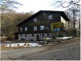 | Podnanos - Vojkova koča na Nanosu (Pod zatrepom)
Vojkova koča is located on the southern edge of the high karst Nanos plateau, near Pleša. This is the prominent peak with television transmitters...
3 h 50 min |
 | Sevnica - Lisca (via Zajčja Gora and Skalce)
Lisca is a panoramic peak located north of Sevnica. From the summit, where a meteorological radar station stands, there are fine views of Posavsk...
2 h 55 min |
| Sevnica - Lisca (via Zajčja Gora and on Pastirčkova pot)
Lisca is a panoramic peak located north of Sevnica. From the summit, where a meteorological radar station stands, there are fine views of Posavsk...
3 h |
| Sevnica - Lisca (over Zajčja Gora and past Sveti Jošt)
Lisca is a panoramic peak located north of Sevnica. From the summit, where a meteorological radar station stands, there are fine views of Posavsk...
3 h |
| Railway station Sevnica - Lisca (From Sevnica over Zajčja Gora to Lisca)
Lisca is a panoramic peak located north of Sevnica. From the summit, where a meteorological radar station stands, there are fine views of Posavsk...
2 h 50 min |
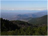 | Malovše - Veliki Rob
Veliki Rob is a panoramic peak situated between Kuclj (1237 m) and Čaven (1185 m). From the summit, where there is a cross, there is a nice view ...
3 h 35 min |
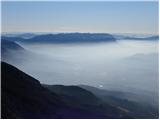 | Malovše - Kucelj (on Čaven)
Kucelj is located on the southern slopes of the Trnovski Forest, northwest of the Vipava Valley. From the bare summit, where a cross stands, ther...
3 h |
| Breg - Lisca (past Sveti Lovrenc)
Lisca is a panoramic peak located north of Sevnica. From the summit, where a meteorological radar station stands, there are fine views of Posavsk...
3 h 25 min |
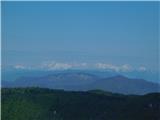 | Breg - Veliko Kozje
Veliko Kozje is a mountain that rises steeply above the left bank of the Savinja River, descending more gently towards the Sava River. The highes...
3 h 15 min |
 | Radeče - Nebeška gora
Nebeška gora is the highest peak of the Radeče ob Savi municipality. At the summit there is a logbook, stamp, luck bell, and some benchesall plac...
2 h 45 min |
 | Radeče - Kum
Kum, at 1,220 metres, is the highest peak in the Posavje Hills. As it rises above the Zasavje region, some call it the Zasavje Triglav. At the su...
3 h 45 min |
 | Radeče - Sveta Marija (Ključevica)
The Church of St. Mary is located on a hill called Ključevica, which rises 1,067 meters above sea level. From the partly vegetated summit, there ...
3 h 10 min |
 | Zidani Most - Veliko Kozje (mimo Gašperjeve koče)
Veliko Kozje is a mountain that rises steeply above the left bank of the Savinja River, descending more gently towards the Sava River. The highes...
2 h 40 min |
 | Zidani Most - Kum (through Škratova dolina (old path))
Kum, at 1,220 metres, is the highest peak in the Posavje Hills. As it rises above the Zasavje region, some call it the Zasavje Triglav. At the su...
3 h |
| Zidani Most - Sveta Marija (Ključevica)
The Church of St. Mary is located on a hill called Ključevica, which rises 1,067 meters above sea level. From the partly vegetated summit, there ...
2 h 30 min |
| Zidani Most - Kum (through Škratova dolina (new path))
Kum, at 1,220 metres, is the highest peak in the Posavje Hills. As it rises above the Zasavje region, some call it the Zasavje Triglav. At the su...
3 h 5 min |
| Zidani Most - Nebeška gora (eastern path)
Nebeška gora is the highest peak of the Radeče ob Savi municipality. At the summit there is a logbook, stamp, luck bell, and some benchesall plac...
2 h 40 min |
| Zidani Most - Nebeška gora (western path)
Nebeška gora is the highest peak of the Radeče ob Savi municipality. At the summit there is a logbook, stamp, luck bell, and some benchesall plac...
2 h 45 min |
| Hrastnik (Podkraj) - Kum (via Matca)
Kum, at 1,220 metres, is the highest peak in the Posavje Hills. As it rises above the Zasavje region, some call it the Zasavje Triglav. At the su...
2 h 55 min |
| Gojače - Kucelj (on Čaven)
Kucelj is located on the southern slopes of the Trnovski Forest, northwest of the Vipava Valley. From the bare summit, where a cross stands, ther...
2 h 55 min |
| Gojače - Veliki Rob
Veliki Rob is a panoramic peak situated between Kuclj (1237 m) and Čaven (1185 m). From the summit, where there is a cross, there is a nice view ...
3 h 30 min |
 | Zagorje ob Savi - Kum (via Završje and Čebulova dolina)
Kum, at 1,220 metres, is the highest peak in the Posavje Hills. As it rises above the Zasavje region, some call it the Zasavje Triglav. At the su...
3 h |
| Dolina Gračnice (Blatnik) - Lisca
Lisca is a panoramic peak located north of Sevnica. From the summit, where a meteorological radar station stands, there are fine views of Posavsk...
3 h 40 min |
| Gračnica Valley (Blatnik) - Veliko Kozje
Veliko Kozje is a mountain that rises steeply above the left bank of the Savinja River, descending more gently towards the Sava River. The highes...
3 h 5 min |
| Hrašče - Vojkova koča na Nanosu (via Brižnik)
Vojkova koča is located on the southern edge of the high karst Nanos plateau, near Pleša. This is the prominent peak with television transmitters...
3 h 10 min |
| Hrašče - Vojkova koča na Nanosu (past troughs)
Vojkova koča is located on the southern edge of the high karst Nanos plateau, near Pleša. This is the prominent peak with television transmitters...
3 h 10 min |