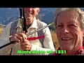
 | From Casera Pramosio to Monte Avostanis
19. 09. 2022 22:31:50
18-09-2022: Route 9.3 km Elevation gain 741 m. Cima Avostanis is located northeast of Creta di Timau, on the border with Austria. The route starts from Casera Pramosio. From the casera, ascend the CAI 402 forest track to Lago di Avostanis and Casera Pramosio Alta, passing Casera Malpasso and Casera... |
 | To South Moiazza via Ferrata Costantini
25. 09. 2022 12:29:33
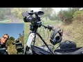
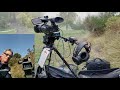
23-07-2006: From my 2006 video archive.The Costantini via ferrata is rightly considered one of the most difficult, longest, and most famous routes in the Dolomites. The average traversal time, starting from Rifugio Carestiato with return to Passo Duran, is about 9 hours. This itinerary overcomes an ... |
 | Heroes' Forest Loop
17. 03. 2022 14:27:11
16-03-2022: Start: Rifugio Bocchette 1322 mElevation gain: 300 m+Length: 10.8 kmThe trail is divided between nature, art, and history, and is of great interest regarding the Great War. It is not the classic trail that recounts the War with historical units and such, but this itinerary born in 2014 a... |
 | Monte Cumieli Ring from Ospedaletto
21. 03. 2022 08:19:58
20-03-2022: Length: 9 km Elevation gain: 440 m. Leaving the car, start the hike along the dirt road closed to cars continuing north through copses and clearings. Beautiful March bloom, almost entirely centered on the alternation between pale yellow primroses and violet periwinkle, trinity herb and c... |
 | Farra di Soligo between history and nature
30. 03. 2022 00:33:27
29-03-2022: Elevation gain: mt. 450 Route: Km 8.500. The hike will take us to visit unexpectedly wild places a stone's throw from the foothill villages, where important strategic settlements existed since antiquity. Start west of Farra di Soligo at the intersection of via Faverei and via San Nicolò.... |
 | Troi da li Fous and Col Maior from Navarons
7. 04. 2022 22:51:02
07-04-2022: Troi da li Fous and Col Maior from Navarons. Route Km. 9.100 elevation gain 560 m.We follow the indications of the terracotta plaques for Troi da li Fous. We follow them leaving the village along a narrow dirt road heading north ending at a clearing. A little further on, we find ourselve... |
 | Ascent to Marmolada
29. 09. 2022 20:58:24
17-07-2005: From my 2005 video archive.The Marmolada (called the Queen of the Dolomites), is a mountain group of the Eastern Alps (Dolomites) on the border between the province of Trento and the province of Belluno, the highest of the Dolomites itself, reaching the maximum altitude with Punta Penia ... |
 | Ascent to Vezzana
3. 10. 2022 22:09:36
26-08-2007: From my 2007 video archive. (Filmed with Hitachi VM-E 565 LE camcorder). Ascent to the summit of Vezzana mt. 3192, also touching the summit of Monte Nuvolo mt. 3075, two beautiful peaks located in the Pale di San Martino Group.... |
 | Milies: Monte Zogo Ring
21. 04. 2022 11:40:11
20-04-2022: Elevation gain 700 m Route length 14.600 km. From the center of Milies we continue on foot along the asphalt road until reaching Valpiana at a junction where the dirt section begins. At the junction continue left, if deciding to do the ring clockwise, along the houses of Val Piano on a t... |
 | Polcenigo: Livenza Springs
23. 04. 2022 10:27:25
19-04-2022: The Livenza springs are located at the foothills of Cansiglio-Cavallo. The abundant annual rainfall and the characteristics of the limestones make this formation highly karstifiable and karstified with spectacular morphologies. The massif is characterized by an almost absent surface hydr... |
 | Monte Orsere Ring via Narcisi Trail
20. 05. 2022 01:35:58
19-05-2022: Tour of Monte Orsere Route Km. 7.400 Elevation gain mt. 515Among the peaks that make up the large Cesen area, Monte Orsere is certainly of interest. After a grassy ridge with extraordinary narcissus blooms, we reach the summit at 1496 m, where it is possible to contemplate the 360° panor... |
 | Monte Canidi Ring from Passo del Praderadego
27. 05. 2022 00:31:55
26-05-2022: Pleasant hike from Passo del Praderadego along the ridges of Monte Canidi and Col de Varnada, a ring of about 14 km and an elevation gain of 600 m.... |
 | From Pian delle Streghe to Cimone di Crasulina
17. 10. 2022 16:09:41
16.10.2022: Elevation gain mt. 640 Route km. 11.400.Arrived at Cercivento we take the road to Pian delle Streghe which starts beside the Pieve di San Martino which climbs asphalted and narrow for 10.5 km, past the beautiful huts and the Ghiaton fountain we pass Pian delle Streghe to where the asphal... |
 | From Passo Falzarego to Cima Croda Negra and Monte Nuvolau
21. 10. 2022 00:29:50
19-10-2022: Beautiful CAP outing from Passo Falzarego to the summit of Croda Negra and Monte Nuvolau. Monte Nuvolau is a mountain in the Dolomites, located in the Nuvolau Group which is one of the smallest in the Dolomites. It is located between Passo Falzarego to the northwest and Passo Giau to the... |
 | Moggesse Ring from Campiolo
9. 06. 2022 03:42:30
08-06-2022: Route Km. 13,500 Elevation gain mt. 713. Stavoli (Stai di Muec), Moggesse di là and Moggessa di quà are three villages in the municipality of Moggio Udinese; Stavoli and Moggessa di quà are reachable only on foot while Moggessa di là is reached by a forest road connecting Grauzaria, Borg... |
 | A Day at Lake Bled
17. 06. 2022 05:03:35
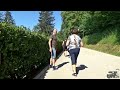
15-06-2022: Lake Bled is a glacial lake located in the northwest area of Slovenia, precisely in the town of Bled. Surrounded by mountains and with an island in the center, Slovenia's only one, it is no coincidence that it attracts many tourists every year. It will be the castle on the cliff, or perh... |
 | From Rocca d'Arsiè to the Ghost Village of Fumegai
29. 06. 2022 21:49:42
29-06-2022: Route Km. 9 Elevation gain mt. 350. The village of Fumegai is a short distance from Lake Arsié (or Lago del Corlo), which rises at about 550 meters altitude, whose inhabitants were completely dedicated to agriculture and pastoralism. Fumegai has only 7 houses, all close and abandoned. He... |
 | From Passo del Brocon to Monte Coppolo
4. 07. 2022 13:17:39
03-07-2022: Ascent to Monte Coppolo from Passo del Brocon. Route Km. 8.800. Elevation gain mt. 430. It is the mountain of Lamòn, the bean village, but it is reached much more easily from Passo Brocon. Two-faced mountain equipped with three distinct summits, Coppolo with its long ridge marks the boun... |
 | The Ponale Road Lake Ledro Tenno Canal and Lake (Day 2)
23. 10. 2022 10:10:59
12-10-2022 From Riva del Garda via Strada del Ponale to Lake Ledro and Canale di Tenno with its lake.... |
 | From Varone Waterfall to Malcesine Castle
23. 10. 2022 21:38:01
13-10-2022: Visit to Varone Waterfall, the giants' potholes in Torbole and finally Malcesine Castle.... |
 | From La Thuile to Rifugio Deffeyes (Day 1)
18. 07. 2022 20:45:30
15-07-2022: DescriptionFrom the La Joux parking lot, follow the signs for Rifugio Deffeyes marker 2, crossing a wooden bridge almost immediately. Begin climbing in the woods, reaching the first waterfall (mandatory detour). After numerous turns in the woods, exit into a clearing above the stream wit... |
 | Loop of Passo Alto from Rifugio Deffeyes and Testa del Rutor (Day 2)
19. 07. 2022 12:44:23
16-07-2022: From the refuge continue on the underlying trail, losing a few meters of elevation. There are 3 options: 1) Take the low trail to Laghi del Rutor and attack the glacier at its front at Lago Superiore (2584 m). Surely the longest way. 2) Follow the entire trail that passes high above the ... |
 | Ring of Monte Costa from Campon
27. 07. 2022 04:59:43
24.07.2022: Route km 15.500 elevation gain Mt. 500. Campon 1038m - Casera Mezzomiglio 1291m - Monte Costa 1375m. Campon 1038m.... |
 | Val delle Mure between History and Malghe
4. 08. 2022 01:35:19
03-08-2022: Relaxing and scenic loop in Val delle Mure Grappa Massif,without a fixed destination.Route Km. 11,500 Total Positive and Negative Elevation Mt. 475... |
 | From Pian de le Femene to Col Visentin
31. 10. 2022 17:50:06
30-10-2022: Pian de le Femene Col Visentin: Distance km 15.740 Elevation Gain Mt. 990.Here is one of the most famous itineraries of the entire prealpine arc, with the goal of Col Visentin at 1763 m elevation. It is so to speak the "western version" of the equally famous Sentiero delle Creste that s... |
 | Combai The Verdiso Road
1. 11. 2022 19:57:40
01-11-2022: The starting point of the excursion on the Strada del Verdiso is the Combai parking lot. Here via pedestrian crossing we reach the center and take left Via Vecchia for Miane from where the walk begins. Trail marker no. 1025 will be the track to follow for the entire route. On a path in t... |
 | Mount Amariana
18. 08. 2022 00:10:52
17-08-2022: Route of 8.600 Km, Elevation Gain 1000 Mt.Mount Amariana (La Mariane in Friulian - 1,906 m a.s.l.) is the mountain dominating Amaro (Carnia), with its typical pyramidal shape: from the summit, there is a very wide panorama over all the Carnic and Julian Alps, the Friulian plain up to the... |
 | Palon della Cavallara Loop
22. 08. 2022 00:06:48
21-08-2022: Route Km. 6.500 Elevation mt. 588. Continue on the white road to Malga Cavallara and then to the stables. From here take trail no. 382 towards Timoncello (flat top with trees visible on the left). The trail climbs first through steep pasture, then sparse wood to the 1913m marked saddle. ... |
 | Caorle Street Piano Festival at the piano (Jacopo Gressini)
31. 08. 2022 17:33:11
30-08-2022: Street Piano FestivalStreet Piano Festival returns to Caorle's historic center from August 26 to 30.Some pianos will be placed in the most beautiful and evocative places of Caorle creating a unique atmosphere thanks to some professional pianists who will make music vibrate in the air. Be... |
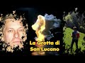 | From Col di Prà to Grotta di San Lucano
6. 09. 2022 23:45:41
04-09-2022: Route Km. 15.300 Total active and passive elevation Mt. 1421 Not many know this remote corner, guardian of an over-millennial history linked to the mystical figure of a bishop named Lucano. San Lucano valley, in Taibon Agordino municipality, is in itself an earthly paradise. Though sever... |
 | Primiero Val Canali and Prati del Cimerlo
12. 11. 2022 09:20:05
11-11-2022: Fairly easy, pleasant and highly rewarding route. Recommended especially on hot days because most of the path is shaded. It runs at the base of the southern slopes of Cimerlo, rich in characteristic ridges, pinnacles and bell towers. From Chalet Piereni follow the panoramic road towards ... |
 | Forchia Navantes Loop from Curiedi
18. 11. 2022 13:37:02
17-11-2022: Begin ascending the track heading towards a wide saddle. Just below it, leave the main dirt road to take the marked mule track leading in a few meters to the spacious Duron saddle (1080 m) between Monte Duron and Monte Diverdalce. Continue left, ascending without obligatory path the gras... |
 | Ascent to Monte Pelmo
26. 09. 2022 20:16:44
03-09-2006: Ascent of Pelmo from my 2006 video archive.Monte Pelmo is an imposing massif that closes Val di Zoldo to the north and rises astride Val Fiorentina and Boite valley. It is 3,168 m high (recently remeasured at 3,159 m) and flanked to the west by a lower but no less imposing core (Pelmetto... |
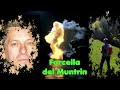 | From Casasola to Forcella del Muntrin
28. 09. 2022 21:43:37
28-09-2022. Route: 7.900 km Elevation gain: 870 mFrom Casasola, at the end of the village is our starting point, 430m, here begins trail 973 heading towards the ridges. We don't stay long on the marked groove, from a small chapel a bit higher we venture into the unknown to the right following a fai... |
 | Ascent to Grossglockner
5. 10. 2022 00:04:50
22-23-07-2007: From my 2007 video archive. (Filmed with Hitachi VM-E 565 LE camcorder). With its 3798 m, Grossglockner is not only the highest mountain in Austria, but also one of the highest peaks in the Eastern Alps. Located on the border between Carinthia and East Tyrol, it is the highest peak of... |
 | Bigontina and Perdonanze Ridges
1. 12. 2022 23:37:57
01-12-2022: CAP hike on the Bigontina and Perdonanze ridges in the Prealpi Vittoriesi.... |
 | Monte Avena Loop from Passo Croce d'Aune
6. 12. 2022 23:38:34
06-12-2022: Monte Avena Loop from Passo Croce d'Aune... |
 | Croda Longa Loop from Borgo Piccin
22. 10. 2022 10:49:45
20-10-2022: Distance: 7.17 km Elevation gain D+: 520 m The impervious southern slope of Col Visentin features an impressive ramification of old trails covering the area between Revine and Sella di Fadalto. They are hard trails due to the steepness and decidedly rugged environment. This week's pro... |
 | Arco Castle and Riva del Garda (Day 1)
22. 10. 2022 18:11:13
11-10-2022 In the surroundings of Riva del Garda.... |
 | From La Casera to Rifugio Col Visentin
26. 10. 2022 21:49:20
26-10-2022: Route of 11.500 km and total elevation gain of 540 m. (From minute 2'20'' to minute 5' no audio due to copyright, sorry to my friends.)Col Visentin with Rifugio Visentin 5° Artiglieria Alpina was the destination of this late October hike. Starting point of our hike to Col Visentin is the... |
 | From Passo San Pellegrino to Punta d'Allochet
28. 10. 2022 16:39:27
27-10-2022: Route of 11.100 km. Total elevation gain 814 m.Passo San Pellegrino is an alpine pass in the Dolomites at 1,918 m a.s.l.Anciently the pass was simply called monte di alocco (mont de aloch), where the term aloch or alochet indicated the vast meadows where livestock still graze today. The ... |
 | Loop between Moliane and Cartizze from San Pietro di Barbozza
16. 12. 2022 16:25:30
15-12-2022: A hike entirely dedicated to wine, in one of Italy's most famous wine areas. Start from San Pietro di Barbozza, near the parish church, then follow Via Cima where roadside are displayed fun artistic works built with Piave pebbles, works by Angelo Favero aka Zoe. At the SantEurosia chapel... |
 | Circumnavigation of Monte Bastia from Campo di Alano
21. 12. 2022 22:00:09
21-12-2022: Climbing from Campo you reach the remains of Borgo di San Daniele; once a flourishing and vital village, especially thanks to its little church. We then arrive at Forcella San Daniele; an ancient crossroads that connects three villages: Alano, Campo, Schievenin. We notice how the trail g... |
 | Trail to Cadini del Brentaz
7. 11. 2022 00:26:28
06-11-2022: Green Loop (San Zenon Cadini del Brentaz)The trail develops in a loop from the village of San Zenon (Sospirolo). Along the path alternating short asphalted sections, mule tracks and forest we find green signage. The Cadini del Brentaz, if there is water, are a spectacle not to be missed... |
 | The Dint Trail
10. 11. 2022 22:42:33
10-11-2022: The Dint Trail.Once parked, follow the lake shore towards the dam for about 300m until finding on the left the sign marking the trail start (Dint Trail Sign). Follow the comfortable trail that begins to climb gently up the mountain side. The trail immediately leads into the suggestive be... |
 | Tour of the Malghe from Casera Coda di Bosco
26. 11. 2022 17:32:53
24-11-2022:... |
 | Loop of Monte Bernardia from Villanova delle Grotte
1. 12. 2022 00:36:28
30-11-2022: From the cemetery of Villanova delle Grotte, take the road to Chialminis but immediately leave it to turn left descending among the houses. Now carefully follow the white-red markers that first on track and then on trail descend to join the asphalted road leading to Borgo Vigant. Reachin... |
 | Jesolo Piazza Milano Stone Nativity
29. 12. 2022 16:26:49
28-12-2022: Jesolo City of Christmas... and nativity: in Piazza Milano, one can admire the Stone Nativity, made with statues handcrafted by the Jesolo sculptor cav. Sergio Dalla Mora, famous for his large marble sculptures, it is a reproduction of the nativity in stone framed by a magical landscape ... |
 | Nativity Scenes in Treporti Lagoon and Lio Piccolo
29. 12. 2022 21:18:24
28-12-2022: The nativity scene by Francesco Orazio, 52 years old from Cavallino-Treporti, fruit vendor by profession, was instead created in the Pordelio canal, at the height of the Zanetti restaurant. It is a Nativity that the craftsman has been making for ten years as the culmination of a passion ... |
 | Loop of Casera Beta or del Guardian from Cordellon
7. 12. 2022 23:48:35
07-12-2022: Cordellon - trail 5 - Casera Beta (Casa del Guardian)From the hamlet of Cordellon, an ancient village isolated by very deep valleys (Val d'Arc and the Rimonta stream gorge) and positioned on a fascinating natural terrace towards Valbelluna, the Piave river and the imposing Pizzoch. Past ... |