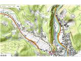
 | Podgrad - Debenji vrh (via old castle Osterberg)
Debenji vrh, also known as Debni or Deben vrh, at 530 m, is the highest peak of Kašeljski grič, a small range located between the Besnica valley ...
50 min |
 | Ribnik - Debenji vrh
Debenji vrh, also known as Debni or Deben vrh, at 530 m, is the highest peak of Kašeljski grič, a small range located between the Besnica valley ...
40 min |
 | Dragomer - Vrh (Debeli hrib)
Vrh is a 540-meter-high hill on the Debeli hrib ridge, which lies between the Ljubljana Marshes and the Horjulščica river valley. The view from t...
40 min |
 | Vrzdenec - Gradišče above Žažar (via Plesa)
Gradišče above Žažar is a panoramic peak topped by a large wooden cross. From the summit, which also has a summit logbook with a stamp, there is ...
45 min |
 | Želimlje - Castle Stari grad above Želimlje
Stari grad above Želimlje is a forest-covered peak located between Želimlje and Rogatec above Želimlje....
50 min |
 | Podgrad - Španov vrh (Besnica)
Španov vrh is a 559-meter-high peak above the Besnica stream valley between Podgrad and Besnica. Just below the summit runs the Borovničeva hikin...
50 min |
 | Bad Gleichenberg (Eichgraben Weg) - Bschaidkogel (via Mühlsteinbruch)
Bschaidkogel is a 563-meter-high mountain located northeast of the town of Bad Gleichenberg....
50 min |
 | Povodje - Veliki vrh (Rašica)
Veliki vrh is a 568-meter-high hill located west of Vrh Staneta Kosca. Just a few meters below the otherwise forested summit lies a small abyss n...
45 min |
 | Ruše - Lorbekov vrh
Lorbekov vrh is a 578-meter-high peak located southwest of Ruše. The summit lies in the forest, but from a meadow just below it, a nice view open...
45 min |
 | Strmica - Toško Čelo (via Brezarjevo brezno)
Toško Čelo is a 590-metre hill above the village of the same name. From the summit, or slightly below it, a beautiful view opens over part of Lju...
45 min |
 | Šujica (Na Gmajni) - Toško Čelo
Toško Čelo is a 590-metre hill above the village of the same name. From the summit, or slightly below it, a beautiful view opens over part of Lju...
50 min |
 | Zgornje Poljčane - Baba (at Boč)
Baba is a 594-meter-high forested peak located near two marked paths on Boč, with only two unmarked footpaths leading to the summit....
35 min |
| Zgornje Poljčane - Baba (at Boč) (Detičkova pot)
Baba is a 594-meter-high forested peak located near two marked paths on Boč, with only two unmarked footpaths leading to the summit....
40 min |
 | Dobrova - Vrhe above Dobrova
Vrhe is a lesser-known but significant peak at the far southeastern end of the Polhograjsko Hribovje. Several unmarked cart tracks and paths lead...
50 min |
 | Podlipoglav - Pugled (past the guard post)
Pugled is a 615-meter-high peak situated between Podlipoglav and Veliki Lipoglav. From the summit, where a large NOB monument stands, the view is...
50 min |
 | Podlipoglav - Pugled (on the western ridge)
Pugled is a 615-meter-high peak situated between Podlipoglav and Veliki Lipoglav. From the summit, where a large NOB monument stands, the view is...
50 min |
 | Sveta Barbara (Nova Hrastnica) - Sveti Andrej (above Zminec)
The Church of St. Andrew is located on a panoramic hill in the Sveti Andrej settlement. From the church, there is a fine view of the Škofjeloško ...
50 min |
 | Deutschfeistritz - Kugelberg
Kugelberg is a 633 m high peak on the elongated Kugelstein ridge between the town of Deutschfeistritz and the municipality of Frohnleiten on the ...
30 min |
 | Kranj (Kalvarija) - Šmarjetna gora (partly on footpath)
Šmarjetna gora is a panoramic peak rising above Kranj. From the summit, where the Church of St. Margaret and the Hotel Bellevue stand, a beautifu...
40 min |
| Kranj-Stražišče (Šrotenturn) - Šmarjetna gora (east path)
Šmarjetna gora is a panoramic peak rising above Kranj. From the summit, where the Church of St. Margaret and the Hotel Bellevue stand, a beautifu...
45 min |
 | Kranj-Stražišče (Šrotenturn) - Šmarjetna gora (west path)
Šmarjetna gora is a panoramic peak rising above Kranj. From the summit, where the Church of St. Margaret and the Hotel Bellevue stand, a beautifu...
40 min |
| Kranj-Stražišče (Šrotenturn) - Šmarjetna gora (by cart track)
Šmarjetna gora is a panoramic peak rising above Kranj. From the summit, where the Church of St. Margaret and the Hotel Bellevue stand, a beautifu...
45 min |
 | Tičnica - Šmarjetna gora
Šmarjetna gora is a panoramic peak rising above Kranj. From the summit, where the Church of St. Margaret and the Hotel Bellevue stand, a beautifu...
50 min |
 | Želimlje - Sveta Marjeta on Golo (shortest path)
The Church of St. Marjeta sits atop a promontory not far from the village of Golo in the Mokrško hribovje hills south of Ig. Archaeological finds...
40 min |
 | Slovenj Gradec - Rahtelov vrh (eastern path)
Rahtelov vrh is located north of Slovenj Gradec, above the left bank of the Mislinja River. On the summit there is a repeater facility and some t...
45 min |
| Slovenj Gradec - Rahtelov vrh (southeastern path)
Rahtelov vrh is located north of Slovenj Gradec, above the left bank of the Mislinja River. On the summit there is a repeater facility and some t...
45 min |
 | Grad Hošperk - Stari grad
Stari grad is a 703-meter-high peak between Planina and Unec. From the summit, home to transmitters and obscured by forest and bushes, views are ...
40 min |
 | Železniki - Hujska (via Kres)
Hujska is a 706-meter-high peak located above Železniki, more precisely between the Dašnjica and Češnjica streams. At the summit there is a bench...
45 min |
| Železniki - Hujska
Hujska is a 706-meter-high peak located above Železniki, more precisely between the Dašnjica and Češnjica streams. At the summit there is a bench...
40 min |
 | Zgornja Besnica (Nova vas) - Rovnik (west path)
Rovnik is a 707-meter-high peak located west of Zgornja Besnica. The summit features two benches, a wish bell, and a logbook box, but offers no v...
40 min |
 | Zgornja Besnica (Nova vas) - Rovnik (east path)
Rovnik is a 707-meter-high peak located west of Zgornja Besnica. The summit features two benches, a wish bell, and a logbook box, but offers no v...
45 min |
 | Sora - Hom (steep past cemetery)
Hom is a 715 m high peak that rises steeply southwest of the village of Sora. From the summit, which is partly forested, there is a beautiful vie...
50 min |
 | Dobrič (Vedet) - Gora Oljka (by road)
Gora Oljka is a hill located east of Šmartno ob Paki. On the summit stands the Church of the Holy Cross, built in the mid-18th century. Just a fe...
50 min |