 | Rudno polje - Viševnik (via Kačji rob)
Viševnik is a 2050 m high mountain rising northwest of Rudno polje on Pokljuka. From the summit, where there is a stamp, a beautiful view opens o...
2 h 30 min |
| End of road on Pokljuka - Viševnik (via Srenjski preval)
Viševnik is a 2050 m high mountain rising northwest of Rudno polje on Pokljuka. From the summit, where there is a stamp, a beautiful view opens o...
2 h 15 min |
 | Medvedova konta - Viševnik
Viševnik is a 2050 m high mountain rising northwest of Rudno polje on Pokljuka. From the summit, where there is a stamp, a beautiful view opens o...
3 h 15 min |
| Pri Rupah - Viševnik
Viševnik is a 2050 m high mountain rising northwest of Rudno polje on Pokljuka. From the summit, where there is a stamp, a beautiful view opens o...
3 h 15 min |
| Rudno polje - Viševnik (via Jezerce and Srenjski preval)
Viševnik is a 2050 m high mountain rising northwest of Rudno polje on Pokljuka. From the summit, where there is a stamp, a beautiful view opens o...
2 h 40 min |
 | Uskovnica (Razpotje) - Viševnik (via Srenjski preval)
Viševnik is a 2050 m high mountain rising northwest of Rudno polje on Pokljuka. From the summit, where there is a stamp, a beautiful view opens o...
2 h 55 min |
 | Pri Rupah - Mrežce (via Lipanski vrh)
Mrežce is a panoramic peak near Lipanski vrh, which is visible on the other side of the gully between the two peaks. Since the slopes towards Pok...
1 h 50 min |
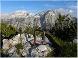 | Rudno polje - Lipanski vrh (via Mrežce)
The panoramic Lipanski vrh is located above the Blejska koča on the Lipanca mountain pasture. From the summit, which drops steeply towards the Kr...
2 h 50 min |
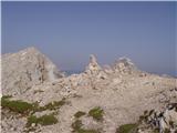 | Vršič - Mala Mojstrovka (southern way)
Mala Mojstrovka is one of the most visited peaks in the Julian Alps due to the relatively high elevation of its starting point. From the summit, ...
2 h 15 min |
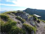 | Dom pod Storžičem - Bašeljski vrh (via Javorniški preval)
Bašeljski vrh is a 1744-meter-high mountain located between Mali Grintovec and Storžič. From the summit, where there is a bench and a registratio...
2 h 50 min |
| Planina Jezerca - Mokrica (via Košutna)
Mokrica is a panoramic peak east of Kompotela. The summit, partially covered with dwarf pines, has a summit logbook....
3 h |
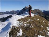 | Globoka dolina - Kofce gora
Kofce gora is a 1967 m high peak located in the eastern part of the longest Slovenian ridge. From the summit, which drops precipitously towards A...
2 h 15 min |
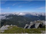 | Mrzli studenec - Veliko Kladivo
Veliko Kladivo is a 2094 m high peak in the longest Slovenian ridge, Košuta. From the summit, which has a register box and stamp, there is a very...
2 h 15 min |
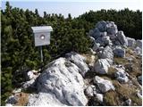 | Kriška planina - Košutna (via planina Košutna)
The summit is located between Kompotela and the mountain pasture Košutna. From the top, there is a beautiful view toward Krvavec and Kalški grebe...
2 h 5 min |
| Planina Jezerca - Košutna (via planina Košutna)
The summit is located between Kompotela and the mountain pasture Košutna. From the top, there is a beautiful view toward Krvavec and Kalški grebe...
2 h 20 min |
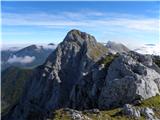 | Mrzli studenec - Malo Kladivo
Malo Kladivo is located in the Košuta ridge. From the summit, which has no registration box, there is a nice view toward the neighboring Veliko K...
2 h |
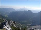 | Johannsenruhe - Bielschitza/Svačica
Svačica is a less prominent peak in the main ridge of the Karawanks. It lies between Vrtača and Stol, slightly offset to the north. The summit, m...
2 h 30 min |
| Bodenbauer - Bielschitza/Svačica (via Karweg)
Svačica is a less prominent peak in the main ridge of the Karawanks. It lies between Vrtača and Stol, slightly offset to the north. The summit, m...
3 h |
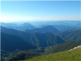 | Ski hotel Vogel - Vogel (po zahodnih pobočjih smučišča Vogel)
Many associate the name Vogel first with the Vogel ski resort near the eponymous peak. From the north, it is recognizable by its pyramidal shape,...
2 h 30 min |
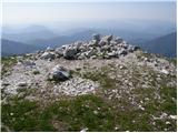 | Ski hotel Vogel - Vogel (po severozahodnih pobočjih Visokega Orlovega roba)
Many associate the name Vogel first with the Vogel ski resort near the eponymous peak. From the north, it is recognizable by its pyramidal shape,...
2 h 30 min |
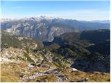 | Ski hotel Vogel - Vogel (via saddle Šija)
Many associate the name Vogel first with the Vogel ski resort near the eponymous peak. From the north, it is recognizable by its pyramidal shape,...
3 h |
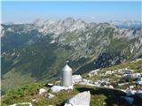 | Planina Kuk - Žabiški Kuk (path past Gradič (old military path))
Žabiški Kuk is located on the southern side ridge of the Lower Bohinj Mountains near the more renowned Vogel and above Planina Razor. From the su...
2 h 20 min |
 | Planina Kuk - Vrh nad Škrbino (direct way)
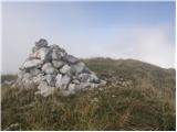
Vrh nad Škrbino is the easternmost two-thousander in the ridge of the Lower Bohinj Mountains. From the summit, there are excellent views of the n...
3 h 15 min |
 | Rifugio Gilberti - Sart / Žrd
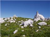
Žrd, or Monte Sart in Italian, is a panoramic mountain located on the northwestern ridge of the Kanin mountains. The summit, which has a logbook ...
3 h 15 min |
 | Rifugio Sorgenti del Piave - Monte Avanza
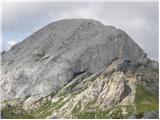
Monte Avanza is a 2,489 m high peak located east of the better-known Monte Peralba. From the summit, where a small cross stands, nice views open ...
3 h |
 | Cristo di Forca - Amariana
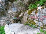
Amariana is a beautiful pyramidal mountain rising above Tolmezzo. Due to its exposed position, it offers wonderful views of the surrounding range...
2 h 30 min |
 | Bodental - Rjautza
Rjavca (Rjavica on maps) is a 1,789-meter-high peak north of the main chain of the Karawanks border ridge. From the summit, which has a cross and...
2 h 30 min |
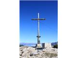 | Drei Zinnen Blick - Strudelköpf / Monte Specie
Strudelköpf / Monte Specie is a 2307-meter-high grassy peak located in Fanes-Sennes-Prags Nature Park. A large cross stands on the summit, erecte...
3 h |
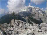 | Fiames - Col Rosa
Col Rosa is a 2,166-meter-high mountain situated north of Cortina d'Ampezzo. From the summit, where a cross stands, there is a very nice view of ...
2 h 45 min |
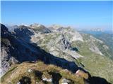 | Obertauern - Gamsspitzl
Gamsspitzl (also Gamskögerl) is a 2340-meter-high mountain in the Radstädter Tauern group. The summit lies west of Zehnerkar Sattel above the Obe...
2 h |
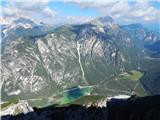 | Landro - Monte Piano
Monte Piano (Toblacher Kreuz) is a 2,305-meter-high mountain located on the northwestern edge of the Monte Piana plateau. Near the summit there a...
2 h 50 min |
 | Sella di Razzo - Bivera (via 210 & 212)
Monte Bivera is a 2,474-meter-high mountain in the Carnic Alps in Italy. It lies about an hour's walk east of the neighboring 2,462-meter-high Cl...
3 h |
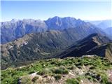 | Chiesetta di S'Anna - Monte Zajavor
Zajavor (Italian: Monte Zajavor or Monte Zaiavor) is a 1,815-meter-high peak in the eastern, grassier part of the Muzci ridge. From the summit, w...
2 h 15 min |