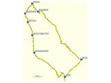
 | Dvor - Polhograjska Grmada (Dvor - Grmada - Belica)
Polhograjska Grmada is an 898 m high peak located in the heart of the Polhograjski Dolomites. From the summit, where there is a registration box ...
2 h 10 min |
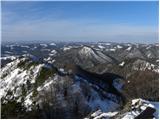 | Preval - Polhograjska Grmada
Polhograjska Grmada is an 898 m high peak located in the heart of the Polhograjski Dolomites. From the summit, where there is a registration box ...
2 h 45 min |
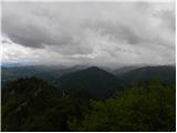 | Gabrje - Polhograjska Grmada
Polhograjska Grmada is an 898 m high peak located in the heart of the Polhograjski Dolomites. From the summit, where there is a registration box ...
2 h 20 min |
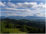 | Preska - Sveti Jakob (via Turnice)
The Church of St. James is located on a scenic hill north of the village of Topol pri Medvodah. From the summit, which features a registration bo...
3 h |
| Preska - Sveti Jakob (via Jeterbenk)
The Church of St. James is located on a scenic hill north of the village of Topol pri Medvodah. From the summit, which features a registration bo...
3 h 15 min |
| Žlebe - Sveti Jakob (via Jeterbenk)
The Church of St. James is located on a scenic hill north of the village of Topol pri Medvodah. From the summit, which features a registration bo...
2 h 15 min |
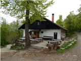 | Topole - Rašica (Vrh Staneta Kosca) (ridge path)
Vrh Staneta Kosca, better known as Rašica, is located north of Ljubljana, more precisely above the villages of Rašica and Dobeno. From the summit...
2 h 10 min |
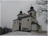 | Zgornja Besnica (Podrovnik) - Sveti Jošt above Kranj (via Gaber)
Sveti Jošt above Kranj is a hill located west of the slightly lower Šmarjetna gora. From the summit, where the Church of St Jošt stands alongside...
2 h 30 min |
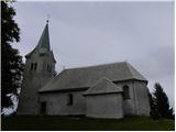 | Puštal - Osolnik
Osolnik is an 858-metre-high mountain located south of Škofja Loka and west of Medvode. From the summit, where the Church of St Mohor and Fortuna...
2 h 15 min |
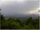 | Preska - Jeterbenk (via Turnice)
Jeterbenk is a 774-meter-high peak located between the Slavkov dom hut on Golo Brdo and Katarina (the village of Topol). From the summit, where t...
2 h 15 min |
 | Preska - Jeterbenk (on ridge)
Jeterbenk is a 774-meter-high peak located between the Slavkov dom hut on Golo Brdo and Katarina (the village of Topol). From the summit, where t...
2 h 15 min |
| Blagovica - Limbarska gora (Blagovica - Limbarska gora - Blagovica)
Limbarska gora is located northeast of Moravče. From the summit, there is a beautiful view of the surrounding peaks, and in good weather, the Kam...
2 h 9 min |
 | Puštal (Na Dobravi) - Sveti Ožbolt (above Zminec)
Sveti Ožbolt is situated on a panoramic rise in the north of the Polhograjski Dolomiti. There is a beautiful view toward the Škofjeloško hribovje...
2 h 15 min |
 | Rakovica - Archangel Gabriel (Planica)
Planica is an 824-meter-high peak located north of Škofja Loka, more precisely between Križna gora and Planica. From the summit, where the church...
2 h 30 min |
 | Vrhnika-Tankovska cesta - Koča na Planini nad Vrhniko (Circular path Vrhnika-Planina-Lintvern-Vrhnika)
Planina nad Vrhniko is for Vrhnika locals something like Šmarna gora for those from Ljubljana. It is 733 m high, reachable by several paths from ...
2 h 20 min |
 | Besnica - Janče
Janče is a 792-meter-high peak situated between the Sava River and the Besnica stream valley. From the summit, where a mountain hut stands and th...
2 h 15 min |
 | Laze pri Dolskem - Janče
Janče is a 792-meter-high peak situated between the Sava River and the Besnica stream valley. From the summit, where a mountain hut stands and th...
2 h 15 min |
 | Moravče - Slivna (Pivkelj)
Slivna, also known as Pivkelj (or Pivkelj turn), lies south of Limbarska gora. Pivkelj is the highest point of the Moravška planinska pot and at ...
2 h 30 min |
 | Polzela - Gora Oljka (via Vimperk)
Gora Oljka is a hill located east of Šmartno ob Paki. On the summit stands the Church of the Holy Cross, built in the mid-18th century. Just a fe...
2 h 15 min |
 | Zvodno - Tolsti vrh above Celjska koča (via Srebotnik on CPP)
Tolsti vrh (also recorded as Tovsti vrh in some sources) is situated above the Celjska koča ski area. The summit has a logbook box and stamp, but...
2 h 15 min |
| Hayrack (Laška vas - Pečovje) - Tolsti vrh above Celjska koča (via Srebotnik on CPP)
Tolsti vrh (also recorded as Tovsti vrh in some sources) is situated above the Celjska koča ski area. The summit has a logbook box and stamp, but...
2 h 15 min |
 | Gorjane (Železno) - Veliki Špiček
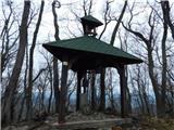
Veliki Špiček is the highest peak of Brežice municipality. From the top a nice view spreads towards the south and east. Most of Brežice municipal...
2 h 50 min |
 | Preska - Rog (via Turnice)
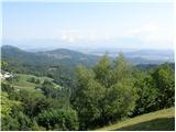
Rog is an 798-meter peak above the village of Topol, just 10 minutes from St. Katarina's Church. From the summit, where a large cross once stood,...
2 h 30 min |
| Preska - Rog (via Jeterbenk)
Rog is an 798-meter peak above the village of Topol, just 10 minutes from St. Katarina's Church. From the summit, where a large cross once stood,...
2 h 45 min |
 | Hrastnik - Klobuk (via Ravne)
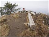
Klobuk is a scenic peak located northeast of Hrastnik. From the summit, which has a logbox and stamp, there are fine views of the valley and surr...
2 h 25 min |
| Dol pri Hrastniku - Klobuk
Klobuk is a scenic peak located northeast of Hrastnik. From the summit, which has a logbox and stamp, there are fine views of the valley and surr...
2 h 10 min |
 | Kozjak nad Pesnico - Tojzlov vrh
Tojzlov vrh is a forested hill on the eastern part of Kozjak. On the summit stands a small stone NOB monument and, more recently, also a summit l...
2 h 35 min |
 | Gorjuša - Murovica (via Dobovlje)
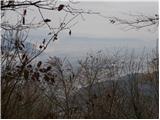
Murovica is a popular excursion point, accessible from the Posavje side, Domžale, or the Moravška Valley. On the summit there is a bench and a lo...
2 h 40 min |
 | Lokvica - Stol (Črni hribi)
Stol, at 629 m, is the second-highest peak in the Črnih hribov ridge. Only its eastern neighbor, the 643 m high Trstelj, rises higher. From the s...
3 h 40 min |
 | Zazid - Golič (via Lipnik)
Golič is a grassy ridge extending from Kojnik to the Slovenian-Croatian border and continuing as the Žbevnica ridge on the Croatian side. Due to ...
2 h 30 min |
 | Zazid - Golič (via Kojnik)
Golič is a grassy ridge extending from Kojnik to the Slovenian-Croatian border and continuing as the Žbevnica ridge on the Croatian side. Due to ...
2 h 30 min |
 | Rakovica - Špičasti hrib
Špičasti hrib (known as Špičasti vrh on maps) is an 837-meter-high hill located west of Sveti Jošt above Kranj. The summit, which has a few bench...
2 h 20 min |
 | Zazid - Kavčič (via Lipnik)
Kavčič is a grassy peak located above the village Rakitovec on the Slovenian-Croatian border. From the summit, where two crosses stand with a sum...
2 h 30 min |
 | Zazid - Nadglavinjak (via Lipnik)
Nadglavinjak is a lesser-known peak located southeast of Golič. From its indistinct grassy summit, nice views open up on Slavnik, Čičarija, Žbevn...
2 h 10 min |
 | Sveti Mavricij - Sveti Socerb (Artviže)
The Church of St. Socerb is located on a panoramic hill above the village of Artviže, which at 817 meters is the highest peak of the Brkini. From...
2 h 15 min |
 | Mlinše - Pleše (via Zasavska Sveta gora)
Pleše is an 866-meter-high peak situated between the Marela ski slope and Zasavska Sveta gora. From the summit, which features a NOB monument, th...
2 h 30 min |
 | Izlake - Pleše (via Grobovščica)
Pleše is an 866-meter-high peak situated between the Marela ski slope and Zasavska Sveta gora. From the summit, which features a NOB monument, th...
2 h 15 min |
 | Braslovško jezero - Grmada (Dobrovlje)
Grmada is a 898 m high, forest-covered peak located on the southeastern part of the Dobroveljska planota plateau. From the summit, where there is...
2 h 25 min |
| Letuš - Grmada (Dobrovlje)
Grmada is a 898 m high, forest-covered peak located on the southeastern part of the Dobroveljska planota plateau. From the summit, where there is...
2 h 25 min |
 | Kozje - Oslica (Bohor) (via Vetrnik)
Oslica is one of Bohor's peaks, located in the eastern part of the range. Unlike some higher Bohor peaks such as Veliki Javornik, Koprivnik, Debe...
2 h 10 min |
 | Stari trg (Pilštanj) - Oslica (Bohor)
Oslica is one of Bohor's peaks, located in the eastern part of the range. Unlike some higher Bohor peaks such as Veliki Javornik, Koprivnik, Debe...
3 h |
 | Stari trg (Pilštanj) - Brest (Bohor)
Brest is a peak on Bohor, though it resembles more of a saddle. It is an important trail junction on Bohor, lying between more easterly Oslica an...
2 h 45 min |
 | Gorica pri Slivnici - Žusem (Panoramska pot)
Žusem is a 669-meter-high hill with a rich history and great potential for the future. It forms the northern edge of Kozjansko, and its name deri...
3 h 20 min |
 | Brezno - Sveti Pankracij (Radelca) (by Remšniški potok)
The Church of St. Pankracij on Radelca is located at an altitude of 900 meters, directly on the border ridge between Slovenia and Austria. The or...
2 h 50 min |
 | Muta (Spodnja Muta) - Sveti Trije Kralji (above Radlje ob Dravi)
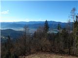
The Church of the Holy Three Kings is located on an 820-meter-high hill rising above the right bank of the Radeljski Stream. From the church, a n...
2 h 30 min |
 | Rechnitz (Badesee) - Irrotkő / Geschriebenstein
Irrotkő is the highest peak of the Kőszeg Mountains (Kőszegi Hegység) and also the highest peak of western Hungary and the Austrian federal state...
2 h 30 min |
 | Lockenhaus - Irrotkő / Geschriebenstein (via Weidriegel)
Irrotkő is the highest peak of the Kőszeg Mountains (Kőszegi Hegység) and also the highest peak of western Hungary and the Austrian federal state...
2 h 45 min |
| Lockenhaus - Irrotkő / Geschriebenstein (through Marchgraben)
Irrotkő is the highest peak of the Kőszeg Mountains (Kőszegi Hegység) and also the highest peak of western Hungary and the Austrian federal state...
2 h 40 min |
 | Puščava - Klančnik (Glančnik)
Klančnik (Glančnik on some maps) is an 877-meter-high peak situated above the right bank of the Drava River, just a few minutes' walk from the Hu...
2 h 15 min |
 | Lovrenc na Pohorju - Klančnik (Glančnik) (via Povh, Brabar and Hudej)
Klančnik (Glančnik on some maps) is an 877-meter-high peak situated above the right bank of the Drava River, just a few minutes' walk from the Hu...
2 h 25 min |
| HE Ožbalt - Klančnik (Glančnik)
Klančnik (Glančnik on some maps) is an 877-meter-high peak situated above the right bank of the Drava River, just a few minutes' walk from the Hu...
2 h 10 min |
| Podvelka - Klančnik (Glančnik) (via Sveti Ignacij)
Klančnik (Glančnik on some maps) is an 877-meter-high peak situated above the right bank of the Drava River, just a few minutes' walk from the Hu...
2 h 30 min |
 | Pišece (Pri mlinu) - Veliki vrh (Orlica)
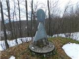
Veliki vrh is the highest point of the Orlica hills at 701 meters above sea level, stretching along the border between Posavje and Kozjansko and ...
2 h 40 min |