 | Planina - Petričev hrib
Petričev hrib is a peak north of Postojna and west of Planina. From the summit, which has a logbook box, there is a nice view of the Notranjska h...
1 h 30 min |
 | Gorenje - Gora (Sveti Lovrenc) (gentle path)
Gora, or Sveti Lovrenc, is a peak above Studeno, a village north of Postojna that serves as a suitable starting point for the ascent to this pano...
1 h 45 min |
 | Ravni - Kršičevec
Kršičevec is a lesser-known mountain located east of Jurišče village in the Pivka basin. From its grassy summit, which has a logbook box with a s...
2 h 30 min |
 | Hunting lodge below Glavica - Grmada at Slavnik
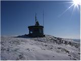
Grmada is a 1,001-meter-high peak located northwest of Slavnik. The summit hosts a fire watchtower, offering fine views over much of Primorska....
2 h 20 min |
 | Cenc - Špičasti vrh (on road over Novina)
Špičasti vrh is a forest-covered mountain located south of the village of Zadlog. To ensure the summit is not without a view, a 13-meter-high woo...
1 h 30 min |
 | Eko koča Nanos (Lovska koča Vojkovo) - Grmada (Nanos)
Grmada is a 1209-meter peak situated near the edge of the Nanos plateau, northwest of the better-known Pleša (about a 20-minute walk away). Becau...
1 h 45 min |
 | Oblakov Vrh - Hudournik
Hudournik is a 1,148-meter-high peak on the northern edge of the Vojskarska planota plateau, which lies between the valleys of the Idrijca, Kanom...
1 h 30 min |
 | Smrečje - Goli vrh
Goli vrh (also Golni vrh on maps) is an indistinct, forest-covered peak above the dispersed settlement of Goli Vrh. There is no view from the sum...
1 h 30 min |
 | Bohinjska Češnjica - Rudnica
Rudnica is a panoramic mountain located between the Lower and Upper Bohinj Valleys. From the summit, where there is a register box with a stamp a...
1 h 30 min |
| Srednja vas (Senožeta) - Rudnica
Rudnica is a panoramic mountain located between the Lower and Upper Bohinj Valleys. From the summit, where there is a register box with a stamp a...
1 h 30 min |
 | Trojane - Lipovec
Lipovec is an 848-meter-high peak located above the pastures of Lipovec. On clear days, the summit offers views of the Posavsko hribovje, Kum, Me...
1 h 30 min |
 | Podmeja - Javor
Javor is a 1,132-meter-high peak situated between Kisovec and Sveta Planina. The summit, covered with forest, offers no views, but a nice panoram...
2 h |
 | Babni Vrt - Gradišče (Pustinjak) (through the forest and past sv. Lovrenc)
Gradišče or Pustinjak (also Gradišče nad Bašljem) is an 871-meter-high peak located above the Belica stream, which lies below the 2,132-meter-hig...
1 h 25 min |
 | Blejska Dobrava (cemetery) - Hom at Bled (via Katarina)
Hom is an 834-meter-high hill rising north above the villages of Zasip and Podhom near Bled, or south of the village Blejska Dobrava near Jesenic...
1 h 25 min |
 | Jeršiče - Baba (at Javorniki)
Baba is a 1,085-meter-high peak located between the Javorniki ridge and Sveta Trojica. From its grassy summit, nice views open up to the Javornik...
1 h 30 min |
 | Možjanca - Kopa (Partizanski vrh)
Kopa, also known as Partizanski vrh, is a 1,024-meter-high mountain located west of the Davovec saddle, which itself lies west to southwest of Kr...
1 h 30 min |
 | Možjanca - Skutman
Skutman is a lesser-known peak above the left bank of the Kokra River and north of Štefanja Gora. The summit is marked by a metal plaque reading ...
1 h 25 min |
 | Možjanca - Skutman (via Zapečnikova planina)
Skutman is a lesser-known peak above the left bank of the Kokra River and north of Štefanja Gora. The summit is marked by a metal plaque reading ...
1 h 25 min |
 | Bela Peč - Ojstri vrh (above Prevala) (past peak Seduc)
Ojstri vrh is a 1,197-meter-high mountain located between the Seduc peak and Prevala. From the summit, there is a beautiful view of the surroundi...
1 h 30 min |
 | Bela Peč - Ojstri vrh (above Prevala) (via Ovčje jame)
Ojstri vrh is a 1,197-meter-high mountain located between the Seduc peak and Prevala. From the summit, there is a beautiful view of the surroundi...
1 h 45 min |
 | Leše - Andrejev vrh (via Leše churches and via chapel)
Andrejev vrh is a forest-covered peak located between Mežica and Leše. On the summit there is a bench and a summit register box with a logbook....
1 h 35 min |
| Leše - Andrejev vrh (past Leše churches and on cart track)
Andrejev vrh is a forest-covered peak located between Mežica and Leše. On the summit there is a bench and a summit register box with a logbook....
1 h 30 min |
 | Nemilje - Sleme (Površnica) (via Prevoje)
Sleme is a panoramic peak located between Rudno, Dražgoše, and Lajše. From the summit, where transmitters are located, there is a nice view of th...
2 h 5 min |
 | Nemilje - Sveti Križ above Selca (via Prevoje)
The Church of the Holy Cross above Selca is situated on a panoramic hill from which a beautiful view opens up over part of the Škofjeloško hribov...
2 h 25 min |
 | Sveta Jedert (Lajše) - Bela peč (Podbliška gora) (via Rigli)
Bela peč is situated on the edge of Jelovica above the village Podblica. From the top of the cliff a beautiful view opens up towards the mentione...
1 h 30 min |
| Sveta Jedert (Lajše) - Bela peč (Podbliška gora) (upper part on the road)
Bela peč is situated on the edge of Jelovica above the village Podblica. From the top of the cliff a beautiful view opens up towards the mentione...
1 h 30 min |
 | Hunting lodge LD Libeliče - Šteharski vrh (Šteharnikov vrh)
Šteharski vrh (also Šteharnikov vrh or Črneška gora) is a 1,018 m high mountain located in the southeastern part of the Strojna range, between th...
1 h 30 min |
 | Bukovo - Črvov vrh
Črvov Vrh, also known as Črvov Grič, is the highest peak of the Šentviška Planota at 974 metres. The plateau rises above the right bank of the Id...
1 h 30 min |
 | Šentviška Gora - Bukovski vrh
Bukovski Vrh (918 m) lies above the settlement of Bukovski Vrh, more precisely above the Pri Pircu homestead. From the grassy summit there is a f...
1 h 30 min |
 | Jazne (Lanišar) - Krog (Ledinski grič)
Krog is a 940-metre-high peak on the western part of the Ledinski grič ridge, between the streams Jerešča and Ledinščicaboth left tributaries of ...
1 h 35 min |
| Ledinsko Razpotje - Krog (Ledinski grič)
Krog is a 940-metre-high peak on the western part of the Ledinski grič ridge, between the streams Jerešča and Ledinščicaboth left tributaries of ...
1 h 30 min |
| Govejk - Krog (Ledinski grič)
Krog is a 940-metre-high peak on the western part of the Ledinski grič ridge, between the streams Jerešča and Ledinščicaboth left tributaries of ...
1 h 45 min |
| Sovodenj - Krog (Ledinski grič)
Krog is a 940-metre-high peak on the western part of the Ledinski grič ridge, between the streams Jerešča and Ledinščicaboth left tributaries of ...
2 h 5 min |
 | Medvodje - Medvodnica (via Tržiška Bistrica)
Medvodnica is a 1,202-meter-high mountain situated between the Košutnik and Tržiška Bistrica streams. The summit lies within the forest, offering...
1 h 30 min |
| Medvodje - Medvodnica (via Košutnik)
Medvodnica is a 1,202-meter-high mountain situated between the Košutnik and Tržiška Bistrica streams. The summit lies within the forest, offering...
1 h 25 min |
 | Veliki Boč (Zgornji Kovač) - Možičev vrh (via Žavcarjev vrh)
Možičev vrh is a 926-meter-high peak located west of the more famous but slightly lower Žavcarjev vrh. A cart track leads to the summit, but due ...
1 h 40 min |
 | Veliko Tinje - Repnikov vrh
Repnikov vrh is a 988-meter-high peak on Pohorje, located between Planina pod Šumikom and Urh. The summit is in the middle of the forest, along a...
1 h 25 min |