 | Vidrga - Zasavska Sveta gora (on forest footpath)
Zasavska Sveta Gora is a popular excursion destination located between Litija and Izlake. From the summit, where the parish church of the Nativit...
1 h 30 min |
| Vidrga - Zasavska Sveta gora (on a cart track)
Zasavska Sveta Gora is a popular excursion destination located between Litija and Izlake. From the summit, where the parish church of the Nativit...
1 h 30 min |
 | Podgorje - Kojnik (via hunting cottage)
Kojnik is a partly forested peak located in the southern part of Podgorski Kras near the Slovenian-Croatian border. From the summit, which has a ...
1 h 30 min |
 | Planina - Petričev hrib
Petričev hrib is a peak north of Postojna and west of Planina. From the summit, which has a logbook box, there is a nice view of the Notranjska h...
1 h 30 min |
| Planina (Dolnja Planina) - Petričev hrib (via Zavrtniki)
Petričev hrib is a peak north of Postojna and west of Planina. From the summit, which has a logbook box, there is a nice view of the Notranjska h...
1 h 35 min |
| Planina (Dolnja Planina) - Petričev hrib (via Sv. Duh)
Petričev hrib is a peak north of Postojna and west of Planina. From the summit, which has a logbook box, there is a nice view of the Notranjska h...
1 h 35 min |
 | Gorenje - Gora (Sveti Lovrenc) (gentle path)
Gora, or Sveti Lovrenc, is a peak above Studeno, a village north of Postojna that serves as a suitable starting point for the ascent to this pano...
1 h 45 min |
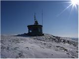 | Hunting lodge below Glavica - Grmada at Slavnik
Grmada is a 1,001-meter-high peak located northwest of Slavnik. The summit hosts a fire watchtower, offering fine views over much of Primorska....
2 h 20 min |
 | Povžane - Grmada at Slavnik
Grmada is a 1,001-meter-high peak located northwest of Slavnik. The summit hosts a fire watchtower, offering fine views over much of Primorska....
2 h 15 min |
| Skadanščina - Grmada at Slavnik (via planina Jegno)
Grmada is a 1,001-meter-high peak located northwest of Slavnik. The summit hosts a fire watchtower, offering fine views over much of Primorska....
2 h 15 min |
| Skadanščina - Grmada at Slavnik (via Planina Jegno)
Grmada is a 1,001-meter-high peak located northwest of Slavnik. The summit hosts a fire watchtower, offering fine views over much of Primorska....
2 h 10 min |
 | Podpeč - Grmada on Mala gora
Grmada (also Grmada above Ortnek) is an 887-meter-high peak located above the village of Vrh pri Poljanah in the Mala Gora range. Just a few mete...
1 h 35 min |
 | Smrečje - Goli vrh
Goli vrh (also Golni vrh on maps) is an indistinct, forest-covered peak above the dispersed settlement of Goli Vrh. There is no view from the sum...
1 h 30 min |
 | Bohinjska Češnjica - Rudnica
Rudnica is a panoramic mountain located between the Lower and Upper Bohinj Valleys. From the summit, where there is a register box with a stamp a...
1 h 30 min |
| Srednja vas (Senožeta) - Rudnica
Rudnica is a panoramic mountain located between the Lower and Upper Bohinj Valleys. From the summit, where there is a register box with a stamp a...
1 h 30 min |
 | Nemilje - Sveti Mohor (Zabrekve) (via Prevoje)
The Church of St. Mohor is located on a 952 m high hill between Zgornja Besnica and Selci. From the church or its nearby surroundings, there is a...
1 h 35 min |
 | Trojane - Lipovec
Lipovec is an 848-meter-high peak located above the pastures of Lipovec. On clear days, the summit offers views of the Posavsko hribovje, Kum, Me...
1 h 30 min |
 | Tržič - Veliki vrh above Završnik (Milanova pot)
Veliki vrh above Završnik is a 968 m high mountain located in the Pirmance ridge, north to northeast of Tržič. From the grassy summit, which feat...
1 h 40 min |
 | Jeršiče - Baba (at Javorniki)
Baba is a 1,085-meter-high peak located between the Javorniki ridge and Sveta Trojica. From its grassy summit, nice views open up to the Javornik...
1 h 30 min |
 | Možjanca - Kopa (Partizanski vrh)
Kopa, also known as Partizanski vrh, is a 1,024-meter-high mountain located west of the Davovec saddle, which itself lies west to southwest of Kr...
1 h 30 min |
 | Bottom station of cableway on Krvavec - Skutman (via Kopa)
Skutman is a lesser-known peak above the left bank of the Kokra River and north of Štefanja Gora. The summit is marked by a metal plaque reading ...
1 h 45 min |
 | Poljšica pri Gorjah (Zatrata) - Hotunjski vrh (on footpath)
Hotunjski vrh is a 1,107-meter-high panoramic peak located above the Zatrnik ski slope. From the summit, where there is a summit register box and...
1 h 30 min |
| Poljšica pri Gorjah (Zatrata) - Hotunjski vrh (by road)
Hotunjski vrh is a 1,107-meter-high panoramic peak located above the Zatrnik ski slope. From the summit, where there is a summit register box and...
2 h |
 | Poljana - Andrejev vrh (past Leše churches and on cart track)
Andrejev vrh is a forest-covered peak located between Mežica and Leše. On the summit there is a bench and a summit register box with a logbook....
1 h 50 min |
| Poljana - Andrejev vrh (via Leše churches and via chapel)
Andrejev vrh is a forest-covered peak located between Mežica and Leše. On the summit there is a bench and a summit register box with a logbook....
1 h 55 min |
| Leše - Andrejev vrh (via Leše churches and via chapel)
Andrejev vrh is a forest-covered peak located between Mežica and Leše. On the summit there is a bench and a summit register box with a logbook....
1 h 35 min |
| Leše - Andrejev vrh (past Leše churches and on cart track)
Andrejev vrh is a forest-covered peak located between Mežica and Leše. On the summit there is a bench and a summit register box with a logbook....
1 h 30 min |
 | Selca - Sleme (Površnica)
Sleme is a panoramic peak located between Rudno, Dražgoše, and Lajše. From the summit, where transmitters are located, there is a nice view of th...
1 h 35 min |
| Železniki - Sleme (Površnica) (via Štalca)
Sleme is a panoramic peak located between Rudno, Dražgoše, and Lajše. From the summit, where transmitters are located, there is a nice view of th...
1 h 35 min |
| Nemilje - Sleme (Površnica) (via Prevoje)
Sleme is a panoramic peak located between Rudno, Dražgoše, and Lajše. From the summit, where transmitters are located, there is a nice view of th...
2 h 5 min |
 | Nemilje - Sveti Križ above Selca (via Prevoje)
The Church of the Holy Cross above Selca is situated on a panoramic hill from which a beautiful view opens up over part of the Škofjeloško hribov...
2 h 25 min |
 | Bukovo - Črvov vrh
Črvov Vrh, also known as Črvov Grič, is the highest peak of the Šentviška Planota at 974 metres. The plateau rises above the right bank of the Id...
1 h 30 min |
 | Šentviška Gora - Bukovski vrh
Bukovski Vrh (918 m) lies above the settlement of Bukovski Vrh, more precisely above the Pri Pircu homestead. From the grassy summit there is a f...
1 h 30 min |
| Grahovo ob Bači (Brelih) - Bukovski vrh (via Žrelo)
Bukovski Vrh (918 m) lies above the settlement of Bukovski Vrh, more precisely above the Pri Pircu homestead. From the grassy summit there is a f...
1 h 40 min |
 | Podgora - Špik (Vranškov grič)
Špik (also marked as Vranškov grič on maps) is a 908 m high mountain west of Hotavlje. The summit lies in forest, but a grassy subpeak offers fin...
1 h 45 min |
 | Hotavlje - Kucelj (above Kopačnica) (via Srednje Brdo)
Kucelj is a 920-meter-high peak located above the left bank of Kopačnica and the settlement of the same name. At the summit there is a bench, a t...
1 h 55 min |
 | Veliki Boč (Zgornji Kovač) - Možičev vrh (via Žavcarjev vrh)
Možičev vrh is a 926-meter-high peak located west of the more famous but slightly lower Žavcarjev vrh. A cart track leads to the summit, but due ...
1 h 40 min |
 | Schrems/Frohnleiten (Hautabauer) - Harterberg (Hoaterberg)
Harterberg, also known as Hoaterberg, is a 1,036 m high hill above the settlement of Schrems/Frohnleiten in the northern part of the Graz Mountai...
2 h |
 | Übelbach - Schankkogel
Schankkogel is, with its 1049 meters, the highest peak of the Notberg hill near the settlement of Guggenbach (close to Übelbach) in Steiermark.Be...
1 h 30 min |
 | Übelbach - Schankkogel (steep path)
Schankkogel is, with its 1049 meters, the highest peak of the Notberg hill near the settlement of Guggenbach (close to Übelbach) in Steiermark.Be...
1 h 30 min |