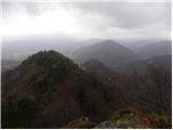
 | Topol - Polhograjska Grmada
Polhograjska Grmada is an 898 m high peak located in the heart of the Polhograjski Dolomites. From the summit, where there is a registration box ...
1 h 15 min |
| Belo - Polhograjska Grmada
Polhograjska Grmada is an 898 m high peak located in the heart of the Polhograjski Dolomites. From the summit, where there is a registration box ...
1 h 20 min |
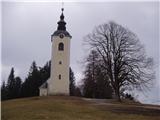 | Selo - Sveti Ožbolt (above Zminec)
Sveti Ožbolt is situated on a panoramic rise in the north of the Polhograjski Dolomiti. There is a beautiful view toward the Škofjeloško hribovje...
1 h 15 min |
 | Selo - Mlaka
Mlaka or Prosenov grič is a forested peak between Pasja ravan and Tošč. Due to the forest, the peak has no view....
1 h 10 min |
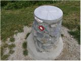 | Dom na Goropekah - Vrh Svetih Treh Kraljev
The Church of the Holy Three Kings stands on a panoramic hill above the village of Vrh Svetih Treh Kraljev. The summit features a panorama board ...
1 h 40 min |
| Sopot - Vrh Svetih Treh Kraljev
The Church of the Holy Three Kings stands on a panoramic hill above the village of Vrh Svetih Treh Kraljev. The summit features a panorama board ...
1 h 25 min |
 | Zaplana (Prezid) - Ulovka
Ulovka is a peak between Zaplana and Zavetišče na Planini nad Vrhniko. From the summit, to which ski lifts run, there is a nice view to the north...
1 h 45 min |
 | Otlica - Sinji vrh
Sinji vrh is a panoramic mountain between Col, Ajdovščina, and Predmeja. It offers views across much of western Slovenia (the sea on clear days)....
1 h 20 min |
 | Predmeja - Otliški maj (Pot po Robu)
Otliški maj is a panoramic peak south of Otlica. It offers nice views of the Vipava Valley, Čavna slopes, Golaki (with the vast Trnovski gozd vis...
1 h 45 min |
 | Podlanišče - Bevkov vrh
Bevkov vrh, a control point on the Slovenian Mountain Trail, is located between Cerkno and Spodnja Idrija. The peak is forested, but the stamp is...
1 h 30 min |
 | Ledinsko Razpotje - Sivka
Sivka is a forested peak located west of Žiri and north of Idrija. At the summit there is a stamp for the Slovenian Mountain Trail and a logbook ...
1 h 15 min |
 | Hrib-Loški Potok - Koča na Kamnem griču
The Koča na Kamnem griču mountain hut is located on Kamni grič, a panoramic hill rising southwest of Sodražica. From the grassy summit surrounded...
1 h 15 min |
 | Bločice - Križna gora
Križna gora is a partly panoramic peak located above the villages of Sveta Ana and Podlož. From the summit, where the Church of the Holy Cross st...
1 h 15 min |
 | Dom na Čreti - Tolsti vrh (Dobrovlje)
Tolsti vrh, together with Šentjoški vrh (1,077 m), is the highest peak of the Dobroveljska planota plateau. From the summit, which has a logbook ...
1 h 45 min |
 | Podlanišče - Ermanovec
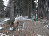
Ermanovec is a 1,026-meter-high peak situated between Cerkno and Gorenja vas, more precisely above Sovodenj and Trebija. Just a few steps from th...
1 h 35 min |
 | Veliko Trebeljevo - Obolno
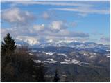
Obolno is a 776-meter-high peak located southwest of the eponymous village. From the grassy summit, by which a radio club hut stands, there is a ...
1 h 20 min |
 | Mala Goričica - Obolno
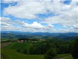
Obolno is a 776-meter-high peak located southwest of the eponymous village. From the grassy summit, by which a radio club hut stands, there is a ...
1 h 10 min |
| Mala Goričica - Obolno (by road)
Obolno is a 776-meter-high peak located southwest of the eponymous village. From the grassy summit, by which a radio club hut stands, there is a ...
1 h 15 min |
 | Velike Lašče - Kamen vrh
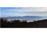
Kamen Vrh is a panoramic hill located on the northern edge of Mala Gora. From the summit, surrounded by low bushes, there are fine views of parts...
1 h 15 min |
 | Seljan - Stene svete Ane (gentle path)
Stene Svete Ane is a vegetated peak located near the Planinska Koča pri Sveti Ani on Mala Gora. A small observation tower stands on the summit, e...
1 h 5 min |
 | Suhi Dol - Sivka (through forest)
Sivka is a grassy peak at the far western end of Polhograjsko hribovje. On clear days, it offers breathtaking views from Snežnik across Javorniki...
1 h 30 min |
| Suhi Dol - Sivka (by road)
Sivka is a grassy peak at the far western end of Polhograjsko hribovje. On clear days, it offers breathtaking views from Snežnik across Javorniki...
1 h 40 min |
 | Cenc - Špičasti vrh (on marked path)
Špičasti vrh is a forest-covered mountain located south of the village of Zadlog. To ensure the summit is not without a view, a 13-meter-high woo...
1 h 30 min |
 | Podmeja - Sveta planina (Partizanski vrh)
Sveta planina, also Partizanski vrh, is a 1,011-meter-high mountain located between Čemšeniška planina and Mrzlica. From the summit, where there ...
1 h 30 min |
 | Hotedršica - Medvedje Brdo
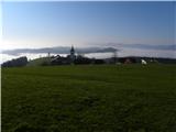
Medvedje Brdo is a small settlement located north of Hotedršica. The highest point of the village is a pleasant viewpoint on Šinkovcov grič (814 ...
1 h 15 min |
 | Rovte - Medvedje Brdo (via Kamnikov Grič)
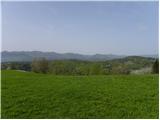
Medvedje Brdo is a small settlement located north of Hotedršica. The highest point of the village is a pleasant viewpoint on Šinkovcov grič (814 ...
1 h 15 min |
 | Sv. Pankracij (Legat) / St. Pongratzen (Legat) - Kapunar / Kapunerkogel (Austrian path)
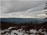
Kapunar is a 1,051-meter-high peak above Radlje ob Dravi. Just below the summit stands an old customs post and border guardhouse, now used by ama...
1 h 55 min |
 | Mislinja - Časov vrh
Časov vrh (Časkov vrh on some maps) is a less prominent hill located between Fričev vrh and Črepič. Since the summit is forested, there is no vie...
1 h 15 min |
 | Mislinja - Fričev vrh (via Črepič)
Fričev vrh is an 881 m high hill located south of Mislinjska Dobrava. From the summit, which has a logbook box with book and stamp inside, there ...
1 h 35 min |
 | Mislinja - Sveti Rupert (Završe)
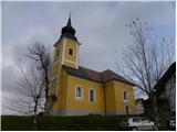
The Church of St. Rupert (Završe) is located on a panoramic rise south of Fričev vrh. In good weather, from the church or its nearby surroundings...
1 h 25 min |
 | Mislinja - Sveti Vid (Završe)
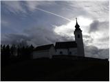
The Church of St. Vitus, next to which there is also a small cemetery, is located in the middle of the dispersed settlement Završe. From the chur...
1 h 10 min |
 | Podlanišče - Štor
Štor is a 1005 m high peak located directly above the Koča na Ermanovcu hut. The summit itself is forested, but from a meadow just a few dozen me...
1 h 20 min |
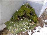 | Čepulje - Sveti Mohor (Zabrekve)
The Church of St. Mohor is located on a 952 m high hill between Zgornja Besnica and Selci. From the church or its nearby surroundings, there is a...
1 h 30 min |
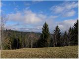 | Sveta Jedert (Lajše) - Sveti Mohor (Zabrekve)
The Church of St. Mohor is located on a 952 m high hill between Zgornja Besnica and Selci. From the church or its nearby surroundings, there is a...
1 h 30 min |
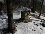 | Podlanišče - Škofje
Škofje is a 973-meter-high peak located above the villages of Čeplez, Planina pri Cerknem, and Podpleče. The summit itself, marked by a small con...
1 h 10 min |
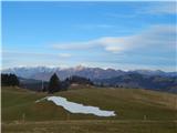 | Ledinsko Razpotje - Loncmanova Sivka (Mrzli Vrh)
Loncmanova Sivka is a panoramic peak above the village Mrzli Vrh near Žiri. From the bare summit, on clear days, there are views of Golaki, Škofj...
1 h 25 min |
 | Cvetrež - Lašček (by road)
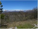
Lašček, at 1071 m, is the highest peak of the Banjška planota plateau, rising above Čepovanski dol, the Soča valley, and the Idrijca valley. From...
1 h 20 min |
 | Šentvid pri Planini - Brest (Bohor) (northern path)
Brest is a peak on Bohor, though it resembles more of a saddle. It is an important trail junction on Bohor, lying between more easterly Oslica an...
1 h 50 min |
 | Col - Sončnica (Reber)
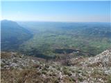
Sončnica is a paragliding site on the periphery of the Gora plateau or Reber ridge. At the take-off point, offering nice views towards the Vipava...
1 h 20 min |
 | Ledinsko Razpotje - Sveta Marija Magdalena (Gore) (west path)
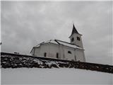
The Church of St. Mary Magdalene is located on a hill above the settlement of Gore, which lies above Idrija. From the church or its immediate sur...
1 h 10 min |
 | Koča pri Jelenovem studencu - Ledenik
Ledenik, at 1,072 meters, is the highest peak of Stojna, a forested ridge situated between Kočevje and Kočevska Reka. On the summit there is a lo...
1 h 15 min |
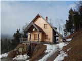 | Jazne (Lanišar) - Planinska koča Mrzl'k
The Planinska koča Mrzl'k mountain hut lies just a few meters below the Mrzlik summit. From the hut opens up a fine view of the neighboring Mrzli...
1 h 10 min |
| Ledinsko Razpotje - Planinska koča Mrzl'k
The Planinska koča Mrzl'k mountain hut lies just a few meters below the Mrzlik summit. From the hut opens up a fine view of the neighboring Mrzli...
1 h 25 min |
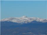 | Sveti Jurij (Remšnik) - Sveti Pankracij (Radelca)
The Church of St. Pankracij on Radelca is located at an altitude of 900 meters, directly on the border ridge between Slovenia and Austria. The or...
1 h 15 min |
 | Gornje Jelenje - Tuhobić (mountain path on Tuhobić)
Tuhobić is a 1109-meter-high peak from which beautiful views open in all directions, with the best sights of Risnjak, Snježnik, Veliki Snežnik, U...
1 h 50 min |
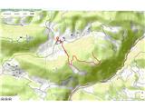 | Škalske Cirkovce - Stropnica (via Stropnik)
Stropnica (880 m) and slightly lower Stropnik (862 m) form a hill rising above Paka pri Velenju on one side and the settlements Škalske and Šmart...
1 h 10 min |
 | Zelovo - Orlove stine (western path)
Orlove stine is a panoramic peak above Peručko Lake. It lies southeast of the better-known Svilaja. From the top, there is a fine view toward the...
1 h 20 min |
 | Zelovo - Umac (at Svilaja)
Umac is a small indistinct peak located southeast of Svilaja. The summit is just 5 minutes from the road leading below Svilaja. At the top are ro...
1 h 30 min |
 | Brest - Muzari (gentle path)
Muzari is a grassy peak located between Špičasti vrh and the better-known Žbevnica, specifically on the marked path from Golič to Žbevnica. On th...
1 h 10 min |
 | Dragonoš - Zečak
Zečak is a spacious, panoramic and grassy summit in the eastern part of Žumberak Mountain. The summit logbook with stamp is a few meters away in ...
1 h 45 min |
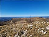 | Brest - Špičasti vrh (pri Žbevnici) (čez Žbevnico)
Pointed Peak is a scenic grassy peak along the marked path between Golič and Žbevnica, near the Slovenian border. The peak has a summit book box ...
1 h 15 min |
| Brest - Špičasti vrh (pri Žbevnici) (gentle path)
Pointed Peak is a scenic grassy peak along the marked path between Golič and Žbevnica, near the Slovenian border. The peak has a summit book box ...
1 h 25 min |