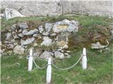
 | Gabrje - Tošč
Tošč, which became the highest peak of the Polhov Gradec Hills decades ago when the Yugoslav army lowered Pasja ravan by 9 metres, is located nor...
3 h 5 min |
 | Jezero - Krim (via Ledenica)
Krim is a 1,107-metre-high mountain rising south of the Ljubljana Marsh. From the summit, where a mountain hut and several transmitters stand, th...
2 h 30 min |
 | Strahomer - Krim (via Strmec)
Krim is a 1,107-metre-high mountain rising south of the Ljubljana Marsh. From the summit, where a mountain hut and several transmitters stand, th...
2 h 10 min |
| Strahomer - Krim (via Kramarca)
Krim is a 1,107-metre-high mountain rising south of the Ljubljana Marsh. From the summit, where a mountain hut and several transmitters stand, th...
2 h 10 min |
 | Vrbljene - Krim
Krim is a 1,107-metre-high mountain rising south of the Ljubljana Marsh. From the summit, where a mountain hut and several transmitters stand, th...
2 h 15 min |
| Tomišelj - Krim
Krim is a 1,107-metre-high mountain rising south of the Ljubljana Marsh. From the summit, where a mountain hut and several transmitters stand, th...
2 h 15 min |
| Jezero - Krim (via homestead Špelin)
Krim is a 1,107-metre-high mountain rising south of the Ljubljana Marsh. From the summit, where a mountain hut and several transmitters stand, th...
2 h 20 min |
 | Zidani Most - Kum (through Škratova dolina (old path))
Kum, at 1,220 metres, is the highest peak in the Posavje Hills. As it rises above the Zasavje region, some call it the Zasavje Triglav. At the su...
3 h |
 | Zagorje ob Savi - Kum (via Završje and Čebulova dolina)
Kum, at 1,220 metres, is the highest peak in the Posavje Hills. As it rises above the Zasavje region, some call it the Zasavje Triglav. At the su...
3 h |
 | Hrastnik (Podkraj) - Kum (via Matca)
Kum, at 1,220 metres, is the highest peak in the Posavje Hills. As it rises above the Zasavje region, some call it the Zasavje Triglav. At the su...
2 h 55 min |
| Zidani Most - Kum (through Škratova dolina (new path))
Kum, at 1,220 metres, is the highest peak in the Posavje Hills. As it rises above the Zasavje region, some call it the Zasavje Triglav. At the su...
3 h 5 min |
| Dolina Sopote (Zagrad) - Kum
Kum, at 1,220 metres, is the highest peak in the Posavje Hills. As it rises above the Zasavje region, some call it the Zasavje Triglav. At the su...
3 h 10 min |
 | Lozice - Vojkova koča na Nanosu
Vojkova koča is located on the southern edge of the high karst Nanos plateau, near Pleša. This is the prominent peak with television transmitters...
3 h |
| Hrašče - Vojkova koča na Nanosu (via Brižnik)
Vojkova koča is located on the southern edge of the high karst Nanos plateau, near Pleša. This is the prominent peak with television transmitters...
3 h 10 min |
| Hrašče - Vojkova koča na Nanosu (past troughs)
Vojkova koča is located on the southern edge of the high karst Nanos plateau, near Pleša. This is the prominent peak with television transmitters...
3 h 10 min |
 | Kamnje - Kucelj (on Čaven)
Kucelj is located on the southern slopes of the Trnovski Forest, northwest of the Vipava Valley. From the bare summit, where a cross stands, ther...
2 h 45 min |
 | Stomaž - Kucelj (on Čaven) (mimo Koče na Čavnu)
Kucelj is located on the southern slopes of the Trnovski Forest, northwest of the Vipava Valley. From the bare summit, where a cross stands, ther...
3 h |
 | Gojače - Kucelj (on Čaven)
Kucelj is located on the southern slopes of the Trnovski Forest, northwest of the Vipava Valley. From the bare summit, where a cross stands, ther...
2 h 55 min |
| Malovše - Kucelj (on Čaven)
Kucelj is located on the southern slopes of the Trnovski Forest, northwest of the Vipava Valley. From the bare summit, where a cross stands, ther...
3 h |
 | Hrastnik - Mrzlica (via Klobuk)
In recent years, Mrzlica has become an extremely popular excursion spot, especially for visitors from Savinjska valley and Zasavje. At 1,122 mete...
3 h 5 min |
| Hrastnik - Mrzlica (via Ravne)
In recent years, Mrzlica has become an extremely popular excursion spot, especially for visitors from Savinjska valley and Zasavje. At 1,122 mete...
3 h 5 min |
 | Trbovlje - Mrzlica
In recent years, Mrzlica has become an extremely popular excursion spot, especially for visitors from Savinjska valley and Zasavje. At 1,122 mete...
2 h 30 min |
 | Dol pri Hrastniku - Mrzlica
In recent years, Mrzlica has become an extremely popular excursion spot, especially for visitors from Savinjska valley and Zasavje. At 1,122 mete...
2 h 50 min |
| Hrastnik - Mrzlica (via Blate)
In recent years, Mrzlica has become an extremely popular excursion spot, especially for visitors from Savinjska valley and Zasavje. At 1,122 mete...
3 h |
 | Prebold - Mrzlica (on logging trail)
In recent years, Mrzlica has become an extremely popular excursion spot, especially for visitors from Savinjska valley and Zasavje. At 1,122 mete...
3 h 10 min |
| Marija Reka (Koritnikov most) - Mrzlica (on logging trail)
In recent years, Mrzlica has become an extremely popular excursion spot, especially for visitors from Savinjska valley and Zasavje. At 1,122 mete...
2 h 45 min |
| Marija Reka (Koritnikov most) - Mrzlica (via Kriška planina)
In recent years, Mrzlica has become an extremely popular excursion spot, especially for visitors from Savinjska valley and Zasavje. At 1,122 mete...
2 h 55 min |
 | Stomaž - Mala gora
Mala gora is a plateau on the slope of Čavna. At 1034 meters' altitude, there is a hut. Mala gora is known for its flowers that are unique to thi...
2 h |
 | Kamnje - Mala gora
Mala gora is a plateau on the slope of Čavna. At 1034 meters' altitude, there is a hut. Mala gora is known for its flowers that are unique to thi...
2 h |
 | Izlake - Črni vrh (Čemšeniška planina)
Črni vrh is the highest peak of Čemšeniška planina and, at 1,204 m, the second-highest peak in Posavsko hribovje. The summit has a logbook box bu...
3 h |
| Izlake - Črni vrh (Čemšeniška planina) (via Razbor pri Čemšeniku)
Črni vrh is the highest peak of Čemšeniška planina and, at 1,204 m, the second-highest peak in Posavsko hribovje. The summit has a logbook box bu...
3 h 10 min |
 | Cerkno - Bevkov vrh
Bevkov vrh, a control point on the Slovenian Mountain Trail, is located between Cerkno and Spodnja Idrija. The peak is forested, but the stamp is...
2 h 50 min |
| Straža - Želin - Bevkov vrh
Bevkov vrh, a control point on the Slovenian Mountain Trail, is located between Cerkno and Spodnja Idrija. The peak is forested, but the stamp is...
2 h 45 min |
 | Spodnja Idrija - Jelenk (easy way)
Jelenk is a mountain between the valley of the Idrijca River, above which it rises steeply, and the valley of the Kanomljica River. From the summ...
2 h |
 | Zabukovica - Gozdnik
Gozdnik is a hill that rises steeply above the village of Zabukovica. There is no view from the summit due to the forest, but a bivouac has been ...
2 h 5 min |
 | Kozje - Veliki Javornik (Bohor) (via Koprivnik)
Veliki Javornik, at 1023 meters, is the highest peak of Bohor. Although the summit is unvegetated and there are no higher hills nearby, there is ...
2 h 45 min |
 | Spodnje Radvanje - Mariborski razglednik (Cigelnica) (on SPP)
Mariborski razglednik (Cigelnica) is a 1,147-meter-high peak located by the Mariborsko Pohorje ski resort. A lookout tower on the summit offers m...
2 h 25 min |
 | Ruše - Žigartov vrh
Žigartov vrh, at 1,346 meters, is the highest peak in the eastern part of Pohorje. An "observation" tower once stood on the summit, erected solel...
3 h 15 min |
 | Cerkno - Ermanovec (via Kladje)
Ermanovec is a 1,026-meter-high peak situated between Cerkno and Gorenja vas, more precisely above Sovodenj and Trebija. Just a few steps from th...
2 h 55 min |
| Cerkno - Ermanovec (via Planina pri Cerknem)
Ermanovec is a 1,026-meter-high peak situated between Cerkno and Gorenja vas, more precisely above Sovodenj and Trebija. Just a few steps from th...
3 h |
 | Trbovlje - Sveta planina (Partizanski vrh)
Sveta planina, also Partizanski vrh, is a 1,011-meter-high mountain located between Čemšeniška planina and Mrzlica. From the summit, where there ...
2 h |
 | Zagreb (Šestine) - Sljeme (path HPD (path 52))
Sljeme, at 1,033 m, is the highest peak of Medvednica, a mountain rising north of Zagreb. The view from the summit, which features a TV transmitt...
2 h 15 min |
 | Zidani Most - Sveta Marija (Ključevica)
The Church of St. Mary is located on a hill called Ključevica, which rises 1,067 meters above sea level. From the partly vegetated summit, there ...
2 h 30 min |
| Radeče - Sveta Marija (Ključevica)
The Church of St. Mary is located on a hill called Ključevica, which rises 1,067 meters above sea level. From the partly vegetated summit, there ...
3 h 10 min |
| Dolina Sopote (Zagrad) - Sveta Marija (Ključevica)
The Church of St. Mary is located on a hill called Ključevica, which rises 1,067 meters above sea level. From the partly vegetated summit, there ...
2 h 35 min |
 | Muta (Spodnja Muta) - Bricnik
Bricnik is a 1,017-meter-high peak located in the Kozjak hills above Muta. On the forested summit there is a logbox with logbook and stamp (the K...
1 h 50 min |
 | Spodnje Radvanje - Ledinekov kogel (on SPP)
Ledinekov kogel is a 1,182-meter-high peak located north of Mariborska koča. Just below the summit there is a fenced area with a radar tower....
2 h 40 min |
 | Prebold - Homič (on logging trail)
Homič is one of the peaks on the Prebold mountain trail, located northwest of the slightly higher and more famous Mrzlica. From the summit, where...
2 h 55 min |
| Prebold - Homič (via Kriška planina)
Homič is one of the peaks on the Prebold mountain trail, located northwest of the slightly higher and more famous Mrzlica. From the summit, where...
3 h 5 min |
| Marija Reka (Koritnikov most) - Homič (on logging trail)
Homič is one of the peaks on the Prebold mountain trail, located northwest of the slightly higher and more famous Mrzlica. From the summit, where...
2 h 30 min |
| Marija Reka (Koritnikov most) - Homič (via Kriška planina)
Homič is one of the peaks on the Prebold mountain trail, located northwest of the slightly higher and more famous Mrzlica. From the summit, where...
2 h 40 min |
| Trbovlje - Homič
Homič is one of the peaks on the Prebold mountain trail, located northwest of the slightly higher and more famous Mrzlica. From the summit, where...
2 h 15 min |