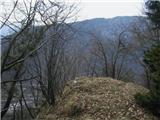
 | Leskovica - Blegoš (on unmarked path)
Blegoš is a 1,562-metre-high mountain located between the Selška Sora and Poljanska Sora rivers. From the grassy summit, where there is a stamp a...
2 h 5 min |
 | Cerknica (Senior citizens home) - Slivnica (Zatrepi - Slivnica)
Slivnica is a 1,114-meter-high peak located north of the Cerknica Field and the intermittent Lake Cerknica. The summit itself is quite rounded, p...
1 h 30 min |
 | Kosmačev preval - Črna gora
The summit is located between the Kot and Vrata valleys. A bivouac with two sleeping places stands on the summit. The view is beautiful towards K...
1 h 15 min |
 | Klemenčevo - Kamniški vrh (on southwest slope)
Kamniški vrh is a 1259-metre-high mountain located north of Kamnik, more precisely between Stahovica and the Korošica valley. From the summit, wh...
1 h 45 min |
 | Razdrto - Vojkova koča na Nanosu (Janez's path)
Vojkova koča is located on the southern edge of the high karst Nanos plateau, near Pleša. This is the prominent peak with television transmitters...
2 h |
 | Begunje (Krpin) - Smokuški vrh (on cart track and past sv. Peter)
Smokuški vrh is a panoramic mountain located on the ridge between the Završnica Valley and the Gorenjska plain. From the summit, where there is a...
1 h 50 min |
 | Rodine - Smokuški vrh (via Sankaška koča)
Smokuški vrh is a panoramic mountain located on the ridge between the Završnica Valley and the Gorenjska plain. From the summit, where there is a...
1 h 45 min |
| Begunje (Krpin) - Smokuški vrh (by road)
Smokuški vrh is a panoramic mountain located on the ridge between the Završnica Valley and the Gorenjska plain. From the summit, where there is a...
1 h 35 min |
 | Begunje (Krpin) - Smokuški vrh (through Blatnica Gorge)
Smokuški vrh is a panoramic mountain located on the ridge between the Završnica Valley and the Gorenjska plain. From the summit, where there is a...
1 h 40 min |
 | Jesenice (Ukova) - Španov vrh
Španov vrh is a 1334-meter-high mountain in the Karavanke that rises between Javorniški Rovt and Planina pod Golico. From the scenic summit, acce...
2 h |
 | Povlje - Grebenc
Grebenc is a lesser-known peak that rises steeply above Mala and Velika Poljana. From this little-visited summit, on a clear day there is a nice ...
2 h 5 min |
| Povlje - Grebenc (by cart track)
Grebenc is a lesser-known peak that rises steeply above Mala and Velika Poljana. From this little-visited summit, on a clear day there is a nice ...
2 h 5 min |
 | Valley of stream Žep - Mali Travnik
Mali Travnik is a lesser-known peak located south of the more famous Veliki Travnik. From the partly vegetated summit, there is a nice view of th...
2 h 5 min |
 | Straža (Jesenice) - Jelenkamen (via Kozjek - east path)
Jelenkamen is a peak in the northern Karawanks above Jesenice, interesting mainly for local hiking enthusiasts, some of whom choose it as their g...
1 h 15 min |
 | Jesenice (Ukova) - Jelenkamen (via Dole)
Jelenkamen is a peak in the northern Karawanks above Jesenice, interesting mainly for local hiking enthusiasts, some of whom choose it as their g...
1 h 20 min |
 | Koroška Bela (RC Kres) - Alničje (hunting path)
Alničje is a 1145 m high ridge-like rise that ascends from the southwest above the Jesenice settlements of Koroška Bela and Javornik, extending n...
1 h 20 min |
 | Spodnja Kokra - Baba
Baba is a 1,119-meter-high peak located west of the Dom Čemšenik mountain hut. The summit, which has a logbook box, offers fine views of the Gore...
1 h 35 min |
 | Potoče - Baba (via sv. Jakob and source below Potoška gora)
Baba is a 1,119-meter-high peak located west of the Dom Čemšenik mountain hut. The summit, which has a logbook box, offers fine views of the Gore...
2 h 10 min |
 | Razdrto - Grmada (Nanos)
Grmada is a 1209-meter peak situated near the edge of the Nanos plateau, northwest of the better-known Pleša (about a 20-minute walk away). Becau...
2 h 5 min |
 | Livek - Kuk (Kolovrat)
Kuk is the highest peak of the Kolovrat range at 1243 m. The range extends from Livek to Kambreško. From the summit, which has several transmitte...
1 h 30 min |
 | Dom pod Reško planino - Javor
Javor is a 1,132-meter-high peak situated between Kisovec and Sveta Planina. The summit, covered with forest, offers no views, but a nice panoram...
2 h 5 min |
 | Ridovc / Ridovcsäge - Mejnik (via valley of Mrzli potok)
Mejnik is a 1517-meter-high peak on the Austrian side of the Karawanks, more precisely in a side ridge of Košuta. On the forested summit is a bou...
2 h 5 min |
 | Podvolovljek (Petkov graben) - Kunšperski vrh (Brezovec)
Kunšperski vrh, also Brezovec, is a lesser-known peak located west of Lepenatka. From its partly vegetated summit, nice views open up towards Vel...
2 h |
 | Podljubelj (Lajb) - Čisovec
Čisovec is a panoramic peak located between Dobrča and Begunjščica. From the summit, beautiful views open up towards Košuta, the Kamnik-Savinja A...
2 h |
 | Poljšica pri Gorjah (Zatrata) - Hotunjski vrh (on footpath)
Hotunjski vrh is a 1,107-meter-high panoramic peak located above the Zatrnik ski slope. From the summit, where there is a summit register box and...
1 h 30 min |
| Poljšica pri Gorjah (Zatrata) - Hotunjski vrh (by road)
Hotunjski vrh is a 1,107-meter-high panoramic peak located above the Zatrnik ski slope. From the summit, where there is a summit register box and...
2 h |
 | Podblica - Bela peč (Podbliška gora)
Bela peč is situated on the edge of Jelovica above the village Podblica. From the top of the cliff a beautiful view opens up towards the mentione...
1 h 30 min |
 | Mežica - Jesenik (Jesenikov vrh) (via saddle Vrh šteng)
Jesenik, also known as Jesenikov vrh, is a 1,199-meter-high forested peak situated between Mežica and Podpeca....
2 h |
 | Mežica - Jesenik (Jesenikov vrh) (via homestead Jesenik)
Jesenik, also known as Jesenikov vrh, is a 1,199-meter-high forested peak situated between Mežica and Podpeca....
2 h 5 min |
 | Mežica - Pikov vrh (via homestead Jesenik)
Pikov vrh is a 1,149-meter-high peak located above Podpeča, more precisely above the Pik homestead, near the Koča na Pikovem mountain hut. On the...
2 h |
| Črna na Koroškem (Mušenik) - Pikov vrh (via Koča na Pikovem)
Pikov vrh is a 1,149-meter-high peak located above Podpeča, more precisely above the Pik homestead, near the Koča na Pikovem mountain hut. On the...
1 h 45 min |
 | Črna na Koroškem (Mušenik) - Veliki vrh (above Mežiška dolina) (via Šumahovo sedlo)
Veliki vrh is a 1,165-meter-high peak located between Mežica and Črna na Koroškem. On the summit, beside the television transmitters, there is a ...
1 h 45 min |
 | Črna na Koroškem (Mušenik) - Šumahov vrh (via Šumahovo sedlo)
Šumahov vrh is a 1,155-meter-high peak on which a wooden cross stands. From the summit, which descends steeply towards Žerjav, a nice view opens ...
1 h 45 min |
 | Spodnja Kokra - Škrbina (Slaparjeva gora) (via farm Zajc)
Škrbina is a 1,142-meter-high peak in the ridge of Slaparjeva gora, above the Kokra Valley. From the summit, there is a nice view towards the Koč...
1 h 40 min |
 | Bela Peč / Villa Bassa - Črni vrh / Colrotondo
Črni vrh / Colrotondo is a fairly panoramic peak located west to southwest of the Belopeška jezera lakes. From the summit, which features a hunti...
2 h |
 | Rodine - Pleče (via Sankaška koča)
Pleče is a 1,131-meter-high peak located north of Sveti Peter above Begunje. The summit is overgrown with forest, but near the top some views ope...
1 h 50 min |
| Begunje (Krpin) - Pleče (by ski slope and via Sankaška koča)
Pleče is a 1,131-meter-high peak located north of Sveti Peter above Begunje. The summit is overgrown with forest, but near the top some views ope...
1 h 45 min |
| Begunje (PGD Begunje) - Pleče (Petrova pot)
Pleče is a 1,131-meter-high peak located north of Sveti Peter above Begunje. The summit is overgrown with forest, but near the top some views ope...
1 h 45 min |
| Begunje (Krpin) - Pleče (by road)
Pleče is a 1,131-meter-high peak located north of Sveti Peter above Begunje. The summit is overgrown with forest, but near the top some views ope...
1 h 40 min |
| Begunje (Krpin) - Pleče (through Blatnica Gorge)
Pleče is a 1,131-meter-high peak located north of Sveti Peter above Begunje. The summit is overgrown with forest, but near the top some views ope...
1 h 45 min |
 | Dolina - Robič
Robič is a 1,384-meter-high peak located between the Tržiška Bistrica Valley and the Košuta ridge. From the summit, there is a beautiful view mai...
1 h 55 min |
 | Jelendol (mansion Puterhof) - Primožkovi hribi
Primožkovi hribi is a small ridge above Jelendol, situated between the Tržiška Bistrica, Dolžanka and Zalega potok streams. The ridge's highest p...
1 h 40 min |
| MHE Zali potok - Primožkovi hribi
Primožkovi hribi is a small ridge above Jelendol, situated between the Tržiška Bistrica, Dolžanka and Zalega potok streams. The ridge's highest p...
1 h 30 min |
 | Dovje - Bela peč (above Dovje)
Bela peč is a lesser-known peak located above the marked trail from Dovje to Dovška Baba. From the summit, there is a beautiful view to the south...
2 h |
 | Übelbach - Schankkogel
Schankkogel is, with its 1049 meters, the highest peak of the Notberg hill near the settlement of Guggenbach (close to Übelbach) in Steiermark.Be...
1 h 30 min |
 | Übelbach - Schankkogel (steep path)
Schankkogel is, with its 1049 meters, the highest peak of the Notberg hill near the settlement of Guggenbach (close to Übelbach) in Steiermark.Be...
1 h 30 min |
 | Mixnitz (parking lot Bärenschützklamm) - Rannerwandkreuz
Rannerwandkreuz is a rocky promontory on the ridge of Ranerwand hill in the Graz Mountains in Austrian Styria.From the rocky promontory, where a ...
1 h 45 min |