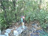
 | Jablje Castle - Rašica (Vrh Staneta Kosca)
Vrh Staneta Kosca, better known as Rašica, is located north of Ljubljana, more precisely above the villages of Rašica and Dobeno. From the summit...
1 h 20 min |
| Loka - Rašica (Vrh Staneta Kosca)
Vrh Staneta Kosca, better known as Rašica, is located north of Ljubljana, more precisely above the villages of Rašica and Dobeno. From the summit...
1 h 20 min |
 | Ljubljana (Šentvid) - Toško Čelo
Toško Čelo is a 590-metre hill above the village of the same name. From the summit, or slightly below it, a beautiful view opens over part of Lju...
1 h 45 min |
 | Grgar - Sveta Gora (via Frančiškov hrib)
Sveta Gora is known mainly among believers and locals. It is a well-known pilgrimage center above Nova Gorica. Believers come here from all over ...
1 h 25 min |
 | Grgar - Sveta Gora (via Po sredi)
Sveta Gora is known mainly among believers and locals. It is a well-known pilgrimage center above Nova Gorica. Believers come here from all over ...
1 h 15 min |
| Grgar - Sveta Gora (via Ranjeke)
Sveta Gora is known mainly among believers and locals. It is a well-known pilgrimage center above Nova Gorica. Believers come here from all over ...
1 h 30 min |
 | Grgar - Sveta Gora (via Križce)
Sveta Gora is known mainly among believers and locals. It is a well-known pilgrimage center above Nova Gorica. Believers come here from all over ...
1 h 30 min |
 | Tacen - Grmada (Mazijeva steza)
Grmada is a 676-meter-high mountain located west of the much more visited Šmarna gora. From the summit, which has a small takeoff area, a beautif...
1 h 10 min |
 | Tacen (Sveti Jurij) - Grmada
Grmada is a 676-meter-high mountain located west of the much more visited Šmarna gora. From the summit, which has a small takeoff area, a beautif...
1 h 5 min |
 | Za koridorjem - Sabotin (on ridge)
Sabotin is a hill above Nova Gorica or, more precisely, above Solkan. Despite its modest height, it is an excellent viewpoint with views of the J...
1 h 15 min |
 | Blatni dol - Koča na Planini nad Vrhniko
Planina nad Vrhniko is for Vrhnika locals something like Šmarna gora for those from Ljubljana. It is 733 m high, reachable by several paths from ...
1 h 10 min |
 | Vrhnika - Koča na Planini nad Vrhniko (via bukev)
Planina nad Vrhniko is for Vrhnika locals something like Šmarna gora for those from Ljubljana. It is 733 m high, reachable by several paths from ...
1 h 5 min |
 | Jevnica - Janče
Janče is a 792-meter-high peak situated between the Sava River and the Besnica stream valley. From the summit, where a mountain hut stands and th...
1 h 45 min |
 | Senožeti - Sveti Miklavž above Sava (footpath)
The Church of St. Miklavž is situated on a panoramic hill south of Moravče. From the summit, there is a beautiful view toward the nearby Limbarsk...
1 h 20 min |
 | Senožeti - Cicelj
Cicelj is a forest-covered peak located between Moravče and the village of Senožeti. From the summit, which has a bench and a logbook box, there ...
1 h 30 min |
 | Kamnica - Cicelj (via farm Buven)
Cicelj is a forest-covered peak located between Moravče and the village of Senožeti. From the summit, which has a bench and a logbook box, there ...
1 h 45 min |
 | Kamnica - Cicelj
Cicelj is a forest-covered peak located between Moravče and the village of Senožeti. From the summit, which has a bench and a logbook box, there ...
1 h 40 min |
 | Senožeti - Cicelj (hunting path)
Cicelj is a forest-covered peak located between Moravče and the village of Senožeti. From the summit, which has a bench and a logbook box, there ...
1 h 30 min |
 | Breg - Sveti Lovrenc (above Okroglice)
The Church of St. Lovrenc is located east of Zidani Most and northwest of Sevnica, above the village of Okroglice and near the Lovrenc peak. From...
1 h 45 min |
| Dolina Gračnice (Blatnik) - Sveti Lovrenc (above Okroglice)
The Church of St. Lovrenc is located east of Zidani Most and northwest of Sevnica, above the village of Okroglice and near the Lovrenc peak. From...
1 h 45 min |
 | Hrastnik - Dom v Gorah
The Dom v Gorah mountain hut is located east of Hrastnik, just a few meters below the 786 m high peak where the church of St. Jurij stands. From ...
1 h 30 min |
 | Rečica ob Paki - Gora Oljka
Gora Oljka is a hill located east of Šmartno ob Paki. On the summit stands the Church of the Holy Cross, built in the mid-18th century. Just a fe...
1 h 15 min |
 | Podgora - Gora Oljka (Martin way)
Gora Oljka is a hill located east of Šmartno ob Paki. On the summit stands the Church of the Holy Cross, built in the mid-18th century. Just a fe...
1 h 20 min |
 | Prebold - Golava
Golava is a peak located north of Mrzlica. From the summit, where there is a small bivouac (Blažev bivak), there is a fine view toward the aforem...
1 h 45 min |
 | Spodnja Rečica - Dom na Šmohorju (via Tolsto)
The mountain lodge on Šmohor is located on a picturesque and scenic ridge between Laško, Liboje and Zabukovica. The lodge, a popular spot for bot...
1 h 35 min |
 | Grgar - Vodice (via Ranjeke)
Vodice (according to some records also Sveti Jakob) is a peak on the western part of the Banjška planota plateau. From the summit, which features...
1 h 30 min |
 | Tremerje - Veliki Slomnik (Tremerje - Veliki Slomnik - Liboje)
Veliki Slomnik is a peak located between Košnica pri Celju and Liboje. The summit has a logbook box, but due to the surrounding forest, there are...
1 h 35 min |
 | Šentjur - Resevna
Resevna is a peak situated south of Šentjur. At the summit stands a 20-meter-high observation tower offering beautiful views that extend far acro...
1 h 30 min |
| Jakob pri Šentjurju - Resevna
Resevna is a peak situated south of Šentjur. At the summit stands a 20-meter-high observation tower offering beautiful views that extend far acro...
1 h 30 min |
 | Šentjur (center) - Resevna (via Krajnče)
Resevna is a peak situated south of Šentjur. At the summit stands a 20-meter-high observation tower offering beautiful views that extend far acro...
1 h 35 min |
| Šentjur (center) - Resevna (steep path)
Resevna is a peak situated south of Šentjur. At the summit stands a 20-meter-high observation tower offering beautiful views that extend far acro...
1 h 30 min |
| Šentjur (center) - Resevna (gentle path)
Resevna is a peak situated south of Šentjur. At the summit stands a 20-meter-high observation tower offering beautiful views that extend far acro...
1 h 35 min |
 | Gorica pri Slivnici - Rifnik
Rifnik is a 568-meter-high peak situated south of Šentjur pri Celju. The summit, known for its archaeological site, offers nice views towards Šen...
1 h 15 min |
 | Zagrad - Grmada above Celje (gentle path)
What Šmarna gora is to people from Ljubljana, Grmada is to those from Celje. Celje's local mountain lies south of the town above Zagrad village. ...
1 h 30 min |
 | Zvodno - Grmada above Celje (via Suhi potok)
What Šmarna gora is to people from Ljubljana, Grmada is to those from Celje. Celje's local mountain lies south of the town above Zagrad village. ...
1 h 15 min |
 | Zagrad - Tolsti vrh above Celjska koča (Po vrheh)
Tolsti vrh (also recorded as Tovsti vrh in some sources) is situated above the Celjska koča ski area. The summit has a logbook box and stamp, but...
1 h 40 min |
 | Zvodno - Tolsti vrh above Celjska koča (via Suhi potok)
Tolsti vrh (also recorded as Tovsti vrh in some sources) is situated above the Celjska koča ski area. The summit has a logbook box and stamp, but...
1 h 30 min |
 | Zvodno - Tolsti vrh above Celjska koča (via Marija)
Tolsti vrh (also recorded as Tovsti vrh in some sources) is situated above the Celjska koča ski area. The summit has a logbook box and stamp, but...
1 h 40 min |
 | Zvodno - Tolsti vrh above Celjska koča (via Suhi potok and on ski slope)
Tolsti vrh (also recorded as Tovsti vrh in some sources) is situated above the Celjska koča ski area. The summit has a logbook box and stamp, but...
1 h 30 min |
 | Lopata - Planinski dom Šentjungert
The mountain hut is located just a few meters below the summit of Gora, where the Church of St. Kunigunda stands; it was built in the 14th centur...
1 h 30 min |
 | Pišece (Pri mlinu) - Veliki Špiček
Veliki Špiček is the highest peak of Brežice municipality. From the top a nice view spreads towards the south and east. Most of Brežice municipal...
1 h 25 min |
 | Kamnica - Murovica
Murovica is a popular excursion point, accessible from the Posavje side, Domžale, or the Moravška Valley. On the summit there is a bench and a lo...
1 h 20 min |
| Senožeti - Murovica (via farm Buven)
Murovica is a popular excursion point, accessible from the Posavje side, Domžale, or the Moravška Valley. On the summit there is a bench and a lo...
1 h 55 min |
 | Bistra - Mali Trebelnik
Mali Trebelnik is an 807-meter-high hill rising above the southwestern part of the Ljubljana Marshes. From the partly grassy summit, which is par...
1 h 45 min |
 | Spodnja Rečica - Tolsto
Tolsto is a 780-meter-high hill between Huda Jama and Šmohor. The summit has a logbook and stamp box, but offers no view due to the forest....
1 h 15 min |
 | Reka - Rodne
Rodne is a 698-meter-high peak situated west of Orehovška Grapa. From the grassy summit, a nice view opens up towards the Cerkljansko-Idrijsko hi...
1 h 20 min |
 | Seljanec - Ham (via Seljanečki potok)
Ham is an isolated peak beside the Ivanščica range, above the Bednja river valley. It is separated from Ivanščica by the Železnice stream valley,...
1 h 30 min |
 | Grgar - Frančiškov hrib
Frančiškov hrib is a less prominent peak on Skalnica, whose highest point is the 681-meter-high Sveta Gora. From the panoramic summit, which feat...
1 h 15 min |
 | Dobrnič - Trebni vrh (via Šahovec)
Trebni vrh is a 581-meter-high hill located south or southwest of Trebnje. On the forested summit stands a bench, and nearby is a logbook box wit...
1 h 45 min |
 | Bela - Čevo
Čevo is the eastern peak on Ivanščica. From the south it is a gentle hill, but from the north it descends very steeply into the valley. It is als...
1 h 45 min |
 | Lesično - Brest (Bohor)
Brest is a peak on Bohor, though it resembles more of a saddle. It is an important trail junction on Bohor, lying between more easterly Oslica an...
1 h 30 min |
 | Kozje - Raskože (Bohor) (via Vetrnik)
Raskože is a 650-meter-high peak on the eastern part of Bohor. Some people also call this area Vetrnik. The south side of the peak is dominated b...
1 h 15 min |
 | Kozje - Pokojni vrh (Bohor) (via Vetrnik)
Pokojni vrh is on the eastern part of Bohor. The western part features a pasture, the rest mostly forest. There is no summit logbook. From the to...
1 h 30 min |
| Tourist farm Žurej - Žusem (Panoramska pot - old route)
Žusem is a 669-meter-high hill with a rich history and great potential for the future. It forms the northern edge of Kozjansko, and its name deri...
1 h 40 min |
 | Tourist farm Žurej - Žusem (Panoramska pot)
Žusem is a 669-meter-high hill with a rich history and great potential for the future. It forms the northern edge of Kozjansko, and its name deri...
1 h 40 min |
 | Loka pri Žusmu (Žamerk) - Žusem
Žusem is a 669-meter-high hill with a rich history and great potential for the future. It forms the northern edge of Kozjansko, and its name deri...
1 h 20 min |
 | Loka pri Žusmu (Žamerk) - Žusem (via Dobrina)
Žusem is a 669-meter-high hill with a rich history and great potential for the future. It forms the northern edge of Kozjansko, and its name deri...
1 h 30 min |
| Krka - Ciganov vrh (Korinjski hrib) (part of circular path Prijetno domače)
Ciganov vrh (Korinjski hrib) is a smaller hill rising above the Krka River valley, from which opens a view (occasionally obscured by vegetation) ...
1 h 45 min |
 | Naraplje - Jelovice
Jelovice, at 623 meters, is the highest peak in the Haloze hills. The summit is accessible from several directions. It offers partial views towar...
1 h 40 min |
| Stogovci (Vabča vas) - Jelovice
Jelovice, at 623 meters, is the highest peak in the Haloze hills. The summit is accessible from several directions. It offers partial views towar...
1 h 40 min |
 | Gradišče pri Vipavi - Škavnica
Škavnica is a 734-meter-high peak above Vipava. From the summit, which features a small cross and bench, there are excellent views of the Vipava ...
1 h 15 min |
 | Railway station (Most na Soči) - Viewpoint Široko
The viewpoint lies at 755 m above Most na Soči in the namesake hamlet of Tolminski Lom. Access is possible by car to the nearby tourist farm or o...
1 h 40 min |
 | Zvodno - Bavč (via Suhi potok)
Bavč is a wooded peak located south of Celje and Zvodno in the Posavsko hribovje between Grmada and Srebotnik. On the way to the summit, views re...
1 h 10 min |
 | Stogovci (Vabča vas) - Kerješetov vrh
Kerješetov vrh is a 590-meter-high hill located above the settlement of Jelovice. The summit is overgrown with forest, so there is no good view f...
1 h 30 min |
 | Radoboj - Sekolje (Strahinjčica)
Sekolje is the easternmost peak of Strahinjčica. It appears as an interesting cone shape from the surrounding areas. The view from the peak is li...
1 h 30 min |
 | Rimske Toplice - Stražnik (via Borovo)
Stražnik is a 648-meter peak south of Rimske Toplice. The summit features a bench and summit register box, with a cross erected in 2021 about 50 ...
1 h 20 min |
 | Podčetrtek (Terme Olimia) - Zavetišče Šmarnica on Mala Rudnica (past castle Podčetrtek)
The Šmarnica shrine is located on Mala Rudnica within the Rudnica range, a smaller hill chain above Podčetrtek. From the shrine there opens a bea...
1 h 15 min |
| Podčetrtek (sveti Lovrenc) - Zavetišče Šmarnica on Mala Rudnica (past castle Podčetrtek)
The Šmarnica shrine is located on Mala Rudnica within the Rudnica range, a smaller hill chain above Podčetrtek. From the shrine there opens a bea...
1 h 5 min |
 | Olimje - Zavetišče Šmarnica on Mala Rudnica
The Šmarnica shrine is located on Mala Rudnica within the Rudnica range, a smaller hill chain above Podčetrtek. From the shrine there opens a bea...
1 h 45 min |
| Slake (Church of the Virgin Mary on Pesek) - Zavetišče Šmarnica on Mala Rudnica
The Šmarnica shrine is located on Mala Rudnica within the Rudnica range, a smaller hill chain above Podčetrtek. From the shrine there opens a bea...
1 h 35 min |
 | Podčetrtek (Terme Olimia) - Silavec (The Tower of Health and Joy on Rudnica) (past castle Podčetrtek)
Silavec is a 622-meter-high peak on Rudnica above Podčetrtek, on which stands a lookout tower slightly over 35 meters tall, offering a beautiful ...
1 h 35 min |
| Podčetrtek (sveti Lovrenc) - Silavec (The Tower of Health and Joy on Rudnica) (past castle Podčetrtek)
Silavec is a 622-meter-high peak on Rudnica above Podčetrtek, on which stands a lookout tower slightly over 35 meters tall, offering a beautiful ...
1 h 25 min |
| Podčetrtek (sveti Lovrenc) - Silavec (The Tower of Health and Joy on Rudnica) (easier path)
Silavec is a 622-meter-high peak on Rudnica above Podčetrtek, on which stands a lookout tower slightly over 35 meters tall, offering a beautiful ...
1 h 15 min |
| Podčetrtek (sveti Lovrenc) - Silavec (The Tower of Health and Joy on Rudnica) (harder path)
Silavec is a 622-meter-high peak on Rudnica above Podčetrtek, on which stands a lookout tower slightly over 35 meters tall, offering a beautiful ...
1 h 15 min |
| Spodnje Tinsko - Silavec (The Tower of Health and Joy on Rudnica)
Silavec is a 622-meter-high peak on Rudnica above Podčetrtek, on which stands a lookout tower slightly over 35 meters tall, offering a beautiful ...
1 h 20 min |
| Olimje - Silavec (The Tower of Health and Joy on Rudnica) (past Koča pri čarovnici)
Silavec is a 622-meter-high peak on Rudnica above Podčetrtek, on which stands a lookout tower slightly over 35 meters tall, offering a beautiful ...
1 h 45 min |
| Olimje - Silavec (The Tower of Health and Joy on Rudnica) (harder path)
Silavec is a 622-meter-high peak on Rudnica above Podčetrtek, on which stands a lookout tower slightly over 35 meters tall, offering a beautiful ...
1 h 35 min |
| Olimje - Silavec (The Tower of Health and Joy on Rudnica) (easier path)
Silavec is a 622-meter-high peak on Rudnica above Podčetrtek, on which stands a lookout tower slightly over 35 meters tall, offering a beautiful ...
1 h 35 min |
| Slake (Church of the Virgin Mary on Pesek) - Silavec (The Tower of Health and Joy on Rudnica) (harder path)
Silavec is a 622-meter-high peak on Rudnica above Podčetrtek, on which stands a lookout tower slightly over 35 meters tall, offering a beautiful ...
1 h 25 min |
| Slake (Church of the Virgin Mary on Pesek) - Silavec (The Tower of Health and Joy on Rudnica) (easier path)
Silavec is a 622-meter-high peak on Rudnica above Podčetrtek, on which stands a lookout tower slightly over 35 meters tall, offering a beautiful ...
1 h 25 min |
 | Zgornje Poljčane - Rančka
Rančka is a 615-meter-high peak located west to southwest of Boč. Just below the summit is a stamp box with a bench nearby; the highest point its...
1 h 25 min |
| Zgornje Poljčane - Rančka (po Jakobovi poti)
Rančka is a 615-meter-high peak located west to southwest of Boč. Just below the summit is a stamp box with a bench nearby; the highest point its...
1 h 25 min |
 | Spodnje Tinsko - Plešivec (Rudnica)
Plešivec is a forest-covered peak on Rudnica, its highest point. The summit has a summit register box, a bench, and a table....
1 h 45 min |
| Olimje - Plešivec (Rudnica) (past lake Zmajevo jezero)
Plešivec is a forest-covered peak on Rudnica, its highest point. The summit has a summit register box, a bench, and a table....
1 h 50 min |
| Olimje - Plešivec (Rudnica)
Plešivec is a forest-covered peak on Rudnica, its highest point. The summit has a summit register box, a bench, and a table....
1 h 30 min |
| Podčetrtek (sveti Lovrenc) - Plešivec (Rudnica)
Plešivec is a forest-covered peak on Rudnica, its highest point. The summit has a summit register box, a bench, and a table....
1 h 50 min |
 | Prebold - Žvajga (northern peak) (western path)
The northern peak of Žvajga is a 620-meter-high hill located south to southwest of Prebold and northwest of the slightly higher southern peak. A ...
1 h 5 min |
 | Prebold - Tolsti vrh (above Prebold)
Tolsti vrh is a 756-meter-high mountain located southwest of Prebold. From the summit, where a logbook is located, there are partial views toward...
1 h 25 min |
 | Rukavac - Orjak (above Opatija) (direct way)
Orjak is a 722-meter-high peak above Opatija. The rocky summit features two stamps and a logbook. From the top, there are views of Opatija and pa...
1 h 30 min |
 | Liganj - Gorica (above Lovran)
Gorica is a panoramic peak above Lovran, which is on Učka. The summit has a logbook. From the top, parts of Učka are visible, highlighted by its ...
1 h 10 min |
 | Stojdraga (Glažuta) - Tuščak (Žumberačka gora)
Tuščak is a forested hill above the Bregana River valley on Žumberačka gora. The summit features a logbox....
1 h 10 min |
 | Stojdraga (Glažuta) - Gradina Tuščak (via Tuščak)
Gradina Tuščak is an HPO point about 10 minutes off the Tuščak summit. The castle is believed to have been built at the end of the 12th or beginn...
1 h 20 min |
 | Podsreda - Rigelj
Rigelj is a 626-meter-high indistinct peak in the Orlice range, on which a few antennas stand....
1 h 15 min |
 | Podsreda - Veliki vrh (Orlica) (through Osredek pri Podsredi)
Veliki vrh is the highest point of the Orlica hills at 701 meters above sea level, stretching along the border between Posavje and Kozjansko and ...
1 h 45 min |
 | Pišece (Pri mlinu) - Intermedija
Intermedija is a 662-meter-high peak in the Orlica range. From the summit, there is a beautiful view mainly to the north and northeast, where on ...
1 h 50 min |
 | Pišece (Pri mlinu) - Velika Vagla
Velika Vagla is a 667-meter-high peak located in the Orlice mountain range, specifically along the marked trail from Pišece to Veliki Špiček....
1 h 5 min |
 | Pišece (Pri mlinu) - Veliki vrh (nad Pišecami)
Veliki vrh is a forested peak located between Veliki Špiček and Velika Vagla. A marked trail from Pišec to Veliki Špiček passes over the summit, ...
1 h 15 min |
 | Stari trg (Pilštanj) - Bredič
Bredič is a 692-meter-high peak in the ridge of the same name, which rises steeply above the right bank of the Bistrica River between the settlem...
1 h 25 min |
| Lesično - Bredič
Bredič is a 692-meter-high peak in the ridge of the same name, which rises steeply above the right bank of the Bistrica River between the settlem...
1 h 55 min |