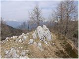
 | Križe - Tolsti vrh (Sheep trail over Kriška gora)
Tolsti vrh, located west of Storžič, is at 1715 metres also the highest peak of the Kriška gora range, which rises steeply above central Gorenjsk...
3 h 45 min |
 | Tominčev slap Waterfall - Dobrča
Dobrča is a 1634-metre mountain located between Begunje and Tržič. From the summit, which has a registration box with a stamp, the view opens onl...
3 h |
 | Hudi Graben - Dobrča (via Lešanska planina)
Dobrča is a 1634-metre mountain located between Begunje and Tržič. From the summit, which has a registration box with a stamp, the view opens onl...
2 h 35 min |
| Hudi Graben - Dobrča
Dobrča is a 1634-metre mountain located between Begunje and Tržič. From the summit, which has a registration box with a stamp, the view opens onl...
2 h 30 min |
 | Grahovše - Veliki Javornik (Ženiklovec)
Veliki Javornik (also known as Ženiklovec) is a 1716 m high peak located between Storžič and Stegovnik. From the grassy summit with its registrat...
2 h 45 min |
 | Grahovše - Veliki Javornik (Ženiklovec) (via Rekar)
Veliki Javornik (also known as Ženiklovec) is a 1716 m high peak located between Storžič and Stegovnik. From the grassy summit with its registrat...
2 h 45 min |
 | Kraljev hrib - Rzenik (west path)
Rzenik is a grassy peak surrounded by dwarf pines that drops precipitously into the Kamniška Bela valley. From the summit, in clear weather, a wo...
3 h 40 min |
 | Volaka - Blegoš (on unmarked path)
Blegoš is a 1,562-metre-high mountain located between the Selška Sora and Poljanska Sora rivers. From the grassy summit, where there is a stamp a...
2 h 35 min |
 | Potoče - Javorov vrh (via Sveti Jakob, below Potoška gora and over Baba)
Javorov Vrh (recorded in some sources as Javorjev Vrh) is a 1,434 m high mountain northeast of Preddvor. The summit, with its registration box an...
2 h 55 min |
| Spodnja Kokra - Javorov vrh (via Baba)
Javorov Vrh (recorded in some sources as Javorjev Vrh) is a 1,434 m high mountain northeast of Preddvor. The summit, with its registration box an...
2 h 30 min |
 | Mače - Bašeljski vrh (via valley of Suha and via Kališče)
Bašeljski vrh is a 1744-meter-high mountain located between Mali Grintovec and Storžič. From the summit, where there is a bench and a registratio...
3 h 25 min |
 | Dovje - Frauenkogel/Dovška Baba (via Blažčeva skala)
Dovška Baba is a 1891-meter-high peak located on the border ridge between Slovenia and Austria. From the summit, which has a registration box and...
3 h 15 min |
 | Rosenbach - Klek
Klek is a 1753-metre-high mountain located between Hruški vrh and the better-known Golica. The summit, on the border between Slovenia and Austria...
3 h 40 min |
 | Log - Vošca
Vošca is a 1737 m high peak located west of Trupejevo poldne. From the grassy summit, there is a beautiful view of the Julian Alps, western Karaw...
2 h 30 min |
 | Kraljev hrib - Koritni vrh (Velika planina)
Koritni vrh is a 1648 m high mountain on the northern part of Velika planina. From the summit, where a small cross stands, there is a beautiful v...
3 h |
 | Okrog pri Motniku - Vivodnik (via Biba planina)
Vivodnik, at 1508 meters, is the highest peak of Menina planina, a plateau rising south of Gornji Grad. From the summit, which has a small observ...
2 h 25 min |
| Okrog pri Motniku - Vivodnik (via Oseke and peak Drč)
Vivodnik, at 1508 meters, is the highest peak of Menina planina, a plateau rising south of Gornji Grad. From the summit, which has a small observ...
2 h 15 min |
| Češnjice v Tuhinju - Vivodnik
Vivodnik, at 1508 meters, is the highest peak of Menina planina, a plateau rising south of Gornji Grad. From the summit, which has a small observ...
2 h 25 min |
 | Mojstrana - Vrtaški vrh (old path)
Vrtaški Vrh is a panoramic mountain above Vrata Valley. From the grassy peak, surrounded by dwarf pines, there is a nice view toward the neighbor...
3 h 30 min |
 | Source of Ljubija - Smrekovec (via Leskovškova pustota)
Smrekovec is a mountain of volcanic origin on the eastern edge of the Smrekovec mountain range. The wide grassy summit features a pyramid with a ...
2 h 20 min |
| Source of Ljubija - Smrekovec (by road)
Smrekovec is a mountain of volcanic origin on the eastern edge of the Smrekovec mountain range. The wide grassy summit features a pyramid with a ...
2 h 30 min |
 | Ivarčko jezero - Uršlja gora (Plešivec) (Grofovska pot)
Uršlja gora, or Plešivec, is a panoramic mountain between Slovenj Gradec and Črna na Koroškem. At or just below the summit stands the Church of S...
2 h 50 min |
 | Trbiž / Tarviso - Svete Višarje / Monte Lussari (on transport road)
Svete Višarje / Monte Lussari is a pilgrimage site for Slavs, Germans, and Romance peoples. Already in the 16th century, the mountain was called ...
3 h 25 min |
 | Ukanc - Vrh Planje (above Globoko) (via Globoko)
Vrh Planje is a less prominent peak in the ridge of the Lower Bohinj Mountains, which has been increasingly visited lately. Vrh Planje (above Glo...
4 h |
 | Bohinjska Bistrica - Krevl (on ski track)
Krevl is a 1515-meter-high peak situated south of the Kobla ski area, more precisely between the Kobla peak and Kravja Črna gora. From the summit...
2 h 45 min |
 | Jevšček - Monte Mataiur/Matajur
Matajur is a panoramic mountain located on the border between Slovenia and Italy. From the summit there is a beautiful view of Kobariški or Bregi...
2 h 30 min |
 | Podljubelj / Unterloibl - Singerberg / Žingarica
Žingarica / Singerberg is a peak on the Austrian side of the Karawanks above the village of Slovenji Plajberk / Windisch Bleiberg. From the summi...
3 h |
 | Podbreg - Logarska peč
Logarska peč is a peak or viewpoint a few meters below the summit, rising steeply above the Logarska Valley. From Logarska peč there is a very ni...
2 h 20 min |
 | Grant - Jehlc (Špičasta kupa)
Different maps list various names for Jehlc, which also vary in elevation. Locals call the peak Jehlc (1625 m), while newer maps show Jehelc and ...
2 h 45 min |
| Stržišče - Jehlc (Špičasta kupa)
Different maps list various names for Jehlc, which also vary in elevation. Locals call the peak Jehlc (1625 m), while newer maps show Jehelc and ...
3 h 30 min |
 | Jesenice (Straža) - Španov vrh (via Jelenkamen)
Španov vrh is a 1334-meter-high mountain in the Karavanke that rises between Javorniški Rovt and Planina pod Golico. From the scenic summit, acce...
2 h 30 min |
 | Zalog - Grebenc
Grebenc is a lesser-known peak that rises steeply above Mala and Velika Poljana. From this little-visited summit, on a clear day there is a nice ...
2 h 25 min |
 | Kal - Rušni vrh
Rušni vrh is a 1,786-meter-high peak located east of Črna Prst. From the summit, which features a border stone from the old Rapallo border, a bea...
2 h 20 min |
| Podbrdo - Rušni vrh
Rušni vrh is a 1,786-meter-high peak located east of Črna Prst. From the summit, which features a border stone from the old Rapallo border, a bea...
3 h 5 min |
 | Bohinjska Bistrica - Rušni vrh (via Planina za Črno goro)
Rušni vrh is a 1,786-meter-high peak located east of Črna Prst. From the summit, which features a border stone from the old Rapallo border, a bea...
3 h 50 min |
 | Radovna - Vošni vrh
Vošni vrh is a 1,621-meter-high mountain located in the ridge that begins at Radovna and ends at Tosc. Although the summit itself is in the fores...
3 h |
 | Ribčev Laz - Hunting cottage Na Glinu
The hunting cottage Na Glinu is situated on a panoramic hill between the mountain pastures Suha and Poljana. From the cottage there opens a nice ...
3 h 30 min |
 | Jasna - Visoka peč (via Mojčin dom)
Visoka peč is a 1,749-meter-high mountain located southwest of Ciprnik. From its summit, which steeply descends towards Planica and features a sm...
3 h 30 min |
| Kranjska Gora - Visoka peč (via Bedančev dom)
Visoka peč is a 1,749-meter-high mountain located southwest of Ciprnik. From its summit, which steeply descends towards Planica and features a sm...
3 h 25 min |
 | Trbiž / Tarviso - Florjanka / Monte Florianca (on transport road)
Florjanka is a 1,653-meter-high mountain on the Italian side of the Julian Alps. At or just below the summit is a reservoir for snowmaking on the...
2 h 30 min |
 | Dom v Lepeni - Velika Montura
Velika Montura is a panoramic peak located between Velika Baba, Lanževica, Bogatin, and Veliki Šmohor. Just below the summit are old Italian bord...
3 h 55 min |
 | Rebrca / Rechberg - Stara gora / Altberg (via Bukovnik)
Stara gora is a 1,552-meter-high peak located northeast of Ojstrca, the highest peak of Obir. On the summit stand a wooden cross and a bench, wit...
2 h 50 min |
| Rebrca / Rechberg - Stara gora / Altberg (via Rokov vrh)
Stara gora is a 1,552-meter-high peak located northeast of Ojstrca, the highest peak of Obir. On the summit stand a wooden cross and a bench, wit...
3 h 10 min |
 | Sele-Zvrhnji Kot (Male) / Zell-Oberwinkel (Male) - Hajnžev Praprotnik / Zeller Prapotnik
Hajnžev Praprotnik is a 1,727-metre peak on the Austrian side of the Karawanks, more precisely between Košutica and the settlement of Sele-Zvrhnj...
3 h 55 min |
 | Podljubelj - Robič (via Zavetišče na Kalu)
Robič is a 1,384-meter-high peak located between the Tržiška Bistrica Valley and the Košuta ridge. From the summit, there is a beautiful view mai...
2 h 15 min |
| Tržič - Robič (via Kamnek and Zavetišče na Kalu)
Robič is a 1,384-meter-high peak located between the Tržiška Bistrica Valley and the Košuta ridge. From the summit, there is a beautiful view mai...
3 h 35 min |
| Tržič (Čegelše) - Robič (via Zavetišče na Kalu)
Robič is a 1,384-meter-high peak located between the Tržiška Bistrica Valley and the Košuta ridge. From the summit, there is a beautiful view mai...
2 h 55 min |
 | Bistrica v Rožu / Feistritz im Rosental - Rabenberg
Rabenberg is a 1,465 m high peak located in the Žingarica / Singerberg ridge. From the summit, there is a partial view to the northwest, while fo...
3 h 20 min |
 | Dovje - Bela peč (above Dovje) (via Blažčeva skala)
Bela peč is a lesser-known peak located above the marked trail from Dovje to Dovška Baba. From the summit, there is a beautiful view to the south...
2 h 15 min |
 | Veliko Tinje - Veliki vrh (on Pohorje) (via Sveti Urh)
Veliki vrh is a 1344-meter-high peak located above the RTC Jakec - Trije kralji ski slope. The highest point of the peak is in the forest, but ju...
2 h 55 min |
 | Spodnja Trenta - Na Glavi
Na Glavi (or Na Glavah) is a 1,666-meter-high peak above Stari Utro. From the summit, overgrown with dwarf pines, there is a very nice view of nu...
3 h 25 min |
 | Mixnitz (parking lot Bärenschützklamm) - Ranerwand
Ranerwand is a 1,308-meter-high peak in the Graz Mountains. It is not an independent summit but the western continuation of the mountain ridge le...
2 h 30 min |
 | Aflenz Kurort (Freibad Aflenz) - Hochstein (at Mitteralm) (via Windgrube)
Hochstein is a scenic summit with a cross and summit register box in the Hochschwab mountain group, between Windgrube peak and the Mitteralm plat...
3 h 35 min |
 | Aflenz Kurort (Freibad Aflenz) - Schönleitenhaus (Windgrube) (on southern ridge)
The Schönleitenhaus hut is located just a few meters below the Windgrube summit. From the hut or the summit, there is a beautiful view of the sur...
3 h |
 | parking lot Hoyer (Neuhofgraben) - Lärchkogel (Gleinalpe) (via Kreuzsattel)
Lärchkogel is a 1,894-meter peak in the Gleinalpe massif with a cross and a small shelter beside it. From the summit, there are fine views of Spe...
3 h 15 min |