 | Rudno polje - Mrežce
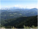
Mrežce is a panoramic peak near Lipanski vrh, which is visible on the other side of the gully between the two peaks. Since the slopes towards Pok...
2 h 40 min |
 | Rudno polje - Lipanski vrh
The panoramic Lipanski vrh is located above the Blejska koča on the Lipanca mountain pasture. From the summit, which drops steeply towards the Kr...
2 h 55 min |
 | Dom pod Storžičem - Tolsti vrh
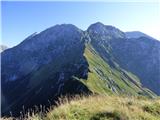
Tolsti vrh, located west of Storžič, is at 1715 metres also the highest peak of the Kriška gora range, which rises steeply above central Gorenjsk...
2 h |
 | Sviščaki - Veliki Snežnik
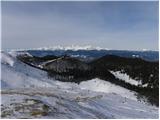
Veliki Snežnik, at 1796 meters, is the highest peak in the nearby and distant surroundings, offering beautiful views over much of Slovenia and ne...
2 h 10 min |
 | Sviščaki - Veliki Snežnik (variant through forest)
Veliki Snežnik, at 1796 meters, is the highest peak in the nearby and distant surroundings, offering beautiful views over much of Slovenia and ne...
2 h |
| Sviščaki - Veliki Snežnik (by road)
Veliki Snežnik, at 1796 meters, is the highest peak in the nearby and distant surroundings, offering beautiful views over much of Slovenia and ne...
2 h |
| Grda draga - Veliki Snežnik (via Mali Snežnik)
Veliki Snežnik, at 1796 meters, is the highest peak in the nearby and distant surroundings, offering beautiful views over much of Slovenia and ne...
1 h 55 min |
| Sviščaki - Veliki Snežnik (via Mali Snežnik)
Veliki Snežnik, at 1796 meters, is the highest peak in the nearby and distant surroundings, offering beautiful views over much of Slovenia and ne...
2 h 15 min |
 | Cimprovka (Davča) - Porezen (by road)
Porezen is a 1,630 m high mountain situated between Davča and Baška Grapa. From the summit, where a large Partisan monument stands, a beautiful v...
2 h 15 min |
 | Križovec - Kahlkogel/Golica (mimo Koče na Golici)
Golica is an unvegetated peak located north of Jesenice. From the summit, where a registration box is placed, there is a fine view of the western...
2 h 10 min |
 | Planina Blato - Pršivec
Pršivec is a panoramic mountain above Lake Bohinj. The view is extensive in all directions: Triglav and the surrounding mountains are clearly vis...
2 h 30 min |
 | end of road on Vogar - Pršivec (via planina Viševnik)
Pršivec is a panoramic mountain above Lake Bohinj. The view is extensive in all directions: Triglav and the surrounding mountains are clearly vis...
2 h 20 min |
 | Planina Blato - Pršivec
Pršivec is a panoramic mountain above Lake Bohinj. The view is extensive in all directions: Triglav and the surrounding mountains are clearly vis...
2 h 30 min |
 | Korensko sedlo - Ofen/Peč
Peč (also known as Tromeja; in Italian Monte Forno, in German Dreiländereck or Ofen) is a 1508 m high peak located at the tripoint between Sloven...
2 h |
 | Korensko sedlo - Ofen/Peč (on marked path)
Peč (also known as Tromeja; in Italian Monte Forno, in German Dreiländereck or Ofen) is a 1508 m high peak located at the tripoint between Sloven...
2 h |
 | Kriška planina - Mokrica (via Kompotela)
Mokrica is a panoramic peak east of Kompotela. The summit, partially covered with dwarf pines, has a summit logbook....
2 h 45 min |
 | Medvedova konta - Debeli vrh above Lipanca
Debeli vrh is a 1962 m high mountain located in the ridge that rises steeply above the Krma valley. From the summit, where a stamp is attached to...
2 h 15 min |
| Rudno polje - Debeli vrh above Lipanca (via Blejska koča)
Debeli vrh is a 1962 m high mountain located in the ridge that rises steeply above the Krma valley. From the summit, where a stamp is attached to...
2 h 45 min |
 | Dom pod Storžičem - Bela peč
The mountain, known mainly among climbers, is located north of Storžič on the slopes of Konjščica. From the summit there is a beautiful view of t...
2 h |
| Dom pod Storžičem - Bela peč (via Javorniški preval)
The mountain, known mainly among climbers, is located north of Storžič on the slopes of Konjščica. From the summit there is a beautiful view of t...
2 h 5 min |
 | Na kopiš - Bela peč (via Spodnja and Zgornja Konjščica)
The mountain, known mainly among climbers, is located north of Storžič on the slopes of Konjščica. From the summit there is a beautiful view of t...
2 h |
 | Ravne - Rosenkogel/Hruški vrh (direct way)
Hruški vrh is a 1776-metre-high mountain located between Dovška Baba and the lesser-known Klek. From the summit, where there is a small chapel de...
2 h |
 | Bohinjsko sedlo - Kobla
The summit is located in the Lower Bohinj Mountains between Črna prst and Soriška planina. Directly below it is a railway tunnel connecting Bohin...
2 h 35 min |
 | Bohinjsko sedlo - Šavnik (by Lajnar)
Šavnik is a grassy peak situated between the ski resorts of Soriška Planina and Kobla. From the summit, which has a registration box with a stamp...
2 h |
 | Golte (Alpine garden) - Smrekovec
Smrekovec is a mountain of volcanic origin on the eastern edge of the Smrekovec mountain range. The wide grassy summit features a pyramid with a ...
2 h 30 min |
 | Dom na Smrekovcu - Komen (Direct way)
At 1684 meters, Komen is the highest peak in the Smrekovec mountain range, which borders between Styria and Carinthia. In good weather, the summi...
2 h |
 | Planina Vodol - Komen
At 1684 meters, Komen is the highest peak in the Smrekovec mountain range, which borders between Styria and Carinthia. In good weather, the summi...
3 h 15 min |
 | Planina Vodol - Veliki Travnik (Turnovka)
Veliki Travnik, also known as Turnovka by the locals, is located on the western edge of the Smrekovec mountain range. From the summit, which has ...
2 h |
 | Koča na Klopnem vrhu - Rogla
Rogla is a peak in the middle of the eponymous ski resort. The peak is forested with a small clearing on which stands a lookout tower. The tower ...
2 h 45 min |
 | Koča na Pesku - Jezerski vrh (via Lovrenška jezera)
Jezerski vrh is located on Ribniško Pohorje near the Ribniška koča mountain hut. Due to the unvegetated peak, there is a nice view of Pohorje and...
3 h 20 min |
| Rogla (Hotel Planja) - Jezerski vrh (via Lovrenška jezera)
Jezerski vrh is located on Ribniško Pohorje near the Ribniška koča mountain hut. Due to the unvegetated peak, there is a nice view of Pohorje and...
3 h 15 min |
| Rogla (Hotel Planja) - Jezerski vrh
Jezerski vrh is located on Ribniško Pohorje near the Ribniška koča mountain hut. Due to the unvegetated peak, there is a nice view of Pohorje and...
3 h 5 min |
 | Ski hotel Vogel - Vogel (čez planino Zadnji Vogel)
Many associate the name Vogel first with the Vogel ski resort near the eponymous peak. From the north, it is recognizable by its pyramidal shape,...
2 h 30 min |
 | Coot Parking Lot - Monte Guarda/Skutnik
Skutnik is a peak situated north of the Učja River on the border with Italy. From the top, there is a beautiful view of the Kanin mountain group,...
2 h |
 | Planina Zapleč - Krasji vrh (via Koluji)
Krasji vrh is situated between Bovec and Kobarid on the Polovnik mountain ridge. At 1773 m it is also the highest peak of the mentioned ridge, so...
2 h |
| Planina Zapleč - Krasji vrh (via snežna jama)
Krasji vrh is situated between Bovec and Kobarid on the Polovnik mountain ridge. At 1773 m it is also the highest peak of the mentioned ridge, so...
2 h |
 | Bohinjsko sedlo - Krevl
Krevl is a 1515-meter-high peak situated south of the Kobla ski area, more precisely between the Kobla peak and Kravja Črna gora. From the summit...
2 h 50 min |
 | Usek - Huhnerkogel/Košenjak (mimo sv. Urbana)
Košenjak is located north of Dravograd and the Drava River on the border with neighbouring Austria. Access to Košenjak is possible on foot or by ...
2 h |
 | St. John the Baptist on Ojstrica - Huhnerkogel/Košenjak (via Bivak Piramida)
Košenjak is located north of Dravograd and the Drava River on the border with neighbouring Austria. Access to Košenjak is possible on foot or by ...
2 h |
 | Jezero Sobote / Stausee Soboth - Huhnerkogel/Košenjak (on marked path)
Košenjak is located north of Dravograd and the Drava River on the border with neighbouring Austria. Access to Košenjak is possible on foot or by ...
2 h |
 | Rifugio Pelizzo - Monte Mataiur/Matajur (via Ledina)
Matajur is a panoramic mountain located on the border between Slovenia and Italy. From the summit there is a beautiful view of Kobariški or Bregi...
2 h |
 | Plajberški graben / Bleiberger Graben - Singerberg / Žingarica
Žingarica / Singerberg is a peak on the Austrian side of the Karawanks above the village of Slovenji Plajberk / Windisch Bleiberg. From the summi...
2 h 20 min |
 | Sveti Trije kralji - Žigartov vrh
Žigartov vrh, at 1,346 meters, is the highest peak in the eastern part of Pohorje. An "observation" tower once stood on the summit, erected solel...
2 h 45 min |
 | Pohorje cable car - Žigartov vrh (via Razglednik)
Žigartov vrh, at 1,346 meters, is the highest peak in the eastern part of Pohorje. An "observation" tower once stood on the summit, erected solel...
2 h 15 min |
| Pohorje cable car - Žigartov vrh (via Mariborska koča)
Žigartov vrh, at 1,346 meters, is the highest peak in the eastern part of Pohorje. An "observation" tower once stood on the summit, erected solel...
2 h 20 min |
 | Platak - Vidikovac
Vidikovac is a 1,408-meter-high peak in Gorski Kotar. From its partly unforested summit, there is a very beautiful view of the nearby Veliki Risn...
2 h 45 min |
 | Ladinger Straße - Speikkogel (Saualpe)
Speikkogel is an indistinct peak in the long ridge of the Svinja mountain pasture / Saualpe. From the spacious summit there is a beautiful view o...
2 h 25 min |
| Ladinger Straße - Speikkogel (Saualpe) (via Offnerhütte)
Speikkogel is an indistinct peak in the long ridge of the Svinja mountain pasture / Saualpe. From the spacious summit there is a beautiful view o...
2 h 35 min |
| Ladinger Straße - Speikkogel (Saualpe) (via Zechhütte)
Speikkogel is an indistinct peak in the long ridge of the Svinja mountain pasture / Saualpe. From the spacious summit there is a beautiful view o...
2 h 20 min |
 | Ladinger Straße - Großer Sauofen (Saualpe)
Großer Sauofen is, due to its location and shorter precipitous southwestern wall, one of the more prominent peaks on the Svinja / Saualpe mountai...
2 h 30 min |
| Ladinger Straße - Großer Sauofen (Saualpe) (via Offnerhütte)
Großer Sauofen is, due to its location and shorter precipitous southwestern wall, one of the more prominent peaks on the Svinja / Saualpe mountai...
2 h 40 min |
| Ladinger Straße - Großer Sauofen (Saualpe) (via Zechhütte)
Großer Sauofen is, due to its location and shorter precipitous southwestern wall, one of the more prominent peaks on the Svinja / Saualpe mountai...
2 h 25 min |
 | Črni Kal - Mladi vrh (via Koprivnik)
Mladi vrh is the higher neighbor of the better-known Stari vrh, separated from it by a saddle. Covered in sparse beech forest, the summit offers ...
2 h 15 min |
 | Pri Rupah - Okroglež
Okroglež is a peak covered with dwarf pines, located between Debela peč and Brda. From the summit, which has a stamp (no logbook), a nice view op...
1 h 55 min |
 | Korensko sedlo - Kamnati vrh/Steinberg (by road)
Kamnati vrh is a 1621 m high mountain located north of Kranjska Gora. From the grassy summit, where a bench stands, there is no view due to the n...
2 h |
 | Bukovnik - Lanež
Lanež is a less distinct peak on the eastern part of Raduha. From the spacious summit a nice view opens on nearby Mala Raduha, Olševa, Peca, Uršl...
2 h 20 min |
 | Mangartska planina - Šober / Monte Sciober Grande (via Stože)
Šober / Monte Sciober Grande is a 1,845 m high peak located between the Remšendol Valley and Jezerska Valley. From the summit there is a fine vie...
2 h 20 min |
 | Ledine - Gladki vrh (Ratitovec) (via planina Klom)
Gladki vrh (Ratitovec), at 1,667 meters, is the most visited peak in the Ratitovec range. From its bare summit, which features a panorama board, ...
1 h 55 min |
| Ledine - Gladki vrh (Ratitovec) (via Kosmati vrh)
Gladki vrh (Ratitovec), at 1,667 meters, is the most visited peak in the Ratitovec range. From its bare summit, which features a panorama board, ...
2 h 10 min |
 | Razglednik - Gladki vrh (Ratitovec)
Gladki vrh (Ratitovec), at 1,667 meters, is the most visited peak in the Ratitovec range. From its bare summit, which features a panorama board, ...
3 h 5 min |
 | Bohinjsko sedlo - Altemaver (Ratitovec)
Altemaver (Ratitovec), at 1,678 meters, is the highest peak of Ratitovec. From its grassy summit, there is a beautiful view of the Julian Alps, J...
3 h 15 min |
 | Razglednik - Altemaver (Ratitovec)
Altemaver (Ratitovec), at 1,678 meters, is the highest peak of Ratitovec. From its grassy summit, there is a beautiful view of the Julian Alps, J...
3 h 10 min |
| Soriška peč - Altemaver (Ratitovec)
Altemaver (Ratitovec), at 1,678 meters, is the highest peak of Ratitovec. From its grassy summit, there is a beautiful view of the Julian Alps, J...
3 h |
 | Koprivna (Kumer) - Topitza
Topica, or Topitza in German, is a 1649-meter-high peak situated northeast of Železna Kapla. From the summit, where a cross stands, a nice view o...
2 h 10 min |
 | Soriška peč - Kremant (Ratitovec)
Kremant is a 1,654 m high peak located on the western part of Ratitovec. From the summit, where a stamp is attached to a metal pole, a nice view ...
2 h 30 min |
 | Bohinjsko sedlo - Kremant (Ratitovec)
Kremant is a 1,654 m high peak located on the western part of Ratitovec. From the summit, where a stamp is attached to a metal pole, a nice view ...
2 h 45 min |
 | Soriška peč - Kačji rob (Ovharn)
Kačji rob (Ovharn) is a 1,552 m high peak situated between the Zgornji Jirn mountain pasture and the lesser-known Žbanjek peak. From the summit, ...
2 h 30 min |
 | Tuškov Grič - Medrce (by road)
Medrce is a 1,410-meter-high peak located between Porezen and Hum. From the summit, which features an old bunker, there are nice views of Kojca, ...
2 h 20 min |
 | Gasthof Pfeifferstocker - Handalm
Handalm is a 1853-meter-high peak located north to northeast of the alpine pass Weinebene. From the grassy summit, which features small granite r...
2 h 15 min |
 | Hebalm (Gasthaus Zur Rehbockhütte) - Weberkogel
Weberkogel is a less prominent peak located north to northwest of the alpine pass Weinebene. On the 1805-meter-high summit stands a medium-sized ...
2 h 35 min |
 | Pod Peco (Koželj) / Koprein-Petzen (Koschiel) - Špičasti vrh / Spitzberg
Špičasti vrh / Spitzberg is a 1,551-meter-high peak located above the Maroldčeva planina / Maroldalm mountain pasture. Because the peak is locate...
2 h 30 min |
 | Ribniška koča - Ostruščica (via Lovrenška jezera)
Ostruščica is a 1,498-meter-high peak located west of the ski slopes on Rogla....
3 h 15 min |
 | Zadnji travnik - Obel kamen (Olševa)
Obel kamen is a 1,911-meter-high peak located in the ridge of Olševa. On the summit is a border stone marked RS XXII 1; a cross and summit logboo...
2 h 15 min |
 | Poden / Bodental - Kosmatica / Kosmatitza
Kosmatica / Kosmatitza is a 1,659-meter-high peak entirely on the Austrian side of the Karawanks, north of Vrtača. From the summit, which is part...
2 h 40 min |
 | Parking Muritzen - Source of Mur / Murusprung (via Sticklerhütte)
The source of the Mur lies at 1,898 m elevation in the Muhrtal (Murwinkel) valley on the eastern foothills of Mureck mountain (2,402 m) in the An...
2 h 15 min |
 | Teichalm (Teichalmsee) - Rote Wand (lower path)
Rote Wand is a 1,505-meter-high mountain in the Graz Mountains in Styria, Austria. The name "Rote Wand" (red wall) comes from its southeast-facin...
2 h 15 min |
| Teichalm (Teichalmsee) - Rote Wand (upper path)
Rote Wand is a 1,505-meter-high mountain in the Graz Mountains in Styria, Austria. The name "Rote Wand" (red wall) comes from its southeast-facin...
2 h 15 min |
 | Glashütten - Steinmandl (Golica / Koralpe)
Steinmandl is a panoramic peak in the Golica/Koralpe range, where numerous stone cairns have been built....
2 h 25 min |
 | Knödelhütte - Hirschegger Alm (northern peak)
Hirschegger Alm (northern peak) is a 1,871-meter-high peak in the Packalpe mountain group. From the grassy summit, a beautiful view opens up all ...
2 h 25 min |
| Unterauerlinger Hütte - Hirschegger Alm (northern peak)
Hirschegger Alm (northern peak) is a 1,871-meter-high peak in the Packalpe mountain group. From the grassy summit, a beautiful view opens up all ...
2 h 15 min |
 | Knödelhütte - Seinerkreuz
Seinerkreuz is a panoramic peak located above the Saureishütte hut and the settlement of Hirschegg. From the summit, a beautiful view opens up of...
2 h 40 min |
 | Planinski dom Orlove stine - Svilaja (past Umac)
Svilaja is a 1509-meter grassy peak above Peručko Lake, north of the town of Sinj. The summit features a cross and a concrete pillar. From the to...
2 h |
 | Alpl (Zisleranger Weg) - Teufelstein
Teufelstein is a 1,498-meter-high mountain in the Fischbacher Alpen group. At the summit there is a cross with a summit logbook, and slightly bel...
2 h 20 min |
| Alpl (Zisleranger Weg) - Teufelstein (past Edelweißhütte)
Teufelstein is a 1,498-meter-high mountain in the Fischbacher Alpen group. At the summit there is a cross with a summit logbook, and slightly bel...
2 h 40 min |
| Alpl (Waldschulle Alpl) - Teufelstein
Teufelstein is a 1,498-meter-high mountain in the Fischbacher Alpen group. At the summit there is a cross with a summit logbook, and slightly bel...
2 h 30 min |
 | Brandlucken - Plankogel
Plankogel is a 1531-meter-high mountain situated in the Almenland nature park. From the panoramic summit, where a cross stands, a beautiful view ...
2 h |
 | Hebalm (Gasthaus Zur Rehbockhütte) - Barofen
Barofen is a panoramic peak between the Weinebene Pass and the mountain road to Hebalm. On its 1,720 m high summit stands a cross with a summit r...
2 h |
 | Zeller Kreuz - Stanglalpe
Stanglalpe is a peak in the Fischabacher Alpen mountain group, which lies in the hills east of the Mur. The peak itself is situated beside a road...
2 h 50 min |
| Schanzsattel - Stanglalpe
Stanglalpe is a peak in the Fischabacher Alpen mountain group, which lies in the hills east of the Mur. The peak itself is situated beside a road...
2 h 20 min |
 | Alpl (Zisleranger Weg) - Steinriegel
Steinriegel is a panoramic peak with a cross and a wind power plant, located in the hills east of the Mur....
2 h 40 min |
 | Nassfeld - Garnitzenberg / Monte Carnizza (Auernig Höhenweg)
Krniška gora (Italian Monte Carnizza, German Garnitzenberg) is a 1950-meter-high mountain east of the Mokrine mountain pass. It is located on the...
2 h |
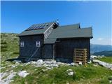 | Raxalm-Berggasthof (Rax) - Raxgmoahütte (Rax)
Raxgmoahütte is a hut owned by the Austrian mountain rescue service, open year-round as a bivouac or shelter. From the hut on top of a panoramic ...
2 h 15 min |
 | Kugina kuća - Šatorina
Šatorina is the highest peak in Central Velebit. A geodetic point is on the summit. The peak is a checkpoint for HPO and the Velebit Mountain Tra...
2 h 30 min |
 | Schwarzkogelhütte - Angerlkogel
Angerlkogel is a 1,774-meter-high peak located along the marked trail from Klippitztörl to Zirbitzkogel....
2 h 45 min |