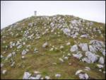
 | Podljubelj (Lajb) - Begunjščica
Begunjščica is a mountain range in the Karawanks east of Stol. Its highest peak is Veliki Vrh, which at over 2,000 m offers a fine view across ce...
3 h 30 min |
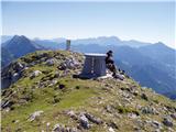 | Ljubelj - Begunjščica (via Zelenica)
Begunjščica is a mountain range in the Karawanks east of Stol. Its highest peak is Veliki Vrh, which at over 2,000 m offers a fine view across ce...
3 h 50 min |
| Tinčkova koča - Begunjščica
Begunjščica is a mountain range in the Karawanks east of Stol. Its highest peak is Veliki Vrh, which at over 2,000 m offers a fine view across ce...
3 h 15 min |
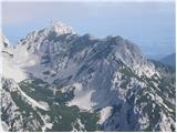 | Tinčkova koča - Begunjščica (via Poljška planina)
Begunjščica is a mountain range in the Karawanks east of Stol. Its highest peak is Veliki Vrh, which at over 2,000 m offers a fine view across ce...
3 h 50 min |
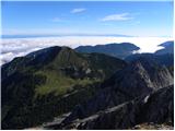 | Johannsenruhe - Hochstuhl/Stol (via Klagenfurter Hütte)
Stol is, at 2,236 m, the highest peak in the Karawanks. From the summit, which has a registration box and stamp, a beautiful view opens onto the ...
3 h 45 min |
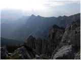 | Vranček - Loibler Baba/Košutica (western way)
Košutica (also known as Ljubeljska Baba) is a panoramic mountain north of the western ridge of Košuta. From the summit, marked by a small cross a...
2 h 50 min |
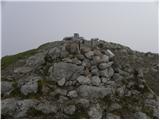 | Planina Zajavornik - Viševnik
Viševnik is a 2050 m high mountain rising northwest of Rudno polje on Pokljuka. From the summit, where there is a stamp, a beautiful view opens o...
3 h 30 min |
| Medvedova konta - Viševnik
Viševnik is a 2050 m high mountain rising northwest of Rudno polje on Pokljuka. From the summit, where there is a stamp, a beautiful view opens o...
3 h 15 min |
| Pri Rupah - Viševnik
Viševnik is a 2050 m high mountain rising northwest of Rudno polje on Pokljuka. From the summit, where there is a stamp, a beautiful view opens o...
3 h 15 min |
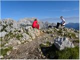 | Rudno polje - Viševnik (via Jezerce and Srenjski preval)
Viševnik is a 2050 m high mountain rising northwest of Rudno polje on Pokljuka. From the summit, where there is a stamp, a beautiful view opens o...
2 h 40 min |
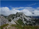 | Uskovnica (Lom) - Viševnik (via Srenjski preval)
Viševnik is a 2050 m high mountain rising northwest of Rudno polje on Pokljuka. From the summit, where there is a stamp, a beautiful view opens o...
3 h 10 min |
| Uskovnica (Razpotje) - Viševnik (via Srenjski preval)
Viševnik is a 2050 m high mountain rising northwest of Rudno polje on Pokljuka. From the summit, where there is a stamp, a beautiful view opens o...
2 h 55 min |
 | Ljubelj - Vertatscha/Vrtača
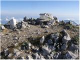
Vrtača is a 2181 m high peak located east of Stol. From the summit, where a large peg stands, a beautiful view opens over parts of the Julian Alp...
3 h 30 min |
| Tinčkova koča - Vertatscha/Vrtača (via Smuška planina in saddle Šija)
Vrtača is a 2181 m high peak located east of Stol. From the summit, where a large peg stands, a beautiful view opens over parts of the Julian Alp...
3 h 30 min |
| Trate / Johannsenruhe - Vertatscha/Vrtača
Vrtača is a 2181 m high peak located east of Stol. From the summit, where a large peg stands, a beautiful view opens over parts of the Julian Alp...
4 h |
 | Planina Jezerca - Kalška gora (via planina Koren)
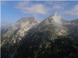
Kalška gora lies between the Kalški greben and Kokrsko sedlo. From the grassy summit there is a beautiful view towards the nearby Kalški greben. ...
4 h 35 min |
| Kokra (Roblek) - Kalška gora (via Kalce)
Kalška gora lies between the Kalški greben and Kokrsko sedlo. From the grassy summit there is a beautiful view towards the nearby Kalški greben. ...
4 h 30 min |
 | Podljubelj (Lajb) - Dobrča
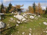
Dobrča is a 1634-metre mountain located between Begunje and Tržič. From the summit, which has a registration box with a stamp, the view opens onl...
4 h 30 min |
 | Planina Kuk - Tolminski Kuk
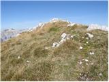
Tolminski Kuk is the highest peak in the Bohinj-Tolmin mountains. The summit, equipped with a registration box, offers a very beautiful view. Fro...
4 h 30 min |
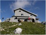 | Aljažev dom v Vratih - Pogačnikov dom na Kriških podih (via Sovatna)
The hut is located on the scenic ridge Griva on Kriški Podi above Trenta. The hut, open during the summer season, also has a large winter room. T...
4 h 30 min |
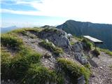 | Dom pod Storžičem - Bašeljski vrh (via Javorniški preval)
Bašeljski vrh is a 1744-meter-high mountain located between Mali Grintovec and Storžič. From the summit, where there is a bench and a registratio...
2 h 50 min |
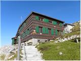 | Trate / Johannsenruhe - Prešernova koča na Stolu (via Celovška koča)
The Prešernova koča na Stolu mountain hut is located just a few metres below the summit of the 2198 m high Mali Stol. From the hut or the nearby ...
3 h 40 min |
 | Kokra (Roblek) - Vrh Korena
Vrh Korena is located between Zvoh and Kalški greben near the Krvavec ski resort. The summit offers a beautiful view of the highest peaks in the ...
3 h |
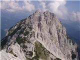 | Koča pod slapom Rinka - Ledinski vrh
The mountain is located above Jezersko and lies on the border with Austria. From the summit there is a beautiful view north towards the neighbour...
3 h 20 min |
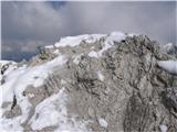 | Velacher Kotschna/Belska Kočna - Ledinski vrh
The mountain is located above Jezersko and lies on the border with Austria. From the summit there is a beautiful view north towards the neighbour...
3 h 45 min |
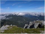 | Matizovec - Veliko Kladivo
Veliko Kladivo is a 2094 m high peak in the longest Slovenian ridge, Košuta. From the summit, which has a register box and stamp, there is a very...
3 h 20 min |
| Globoka dolina - Veliko Kladivo
Veliko Kladivo is a 2094 m high peak in the longest Slovenian ridge, Košuta. From the summit, which has a register box and stamp, there is a very...
3 h |
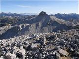 | Planina Kuhinja - Batognica
Batognica is a 2164 m high mountain that was the site of the so-called mine warfare during World War I. Remnants of the fighting between Italian ...
3 h 20 min |
 | Bele Vode - Jerebica
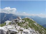
Jerebica is a mountain located on the border between Slovenia and Italy, between the Možnica and Jezerska valleys. From the summit, where there i...
3 h 30 min |
 | Dom pod Storžičem - Stegovnik (eastern way)
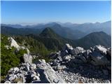
Stegovnik (also Štegovnik) is a scenic ridge mountain between the valley of Tržiška Bistrica and Kokra. From the summit, there is a very nice vie...
4 h |
| Dom pod Storžičem - Stegovnik (western way)
Stegovnik (also Štegovnik) is a scenic ridge mountain between the valley of Tržiška Bistrica and Kokra. From the summit, there is a very nice vie...
4 h |
 | Markova raven - Košutna (marked way)
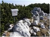
The summit is located between Kompotela and the mountain pasture Košutna. From the top, there is a beautiful view toward Krvavec and Kalški grebe...
2 h 50 min |
 | Matizovec - Malo Kladivo
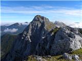
Malo Kladivo is located in the Košuta ridge. From the summit, which has no registration box, there is a nice view toward the neighboring Veliko K...
3 h 5 min |
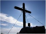 | Tinčkova koča - Bielschitza/Svačica (via Smokuška planina)
Svačica is a less prominent peak in the main ridge of the Karawanks. It lies between Vrtača and Stol, slightly offset to the north. The summit, m...
3 h 30 min |
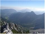 | Ljubelj - Bielschitza/Svačica (upper path)
Svačica is a less prominent peak in the main ridge of the Karawanks. It lies between Vrtača and Stol, slightly offset to the north. The summit, m...
4 h 20 min |
| Ljubelj - Bielschitza/Svačica (via Vatelca or Skleda)
Svačica is a less prominent peak in the main ridge of the Karawanks. It lies between Vrtača and Stol, slightly offset to the north. The summit, m...
4 h |
| Bodenbauer - Bielschitza/Svačica (via Karweg)
Svačica is a less prominent peak in the main ridge of the Karawanks. It lies between Vrtača and Stol, slightly offset to the north. The summit, m...
3 h |
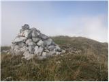 | Planina Kuk - Vrh nad Škrbino (direct way)
Vrh nad Škrbino is the easternmost two-thousander in the ridge of the Lower Bohinj Mountains. From the summit, there are excellent views of the n...
3 h 15 min |
| Tolminske Ravne - Vrh nad Škrbino (on mule track and direct way)
Vrh nad Škrbino is the easternmost two-thousander in the ridge of the Lower Bohinj Mountains. From the summit, there are excellent views of the n...
4 h |
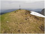 | Weissensee - Eckwand (via Almspitz)
Eckwand (2,221 m) is a peak in the Latschur group. From its grassy summit, which features a cross, there are beautiful views of the Gailtal Alps,...
4 h 45 min |
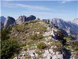 | Remšendol - Šober / Monte Sciober Grande (via 518)
Šober / Monte Sciober Grande is a 1,845 m high peak located between the Remšendol Valley and Jezerska Valley. From the summit there is a fine vie...
3 h |
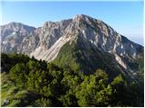 | Vranček - Lokovnikov Grintovec / Grintoutz
Lokovnikov Grintovec is a dwarf pine-covered peak north of Košutica, separated from it by Dovjakovo sedlo saddle (1,728 m). Its southwestern and ...
2 h 50 min |
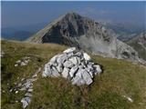 | Planina Kuk - Zeleni vrh
Zeleni vrh is a 2052-meter-high mountain located east of the highest peak of the Spodnje Bohinjske gore. From the grassy summit, which drops prec...
4 h 5 min |
 | Tolminske Ravne - Zeleni vrh (via Dolina pod Ploščo)
Zeleni vrh is a 2052-meter-high mountain located east of the highest peak of the Spodnje Bohinjske gore. From the grassy summit, which drops prec...
4 h 10 min |
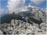 | Fiames - Col Rosa
Col Rosa is a 2,166-meter-high mountain situated north of Cortina d'Ampezzo. From the summit, where a cross stands, there is a very nice view of ...
2 h 45 min |
 | Landro - Monte Piano
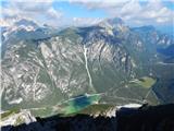
Monte Piano (Toblacher Kreuz) is a 2,305-meter-high mountain located on the northwestern edge of the Monte Piana plateau. Near the summit there a...
2 h 50 min |
 | Pala Barzana - Monte Raut (CAI 967)
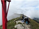
Raut is a 2,025 m high limestone vantage point above the Friulian plain and the second-highest peak of the ridge between lakes Barcis and Selva. ...
3 h 45 min |
 | Kesselfall - Höhenburg
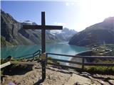
Höhenburg is a 2,108-metre mountain in the Glockner group of the High Tauern. It is located beside the Mooserboden reservoir. From the summit, wh...
3 h 50 min |
 | Weißenbach - Spitzegel / Negal (25d)
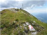
Spitzegel / Negal is a 2,119 m high mountain in the Gailtal Alps in Austria. The ridge with its highest peak Spitzegel / Nagal logically connects...
3 h 40 min |
 | Collina - Cima Ombladet (path 141)
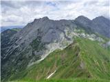
Cima Ombladet is a 2,255-meter-high mountain in the Carnic Alps east of the town of Forni Avoltri. From the summit, where a small cross stands, t...
3 h 20 min |
 | Crno polje - Zelena glava
Zelena glava is the highest peak of the Prenj mountain range, located in northern Herzegovina south of Konjic and north of Mostar. From the summi...
4 h |
| Koča pod slapom Rinka - Skuta Glacier
Ledenik pod Skuto is today the largest glacier in Slovenia. Due to its location, it is in good condition and has been slightly expanding accordin...
4 h 10 min |
 | Planina Zajzera - Visoki Pipar / Monte Piper (path 648)
Visoki Pipar or Italian Monte Piper is, with 2069 meters, the highest and most easily accessible peak in the Pipar ridge in the Naborje mountains...
3 h |
 | Niederalpl Ort - Hohe Veitsch (through Rodel valley)
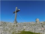
Hohe Veitsch is the highest peak of the Veitsch mountain range, located in the eastern part of the Northern Limestone Alps. From the summit, a be...
2 h 40 min |
 | parking lot Hoyer (Neuhofgraben) - Speikkogel (Gleinalpe)
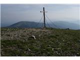
Speikkogel lies northwest of Graz and, at 1988 m, is the second highest peak of the Gleinalpe.The European path E6 and the Austrian Central Alpin...
3 h 30 min |
 | parking lot Hoyer (Neuhofgraben) - Lenzmoarkogel (Gleinalpe)
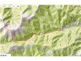
Lenzmoarkogel is located northwest of Gradec and, at 1991 meters above sea level, is the highest peak of the Gleinalpe (Glinska planina).The thre...
3 h 45 min |
 | parking lot Hoyer (Neuhofgraben) - Lärchkogel (Gleinalpe) (via Speikkogel)
Lärchkogel is a 1,894-meter peak in the Gleinalpe massif with a cross and a small shelter beside it. From the summit, there are fine views of Spe...
4 h 15 min |
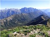 | Passo Tanamea - Monte Zajavor
Zajavor (Italian: Monte Zajavor or Monte Zaiavor) is a 1,815-meter-high peak in the eastern, grassier part of the Muzci ridge. From the summit, w...
3 h |