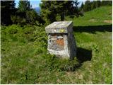
 | Klemenčevo - Kamniški vrh (by Korošaki waterfalls)
Kamniški vrh is a 1259-metre-high mountain located north of Kamnik, more precisely between Stahovica and the Korošica valley. From the summit, wh...
2 h 15 min |
 | Okrog pri Motniku - Vivodnik (via Biba planina)
Vivodnik, at 1508 meters, is the highest peak of Menina planina, a plateau rising south of Gornji Grad. From the summit, which has a small observ...
2 h 25 min |
| Okrog pri Motniku - Vivodnik (via Oseke and peak Drč)
Vivodnik, at 1508 meters, is the highest peak of Menina planina, a plateau rising south of Gornji Grad. From the summit, which has a small observ...
2 h 15 min |
| Češnjice v Tuhinju - Vivodnik
Vivodnik, at 1508 meters, is the highest peak of Menina planina, a plateau rising south of Gornji Grad. From the summit, which has a small observ...
2 h 25 min |
 | Razdrto - Vojkova koča na Nanosu (Janez's path)
Vojkova koča is located on the southern edge of the high karst Nanos plateau, near Pleša. This is the prominent peak with television transmitters...
2 h |
 | Mislinjski graben (Pestotnik) - Rogla (via Ostruščica)
Rogla is a peak in the middle of the eponymous ski resort. The peak is forested with a small clearing on which stands a lookout tower. The tower ...
3 h |
 | Laze - Črni vrh above Novaki
Črni vrh, the highest point of the popular Cerkno ski center, is located northeast of Novaki. Near the summit, where an artificial lake has been ...
2 h |
 | Bač - Kršičevec
Kršičevec is a lesser-known mountain located east of Jurišče village in the Pivka basin. From its grassy summit, which has a logbook box with a s...
2 h 15 min |
 | Bukovo - Kojca (north path)
Kojca is a panoramic peak rising south of Baška grapa. From the summit, where there is a haystack, fine views extend over the Lower Bohinj Mounta...
2 h 15 min |
 | Bukovo - Kojca (south path)
Kojca is a panoramic peak rising south of Baška grapa. From the summit, where there is a haystack, fine views extend over the Lower Bohinj Mounta...
2 h 15 min |
 | Begunje (Krpin) - Smokuški vrh (on cart track and past sv. Peter)
Smokuški vrh is a panoramic mountain located on the ridge between the Završnica Valley and the Gorenjska plain. From the summit, where there is a...
1 h 50 min |
 | Jesenice (Ukova) - Španov vrh
Španov vrh is a 1334-meter-high mountain in the Karavanke that rises between Javorniški Rovt and Planina pod Golico. From the scenic summit, acce...
2 h |
 | Jesenice (Straža) - Španov vrh (via Jelenkamen)
Španov vrh is a 1334-meter-high mountain in the Karavanke that rises between Javorniški Rovt and Planina pod Golico. From the scenic summit, acce...
2 h 30 min |
 | Povlje - Grebenc
Grebenc is a lesser-known peak that rises steeply above Mala and Velika Poljana. From this little-visited summit, on a clear day there is a nice ...
2 h 5 min |
| Povlje - Grebenc (by cart track)
Grebenc is a lesser-known peak that rises steeply above Mala and Velika Poljana. From this little-visited summit, on a clear day there is a nice ...
2 h 5 min |
 | Potoče - Baba (via sv. Jakob and source below Potoška gora)
Baba is a 1,119-meter-high peak located west of the Dom Čemšenik mountain hut. The summit, which has a logbook box, offers fine views of the Gore...
2 h 10 min |
 | Razdrto - Grmada (Nanos)
Grmada is a 1209-meter peak situated near the edge of the Nanos plateau, northwest of the better-known Pleša (about a 20-minute walk away). Becau...
2 h 5 min |
 | Dom pod Reško planino - Javor
Javor is a 1,132-meter-high peak situated between Kisovec and Sveta Planina. The summit, covered with forest, offers no views, but a nice panoram...
2 h 5 min |
 | Ridovc / Ridovcsäge - Mejnik (via valley of Mrzli potok)
Mejnik is a 1517-meter-high peak on the Austrian side of the Karawanks, more precisely in a side ridge of Košuta. On the forested summit is a bou...
2 h 5 min |
 | Podvolovljek (Petkov graben) - Kunšperski vrh (Brezovec)
Kunšperski vrh, also Brezovec, is a lesser-known peak located west of Lepenatka. From its partly vegetated summit, nice views open up towards Vel...
2 h |
 | Mislinjski graben (Pestotnik) - Ostruščica
Ostruščica is a 1,498-meter-high peak located west of the ski slopes on Rogla....
2 h 30 min |
 | Podljubelj (Lajb) - Čisovec
Čisovec is a panoramic peak located between Dobrča and Begunjščica. From the summit, beautiful views open up towards Košuta, the Kamnik-Savinja A...
2 h |
 | Poljšica pri Gorjah (Zatrata) - Hotunjski vrh (by road)
Hotunjski vrh is a 1,107-meter-high panoramic peak located above the Zatrnik ski slope. From the summit, where there is a summit register box and...
2 h |
| Bled (Velika Zaka) - Hotunjski vrh
Hotunjski vrh is a 1,107-meter-high panoramic peak located above the Zatrnik ski slope. From the summit, where there is a summit register box and...
2 h 30 min |
| Bohinjska Bela (St. Marjeta) - Hotunjski vrh
Hotunjski vrh is a 1,107-meter-high panoramic peak located above the Zatrnik ski slope. From the summit, where there is a summit register box and...
2 h 15 min |
 | Bled (Velika Zaka) - Turn (above Bohinjska Bela)
Turn is a panoramic and precipitous peak located above Bohinjska Bela. From the summit, there is a nice view of Ratitovec, Jelovica, the Kamnik-S...
3 h 15 min |
 | Njivica - Bela peč (Podbliška gora)
Bela peč is situated on the edge of Jelovica above the village Podblica. From the top of the cliff a beautiful view opens up towards the mentione...
2 h 35 min |
| Nemilje - Bela peč (Podbliška gora) (via Sleme)
Bela peč is situated on the edge of Jelovica above the village Podblica. From the top of the cliff a beautiful view opens up towards the mentione...
2 h 25 min |
 | Kropa (Slovenska peč) - Bela peč (Podbliška gora) (via tehnika Meta)
Bela peč is situated on the edge of Jelovica above the village Podblica. From the top of the cliff a beautiful view opens up towards the mentione...
3 h |
| Kropa - Bela peč (Podbliška gora) (via tehnika Meta)
Bela peč is situated on the edge of Jelovica above the village Podblica. From the top of the cliff a beautiful view opens up towards the mentione...
3 h |
 | Leše - Hom (above Prevalje) (via Kot pri Prevaljah)
Hom is a 1,193 m high peak situated between Uršlja gora and Prevalje. On the summit is a register box with logbook, but the view is quite limited...
2 h 40 min |
 | Mežica - Jesenik (Jesenikov vrh) (via saddle Vrh šteng)
Jesenik, also known as Jesenikov vrh, is a 1,199-meter-high forested peak situated between Mežica and Podpeca....
2 h |
 | Mežica - Jesenik (Jesenikov vrh) (via homestead Jesenik)
Jesenik, also known as Jesenikov vrh, is a 1,199-meter-high forested peak situated between Mežica and Podpeca....
2 h 5 min |
 | Mežica - Pikov vrh (via homestead Jesenik)
Pikov vrh is a 1,149-meter-high peak located above Podpeča, more precisely above the Pik homestead, near the Koča na Pikovem mountain hut. On the...
2 h |
| Črna na Koroškem (Mušenik) - Pikov vrh (via Šumahovo sedlo)
Pikov vrh is a 1,149-meter-high peak located above Podpeča, more precisely above the Pik homestead, near the Koča na Pikovem mountain hut. On the...
2 h 25 min |
 | Mežica - Veliki vrh (above Mežiška dolina) (via Pikov vrh)
Veliki vrh is a 1,165-meter-high peak located between Mežica and Črna na Koroškem. On the summit, beside the television transmitters, there is a ...
2 h 40 min |
| Črna na Koroškem (Mušenik) - Veliki vrh (above Mežiška dolina) (via Koča na Pikovem)
Veliki vrh is a 1,165-meter-high peak located between Mežica and Črna na Koroškem. On the summit, beside the television transmitters, there is a ...
2 h 25 min |
 | Mežica - Šumahov vrh (via Pikov and Veliki vrh)
Šumahov vrh is a 1,155-meter-high peak on which a wooden cross stands. From the summit, which descends steeply towards Žerjav, a nice view opens ...
3 h 5 min |
 | Bela Peč / Villa Bassa - Črni vrh / Colrotondo
Črni vrh / Colrotondo is a fairly panoramic peak located west to southwest of the Belopeška jezera lakes. From the summit, which features a hunti...
2 h |
 | Rodine - Pleče (via Sankaška koča)
Pleče is a 1,131-meter-high peak located north of Sveti Peter above Begunje. The summit is overgrown with forest, but near the top some views ope...
1 h 50 min |
 | Podljubelj - Robič (via Zavetišče na Kalu)
Robič is a 1,384-meter-high peak located between the Tržiška Bistrica Valley and the Košuta ridge. From the summit, there is a beautiful view mai...
2 h 15 min |
| Dolina - Robič
Robič is a 1,384-meter-high peak located between the Tržiška Bistrica Valley and the Košuta ridge. From the summit, there is a beautiful view mai...
1 h 55 min |
| Tržič (Čegelše) - Robič (via Zavetišče na Kalu)
Robič is a 1,384-meter-high peak located between the Tržiška Bistrica Valley and the Košuta ridge. From the summit, there is a beautiful view mai...
2 h 55 min |
| Podljubelj (Pod Košuto) - Robič (via lake Jezero pri Čežov)
Robič is a 1,384-meter-high peak located between the Tržiška Bistrica Valley and the Košuta ridge. From the summit, there is a beautiful view mai...
2 h 15 min |
 | Dovje - Bela peč (above Dovje)
Bela peč is a lesser-known peak located above the marked trail from Dovje to Dovška Baba. From the summit, there is a beautiful view to the south...
2 h |
| Dovje - Bela peč (above Dovje) (via Blažčeva skala)
Bela peč is a lesser-known peak located above the marked trail from Dovje to Dovška Baba. From the summit, there is a beautiful view to the south...
2 h 15 min |
 | Veliko Tinje - Veliki vrh (on Pohorje) (via Sveti Urh)
Veliki vrh is a 1344-meter-high peak located above the RTC Jakec - Trije kralji ski slope. The highest point of the peak is in the forest, but ju...
2 h 55 min |