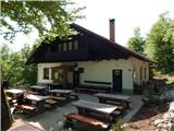
 | Spodnje Dobeno - Rašica (Vrh Staneta Kosca)
Vrh Staneta Kosca, better known as Rašica, is located north of Ljubljana, more precisely above the villages of Rašica and Dobeno. From the summit...
50 min |
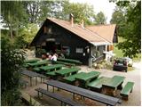 | Preval - Toško Čelo
Toško Čelo is a 590-metre hill above the village of the same name. From the summit, or slightly below it, a beautiful view opens over part of Lju...
35 min |
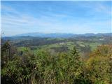 | Gabrje - Limbarska gora (footpath)
Limbarska gora is located northeast of Moravče. From the summit, there is a beautiful view of the surrounding peaks, and in good weather, the Kam...
45 min |
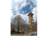 | Kuren - Koča na Planini nad Vrhniko
Planina nad Vrhniko is for Vrhnika locals something like Šmarna gora for those from Ljubljana. It is 733 m high, reachable by several paths from ...
45 min |
 | Katarija - Sveti Miklavž above Sava
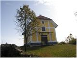
The Church of St. Miklavž is situated on a panoramic hill south of Moravče. From the summit, there is a beautiful view toward the nearby Limbarsk...
45 min |
 | Brezje pri Dobrovi - Ključ
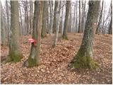
Ključ is a forest-covered peak located north of the village Brezje pri Dobrovi and south of Dolenja vas. The summit, which has a stamp box with l...
45 min |
 | Vrtovin - Školj Svetega Pavla above Vrtovin
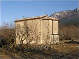
Školj sv. Pavla is located on a panoramic hill above the village of Vrtovin, which lies west of Ajdovščina. From the church, near which the logbo...
35 min |
 | Vratca - Škabrijel
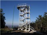
Škabrijel is a hill northeast of the town of Gorica. Since the vegetation on the summit was cleared and a tall metal observation tower was erecte...
40 min |
| Kekec - Škabrijel
Škabrijel is a hill northeast of the town of Gorica. Since the vegetation on the summit was cleared and a tall metal observation tower was erecte...
50 min |
 | Prevala - Škabrijel
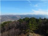
Škabrijel is a hill northeast of the town of Gorica. Since the vegetation on the summit was cleared and a tall metal observation tower was erecte...
50 min |
 | Dobrič - Gora Oljka
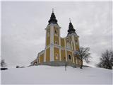
Gora Oljka is a hill located east of Šmartno ob Paki. On the summit stands the Church of the Holy Cross, built in the mid-18th century. Just a fe...
50 min |
 | Dobrič (Vedet) - Gora Oljka (via Rogeljšek)
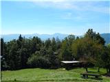
Gora Oljka is a hill located east of Šmartno ob Paki. On the summit stands the Church of the Holy Cross, built in the mid-18th century. Just a fe...
40 min |
| Dobrič (Vedet) - Gora Oljka (via Brezovec)
Gora Oljka is a hill located east of Šmartno ob Paki. On the summit stands the Church of the Holy Cross, built in the mid-18th century. Just a fe...
50 min |
 | Migojnice - Dom na Bukovici
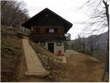
The mountain hut Dom na Bukovici is situated just a few meters below the summit of the forested Bukovica. From the hut, near which there is a lar...
45 min |
 | Zabukovica - Dom na Bukovici
The mountain hut Dom na Bukovici is situated just a few meters below the summit of the forested Bukovica. From the hut, near which there is a lar...
45 min |
 | Kasaze - Dom na Bukovici
The mountain hut Dom na Bukovici is situated just a few meters below the summit of the forested Bukovica. From the hut, near which there is a lar...
45 min |
 | Matke (Zahom) - Dragov dom na Homu
Dragov dom is located on a scenic hill south of Šempeter. From the summit, where there is also the Church of St. Magdalena, there is a fine panor...
35 min |
 | Gora - Trstelj (mimo Stjenkove koče)
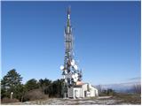
Trstelj is the highest peak in the ridge of Črni hribi. From the spacious summit, which has TV transmitters, the view is divided. From the north ...
50 min |
 | Lipa - Trstelj
Trstelj is the highest peak in the ridge of Črni hribi. From the spacious summit, which has TV transmitters, the view is divided. From the north ...
40 min |
 | Železna vrata - Trstelj (mimo Stjenkove koče)
Trstelj is the highest peak in the ridge of Črni hribi. From the spacious summit, which has TV transmitters, the view is divided. From the north ...
35 min |
 | Košnica - Veliki Slomnik
Veliki Slomnik is a peak located between Košnica pri Celju and Liboje. The summit has a logbook box, but due to the surrounding forest, there are...
40 min |
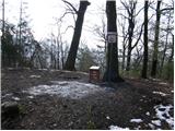 | Košnica - Hom above Celje
Hom is a forest-covered peak located north of Košnica pri Celju. The summit features a logbook box and a small bench....
40 min |
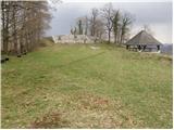 | Jakob pri Šentjurju - Rifnik
Rifnik is a 568-meter-high peak situated south of Šentjur pri Celju. The summit, known for its archaeological site, offers nice views towards Šen...
45 min |
| Šentjur - Rifnik
Rifnik is a 568-meter-high peak situated south of Šentjur pri Celju. The summit, known for its archaeological site, offers nice views towards Šen...
45 min |
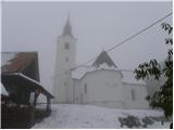 | Galicija - Planinski dom Šentjungert
The mountain hut is located just a few meters below the summit of Gora, where the Church of St. Kunigunda stands; it was built in the 14th centur...
45 min |
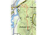 | Ljubljana (Zalog) - Debenji vrh
Debenji vrh, also known as Debni or Deben vrh, at 530 m, is the highest peak of Kašeljski grič, a small range located between the Besnica valley ...
45 min |
 | Ljubljana (Zalog) - Debenji vrh
Debenji vrh, also known as Debni or Deben vrh, at 530 m, is the highest peak of Kašeljski grič, a small range located between the Besnica valley ...
45 min |
| Ljubljana (Zalog) - Debenji vrh (Trda varianta)
Debenji vrh, also known as Debni or Deben vrh, at 530 m, is the highest peak of Kašeljski grič, a small range located between the Besnica valley ...
40 min |
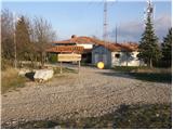 | border crossing Lipica - Kokoš (steep way)
The Koča na Kokoši mountain hut is located on Jirmanec peak, just 5 minutes from the forested Kokoš. From the summit, situated south of Lokavsko ...
50 min |
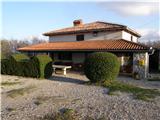 | Lipica (Škibini) - Kokoš
The Koča na Kokoši mountain hut is located on Jirmanec peak, just 5 minutes from the forested Kokoš. From the summit, situated south of Lokavsko ...
50 min |
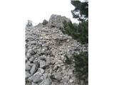 | Pesek / Pese - Kokoš
The Koča na Kokoši mountain hut is located on Jirmanec peak, just 5 minutes from the forested Kokoš. From the summit, situated south of Lokavsko ...
40 min |
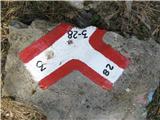 | Grozzana / Gročana - Kokoš
The Koča na Kokoši mountain hut is located on Jirmanec peak, just 5 minutes from the forested Kokoš. From the summit, situated south of Lokavsko ...
40 min |
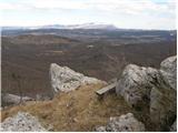 | Vilenica - Stari tabor
Stari Tabor is a panoramic peak located west of Divača, north of Lokev, and south of the village of Povir. From the summit, which has a stamp and...
45 min |
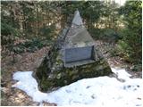 | Šober (Dobajev mlin) - Tojzlov vrh
Tojzlov vrh is a forested hill on the eastern part of Kozjak. On the summit stands a small stone NOB monument and, more recently, also a summit l...
50 min |
 | Šober (Zgornji Tepeh) - Tojzlov vrh
Tojzlov vrh is a forested hill on the eastern part of Kozjak. On the summit stands a small stone NOB monument and, more recently, also a summit l...
50 min |
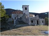 | Vitovlje - Vitovski hrib (by road)
Vitovski hrib is a 604-meter-high hill located north of the village Vitovlje in the Vipava Valley. From the summit, where there is a church dedic...
30 min |
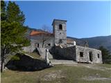 | Vitovlje - Vitovski hrib (west path)
Vitovski hrib is a 604-meter-high hill located north of the village Vitovlje in the Vipava Valley. From the summit, where there is a church dedic...
40 min |
 | Vitovlje - Vitovski hrib (via Vitovlje Lake)
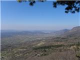
Vitovski hrib is a 604-meter-high hill located north of the village Vitovlje in the Vipava Valley. From the summit, where there is a church dedic...
40 min |
 | Velika Zaka (Bled) - Mala Osojnica (along Ojstrica)
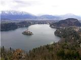
Mala Osojnica is a 691-meter-high peak rising above Lake Bled near Velika Zaka. It is considered the most popular spot for photographers, as all ...
40 min |
 | Preval Prosca - Visoki hrib
Visoki hrib is a 602-meter-high hill located south of Polhov Gradec. From the summit, which is partly overgrown with forest, a beautiful view ope...
50 min |
 | Trnovec (Legastja) - Sveti Florijan (Tehovec)
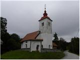
The Church of St. Florijan is a subsidiary church located in the village of Tehovec above Medvode. From the church, first mentioned in 1548, a ni...
50 min |
 | Blagovica - Golčaj
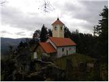
Golčaj is a 690 m high hill rising south of Blagovica. At the summit, which has a logbook box and stamp, stands a NOB monument; a few tens of met...
40 min |
 | Beli Potok at Frankolovo - Lindek Castle
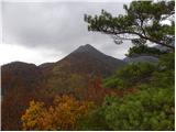
Lindek Castle, first mentioned in 1264, is located on Grajski hrib (Castle Hill), north of Frankolovo. From the summit, where only ruins of the f...
45 min |
 | Prelože pri Lokvi - Veliko Gradišče
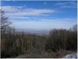
Veliko Gradišče is a 742-meter-high peak south of the village Lokev on the Karst and east of Kokoš. From the summit, marked by a concrete boulder...
45 min |
 | Gaber pri Semiču - Semenič
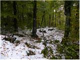
Semenič is a 590-meter-high, forest-covered peak located southwest of the better-known Smuk above Semič. A castle from the 12th century once stoo...
30 min |
 | Pirman - Turjak Castle (longer path)
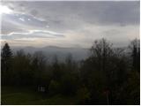
Turjak Castle (Slovenian: Grad Turjak or Turjaški grad; German: Burg Ursperg, later Schloss Auersperg) lies on the edge of Turjak village and is ...
40 min |
 | Kamnik - Castle Stari grad Kamnik
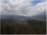
Stari grad Kamnik, formerly known as Zgornji grad (Oberstain), is located on a scenic hill east of Kamnik called Krniška gora. Today, only ruins ...
35 min |
 | Trebnje Castle - Trebni vrh (steep path)
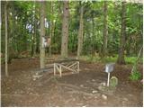
Trebni vrh is a 581-meter-high hill located south or southwest of Trebnje. On the forested summit stands a bench, and nearby is a logbook box wit...
45 min |
| Trebnje Castle - Trebni vrh (via caves)
Trebni vrh is a 581-meter-high hill located south or southwest of Trebnje. On the forested summit stands a bench, and nearby is a logbook box wit...
50 min |
 | Treskavac - Veli Vrh
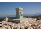
Veli Vrh is not the highest peak on the island of Krk, but it offers the best view of the entire island, the Bay of Rijeka / Riješki zaliv, Učka,...
50 min |
 | Špitalič pri Slovenskih Konjicah - Babček
Babček is an indistinct peak on the hiking trail between Konjiška gora and Boč. An asphalt road runs practically right below the summit. There ar...
50 min |
 | Preddvor - Novi grad (Pusti grad)
Novi grad or Pusti grad (German: Neuburg) is first mentioned in 1156. Today, only ruins remain of the castle, which is located on a hill north to...
40 min |
 | Travnarjev gozd (Hotenjsko podolje) - Sveta Barbara (Ravnik pri Hotedršici)
The Church of St. Barbara is located on a panoramic rise above the settlement of Ravnik pri Hotedršici. From the church or its immediate surround...
35 min |
 | Prevala - Veliki hrib (survey point 526)
Veliki hrib, or kota 526 (the latter mainly associated with World War I; also Mali vrh on some maps), is a peak located northwest of Škabrijel, w...
35 min |
 | Čatež - Bajturn (Zaplaški hrib) (on north slope)
Bajturn, or Zaplaški hrib, at 609 meters, is the highest peak in the Trebnje municipality. The summit features a pleasant bench with a table, a b...
50 min |
 | Ljubljana (G Design Hotel) - Gradišče (above Dobrova)
Gradišče is a forest-covered peak located south of the settlement Dobrova and north of Brezovica pri Ljubljani. From the summit, where there is a...
45 min |
 | Brezovica pri Ljubljani (Radna) - Gradišče (above Dobrova)
Gradišče is a forest-covered peak located south of the settlement Dobrova and north of Brezovica pri Ljubljani. From the summit, where there is a...
45 min |
 | Žiri - Goropeški grič (Pikrej)
Goropeški grič, also known as Pikrej, is located south of Žiri. From the meadows near the logbook box, a nice view opens up onto the surrounding ...
30 min |
 | Radlje ob Dravi - Castle Stari grad above Radlje ob Dravi (Mahrenberg)
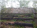
Stari grad above Radlje ob Dravi (Mahrenberg) is situated on a hill north of Radlje ob Dravi. From the partly renovated ruins, a nice view opens ...
40 min |
 | Lovnik - Ljubična gora
Ljubična gora is an elongated hill above the settlements of Ljubično, Zbelovo and Zbelovska gora. The peak is hidden in forest and not well visib...
45 min |
 | Zreče (Terme Zreče) - Brinjeva gora (above Zreče) (on PP1)
Brinjeva gora is a prominent hill situated between Zreče and Oplotnica. It is known for several churches located along its entire ridge. Several ...
45 min |
| Zreče (Terme Zreče) - Brinjeva gora (above Zreče) (via farm Pudgrošek)
Brinjeva gora is a prominent hill situated between Zreče and Oplotnica. It is known for several churches located along its entire ridge. Several ...
50 min |
 | Oplotnica - Sveti Mohor (Lačna Gora)
The Church of St. Mohor and Fortunat is situated on a 602-meter-high hill above the settlement Lačna Gora. In front of the church there is a logb...
45 min |
 | Zreče (church of St. Egidij) - Sveti Martin (Zlakova) (on PP4)
The Church of St. Martin is situated on a panoramic hill on the edge of Zlakova village. From the church, a nice view opens up towards part of Po...
40 min |
 | Zreče (Terme Zreče) - Golika
Golika is a 609-meter-high peak on Brinjeva gora, on which stands the church of St. Neža....
50 min |
 | Gleichenberg Dorf - Gleichenberger Kogel
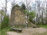
Gleichenberger Kogel is a 598-meter-high mountain of volcanic origin located above Bad Gleichenberg in Styria....
50 min |
 | Straßengel - Frauenkogel (path no. 1)
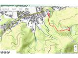
Frauenkogel is a 683-meter-high hill in the western part of the Graz mountains in Steiermark.The hill is located not far northwest of Graz.On the...
45 min |
 | Tourist farm Žurej - Church of St. Helena on Javor
The Church of St. Helena stands on Javor, just off the highest point of the nearby peak where there is also a summit register box and an NOB monu...
45 min |
 | Spodnje Radvanje - Archaeological site Poštela
The archaeological site Poštela is located on a forested hill in the far eastern part of Pohorje....
40 min |
 | Veliki Erjavec - Vodenica
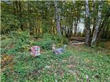
Vodenica is a vast, forest-covered hill southwest of Ozalj. The summit is an HPO point and part of the Dubovačka planinska pot. The summit is par...
45 min |
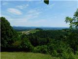 | Stari trg (Pilštanj) - Vina gora
Vina Gora is a scenic hill rising east of the medieval market town of Pilštanj. Its summit has been converted into an attractive open-air museum ...
45 min |
| Lesično - Vina gora
Vina Gora is a scenic hill rising east of the medieval market town of Pilštanj. Its summit has been converted into an attractive open-air museum ...
45 min |
| Lesično - Vina gora (along the water educational trail)
Vina Gora is a scenic hill rising east of the medieval market town of Pilštanj. Its summit has been converted into an attractive open-air museum ...
45 min |