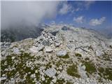
 | Pri Mlinču - Mangart (italijanska pot)
Mangart (also spelled Mangrt; both forms are grammatically correct) is a mountain that attracts a large number of visitors in summer. Access to t...
4 h 45 min |
 | Suhadolnik - Grintovec (via Streha)
Grintovec is the highest peak of the Kamnik-Savinja Alps. It is located above the Kamniška Bistrica Valley, Suhi Dol, and the Ravenska Kočna Vall...
4 h 45 min |
 | Pišnica - Špik (via Kačji graben)
Špik is a 2,472 m high mountain situated in the heart of the Martuljek group. From the summit, clearly visible from the road through Gozd Martulj...
4 h 40 min |
| Ruski križ - Špik (via Kačji graben)
Špik is a 2,472 m high mountain situated in the heart of the Martuljek group. From the summit, clearly visible from the road through Gozd Martulj...
4 h 45 min |
 | The Kot Valley - Begunjski vrh
Begunjski Vrh is a 2,461 m high mountain located in the heart of the highest peaks of the Julian Alps. From the summit, which has a registration ...
4 h 40 min |
 | Bodenbauer - Hochstuhl/Stol
Stol is, at 2,236 m, the highest peak in the Karawanks. From the summit, which has a registration box and stamp, a beautiful view opens onto the ...
4 h 30 min |
 | Bodenbauer - Vertatscha/Vrtača
Vrtača is a 2181 m high peak located east of Stol. From the summit, where a large peg stands, a beautiful view opens over parts of the Julian Alp...
4 h 45 min |
 | Jermanca - Planjava (via Kamniško sedlo)
Planjava is a smaller mountain group east of Kamniško sedlo. It has two peaks eastern and western. The marked path leads to the eastern peak, wh...
4 h 30 min |
| Koča pod slapom Rinka - Planjava
Planjava is a smaller mountain group east of Kamniško sedlo. It has two peaks eastern and western. The marked path leads to the eastern peak, wh...
4 h 45 min |
| Planina Podvežak - Planjava (via Srebrno sedlo)
Planjava is a smaller mountain group east of Kamniško sedlo. It has two peaks eastern and western. The marked path leads to the eastern peak, wh...
4 h 15 min |
 | Planina Podvežak - Planjava (via Škarje)
Planjava is a smaller mountain group east of Kamniško sedlo. It has two peaks eastern and western. The marked path leads to the eastern peak, wh...
4 h 45 min |
 | Kraljev dol - Planjava (via Srebrno sedlo)
Planjava is a smaller mountain group east of Kamniško sedlo. It has two peaks eastern and western. The marked path leads to the eastern peak, wh...
4 h 30 min |
 | The Krma Valley - Debela peč
Debela peč is a 2014 m high mountain that rises steeply above the Krma valley on one side and gently descends towards the expansive Pokljuka fore...
3 h 30 min |
 | Dom pod Storžičem - Storžič (via Škarjev rob)
Storžič is a 2132 m high mountain located in the western part of the Kamnik-Savinja Alps. From the summit, where there is a cross, a beautiful vi...
3 h 5 min |
 | Jekarica - Storžič
Storžič is a 2132 m high mountain located in the western part of the Kamnik-Savinja Alps. From the summit, where there is a cross, a beautiful vi...
3 h |
| Tržiški graben - Storžič (via Javorniški preval)
Storžič is a 2132 m high mountain located in the western part of the Kamnik-Savinja Alps. From the summit, where there is a cross, a beautiful vi...
3 h 45 min |
 | Jermanca - Brana (via Kamniško sedlo)
Brana is a mountain above Kamniško sedlo. From the spacious summit, which has a registration box and a small cross, there is a very beautiful vie...
3 h 45 min |
| Koča pod slapom Rinka - Brana
Brana is a mountain above Kamniško sedlo. From the spacious summit, which has a registration box and a small cross, there is a very beautiful vie...
3 h 45 min |
 | Erjavčev rovt - Mittagskogel/Kepa
Kepa (also Jepa, German: Mittagskogel) is a panoramic mountain in the western Karavanke, located on the border ridge between Slovenia and Austria...
3 h 50 min |
| Ravne - Mittagskogel/Kepa
Kepa (also Jepa, German: Mittagskogel) is a panoramic mountain in the western Karavanke, located on the border ridge between Slovenia and Austria...
4 h 15 min |
 | Iličev rovt / Illitsch Rauth - Mittagskogel/Kepa (path 680)
Kepa (also Jepa, German: Mittagskogel) is a panoramic mountain in the western Karavanke, located on the border ridge between Slovenia and Austria...
3 h |
 | V Koncu - Kalška gora
Kalška gora lies between the Kalški greben and Kokrsko sedlo. From the grassy summit there is a beautiful view towards the nearby Kalški greben. ...
3 h 15 min |
| Suhadolnik - Kalška gora
Kalška gora lies between the Kalški greben and Kokrsko sedlo. From the grassy summit there is a beautiful view towards the nearby Kalški greben. ...
3 h 30 min |
| Dom na Gospincu - Kalška gora (via Zvoh)
Kalška gora lies between the Kalški greben and Kokrsko sedlo. From the grassy summit there is a beautiful view towards the nearby Kalški greben. ...
4 h 45 min |
 | Planina Podvežak - Ojstrica (via Kocbekov dom)
Ojstrica, named for its sharp shape, rises steeply above Korošica, the Logarska Dolina valley, and Robanov Kot. From the summit, which has a regi...
4 h |
 | Planina Ravne - Ojstrica (via Dolga trata and Mala Ojstrica)
Ojstrica, named for its sharp shape, rises steeply above Korošica, the Logarska Dolina valley, and Robanov Kot. From the summit, which has a regi...
4 h 45 min |
 | Dom Planincev v Logarski dolini - Ojstrica (via Škarje)
Ojstrica, named for its sharp shape, rises steeply above Korošica, the Logarska Dolina valley, and Robanov Kot. From the summit, which has a regi...
4 h 10 min |
| Kraljev dol - Ojstrica (via Mala Ojstrica)
Ojstrica, named for its sharp shape, rises steeply above Korošica, the Logarska Dolina valley, and Robanov Kot. From the summit, which has a regi...
3 h 45 min |
| Kraljev dol - Ojstrica (via Kocbekov dom)
Ojstrica, named for its sharp shape, rises steeply above Korošica, the Logarska Dolina valley, and Robanov Kot. From the summit, which has a regi...
4 h 15 min |
 | Planina Zapleč - Krn
Krn, at 2244 m, is the highest peak of the Krn mountain group, which rises steeply above the central part of the Soča River. From the summit, fea...
4 h 30 min |
 | Tolminske Ravne - Tolminski Kuk (via planina Razor)
Tolminski Kuk is the highest peak in the Bohinj-Tolmin mountains. The summit, equipped with a registration box, offers a very beautiful view. Fro...
4 h 45 min |
 | The Krma Valley - Brda
Brda is a panoramic peak situated between Pokljuka and Krma. The summit has a stamp attached to a metal pole and offers a beautiful view towards ...
2 h 55 min |
 | Podnar / Bodenbauer - Prešernova koča na Stolu
The Prešernova koča na Stolu mountain hut is located just a few metres below the summit of the 2198 m high Mali Stol. From the hut or the nearby ...
4 h 25 min |
 | Kriška planina - Kalški greben (via Zvoh)
Kalški greben is a 2224 m high peak and the highest point of the ridge bearing the same name. From the summit, where there is a summit register a...
4 h 10 min |
| Dom na Gospincu - Kalški greben (via Zvoh)
Kalški greben is a 2224 m high peak and the highest point of the ridge bearing the same name. From the summit, where there is a summit register a...
4 h 10 min |
| Planina Jezerca - Kalški greben (via Dom na Krvavcu and Zvoh)
Kalški greben is a 2224 m high peak and the highest point of the ridge bearing the same name. From the summit, where there is a summit register a...
4 h 25 min |
 | The Kot Valley - Visoka Vrbanova špica (via Staničev dom)
Visoka Vrbanova špica is located at the far southwestern end of the ridge rising above the Kot and Vrata valleys, and higher up between the Kot a...
4 h 30 min |
 | Bodenbauer - Ovčji vrh (Kozjak) / Geissberg (Kosiak) (direct way)
Ovčji Vrh or Kozjak, known in German as Geissberg or Kosiak, is a 2024 m high peak located north of the main Karawanks ridge. Rising above Celovš...
3 h |
| Bodenbauer - Ovčji vrh (Kozjak) / Geissberg (Kosiak) (via Klagenfurter Hütte)
Ovčji Vrh or Kozjak, known in German as Geissberg or Kosiak, is a 2024 m high peak located north of the main Karawanks ridge. Rising above Celovš...
3 h 15 min |
 | Aljažev dom v Vratih - Bovški Gamsovec (via Luknja)
Bovški Gamsovec is a 2392 m high mountain in the immediate vicinity of Triglav. From the summit there is a magnificent view of Triglav and its no...
4 h 35 min |
| Aljažev dom v Vratih - Bovški Gamsovec (via Sovatna)
Bovški Gamsovec is a 2392 m high mountain in the immediate vicinity of Triglav. From the summit there is a magnificent view of Triglav and its no...
4 h 45 min |
 | Rifugio Tolazzi - Monte Coglians (Hohe Warte) (via Rifugio Marinelli)
Monte Coglians (Hohe Warte) is, at 2,780 meters, the highest mountain of the Carnic Alps. From the summit, which has a cross and a bell, there is...
4 h 25 min |
 | Žabnice / Camporosso in Valcanale - Kamniti lovec / Cima del Cacciatore
Kamniti lovec is a popular excursion point above Trbiž. Due to the short approach, shortened by the cable car to Višarje, it is well visited. Two...
3 h 30 min |
 | Ravenska Kočna - Velika (Koroška) Baba (via Jenkova planina)
Velika (Koroška) Baba is a 2127 m high mountain on the border ridge above the Ravenska Kočna valley on the Slovenian side and above the Bela (Bel...
3 h 30 min |
 | Tolminske Ravne - Vrh nad Škrbino (on steep and direct path)
Vrh nad Škrbino is the easternmost two-thousander in the ridge of the Lower Bohinj Mountains. From the summit, there are excellent views of the n...
3 h 30 min |
 | Goldberg - Torkofel
Torkofel is the highest peak of the panoramic Jauken ridge, which extends north of the Gailtal valley. From the summit cross, there is a nice vie...
3 h 45 min |
 | Reißkofelbad - Reißkofel (via east ridge)
Reißkofel is a 2371 m high mountain in the Gailtal Alps. The summit, marked by a cross, also features a summit register. The view is particularly...
4 h 45 min |
 | Reißkofelbad - Kleiner Reißkofel
Kleiner Reißkofel is a 2,161-meter-high mountain east of Reißkofel. From the summit, where a cross stands, there are fine views of the nearby Rei...
3 h 30 min |
 | Göriach - Scharnock
Scharnock is a panoramic peak located in the Schladminger Tauern group. From the summit, where a cross stands, there is a nice view of the surrou...
3 h 30 min |
 | Göriach - Hochgolling (Normalanstieg)
Hochgolling is a 2863 m high peak (2862 m according to some sources), located in the heart of the Schladminger Tauern group. With its height, it ...
4 h |
 | Dom Planincev v Logarski dolini - Krofička (marked path)
Krofička (or Grofička according to some records) is a peak located northeast of Ojstrica. From the summit, which steeply descends towards Logarsk...
3 h 35 min |
 | Cave del Mole - Viš/Jof Fuart
Viš is a 2,666 m high peak in the western Julian Alps. From the summit, which features a statue of St. Mary and a cross beside it, there are fine...
4 h 30 min |
 | NC Planica - Srednja Ponca / Ponza di Mezze
Srednja Ponca is a 2,228-meter-high peak rising steeply above Tamar, Planica, and Mangartska Dolina. From the summit, which has a stamp, there ar...
4 h |
 | Cave del Mole - Koštrunove špice (via Forcella Lavinal dell Orso)
Koštrunove špice is a 2,502-meter-high peak located southwest of Viš (2,666 m). From the summit, a beautiful view opens up over much of the weste...
4 h |
| Cave del Mole - Koštrunove špice (via Forcella Mose)
Koštrunove špice is a 2,502-meter-high peak located southwest of Viš (2,666 m). From the summit, a beautiful view opens up over much of the weste...
4 h |
| Sella Nevea - Koštrunove špice (via Forcella Lavinal dell Orso)
Koštrunove špice is a 2,502-meter-high peak located southwest of Viš (2,666 m). From the summit, a beautiful view opens up over much of the weste...
4 h 30 min |
 | Tolminske Ravne - Zeleni vrh (via planina Razor)
Zeleni vrh is a 2052-meter-high mountain located east of the highest peak of the Spodnje Bohinjske gore. From the grassy summit, which drops prec...
4 h 20 min |
 | Fiames - Punta Fiames
Punta Fiames is a 2,240-meter-high peak located north of Cortina d'Ampezzo. The mountain is popular mainly among fans of via ferrata routes, as a...
3 h 30 min |
 | Coot Parking Lot - Velika Baba (Kanin) (over Zg. Brda and saddle Med Baban)
Velika Baba is the southernmost two-thousander of the Kanin mountains. It is separated from the main ridge to the north by the saddle Med Baban, ...
3 h 15 min |
 | Coot Parking Lot - Velika Baba (Kanin) (via Skutnik)
Velika Baba is the southernmost two-thousander of the Kanin mountains. It is separated from the main ridge to the north by the saddle Med Baban, ...
4 h 20 min |
 | Plockenpass - Cima di Mezzo / Keller Warte (via Rifugio Marinelli)
Cima di Mezzo (German: Keller Warte) is a 2,713-meter-high mountain in the Carnic Alps on the border between Austria and Italy. A small cross and...
4 h 35 min |
| Rifugio Tolazzi - Cima di Mezzo / Keller Warte (via Rifugio Marinelli)
Cima di Mezzo (German: Keller Warte) is a 2,713-meter-high mountain in the Carnic Alps on the border between Austria and Italy. A small cross and...
4 h |
 | Weißenbach - Spitzegel / Negal (via Bodenalm)
Spitzegel / Negal is a 2,119 m high mountain in the Gailtal Alps in Austria. The ridge with its highest peak Spitzegel / Nagal logically connects...
4 h 30 min |
 | Passo di Sant'Antonio - Monte Aiarnola (via normale)
Monte Aiarnola is a mountain at the far eastern end of the Sexten Dolomites group. From it there is a nice view towards the western Carnic Alps, ...
3 h 30 min |
 | Cima Sappada - Creton di Tul
Creton di Tul is a 2,288-metre mountain in the Pesarina Dolomites group of the Carnic Alps in Italy, south of Sappada and west of the neighbourin...
3 h 30 min |
 | Cima Sappada - Creta Forata
Creta Forata is a 2,462-meter-high mountain in the Pesarina Dolomites group of the Carnic Alps in Italy, south of Sappada. A small cross and a st...
4 h |
 | Gschnitz - Kalkwand (western approach from Gschnitza via Pinnisjoch)
Kalkwand is an extensive mountain in the eastern part of the Habicht group in the central Stubai Alps. Due to its attractive views, relatively ea...
3 h 45 min |
 | Sankt Ilgen (Der Bodenbauer) - Hochschwab
Hochschwab, at 2,277 meters, is the highest peak of its namesake mountain group in the Northern Limestone Alps. From the summit, where a cross st...
4 h 25 min |
 | Planina Zapleč - Srednji vrh (at Krn)
Srednji vrh is a 2134-meter-high peak located in the ridge between Krn and Krnčica. A marked path leads to the summit, which offers very nice vie...
3 h 10 min |
 | Ruski križ - Lipnica (via Koča v Krnici)
Lipnica is a high-mountain peak standing in the immediate vicinity of Špik and representing its southern neighbour. It lies on the ridge that des...
4 h 15 min |