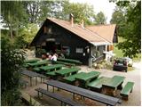
 | Ljubljana (Podutik) - Toško Čelo
Toško Čelo is a 590-metre hill above the village of the same name. From the summit, or slightly below it, a beautiful view opens over part of Lju...
1 h |
 | Brezje pri Dobrovi - Ključ
Ključ is a forest-covered peak located north of the village Brezje pri Dobrovi and south of Dolenja vas. The summit, which has a stamp box with l...
45 min |
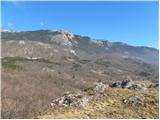 | Gojače - Školj Svetega Pavla above Vrtovin (past trough)
Školj sv. Pavla is located on a panoramic hill above the village of Vrtovin, which lies west of Ajdovščina. From the church, near which the logbo...
1 h |
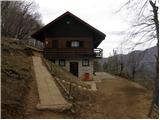 | Migojnice - Dom na Bukovici
The mountain hut Dom na Bukovici is situated just a few meters below the summit of the forested Bukovica. From the hut, near which there is a lar...
45 min |
 | Zabukovica - Dom na Bukovici
The mountain hut Dom na Bukovici is situated just a few meters below the summit of the forested Bukovica. From the hut, near which there is a lar...
45 min |
 | Kasaze - Dom na Bukovici
The mountain hut Dom na Bukovici is situated just a few meters below the summit of the forested Bukovica. From the hut, near which there is a lar...
45 min |
 | Košnica - Veliki Slomnik
Veliki Slomnik is a peak located between Košnica pri Celju and Liboje. The summit has a logbook box, but due to the surrounding forest, there are...
40 min |
 | Košnica - Hom above Celje
Hom is a forest-covered peak located north of Košnica pri Celju. The summit features a logbook box and a small bench....
40 min |
 | Jakob pri Šentjurju - Rifnik
Rifnik is a 568-meter-high peak situated south of Šentjur pri Celju. The summit, known for its archaeological site, offers nice views towards Šen...
45 min |
| Šentjur - Rifnik
Rifnik is a 568-meter-high peak situated south of Šentjur pri Celju. The summit, known for its archaeological site, offers nice views towards Šen...
45 min |
 | Vezovje (bus station Vezovje most) - Rifnik
Rifnik is a 568-meter-high peak situated south of Šentjur pri Celju. The summit, known for its archaeological site, offers nice views towards Šen...
45 min |
 | Galicija - Planinski dom Šentjungert
The mountain hut is located just a few meters below the summit of Gora, where the Church of St. Kunigunda stands; it was built in the 14th centur...
45 min |
 | Ljubljana (Zalog) - Debenji vrh
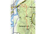
Debenji vrh, also known as Debni or Deben vrh, at 530 m, is the highest peak of Kašeljski grič, a small range located between the Besnica valley ...
45 min |
 | Ljubljana (Zalog) - Debenji vrh
Debenji vrh, also known as Debni or Deben vrh, at 530 m, is the highest peak of Kašeljski grič, a small range located between the Besnica valley ...
45 min |
| Ljubljana (Zalog) - Debenji vrh (Trda varianta)
Debenji vrh, also known as Debni or Deben vrh, at 530 m, is the highest peak of Kašeljski grič, a small range located between the Besnica valley ...
40 min |
 | Vitovlje - Vitovski hrib (west path)
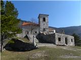
Vitovski hrib is a 604-meter-high hill located north of the village Vitovlje in the Vipava Valley. From the summit, where there is a church dedic...
40 min |
 | Vitovlje - Vitovski hrib (via Vitovlje Lake)
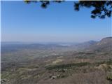
Vitovski hrib is a 604-meter-high hill located north of the village Vitovlje in the Vipava Valley. From the summit, where there is a church dedic...
40 min |
 | Lokvica - Fajti hrib
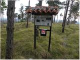
Fajti, also known in some records as Fajtji hrib, is a 433-meter-high hill located in the Črni hribi ridge. The summit is known mainly for the fi...
1 h |
 | Ljubljana (Gruberjeva brv) - Mazovnik (Golovec)
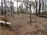
Mazovnik, at 450 m, is the highest peak of Golovec, a hill range located on the southeastern outskirts of Ljubljana. Golovec remained bare until ...
1 h |
 | Podgrad - Castle Stari grad (Stari Osterberg) (on Ostrovrhar trail)
Stari grad, or Stari Osterberg, was first mentioned in the 12th century (less likely as early as 1015), at which time the castle belonged to the ...
45 min |
 | Serdica - Serdiški breg (Rdeči breg)
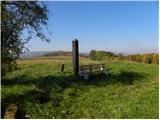
Serdiški breg (Rdeči breg) is a 416 m high hill located right next to the Austrian border. From its grassy summit, which has a few benches and a ...
40 min |
 | Nuskova - Serdiški breg (Rdeči breg)
Serdiški breg (Rdeči breg) is a 416 m high hill located right next to the Austrian border. From its grassy summit, which has a few benches and a ...
50 min |
| Nuskova - Serdiški breg (Rdeči breg) (via Brunarjev breg)
Serdiški breg (Rdeči breg) is a 416 m high hill located right next to the Austrian border. From its grassy summit, which has a few benches and a ...
1 h |
| Serdica - Serdiški breg (Rdeči breg) (via Brunarjev breg)
Serdiški breg (Rdeči breg) is a 416 m high hill located right next to the Austrian border. From its grassy summit, which has a few benches and a ...
50 min |
 | border crossing Sotina - Sotinski breg (Kugla)
Sotinski breg (Kugla) is the highest peak of Prekmurje at 418 m. From the summit, which features a wooden observation tower with a bell and cross...
45 min |
 | Sotina - Sotinski breg (Kugla) (via the source of mineral water)
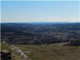
Sotinski breg (Kugla) is the highest peak of Prekmurje at 418 m. From the summit, which features a wooden observation tower with a bell and cross...
50 min |
 | Kubed - Lačna
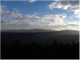
Lačna is a 451-meter-high hill located between Gračišče, Kubed, and Hrastovlje. The summit, which features a metal observation tower offering nic...
45 min |
 | Škofja Loka - Divja Loka Castle (Stari grad)
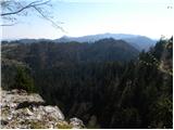
Divja Loka Castle (also known as Stari grad) above Škofja Loka is located on a small hill north of Nemški grič. First mentioned in 1202, it was r...
40 min |
 | Phliški bajer - Mengeška koča on Gobavica (ridge path)
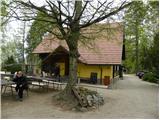
Gobavica is a hill rising above Mengeš. Mengeška koča mountain hut stands on it, along with a goat pen. It is one of the starting points for the ...
1 h 10 min |
 | Šentilj v Slovenskih goricah - Plački vrh
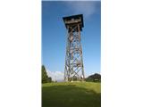
Plački vrh is a peak in Slovenske Gorice. It lies in the municipality of Kungota, right on the border with Austria.A 28-meter-high lookout tower ...
1 h |
 | Pirman - Turjak Castle (longer path)
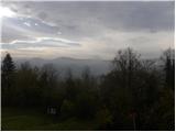
Turjak Castle (Slovenian: Grad Turjak or Turjaški grad; German: Burg Ursperg, later Schloss Auersperg) lies on the edge of Turjak village and is ...
40 min |
 | Trebnje Castle - Trebni vrh (steep path)
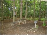
Trebni vrh is a 581-meter-high hill located south or southwest of Trebnje. On the forested summit stands a bench, and nearby is a logbook box wit...
45 min |
 | Šahovec - Trebni vrh (Baragova pot)
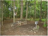
Trebni vrh is a 581-meter-high hill located south or southwest of Trebnje. On the forested summit stands a bench, and nearby is a logbook box wit...
1 h 5 min |
 | Dragomer - Vrh (Debeli hrib) (on Pentlja)
Vrh is a 540-meter-high hill on the Debeli hrib ridge, which lies between the Ljubljana Marshes and the Horjulščica river valley. The view from t...
1 h |
 | Treskavac - Veli Vrh
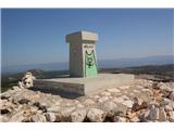
Veli Vrh is not the highest peak on the island of Krk, but it offers the best view of the entire island, the Bay of Rijeka / Riješki zaliv, Učka,...
50 min |
 | Špitalič pri Slovenskih Konjicah - Babček
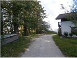
Babček is an indistinct peak on the hiking trail between Konjiška gora and Boč. An asphalt road runs practically right below the summit. There ar...
50 min |
 | Rdeči Kal - Ostri vrh (above Globodol) (via Dom LD Dobrnič)
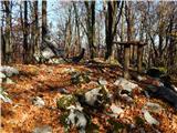
Ostri vrh is a 523-meter-high peak located between Vrbovec, Rdeči Kal, Gorenji, Srednji, and Dolenji Globodol, Dolnji and Gornji Ajdovec, and Pod...
1 h |
 | Okrog (Lazar) - Zaplaz
Zaplaz is a 543-meter-high hill located above Čatež, a settlement best known as the endpoint of the Levstik Trail (From Litija to Čatež). The sum...
1 h 10 min |
| Bridge over Dušica - Zaplaz
Zaplaz is a 543-meter-high hill located above Čatež, a settlement best known as the endpoint of the Levstik Trail (From Litija to Čatež). The sum...
1 h |
 | Topole - Koseški hrib
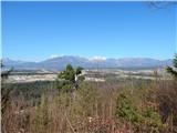
Koseški hrib is located between Kuharjev boršt and Koseze, the settlement after which the peak is also named. From the summit, which has a table,...
55 min |
 | Dravograd lake - Church of the Holy Cross at Dravograd
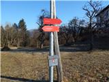
The Church of the Holy Cross near Dravograd stands on a panoramic rise from which fine views extend over the western Pohorje, Slovenjgraška Basin...
45 min |
 | Ljubljana (G Design Hotel) - Gradišče (above Dobrova)
Gradišče is a forest-covered peak located south of the settlement Dobrova and north of Brezovica pri Ljubljani. From the summit, where there is a...
45 min |
 | Brezovica pri Ljubljani (Radna) - Gradišče (above Dobrova)
Gradišče is a forest-covered peak located south of the settlement Dobrova and north of Brezovica pri Ljubljani. From the summit, where there is a...
45 min |
 | Doklece - Janški vrh (by road)
Janški vrh is a 417-meter-high peak on which stands a small namesake settlement and the Church of St. John the Baptist from the 15th century. The...
45 min |
 | Dolena (Stojana vas) - Janški vrh
Janški vrh is a 417-meter-high peak on which stands a small namesake settlement and the Church of St. John the Baptist from the 15th century. The...
50 min |
 | Radlje ob Dravi - Castle Stari grad above Radlje ob Dravi (Mahrenberg)
Stari grad above Radlje ob Dravi (Mahrenberg) is situated on a hill north of Radlje ob Dravi. From the partly renovated ruins, a nice view opens ...
40 min |
 | Zbelovo (railway underpass) - Ljubična gora (via Marijine stopinje)
Ljubična gora is an elongated hill above the settlements of Ljubično, Zbelovo and Zbelovska gora. The peak is hidden in forest and not well visib...
45 min |
 | Zbelovo (railway underpass) - Ljubična gora
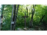
Ljubična gora is an elongated hill above the settlements of Ljubično, Zbelovo and Zbelovska gora. The peak is hidden in forest and not well visib...
45 min |
 | Lovnik - Ljubična gora
Ljubična gora is an elongated hill above the settlements of Ljubično, Zbelovo and Zbelovska gora. The peak is hidden in forest and not well visib...
45 min |
 | Vojnik - Sveti Tomaž above Vojnik
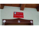
Sv. Tomaž is a church on a partly vegetated 444 m high summit near Vojnik. There is a logbook with a stamp at the top. Below the summit stands th...
1 h |
 | Gradišče pri Vipavi - Plaz
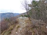
Plaz or Vrh Plaza is a 528-meter-high peak above the Vipava Valley, more precisely between Vipava and Gradišče. From the summit, which has a summ...
40 min |
 | Liboje - Kamčič (via organic farm Kralj - southern approach)
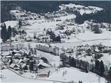
Kamčič is a wooded peak in the Posavje Hills, located north of Šmohor between Kotečnik to the left and Veliki Slomnik to the right. It is recogni...
1 h 10 min |
 | Velika Kostrevnica - Kožljevec
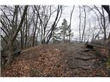
Kožljevec (also Kožlevec) is a 533-meter-high hill above Cerovica in the municipality of Šmartno pri Litiji. The forested summit features a logbo...
1 h 10 min |
 | Brezje pri Dobrovi - Vrhovčev grič (via Strmca)
Vrhovčev grič is an indistinct, forested peak located just a few meters off the marked trail between Debeli hrib and Strmca....
50 min |
| Dragomer (bajer) - Vrhovčev grič (via Ferjanka and Strmca)
Vrhovčev grič is an indistinct, forested peak located just a few meters off the marked trail between Debeli hrib and Strmca....
1 h 10 min |
 | Lovska koča Muljava - Mali Petrovac (Petrova gora) (Roman path)
Mali Petrovac is a rather low hill located somewhere on the border between Banija and Kordun, as well as Pannonian Croatia and Gorski Kotar. The ...
1 h |
 | Lovska koča Muljava - Veliki Petrovac (Petrova gora) (Roman path)
Veliki Petrovac is a 512-meter-high peak on Petrova gora....
50 min |
 | Velenje (Stari trg) - Veliko Gradišče
Gradišče is a hill above Pesje near Velenje.It has two peaks: Veliko Gradišče and Malo Gradišče.Veliko Gradišče lies west of the St. James church...
1 h |
 | Naraplje - Church of St. Bolfenk (Jelovice)
The Church of St. Bolfenk is situated on a 537-meter-high hill above the settlement of Jelovice. From the top, a nice view opens up towards Haloz...
1 h |
| Stogovci (Vabča vas) - Church of St. Bolfenk (Jelovice)
The Church of St. Bolfenk is situated on a 537-meter-high hill above the settlement of Jelovice. From the top, a nice view opens up towards Haloz...
1 h |
 | Oplotnica - Sveti Mohor (Lačna Gora)
The Church of St. Mohor and Fortunat is situated on a 602-meter-high hill above the settlement Lačna Gora. In front of the church there is a logb...
45 min |
 | Pichla bei Radkersburg - Königsberg
Königsberg is a 462-meter-high peak situated in Steiermark near the border with Slovenia. On the summit of volcanic origin, there are some memori...
40 min |
 | Bad Gleichenberg (Eichgraben Weg) - Gleichenberger Kogel (via Mühlsteinbruch)
Gleichenberger Kogel is a 598-meter-high mountain of volcanic origin located above Bad Gleichenberg in Styria....
1 h 10 min |
| Bad Gleichenberg (Eichgraben Weg) - Gleichenberger Kogel
Gleichenberger Kogel is a 598-meter-high mountain of volcanic origin located above Bad Gleichenberg in Styria....
1 h 5 min |
 | Gleichenberg Dorf - Gleichenberger Kogel
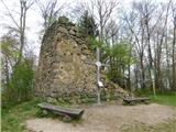
Gleichenberger Kogel is a 598-meter-high mountain of volcanic origin located above Bad Gleichenberg in Styria....
50 min |
 | Laško (cemetery Laško) - Church of St. Michael at Šmihel
The Church of St. Michael at Šmihel is situated on a scenic hill above Laško. From the church, beautiful views open up to Veliko Kozje, Kopitnik,...
40 min |
| Laško (cemetery Laško) - Church of St. Michael at Šmihel (past Sveti Krištof)
The Church of St. Michael at Šmihel is situated on a scenic hill above Laško. From the church, beautiful views open up to Veliko Kozje, Kopitnik,...
52 min |
 | Tourist farm Žurej - Church of St. Helena on Javor
The Church of St. Helena stands on Javor, just off the highest point of the nearby peak where there is also a summit register box and an NOB monu...
45 min |
 | Borovic (road on Hum) - Sveti Duh (Hum) (past Titova špilja)
Sveti Duh is a chapel located northeast of Hum, the highest peak on Vis island, though it is under military control and inaccessible. From the ch...
50 min |
 | Stoperce - Sveta Ana above Stoperce
The Church of St. Anne is situated on a 460-meter-high hill rising west of the settlement Stoperce. From the church or its nearby surroundings, a...
40 min |
 | Snack Bar Zelena dolina - Church of Our Lady of Loreto in Ložno
The Church of Our Lady of Loreto at Ložno stands on a panoramic hill northeast of Rogaška Slatina. A chapel and an NOB monument stand by the chur...
1 h 5 min |
 | Lovnik - Rančka
Rančka is a 615-meter-high peak located west to southwest of Boč. Just below the summit is a stamp box with a bench nearby; the highest point its...
1 h |
 | Spodnje Radvanje - Archaeological site Poštela
The archaeological site Poštela is located on a forested hill in the far eastern part of Pohorje....
40 min |
 | Donji Borki - Petrov vrh above Daruvar
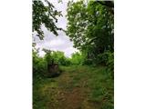
Petrov vrh is one of the peaks on Papuk Mountain. It is located above the town of Daruvar and is a popular destination for local residents. There...
1 h |
 | Buzet Railway Station - Pilj (nad Buzetom)
Pilj is a grassy peak above Buzet. It is located on the edge of the cliff. From the summit, which has an inscription on the rock, a beautiful vie...
1 h |
 | Loka pri Žusmu (Žamerk) - Castle Žusem
Castle Žusem (German Sussenheim), of which only ruins remain today, is located east to northeast of Žusem, a peak with a lookout tower....
50 min |
 | Pernica - Vavtošek
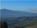
Vavtošek is a scenic summit in the Slovenske Gorice on which several transmitters stand. From the top there is a fine view mainly towards the sou...
1 h 5 min |
 | Veliki Erjavec - Vodenica
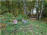
Vodenica is a vast, forest-covered hill southwest of Ozalj. The summit is an HPO point and part of the Dubovačka planinska pot. The summit is par...
45 min |
 | Stainz bei Straden - Rosenberg
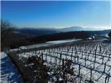
Rosenberg is a panoramic peak located south of the Aussichtswarte Vulkanland observation tower, or just slightly above the settlement of Rožni Vr...
1 h 10 min |
 | Jama Pekel (parking lot) - Apno (shorter path)
Apno is a 525-metre-high mountain located on the Ponikovski karst. The summit has some benches, a summit register box, but due to the forest ther...
1 h |