 | Kališe - Kranjska reber
Kranjska reber, also known as Vrh Kašne planine (1435 m), is a mountain of volcanic origin. From the summit, which has a registration box with a ...
1 h 30 min |
| Volovljek - Kranjska reber (on unmarked path)
Kranjska reber, also known as Vrh Kašne planine (1435 m), is a mountain of volcanic origin. From the summit, which has a registration box with a ...
1 h 15 min |
 | Kosmačev preval - Črna gora
The summit is located between the Kot and Vrata valleys. A bivouac with two sleeping places stands on the summit. The view is beautiful towards K...
1 h 15 min |
 | Kajfežev rob - Kamniški vrh
Kamniški vrh is a 1259-metre-high mountain located north of Kamnik, more precisely between Stahovica and the Korošica valley. From the summit, wh...
1 h 15 min |
 | Kozarnice - Srednji Golak (unmarked eastern way)
Srednji Golak is located between Mali and Veliki Golak on the plateau of Trnovski gozd above Predmeja. The peak is covered with dwarf pines, and ...
1 h 45 min |
 | Avsa - Mrzli vrh (on Matajur)
Mrzli vrh is a 1358-meter-high peak located in the Matajur range. From the summit, where there is a panorama board and a summit register box with...
1 h 25 min |
 | Gorenje - Gora (Sveti Lovrenc) (gentle path)
Gora, or Sveti Lovrenc, is a peak above Studeno, a village north of Postojna that serves as a suitable starting point for the ascent to this pano...
1 h 45 min |
 | Planina Smrečica (Poglajnov rovt) - Galetovec
Galetovec is an indistinct peak on the southeastern part of the Pokljuka plateau. From the summit, which has a logbook, there is a nice view of t...
2 h |
 | Preval Hlevišče - Mladi vrh
Mladi vrh is the higher neighbor of the better-known Stari vrh, separated from it by a saddle. Covered in sparse beech forest, the summit offers ...
1 h 45 min |
 | Cenc - Špičasti vrh (on road over Novina)
Špičasti vrh is a forest-covered mountain located south of the village of Zadlog. To ensure the summit is not without a view, a 13-meter-high woo...
1 h 30 min |
 | Dom Pristava in Javorniški Rovt - Španov vrh
Španov vrh is a 1334-meter-high mountain in the Karavanke that rises between Javorniški Rovt and Planina pod Golico. From the scenic summit, acce...
1 h 30 min |
| Planina pod Golico - Španov vrh
Španov vrh is a 1334-meter-high mountain in the Karavanke that rises between Javorniški Rovt and Planina pod Golico. From the scenic summit, acce...
1 h 15 min |
 | Planina Lom - Kobilja glava
Kobilja glava is a 1,475-meter-high peak located east of Tolmin. From the summit, where a cross stands, there is a beautiful view of Krn, the ran...
1 h 15 min |
 | Koča na planini Stador - Jalovnik
Jalovnik is a grassy peak located southeast of the slightly higher Kobilja glava. From the summit, which has a summit logbook, there is a nice vi...
1 h 30 min |
| Planina Lom - Jalovnik
Jalovnik is a grassy peak located southeast of the slightly higher Kobilja glava. From the summit, which has a summit logbook, there is a nice vi...
1 h 30 min |
 | Koroška Bela (RC Kres) - Alničje (hunting path)
Alničje is a 1145 m high ridge-like rise that ascends from the southwest above the Jesenice settlements of Koroška Bela and Javornik, extending n...
1 h 20 min |
 | Eko koča Nanos (Lovska koča Vojkovo) - Grmada (Nanos)
Grmada is a 1209-meter peak situated near the edge of the Nanos plateau, northwest of the better-known Pleša (about a 20-minute walk away). Becau...
1 h 45 min |
 | Poljana - Smolnik
Smolnik is a steep 1075-meter-high peak a solitary summit below Valvasorjev dom hut rising above the Zavrh (Završnica) valley, with views of St...
1 h 15 min |
 | Oblakov Vrh - Hudournik
Hudournik is a 1,148-meter-high peak on the northern edge of the Vojskarska planota plateau, which lies between the valleys of the Idrijca, Kanom...
1 h 30 min |
 | Makekova Kočna - Javornik above Jezersko
Javornik is a forested peak between the valleys of Ravenska Kočna and Makekove Kočna. There is no view from the summit due to the trees, but near...
1 h 45 min |
 | Makekova Kočna - Skubrov vrh
Skubrov vrh is a 1276 m high mountain rising steeply above the Ravenska Kočna valley. The forested summit offers no views....
1 h 10 min |
 | Poden / Bodental - Požgani rob
Požgani rob is a 1,513-meter-high mountain north of Rjavca. The summit is surrounded by forest, so there is no good view from it, but a nice pano...
1 h 10 min |
 | Podmeja - Javor
Javor is a 1,132-meter-high peak situated between Kisovec and Sveta Planina. The summit, covered with forest, offers no views, but a nice panoram...
2 h |
 | Matevljek - Petelinjek
Petelinjek is a 1212 m high peak located in the Racna gora range. From the summit, where there is a small metal chair, a cairn, and an old ladder...
1 h 15 min |
 | Rotek - Erbelc
Erbelc is a 1,308-meter-high peak that rises steeply above Zgornja Sorica. From the summit, which has a summit logbook, there is a fine view of t...
1 h 15 min |
| Spodnje Danje - Erbelc
Erbelc is a 1,308-meter-high peak that rises steeply above Zgornja Sorica. From the summit, which has a summit logbook, there is a fine view of t...
1 h 15 min |
 | Rotek - Tonderškofel
Tonderškofel is a 1,326-meter-high peak located between Soriška peč and Erbelc. From the partly overgrown summit, which has no marked trail leadi...
1 h 15 min |
| Spodnje Danje - Tonderškofel
Tonderškofel is a 1,326-meter-high peak located between Soriška peč and Erbelc. From the partly overgrown summit, which has no marked trail leadi...
1 h 15 min |
 | Jeršiče - Baba (at Javorniki)
Baba is a 1,085-meter-high peak located between the Javorniki ridge and Sveta Trojica. From its grassy summit, nice views open up to the Javornik...
1 h 30 min |
 | Možjanca - Kopa (Partizanski vrh)
Kopa, also known as Partizanski vrh, is a 1,024-meter-high mountain located west of the Davovec saddle, which itself lies west to southwest of Kr...
1 h 30 min |
 | Bele Vode (Kovač) - Sveti Križ above Bele Vode (on south ridge)
The Church of St. Cross is located on Kriška gora, formerly called Oslovska gora. Kriška gora rises above Beli Vodi, or above the streams Ljubija...
1 h 10 min |
 | Tolminske Ravne - Javor (above Tolminske Ravne)
Javor is a 1,363-meter-high peak situated between Tolminske Ravne and Grušnica. From the summit, which features a small cross, nice views open up...
1 h 20 min |
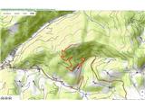
 | Polja - Kališje
Kališje is a lesser-known peak in the western part of the Karawanks. From the summit, where transmitters are located, there are some views toward...
1 h 40 min |
 | Bela Peč - Ojstri vrh (above Prevala) (past peak Seduc)
Ojstri vrh is a 1,197-meter-high mountain located between the Seduc peak and Prevala. From the summit, there is a beautiful view of the surroundi...
1 h 30 min |
 | Bela Peč - Ojstri vrh (above Prevala) (via Ovčje jame)
Ojstri vrh is a 1,197-meter-high mountain located between the Seduc peak and Prevala. From the summit, there is a beautiful view of the surroundi...
1 h 45 min |
 | Poljšica pri Gorjah (Zatrata) - Hotunjski vrh (on footpath)
Hotunjski vrh is a 1,107-meter-high panoramic peak located above the Zatrnik ski slope. From the summit, where there is a summit register box and...
1 h 30 min |
| Poljšica pri Gorjah (Zatrata) - Hotunjski vrh (by road)
Hotunjski vrh is a 1,107-meter-high panoramic peak located above the Zatrnik ski slope. From the summit, where there is a summit register box and...
2 h |
 | Podblica - Bela peč (Podbliška gora)
Bela peč is situated on the edge of Jelovica above the village Podblica. From the top of the cliff a beautiful view opens up towards the mentione...
1 h 30 min |
 | Sveta Jedert (Lajše) - Bela peč (Podbliška gora) (via Rigli)
Bela peč is situated on the edge of Jelovica above the village Podblica. From the top of the cliff a beautiful view opens up towards the mentione...
1 h 30 min |
| Sveta Jedert (Lajše) - Bela peč (Podbliška gora) (upper part on the road)
Bela peč is situated on the edge of Jelovica above the village Podblica. From the top of the cliff a beautiful view opens up towards the mentione...
1 h 30 min |
 | Hunting lodge LD Libeliče - Šteharski vrh (Šteharnikov vrh)
Šteharski vrh (also Šteharnikov vrh or Črneška gora) is a 1,018 m high mountain located in the southeastern part of the Strojna range, between th...
1 h 30 min |
 | Šumahovo sedlo - Jesenik (Jesenikov vrh) (via Veliki and Pikov vrh)
Jesenik, also known as Jesenikov vrh, is a 1,199-meter-high forested peak situated between Mežica and Podpeca....
1 h 45 min |
 | Koča na Pikovem - Šumahov vrh (via Pikov and Veliki vrh)
Šumahov vrh is a 1,155-meter-high peak on which a wooden cross stands. From the summit, which descends steeply towards Žerjav, a nice view opens ...
1 h 35 min |
 | Završnica (Pri žagi) - Tolsti vrh (at Poljška planina) (via saddle Kališča)
Tolsti vrh is a 1,225-meter-high peak located between Završnica Valley and Draga Valley. The summit lies in forest, but a viewpoint just below of...
1 h 25 min |
 | Apno - Prgozdnik (Martinova pot)
Prgozdnik is a 1013 meters high peak, which is situated on the eponymous ridge, between the settlements Ambrož pod Krvavcem, Šenturška Gora, Apno...
1 h 10 min |
 | Poden / Bodental - Veliki Rob / Großer Rain
Veliki Rob / Großer Rain is a 1,464-meter-high peak located on the Austrian side of the Karawanks, specifically in the ridge above the Poden / Bo...
1 h 50 min |
 | Poden / Bodental - Veronjak / Hausberg
Veronjak / Hausberg is a 1,348-meter-high peak located above the Poden / Bodental valley on the Austrian side of the Karawanks. From the summit, ...
1 h 20 min |
| Slovenji Plajberk / Windisch Bleiberg - Veronjak / Hausberg (via Veronjak / Hausberg)
Veronjak / Hausberg is a 1,348-meter-high peak located above the Poden / Bodental valley on the Austrian side of the Karawanks. From the summit, ...
1 h 25 min |
 | Slovenji Plajberk / Windisch Bleiberg - Rabenberg
Rabenberg is a 1,465 m high peak located in the Žingarica / Singerberg ridge. From the summit, there is a partial view to the northwest, while fo...
1 h 45 min |
| Plajberški graben / Bleiberger Graben - Rabenberg
Rabenberg is a 1,465 m high peak located in the Žingarica / Singerberg ridge. From the summit, there is a partial view to the northwest, while fo...
1 h 45 min |
 | Medvodje - Penatca
Penatca is a 1,299-meter-high peak located above the right bank of the Tržiška Bistrica. The summit itself is in the forest, but a few steps to t...
1 h 40 min |
 | Medvodje - Medvodnica (via Tržiška Bistrica)
Medvodnica is a 1,202-meter-high mountain situated between the Košutnik and Tržiška Bistrica streams. The summit lies within the forest, offering...
1 h 30 min |
| Medvodje - Medvodnica (via Košutnik)
Medvodnica is a 1,202-meter-high mountain situated between the Košutnik and Tržiška Bistrica streams. The summit lies within the forest, offering...
1 h 25 min |
 | Erjavčev rovt - Bela peč (above Dovje)
Bela peč is a lesser-known peak located above the marked trail from Dovje to Dovška Baba. From the summit, there is a beautiful view to the south...
1 h 15 min |
 | Schrems/Frohnleiten (Hautabauer) - Harterberg (Hoaterberg)
Harterberg, also known as Hoaterberg, is a 1,036 m high hill above the settlement of Schrems/Frohnleiten in the northern part of the Graz Mountai...
2 h |
 | Dražgoše (Na Pečeh) - Britmanca
Britmanca is a 1,231-meter-high peak on the edge of the Jelovica plateau. Slightly south and lower from the summit along a well-worn path lies a ...
1 h 10 min |
| Dražgoše (Jelenšče) - Britmanca (gentle path)
Britmanca is a 1,231-meter-high peak on the edge of the Jelovica plateau. Slightly south and lower from the summit along a well-worn path lies a ...
1 h 15 min |