 | Jezero - Krim (via Ledenica)
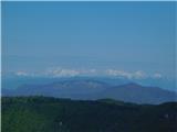
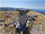
Krim is a 1,107-metre-high mountain rising south of the Ljubljana Marsh. From the summit, where a mountain hut and several transmitters stand, th...
2 h 30 min |
 | Strahomer - Krim (via Strmec)
Krim is a 1,107-metre-high mountain rising south of the Ljubljana Marsh. From the summit, where a mountain hut and several transmitters stand, th...
2 h 10 min |
| Strahomer - Krim (via Kramarca)
Krim is a 1,107-metre-high mountain rising south of the Ljubljana Marsh. From the summit, where a mountain hut and several transmitters stand, th...
2 h 10 min |
 | Vrbljene - Krim
Krim is a 1,107-metre-high mountain rising south of the Ljubljana Marsh. From the summit, where a mountain hut and several transmitters stand, th...
2 h 15 min |
| Tomišelj - Krim
Krim is a 1,107-metre-high mountain rising south of the Ljubljana Marsh. From the summit, where a mountain hut and several transmitters stand, th...
2 h 15 min |
| Jezero - Krim (via homestead Špelin)
Krim is a 1,107-metre-high mountain rising south of the Ljubljana Marsh. From the summit, where a mountain hut and several transmitters stand, th...
2 h 20 min |
 | Trbovlje - Kum (via Čebulova dolina)
Kum, at 1,220 metres, is the highest peak in the Posavje Hills. As it rises above the Zasavje region, some call it the Zasavje Triglav. At the su...
3 h 30 min |
 | Zidani Most - Kum (through Škratova dolina (old path))
Kum, at 1,220 metres, is the highest peak in the Posavje Hills. As it rises above the Zasavje region, some call it the Zasavje Triglav. At the su...
3 h |
 | Hrastnik (Podkraj) - Kum (via Matca)
Kum, at 1,220 metres, is the highest peak in the Posavje Hills. As it rises above the Zasavje region, some call it the Zasavje Triglav. At the su...
2 h 55 min |
| Zidani Most - Kum (through Škratova dolina (new path))
Kum, at 1,220 metres, is the highest peak in the Posavje Hills. As it rises above the Zasavje region, some call it the Zasavje Triglav. At the su...
3 h 5 min |
| Dolina Sopote (Zagrad) - Kum
Kum, at 1,220 metres, is the highest peak in the Posavje Hills. As it rises above the Zasavje region, some call it the Zasavje Triglav. At the su...
3 h 10 min |
 | Lozice - Vojkova koča na Nanosu
Vojkova koča is located on the southern edge of the high karst Nanos plateau, near Pleša. This is the prominent peak with television transmitters...
3 h |
| Hrašče - Vojkova koča na Nanosu (via Brižnik)
Vojkova koča is located on the southern edge of the high karst Nanos plateau, near Pleša. This is the prominent peak with television transmitters...
3 h 10 min |
| Hrašče - Vojkova koča na Nanosu (past troughs)
Vojkova koča is located on the southern edge of the high karst Nanos plateau, near Pleša. This is the prominent peak with television transmitters...
3 h 10 min |
 | Kamnje - Kucelj (on Čaven)
Kucelj is located on the southern slopes of the Trnovski Forest, northwest of the Vipava Valley. From the bare summit, where a cross stands, ther...
2 h 45 min |
 | Stomaž - Kucelj (on Čaven) (mimo Koče na Čavnu)
Kucelj is located on the southern slopes of the Trnovski Forest, northwest of the Vipava Valley. From the bare summit, where a cross stands, ther...
3 h |
 | Gojače - Kucelj (on Čaven)
Kucelj is located on the southern slopes of the Trnovski Forest, northwest of the Vipava Valley. From the bare summit, where a cross stands, ther...
2 h 55 min |
| Malovše - Kucelj (on Čaven)
Kucelj is located on the southern slopes of the Trnovski Forest, northwest of the Vipava Valley. From the bare summit, where a cross stands, ther...
3 h |
 | Hrastnik - Mrzlica (via Klobuk)
In recent years, Mrzlica has become an extremely popular excursion spot, especially for visitors from Savinjska valley and Zasavje. At 1,122 mete...
3 h 5 min |
| Hrastnik - Mrzlica (via Ravne)
In recent years, Mrzlica has become an extremely popular excursion spot, especially for visitors from Savinjska valley and Zasavje. At 1,122 mete...
3 h 5 min |
 | Trbovlje - Mrzlica
In recent years, Mrzlica has become an extremely popular excursion spot, especially for visitors from Savinjska valley and Zasavje. At 1,122 mete...
2 h 30 min |
 | Dol pri Hrastniku - Mrzlica
In recent years, Mrzlica has become an extremely popular excursion spot, especially for visitors from Savinjska valley and Zasavje. At 1,122 mete...
2 h 50 min |
| Hrastnik - Mrzlica (via Blate)
In recent years, Mrzlica has become an extremely popular excursion spot, especially for visitors from Savinjska valley and Zasavje. At 1,122 mete...
3 h |
 | Prebold - Mrzlica (on logging trail)
In recent years, Mrzlica has become an extremely popular excursion spot, especially for visitors from Savinjska valley and Zasavje. At 1,122 mete...
3 h 10 min |
| Prebold - Mrzlica (via Kriška planina)
In recent years, Mrzlica has become an extremely popular excursion spot, especially for visitors from Savinjska valley and Zasavje. At 1,122 mete...
3 h 20 min |
 | Stomaž - Mala gora
Mala gora is a plateau on the slope of Čavna. At 1034 meters' altitude, there is a hut. Mala gora is known for its flowers that are unique to thi...
2 h |
 | Kamnje - Mala gora
Mala gora is a plateau on the slope of Čavna. At 1034 meters' altitude, there is a hut. Mala gora is known for its flowers that are unique to thi...
2 h |
 | Izlake - Črni vrh (Čemšeniška planina)
Črni vrh is the highest peak of Čemšeniška planina and, at 1,204 m, the second-highest peak in Posavsko hribovje. The summit has a logbook box bu...
3 h |
| Izlake - Črni vrh (Čemšeniška planina) (via Razbor pri Čemšeniku)
Črni vrh is the highest peak of Čemšeniška planina and, at 1,204 m, the second-highest peak in Posavsko hribovje. The summit has a logbook box bu...
3 h 10 min |
 | Breg (Liški potok) - Lisca
Lisca is a panoramic peak located north of Sevnica. From the summit, where a meteorological radar station stands, there are fine views of Posavsk...
2 h 5 min |
| Railway station Sevnica - Lisca (From Sevnica over Zajčja Gora to Lisca)
Lisca is a panoramic peak located north of Sevnica. From the summit, where a meteorological radar station stands, there are fine views of Posavsk...
2 h 50 min |
| Krakovo (Mastnak wine cellar) - Lisca (Pastirčkova pot)
Lisca is a panoramic peak located north of Sevnica. From the summit, where a meteorological radar station stands, there are fine views of Posavsk...
1 h 55 min |
| Sevnica - Lisca (via Zajčja Gora and Skalce)
Lisca is a panoramic peak located north of Sevnica. From the summit, where a meteorological radar station stands, there are fine views of Posavsk...
2 h 55 min |
| Sevnica - Lisca (via Zajčja Gora and on Pastirčkova pot)
Lisca is a panoramic peak located north of Sevnica. From the summit, where a meteorological radar station stands, there are fine views of Posavsk...
3 h |
| Breg - Lisca (past Sveti Lovrenc)
Lisca is a panoramic peak located north of Sevnica. From the summit, where a meteorological radar station stands, there are fine views of Posavsk...
3 h 25 min |
| Sevnica - Lisca (over Zajčja Gora and past Sveti Jošt)
Lisca is a panoramic peak located north of Sevnica. From the summit, where a meteorological radar station stands, there are fine views of Posavsk...
3 h |
| Krakovo (Mastnak wine cellar) - Lisca (past Sveti Jošt)
Lisca is a panoramic peak located north of Sevnica. From the summit, where a meteorological radar station stands, there are fine views of Posavsk...
1 h 55 min |
 | Source of Hubelj - Sinji vrh (via Otliško okno)
Sinji vrh is a panoramic mountain between Col, Ajdovščina, and Predmeja. It offers views across much of western Slovenia (the sea on clear days)....
2 h 15 min |
 | Jamce - Sinji vrh (eastern path via Škraplje)
Sinji vrh is a panoramic mountain between Col, Ajdovščina, and Predmeja. It offers views across much of western Slovenia (the sea on clear days)....
2 h 55 min |
 | Spodnja Idrija - Jelenk (easy way)
Jelenk is a mountain between the valley of the Idrijca River, above which it rises steeply, and the valley of the Kanomljica River. From the summ...
2 h |
 | Zidani Most - Veliko Kozje (mimo Gašperjeve koče)
Veliko Kozje is a mountain that rises steeply above the left bank of the Savinja River, descending more gently towards the Sava River. The highes...
2 h 40 min |
 | Gračnica - Veliko Kozje
Veliko Kozje is a mountain that rises steeply above the left bank of the Savinja River, descending more gently towards the Sava River. The highes...
2 h 15 min |
 | Gračnica Valley (Blatnik) - Veliko Kozje
Veliko Kozje is a mountain that rises steeply above the left bank of the Savinja River, descending more gently towards the Sava River. The highes...
3 h 5 min |
| Breg - Veliko Kozje
Veliko Kozje is a mountain that rises steeply above the left bank of the Savinja River, descending more gently towards the Sava River. The highes...
3 h 15 min |
 | Prebold - Reška planina (via Tolsti vrh and Strnik)
Reška planina is a peak in the Posavsko hribovje, located southwest of Prebold. The summit is in the forest and marked by a sign on a tree; it li...
3 h |
 | Spodnja Rečica - Gozdnik (via Tolsto)
Gozdnik is a hill that rises steeply above the village of Zabukovica. There is no view from the summit due to the forest, but a bivouac has been ...
3 h 20 min |
 | Spodnja Rečica - Malič (via Tolsto)
Malič is a 936-meter-high peak situated between Celje and Laško, more precisely above Spodnja Rečica. From the summit, which has a transmitter, b...
2 h 15 min |
| Laško - Malič
Malič is a 936-meter-high peak situated between Celje and Laško, more precisely above Spodnja Rečica. From the summit, which has a transmitter, b...
2 h 15 min |
 | Tremerje - Malič (on western ridge of Malič)
Malič is a 936-meter-high peak situated between Celje and Laško, more precisely above Spodnja Rečica. From the summit, which has a transmitter, b...
2 h |
 | Kozje - Veliki Javornik (Bohor) (via Koprivnik)
Veliki Javornik, at 1023 meters, is the highest peak of Bohor. Although the summit is unvegetated and there are no higher hills nearby, there is ...
2 h 45 min |
 | Lesično - Koprivnik (Bohor)
Koprivnik, or Veliki Koprivnik, is one of numerous peaks on Bohor. It is located between Koča na Bohorju and Veliki Javornik. From the summit, wh...
3 h 15 min |
 | Kozje - Koprivnik (Bohor) (via Vetrnik)
Koprivnik, or Veliki Koprivnik, is one of numerous peaks on Bohor. It is located between Koča na Bohorju and Veliki Javornik. From the summit, wh...
3 h 10 min |
 | Spodnje Radvanje - Mariborski razglednik (Cigelnica) (on SPP)
Mariborski razglednik (Cigelnica) is a 1,147-meter-high peak located by the Mariborsko Pohorje ski resort. A lookout tower on the summit offers m...
2 h 25 min |
 | Slivnica pri Mariboru - Mariborski razglednik (Cigelnica)
Mariborski razglednik (Cigelnica) is a 1,147-meter-high peak located by the Mariborsko Pohorje ski resort. A lookout tower on the summit offers m...
3 h 25 min |
 | Radeče - Nebeška gora
Nebeška gora is the highest peak of the Radeče ob Savi municipality. At the summit there is a logbook, stamp, luck bell, and some benchesall plac...
2 h 45 min |
| Zidani Most - Nebeška gora (eastern path)
Nebeška gora is the highest peak of the Radeče ob Savi municipality. At the summit there is a logbook, stamp, luck bell, and some benchesall plac...
2 h 40 min |
| Zidani Most - Nebeška gora (western path)
Nebeška gora is the highest peak of the Radeče ob Savi municipality. At the summit there is a logbook, stamp, luck bell, and some benchesall plac...
2 h 45 min |
 | Hrastnik - Kal (Kalski hrib) (via Klobuk)
Kal (Kalski hrib) is a 985 m high peak located between the better-known Mrzlica and the lesser-known Klobuk. From the summit, where there is a be...
2 h 25 min |
| Hrastnik - Kal (Kalski hrib) (via Ravne)
Kal (Kalski hrib) is a 985 m high peak located between the better-known Mrzlica and the lesser-known Klobuk. From the summit, where there is a be...
2 h 25 min |
 | Dol pri Hrastniku - Kal (Kalski hrib)
Kal (Kalski hrib) is a 985 m high peak located between the better-known Mrzlica and the lesser-known Klobuk. From the summit, where there is a be...
2 h 10 min |
| Hrastnik - Kal (Kalski hrib) (via Blate)
Kal (Kalski hrib) is a 985 m high peak located between the better-known Mrzlica and the lesser-known Klobuk. From the summit, where there is a be...
2 h 20 min |
 | Jelovec - Žavcarjev vrh
Žavcarjev vrh is a 915 m high mountain located north of the Drava River on the slopes of Kozjak. Since the summit is completely forested, there i...
2 h 25 min |
 | Gojače - Veliki Rob
Veliki Rob is a panoramic peak situated between Kuclj (1237 m) and Čaven (1185 m). From the summit, where there is a cross, there is a nice view ...
3 h 30 min |
 | Trbovlje - Sveta planina (Partizanski vrh)
Sveta planina, also Partizanski vrh, is a 1,011-meter-high mountain located between Čemšeniška planina and Mrzlica. From the summit, where there ...
2 h |
 | Izlake - Pleše (via Grobovščica)
Pleše is an 866-meter-high peak situated between the Marela ski slope and Zasavska Sveta gora. From the summit, which features a NOB monument, th...
2 h 15 min |
 | Straža - Vrhovec
Vrhovec (also Lokvarski Vrh) is a 1,079-meter-high grassy peak situated south of the Šebreljska Plateau. From the summit, which has a panorama bo...
3 h 30 min |
 | Braslovško jezero - Grmada (Dobrovlje)
Grmada is a 898 m high, forest-covered peak located on the southeastern part of the Dobroveljska planota plateau. From the summit, where there is...
2 h 25 min |
| Žovneško jezero - Grmada (Dobrovlje)
Grmada is a 898 m high, forest-covered peak located on the southeastern part of the Dobroveljska planota plateau. From the summit, where there is...
2 h 5 min |
 | Zagreb (Šestine) - Sljeme (path HPD (path 52))
Sljeme, at 1,033 m, is the highest peak of Medvednica, a mountain rising north of Zagreb. The view from the summit, which features a TV transmitt...
2 h 15 min |
 | Kozje - Oslica (Bohor) (via Vetrnik)
Oslica is one of Bohor's peaks, located in the eastern part of the range. Unlike some higher Bohor peaks such as Veliki Javornik, Koprivnik, Debe...
2 h 10 min |
 | Kozje - Debeli vrh (Bohor) (via Vetrnik)
Debeli vrh is a 921-meter-high peak on Bohor between Veliki Koprivnik and Oslica. Covered in dense forest, it offers no views. A marked hiking tr...
2 h 35 min |
 | Podvelka - Hlebov vrh (Rdeči Breg) (via Viltužnik)
Rdeči breg stretches between the Radoljna gorge to the east, the Drava to the north, and the Velka stream to the east. It is separated from the m...
2 h |
 | HE Ožbalt - Hlebov vrh (Rdeči Breg)
Rdeči breg stretches between the Radoljna gorge to the east, the Drava to the north, and the Velka stream to the east. It is separated from the m...
2 h 50 min |
 | Zidani Most - Sveta Marija (Ključevica)
The Church of St. Mary is located on a hill called Ključevica, which rises 1,067 meters above sea level. From the partly vegetated summit, there ...
2 h 30 min |
| Radeče - Sveta Marija (Ključevica)
The Church of St. Mary is located on a hill called Ključevica, which rises 1,067 meters above sea level. From the partly vegetated summit, there ...
3 h 10 min |
| Dolina Sopote (Zagrad) - Sveta Marija (Ključevica)
The Church of St. Mary is located on a hill called Ključevica, which rises 1,067 meters above sea level. From the partly vegetated summit, there ...
2 h 35 min |
 | Nakovana - Sveti Ilija (Pelješac)
Sveti Ilija, also Zmijino brdo, is a 961-meter-high mountain and the highest peak of the Pelješac Peninsula. From the top, a nice view opens up o...
2 h 45 min |
 | Brezno - Sveti Pankracij (Radelca) (by Remšniški potok)
The Church of St. Pankracij on Radelca lies on the border ridge between Slovenia and Austria; since 1966, following an interstate agreement, it h...
2 h 50 min |
 | Railway station (Most na Soči) - Veliki vrh (above Lom)
Veliki vrh is located on the northeastern part of the Banjška planota plateau, which rises above Čepovani dol, the Soča river valley, and the Idr...
3 h 15 min |
 | Ožbalt - Sršenov vrh
Sršenov vrh is a 963-meter-high peak located in the Kozjak hills, more precisely between Ožbalt and Zgornja Kapla. The summit itself offers no sp...
2 h 45 min |
 | Podvelka - Klančnik (Glančnik) (via Sveti Ignacij)
Klančnik (Glančnik on some maps) is an 877-meter-high peak situated above the right bank of the Drava River, just a few minutes' walk from the Hu...
2 h 30 min |
 | Spodnje Radvanje - Ledinekov kogel (on SPP)
Ledinekov kogel is a 1,182-meter-high peak located north of Mariborska koča. Just below the summit there is a fenced area with a radar tower....
2 h 40 min |
 | Slivnica pri Mariboru - Ledinekov kogel (eastern path)
Ledinekov kogel is a 1,182-meter-high peak located north of Mariborska koča. Just below the summit there is a fenced area with a radar tower....
3 h 25 min |
 | Slivnica pri Mariboru - Ledinekov kogel (western path)
Ledinekov kogel is a 1,182-meter-high peak located north of Mariborska koča. Just below the summit there is a fenced area with a radar tower....
3 h 25 min |
 | Selnica ob Dravi - Kranjčeva pečina
Kranjčeva pečina is located above the Kranjc homestead in the Kozjak range. A logbook box is on the panoramic cliff, with views mainly towards th...
2 h 10 min |
 | Prebold - Strtnik (Strnik) (via Tolsti vrh)
Strtnik or Strnik is an 845-meter-high mountain situated between Reška planina and Tolsti vrh. The peak is a point on the Prebold mountain trail....
1 h 55 min |
 | Prebold - Homič (on logging trail)
Homič is one of the peaks on the Prebold mountain trail, located northwest of the slightly higher and more famous Mrzlica. From the summit, where...
2 h 55 min |
| Prebold - Homič (via Kriška planina)
Homič is one of the peaks on the Prebold mountain trail, located northwest of the slightly higher and more famous Mrzlica. From the summit, where...
3 h 5 min |
| Trbovlje - Homič
Homič is one of the peaks on the Prebold mountain trail, located northwest of the slightly higher and more famous Mrzlica. From the summit, where...
2 h 15 min |
 | Majkovi - Neprobić
Neprobić is a panoramic peak above Slano, near the border with Bosnia and Herzegovina. The summit has a geodetic marker and is an HPO point. From...
3 h |
 | Žabče (road to Tolminske Ravne) - Poloje
Poloje is a 981-meter-high peak with a summit register, located in the Julian Alps, more precisely between Žabijski vrh and Tolminski Triglav....
2 h |