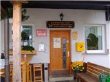
 | Dvor - Polhograjska Grmada (Dvor - Grmada - Belica)
Polhograjska Grmada is an 898 m high peak located in the heart of the Polhograjski Dolomites. From the summit, where there is a registration box ...
2 h 10 min |
 | Preval - Polhograjska Grmada
Polhograjska Grmada is an 898 m high peak located in the heart of the Polhograjski Dolomites. From the summit, where there is a registration box ...
2 h 45 min |
 | Gabrje - Polhograjska Grmada
Polhograjska Grmada is an 898 m high peak located in the heart of the Polhograjski Dolomites. From the summit, where there is a registration box ...
2 h 20 min |
 | Preska - Sveti Jakob
The Church of St. James is located on a scenic hill north of the village of Topol pri Medvodah. From the summit, which features a registration bo...
2 h |
 | Preval - Sveti Jakob
The Church of St. James is located on a scenic hill north of the village of Topol pri Medvodah. From the summit, which features a registration bo...
2 h 5 min |
 | Žlebe - Sveti Jakob (via Turnice)
The Church of St. James is located on a scenic hill north of the village of Topol pri Medvodah. From the summit, which features a registration bo...
2 h |
| Žlebe - Sveti Jakob (via Jeterbenk)
The Church of St. James is located on a scenic hill north of the village of Topol pri Medvodah. From the summit, which features a registration bo...
2 h 15 min |
 | Slavkov dom na Golem Brdu - Sveti Jakob
The Church of St. James is located on a scenic hill north of the village of Topol pri Medvodah. From the summit, which features a registration bo...
2 h 5 min |
 | Phliški bajer - Rašica (Vrh Staneta Kosca) (ridge path)
Vrh Staneta Kosca, better known as Rašica, is located north of Ljubljana, more precisely above the villages of Rašica and Dobeno. From the summit...
2 h |
| Topole - Rašica (Vrh Staneta Kosca) (ridge path)
Vrh Staneta Kosca, better known as Rašica, is located north of Ljubljana, more precisely above the villages of Rašica and Dobeno. From the summit...
2 h 10 min |
 | Puštal - Osolnik
Osolnik is an 858-metre-high mountain located south of Škofja Loka and west of Medvode. From the summit, where the Church of St Mohor and Fortuna...
2 h 15 min |
| Puštal (Na Dobravi) - Osolnik
Osolnik is an 858-metre-high mountain located south of Škofja Loka and west of Medvode. From the summit, where the Church of St Mohor and Fortuna...
2 h |
 | Preval - Jeterbenk
Jeterbenk is a 774-meter-high peak located between the Slavkov dom hut on Golo Brdo and Katarina (the village of Topol). From the summit, where t...
2 h 5 min |
 | Loke - Krvavica (via Zajčeva koča)
Krvavica is a 909-metre-high peak located east of Čemšeniška planina. From the summit, which drops steeply on all sides, there is a beautiful vie...
2 h 10 min |
 | Lake Gradišče - Limbarska gora
Limbarska gora is located northeast of Moravče. From the summit, there is a beautiful view of the surrounding peaks, and in good weather, the Kam...
1 h 55 min |
| Blagovica - Limbarska gora (Blagovica - Limbarska gora - Blagovica)
Limbarska gora is located northeast of Moravče. From the summit, there is a beautiful view of the surrounding peaks, and in good weather, the Kam...
2 h 9 min |
 | Puštal (Na Dobravi) - Sveti Ožbolt (above Zminec)
Sveti Ožbolt is situated on a panoramic rise in the north of the Polhograjski Dolomiti. There is a beautiful view toward the Škofjeloško hribovje...
2 h 15 min |
 | Rakovica - Archangel Gabriel (Planica)
Planica is an 824-meter-high peak located north of Škofja Loka, more precisely between Križna gora and Planica. From the summit, where the church...
2 h 30 min |
 | Škofja Loka - Archangel Gabriel (Planica)
Planica is an 824-meter-high peak located north of Škofja Loka, more precisely between Križna gora and Planica. From the summit, where the church...
2 h 5 min |
 | Vrhnika-Tankovska cesta - Koča na Planini nad Vrhniko (Circular path Vrhnika-Planina-Lintvern-Vrhnika)
Planina nad Vrhniko is for Vrhnika locals something like Šmarna gora for those from Ljubljana. It is 733 m high, reachable by several paths from ...
2 h 20 min |
 | Besnica - Janče
Janče is a 792-meter-high peak situated between the Sava River and the Besnica stream valley. From the summit, where a mountain hut stands and th...
2 h 15 min |
 | Laze pri Dolskem - Janče
Janče is a 792-meter-high peak situated between the Sava River and the Besnica stream valley. From the summit, where a mountain hut stands and th...
2 h 15 min |
 | Litija - Janče (via Širmanski hrib)
Janče is a 792-meter-high peak situated between the Sava River and the Besnica stream valley. From the summit, where a mountain hut stands and th...
3 h 30 min |
 | Kamnica - Sveti Miklavž above Sava (via Velika vas)
The Church of St. Miklavž is situated on a panoramic hill south of Moravče. From the summit, there is a beautiful view toward the nearby Limbarsk...
2 h 5 min |
 | Krakovo (Mastnak wine cellar) - Lisca (Pastirčkova pot)
Lisca is a panoramic peak located north of Sevnica. From the summit, where a meteorological radar station stands, there are fine views of Posavsk...
1 h 55 min |
| Krakovo (Mastnak wine cellar) - Lisca (past Sveti Jošt)
Lisca is a panoramic peak located north of Sevnica. From the summit, where a meteorological radar station stands, there are fine views of Posavsk...
1 h 55 min |
 | Moravče - Slivna (Pivkelj)
Slivna, also known as Pivkelj (or Pivkelj turn), lies south of Limbarska gora. Pivkelj is the highest point of the Moravška planinska pot and at ...
2 h 30 min |
 | Divje jezero - Hleviška planina (via Prižnica)
Hleviška planina (also Hleviške planine) is a slightly vegetated but still very panoramic peak. From the summit, the home mountain of Idrija, the...
2 h 30 min |
 | Idrija - Hleviška planina (via Kodrov rovt)
Hleviška planina (also Hleviške planine) is a slightly vegetated but still very panoramic peak. From the summit, the home mountain of Idrija, the...
2 h |
 | Stoperce - Donačka gora
Donačka gora is a peak located north of Rogatec. From the summit, which geographically belongs to the Karawanks, there is a nice view of the near...
2 h 5 min |
 | Polzela - Gora Oljka (via Vimperk)
Gora Oljka is a hill located east of Šmartno ob Paki. On the summit stands the Church of the Holy Cross, built in the mid-18th century. Just a fe...
2 h 15 min |
 | Tremerje - Dom na Šmohorju
The mountain lodge on Šmohor is located on a picturesque and scenic ridge between Laško, Liboje and Zabukovica. The lodge, a popular spot for bot...
2 h 15 min |
 | Liboje - Malič
Malič is a 936-meter-high peak situated between Celje and Laško, more precisely above Spodnja Rečica. From the summit, which has a transmitter, b...
2 h |
| Spodnja Rečica - Malič (via Tolsto)
Malič is a 936-meter-high peak situated between Celje and Laško, more precisely above Spodnja Rečica. From the summit, which has a transmitter, b...
2 h 15 min |
| Zgornja Rečica (church of Blessed Anton Martin Slomšek) - Malič
Malič is a 936-meter-high peak situated between Celje and Laško, more precisely above Spodnja Rečica. From the summit, which has a transmitter, b...
2 h 20 min |
 | Gradišče pri Vipavi - Gradiška Tura (via Plaz)
Gradiška Tura is a prominent 754-meter peak rising at the far western edge of the Nanos plateau directly above the Vipava Valley. Thanks to its e...
2 h |
 | Črni hribi - Trstelj
Trstelj is the highest peak in the ridge of Črni hribi. From the spacious summit, which has TV transmitters, the view is divided. From the north ...
2 h |
 | Štore - Resevna
Resevna is a peak situated south of Šentjur. At the summit stands a 20-meter-high observation tower offering beautiful views that extend far acro...
2 h 30 min |
 | Štore - Tolsti vrh above Celjska koča (via Bojanski graben)
Tolsti vrh (also recorded as Tovsti vrh in some sources) is situated above the Celjska koča ski area. The summit has a logbook box and stamp, but...
2 h 30 min |
 | Štore - Tolsti vrh above Celjska koča (via Marija)
Tolsti vrh (also recorded as Tovsti vrh in some sources) is situated above the Celjska koča ski area. The summit has a logbook box and stamp, but...
2 h |
 | Zvodno - Tolsti vrh above Celjska koča (via Srebotnik on CPP)
Tolsti vrh (also recorded as Tovsti vrh in some sources) is situated above the Celjska koča ski area. The summit has a logbook box and stamp, but...
2 h 15 min |
| Hayrack (Laška vas - Pečovje) - Tolsti vrh above Celjska koča (via Srebotnik on CPP)
Tolsti vrh (also recorded as Tovsti vrh in some sources) is situated above the Celjska koča ski area. The summit has a logbook box and stamp, but...
2 h 15 min |
 | Teharje - Srebotnik (Pot I. Celjske čete)
Srebotnik is a slightly vegetated peak located south of Celje and Štore in the Posavsko hribovje. The summit, which has a logbook box and a small...
2 h |
 | Podgorje ob Sevnični (Kurja vas) - Skalica (Bohor)
Skalica is a lesser-known peak on the western part of Bohor. From the summit, which has a logbook box, there is a nice view to the south and west...
2 h 20 min |
 | Podsreda - Veliki Špiček (through Osredek pri Podsredi)
Veliki Špiček is the highest peak of Brežice municipality. From the top a nice view spreads towards the south and east. Most of Brežice municipal...
2 h 45 min |
| Gorjane (Železno) - Veliki Špiček
Veliki Špiček is the highest peak of Brežice municipality. From the top a nice view spreads towards the south and east. Most of Brežice municipal...
2 h 50 min |
 | Zagrad - Nebeška gora
Nebeška gora is the highest peak of the Radeče ob Savi municipality. At the summit there is a logbook, stamp, luck bell, and some benchesall plac...
2 h 10 min |
 | Hrastnik - Klobuk (via Ravne)
Klobuk is a scenic peak located northeast of Hrastnik. From the summit, which has a logbox and stamp, there are fine views of the valley and surr...
2 h 25 min |
| Dol pri Hrastniku - Klobuk
Klobuk is a scenic peak located northeast of Hrastnik. From the summit, which has a logbox and stamp, there are fine views of the valley and surr...
2 h 10 min |
 | Spodnji Slemen - Žavcarjev vrh
Žavcarjev vrh is a 915 m high mountain located north of the Drava River on the slopes of Kozjak. Since the summit is completely forested, there i...
2 h 35 min |
 | Jelovec - Žavcarjev vrh
Žavcarjev vrh is a 915 m high mountain located north of the Drava River on the slopes of Kozjak. Since the summit is completely forested, there i...
2 h 25 min |
 | Kozjak nad Pesnico - Tojzlov vrh
Tojzlov vrh is a forested hill on the eastern part of Kozjak. On the summit stands a small stone NOB monument and, more recently, also a summit l...
2 h 35 min |
 | Gorjuša - Murovica (via Dobovlje)
Murovica is a popular excursion point, accessible from the Posavje side, Domžale, or the Moravška Valley. On the summit there is a bench and a lo...
2 h 40 min |
 | Senožeti - Murovica (via Vrh pri Dolskem)
Murovica is a popular excursion point, accessible from the Posavje side, Domžale, or the Moravška Valley. On the summit there is a bench and a lo...
2 h 5 min |
| Senožeti - Murovica (via farm Buven)
Murovica is a popular excursion point, accessible from the Posavje side, Domžale, or the Moravška Valley. On the summit there is a bench and a lo...
1 h 55 min |
 | Zazid - Golič (via Lipnik)
Golič is a grassy ridge extending from Kojnik to the Slovenian-Croatian border and continuing as the Žbevnica ridge on the Croatian side. Due to ...
2 h 30 min |
 | Zazid - Golič (via Kojnik)
Golič is a grassy ridge extending from Kojnik to the Slovenian-Croatian border and continuing as the Žbevnica ridge on the Croatian side. Due to ...
2 h 30 min |
 | Rakovica - Špičasti hrib
Špičasti hrib (known as Špičasti vrh on maps) is an 837-meter-high hill located west of Sveti Jošt above Kranj. The summit, which has a few bench...
2 h 20 min |
 | Zazid - Kavčič (via Lipnik)
Kavčič is a grassy peak located above the village Rakitovec on the Slovenian-Croatian border. From the summit, where two crosses stand with a sum...
2 h 30 min |
 | Zazid - Nadglavinjak (via Lipnik)
Nadglavinjak is a lesser-known peak located southeast of Golič. From its indistinct grassy summit, nice views open up on Slavnik, Čičarija, Žbevn...
2 h 10 min |
 | Sveti Mavricij - Sveti Socerb (Artviže)
The Church of St. Socerb is located on a panoramic hill above the village of Artviže, which at 817 meters is the highest peak of the Brkini. From...
2 h 15 min |
 | Cerkno - Veliki vrh (Lajše)
Veliki vrh is an almost 900-meter-high elevation rising south of Cerkno. From the summit, which features several television and radio transmitter...
2 h |
 | Mlinše - Pleše (via Zasavska Sveta gora)
Pleše is an 866-meter-high peak situated between the Marela ski slope and Zasavska Sveta gora. From the summit, which features a NOB monument, th...
2 h 30 min |
 | Izlake - Pleše (via Grobovščica)
Pleše is an 866-meter-high peak situated between the Marela ski slope and Zasavska Sveta gora. From the summit, which features a NOB monument, th...
2 h 15 min |
 | Braslovško jezero - Grmada (Dobrovlje)
Grmada is a 898 m high, forest-covered peak located on the southeastern part of the Dobroveljska planota plateau. From the summit, where there is...
2 h 25 min |
| Letuš - Grmada (Dobrovlje)
Grmada is a 898 m high, forest-covered peak located on the southeastern part of the Dobroveljska planota plateau. From the summit, where there is...
2 h 25 min |
| Žovneško jezero - Grmada (Dobrovlje)
Grmada is a 898 m high, forest-covered peak located on the southeastern part of the Dobroveljska planota plateau. From the summit, where there is...
2 h 5 min |
 | Gorenja vas - Javorč (via Jermanca)
Javorč is a 901-meter-high peak located northeast of Žiri. The summit, featuring a logbox with a logbook, lies at the edge of a larger clearing, ...
2 h |
 | Kozje - Oslica (Bohor) (via Vetrnik)
Oslica is one of Bohor's peaks, located in the eastern part of the range. Unlike some higher Bohor peaks such as Veliki Javornik, Koprivnik, Debe...
2 h 10 min |
 | Stari trg (Pilštanj) - Oslica (Bohor)
Oslica is one of Bohor's peaks, located in the eastern part of the range. Unlike some higher Bohor peaks such as Veliki Javornik, Koprivnik, Debe...
3 h |
 | Kozje - Debeli vrh (Bohor) (via Vetrnik)
Debeli vrh is a 921-meter-high peak on Bohor between Veliki Koprivnik and Oslica. Covered in dense forest, it offers no views. A marked hiking tr...
2 h 35 min |
 | Stari trg (Pilštanj) - Debeli vrh (Bohor)
Debeli vrh is a 921-meter-high peak on Bohor between Veliki Koprivnik and Oslica. Covered in dense forest, it offers no views. A marked hiking tr...
3 h 10 min |
 | Kozje - Brest (Bohor) (via Vetrnik)
Brest is a peak on Bohor, though it resembles more of a saddle. It is an important trail junction on Bohor, lying between more easterly Oslica an...
2 h |
 | Stari trg (Pilštanj) - Brest (Bohor)
Brest is a peak on Bohor, though it resembles more of a saddle. It is an important trail junction on Bohor, lying between more easterly Oslica an...
2 h 45 min |
 | Studenice - Plešivec (at Boč)
Peace, silence, varied terrain... these are characteristics of the peak at the crossroads of numerous paths between the Maribor, Celje, and Ptuj ...
2 h |
 | Studenice - Plešivec (at Boč) (final part on forest road)
Peace, silence, varied terrain... these are characteristics of the peak at the crossroads of numerous paths between the Maribor, Celje, and Ptuj ...
2 h |
 | Podvelka - Hlebov vrh (Rdeči Breg) (via Viltužnik)
Rdeči breg stretches between the Radoljna gorge to the east, the Drava to the north, and the Velka stream to the east. It is separated from the m...
2 h |
 | Puščava - Hlebov vrh (Rdeči Breg)
Rdeči breg stretches between the Radoljna gorge to the east, the Drava to the north, and the Velka stream to the east. It is separated from the m...
2 h 55 min |
| HE Ožbalt - Hlebov vrh (Rdeči Breg)
Rdeči breg stretches between the Radoljna gorge to the east, the Drava to the north, and the Velka stream to the east. It is separated from the m...
2 h 50 min |
 | Brezno - Sveti Pankracij (Radelca) (by Remšniški potok)
The Church of St. Pankracij on Radelca is located at an altitude of 900 meters, directly on the border ridge between Slovenia and Austria. The or...
2 h 50 min |
 | Muta (Spodnja Muta) - Sveti Trije Kralji (above Radlje ob Dravi)
The Church of the Holy Three Kings is located on an 820-meter-high hill rising above the right bank of the Radeljski Stream. From the church, a n...
2 h 30 min |
 | Radlje ob Dravi - Sveti Anton na MP Radelj / St. Anton am Radlpaß (via old castle)
The Church of St. Anton at the Radelj border crossing / St. Anton am Radlpaß is located on the Austrian side of Kozjak on a 720-meter-high hill r...
2 h 15 min |
 | Dravograd (Meža) - Anski vrh (above Pameče)
Anski vrh is a panoramic peak above Pameče, crowned by the Church of St. Anne. From the church or its surroundings, nice views open towards Uršlj...
3 h |
 | Hotavlje - Vrhovski grič (via Slajka)
Vrhovski Grič is a panoramic hill along the marked trail from Trebija to Ermanovec. From the grassy summit there is a fine view of the surroundin...
2 h 30 min |
 | Rechnitz (Badesee) - Irrotkő / Geschriebenstein
Irrotkő is the highest peak of the Kőszeg Mountains (Kőszegi Hegység) and also the highest peak of western Hungary and the Austrian federal state...
2 h 30 min |
 | Lockenhaus - Irrotkő / Geschriebenstein (via Weidriegel)
Irrotkő is the highest peak of the Kőszeg Mountains (Kőszegi Hegység) and also the highest peak of western Hungary and the Austrian federal state...
2 h 45 min |
| Lockenhaus - Irrotkő / Geschriebenstein (through Marchgraben)
Irrotkő is the highest peak of the Kőszeg Mountains (Kőszegi Hegység) and also the highest peak of western Hungary and the Austrian federal state...
2 h 40 min |
 | Puščava - Klančnik (Glančnik)
Klančnik (Glančnik on some maps) is an 877-meter-high peak situated above the right bank of the Drava River, just a few minutes' walk from the Hu...
2 h 15 min |
| HE Ožbalt - Klančnik (Glančnik)
Klančnik (Glančnik on some maps) is an 877-meter-high peak situated above the right bank of the Drava River, just a few minutes' walk from the Hu...
2 h 10 min |
 | Podvelka - Klančnik (Glančnik) (via Sveti Ignacij)
Klančnik (Glančnik on some maps) is an 877-meter-high peak situated above the right bank of the Drava River, just a few minutes' walk from the Hu...
2 h 30 min |
 | Deutschfeistritz - Schartnerkogel (via Gamskogel)
Schartnerkogel is a 931-meter-high hill above the town Deutschfeistritz (Nemška Bistrica) in the western part of the Graz Mountains. A cross stan...
3 h |
 | Deutschfeistritz - Schartnerkogel (on road)
Schartnerkogel is a 931-meter-high hill above the town Deutschfeistritz (Nemška Bistrica) in the western part of the Graz Mountains. A cross stan...
2 h |
 | Rechnitz (Badesee) - Großer Hirschenstein
Großer Hirschenstein is an 862-meter-high peak located west of the slightly higher Geschriebenstein / Írott-kő, the highest point in the Austrian...
2 h |
 | Vuzenica - Sedovnikov vrh
Sedovnikov vrh is a forest-covered peak situated above Požarski jarek, in close proximity to the marked path from Vuzenica to Koča Planinc....
2 h 35 min |
 | Slake (Church of the Virgin Mary on Pesek) - Plešivec (Rudnica)
Plešivec is a forest-covered peak on Rudnica, its highest point. The summit has a summit register box, a bench, and a table....
2 h |
 | Loka pri Žusmu (Žamerk) - Plešivec (Rudnica)
Plešivec is a forest-covered peak on Rudnica, its highest point. The summit has a summit register box, a bench, and a table....
2 h |
 | Podgorje ob Sevnični (Kurja vas) - Ješivec
Ješivec (also Ješivc) is a 934-meter-high peak in Posavsko hribovje, from which a beautiful view opens up mainly to the south and west, while for...
2 h 45 min |
 | Prebold - Strtnik (Strnik) (via Tolsti vrh)
Strtnik or Strnik is an 845-meter-high mountain situated between Reška planina and Tolsti vrh. The peak is a point on the Prebold mountain trail....
1 h 55 min |
 | Podgorje ob Sevnični (Kurja vas) - Zaloška gora
Zaloška gora is a 930-meter-high panoramic peak on Bohor, from which a beautiful view opens up towards the east, south and partly west, while to ...
1 h 55 min |
 | ŽP Buzet - Špičasti vrh (pri Žbevnici) (čez Žbevnico)
Pointed Peak is a scenic grassy peak along the marked path between Golič and Žbevnica, near the Slovenian border. The peak has a summit book box ...
3 h 30 min |
 | Pišece (Pri mlinu) - Veliki vrh (Orlica)
Veliki vrh is the highest point of the Orlica hills at 701 meters above sea level, stretching along the border between Posavje and Kozjansko and ...
2 h 40 min |
| Grad Pišece - Veliki vrh (Orlica) (via Velika bukva)
Veliki vrh is the highest point of the Orlica hills at 701 meters above sea level, stretching along the border between Posavje and Kozjansko and ...
1 h 55 min |
 | Podsreda - Intermedija (through Osredek pri Podsredi)
Intermedija is a 662-meter-high peak in the Orlica range. From the summit, there is a beautiful view mainly to the north and northeast, where on ...
2 h 20 min |
| Gorjane (Železno) - Intermedija
Intermedija is a 662-meter-high peak in the Orlica range. From the summit, there is a beautiful view mainly to the north and northeast, where on ...
2 h 25 min |
 | Lesično - Bredič
Bredič is a 692-meter-high peak in the ridge of the same name, which rises steeply above the right bank of the Bistrica River between the settlem...
1 h 55 min |