 | Selo nad Polhovim Gradcem - Tošč
Tošč, which became the highest peak of the Polhov Gradec Hills decades ago when the Yugoslav army lowered Pasja ravan by 9 metres, is located nor...
1 h |
 | Lontovž - Kum (by road)
Kum, at 1,220 metres, is the highest peak in the Posavje Hills. As it rises above the Zasavje region, some call it the Zasavje Triglav. At the su...
50 min |
 | Radlek - Slivnica
Slivnica is a 1,114-meter-high peak located north of the Cerknica Field and the intermittent Lake Cerknica. The summit itself is quite rounded, p...
1 h 20 min |
 | Leška gmajna - Lepenatka
Lepenatka is a grassy peak located south of the 1557-metre-high Rogatec. From the summit, which has a summit register box and stamp, there is a b...
1 h 15 min |
 | Molnarjev breg - Kamniški vrh (via planina Osredek)
Kamniški vrh is a 1259-metre-high mountain located north of Kamnik, more precisely between Stahovica and the Korošica valley. From the summit, wh...
1 h 30 min |
 | Preval - Stari vrh
Stari Vrh is a 1,217-metre-high mountain located above the ski resort of the same name. There is no view from the summit itself due to the forest...
50 min |
 | Črni Kal - Koprivnik (via Romovec)
Koprivnik is a 1393-meter-high mountain located between Blegoš and Mladi vrh. From the summit, which has a registration box and a stamp, the view...
1 h |
 | Črni Vrh - Pasja ravan
Pasja ravan is the second-highest peak in the Polhograjsko hribovje. A few decades ago, at 1029 meters, it was the highest, but in the second hal...
1 h |
 | Polomova rajda - Veliki Modrasovec (via Koča na Čavnu)
Veliki Modrasovec is located on the southern part of the Trnovski Forest near Predmeja. On the summit stands an old military building, which we m...
1 h 25 min |
 | Mala Lazna - Mali Golak
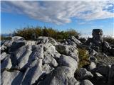
Mali Golak is the highest peak in the Golaki group at 1495 meters above sea level and at the same time the highest point of the entire Trnovski g...
1 h 25 min |
 | Škrbina - Srednji Golak
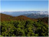
Srednji Golak is located between Mali and Veliki Golak on the plateau of Trnovski gozd above Predmeja. The peak is covered with dwarf pines, and ...
1 h 15 min |
 | Lokve - Poldanovec
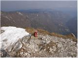
Poldanovec is located in Govci, on the northern edge of the Trnovo plateau. Govci rise steeply above the valley of Gorenja Trebuša. Poldanovec is...
1 h 30 min |
 | Turški klanec - Mrzovec
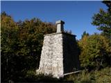
Mržovec is the most prominent peak in the heart of the Trnovo Plateau. Its location offers wonderful views, though high trees obscure them from t...
1 h 30 min |
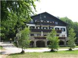 | Podmeja - Mrzlica
In recent years, Mrzlica has become an extremely popular excursion spot, especially for visitors from Savinjska valley and Zasavje. At 1,122 mete...
1 h 15 min |
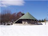 | Planinski dom pri Gospodični - Trdinov vrh
Trdinov vrh (1178 m) is the highest point in the Gorjanci range, across which the state border between Slovenia and Croatia runs. Although the su...
55 min |
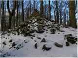 | Prvine - Črni vrh (Čemšeniška planina)
Črni vrh is the highest peak of Čemšeniška planina and, at 1,204 m, the second-highest peak in Posavsko hribovje. The summit has a logbook box bu...
1 h |
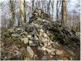 | Planinski dom Vrhe - Črni vrh (Čemšeniška planina)
Črni vrh is the highest peak of Čemšeniška planina and, at 1,204 m, the second-highest peak in Posavsko hribovje. The summit has a logbook box bu...
1 h 30 min |
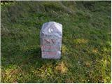 | Kalce - Veliki Javornik (Javorniki)
Veliki Javornik is a 1,268-meter-high peak of the forested hills named Javorniki. The extensive Javorniki forests stretch from Postojna to Cerkni...
1 h 30 min |
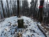 | Podlanišče - Bevkov vrh
Bevkov vrh, a control point on the Slovenian Mountain Trail, is located between Cerkno and Spodnja Idrija. The peak is forested, but the stamp is...
1 h 30 min |
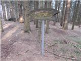 | Ledinsko Razpotje - Sivka
Sivka is a forested peak located west of Žiri and north of Idrija. At the summit there is a stamp for the Slovenian Mountain Trail and a logbook ...
1 h 15 min |
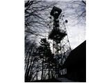 | Kamna Gora - Stolpnik
Stolpnik, at 1012 meters, is the highest peak of Konjiška gora, a range stretching southwest from Slovenske Konjice. A 25-meter-high observation ...
1 h |
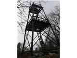 | Štufna - Veliki Rog
Veliki Rog lies in the middle of the endless forests of the karst plateau Kočevski Rog and, at 1,099 meters above sea level, is its highest peak....
50 min |
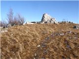 | Juršče - Kršičevec
Kršičevec is a lesser-known mountain located east of Jurišče village in the Pivka basin. From its grassy summit, which has a logbook box with a s...
1 h 30 min |
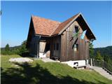 | Mali Log - Koča na Kamnem griču
The Koča na Kamnem griču mountain hut is located on Kamni grič, a panoramic hill rising southwest of Sodražica. From the grassy summit surrounded...
50 min |
 | Hrib-Loški Potok - Koča na Kamnem griču
The Koča na Kamnem griču mountain hut is located on Kamni grič, a panoramic hill rising southwest of Sodražica. From the grassy summit surrounded...
1 h 15 min |
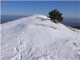 | Zagrad - Ostrič
Ostrič (marked as Žabnik on some maps) is a 1056 m high peak on the Slovenian side of Čičarija. From the bare summit, where there is a round summ...
1 h 5 min |
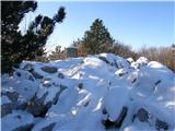 | Zagrad - Razsušica (zahodna pot)
Razsušica, at 1083 meters, is the highest peak of Slovenian Istria. Although the summit is partly vegetated, it offers a nice view towards the ne...
1 h 15 min |
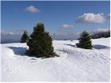 | Kampelc - Čelkov vrh
Čelkov vrh is a 1,106-meter peak south of Črni vrh. From the summit, which has a logbook box and stamp, there are fine views toward the Julian Al...
50 min |
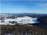 | Cenc - Špičasti vrh (on marked path)
Špičasti vrh is a forest-covered mountain located south of the village of Zadlog. To ensure the summit is not without a view, a 13-meter-high woo...
1 h 30 min |
 | Podkraj - Križna gora (Hrušica) (steep way)
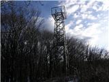
Križna gora is a 1162 m high peak located north of the village Podkraj. From the summit, where a lookout tower stands, there are fine views over ...
1 h |
| Podkraj - Križna gora (Hrušica) (gentle path)
Križna gora is a 1162 m high peak located north of the village Podkraj. From the summit, where a lookout tower stands, there are fine views over ...
1 h 20 min |
 | Podmeja - Sveta planina (Partizanski vrh)
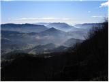
Sveta planina, also Partizanski vrh, is a 1,011-meter-high mountain located between Čemšeniška planina and Mrzlica. From the summit, where there ...
1 h 30 min |
 | Brest - Žbevnica (gentle path)
Žbevnica is a 1,014-meter-high peak situated above the village of Brest, on the Slovenian-Croatian border. From the summit, a beautiful view open...
1 h |
 | Kalce - Mali Javornik (Javorniki)
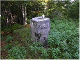
Mali Javornik is a 1219 m high mountain located in the forested ridge of Javorniki. There is no view from the summit itself due to the forest, bu...
1 h |
 | Livške Ravne - Na gradu
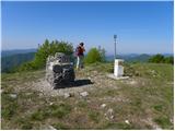
Na gradu is a 1115 m high peak located in the middle of the Kolovrat range, precisely on the border between Slovenia and Italy. From the grassy s...
1 h 25 min |
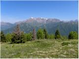 | Solarji - Trinški vrh
Trinški vrh (sometimes also spelled Trniški vrh) is a 1138 m high mountain located on the treeless part of the Kolovrat ridge, specifically betwe...
55 min |
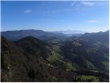 | Raspet - Kopa (Cimprovka)
Kopa is a 1360 m high peak or panoramic promontory from which a nice view opens up on Cerkno, the hills surrounding it, Ratitovec, Trnovski gozd,...
1 h 10 min |
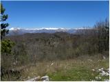 | Cvetrež - Lašček
Lašček, at 1071 m, is the highest peak of the Banjška planota plateau, rising above Čepovanski dol, the Soča valley, and the Idrijca valley. From...
1 h |
| Cvetrež - Lašček (by road)
Lašček, at 1071 m, is the highest peak of the Banjška planota plateau, rising above Čepovanski dol, the Soča valley, and the Idrijca valley. From...
1 h 20 min |
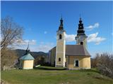 | Bele Vode (Sveti Andrej) - Sveti Križ above Bele Vode (lower path)
The Church of St. Cross is located on Kriška gora, formerly called Oslovska gora. Kriška gora rises above Beli Vodi, or above the streams Ljubija...
1 h 15 min |
| Bele Vode (Sveti Andrej) - Sveti Križ above Bele Vode (upper path)
The Church of St. Cross is located on Kriška gora, formerly called Oslovska gora. Kriška gora rises above Beli Vodi, or above the streams Ljubija...
1 h |
 | Koča pri Jelenovem studencu - Ledenik
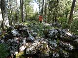
Ledenik, at 1,072 meters, is the highest peak of Stojna, a forested ridge situated between Kočevje and Kočevska Reka. On the summit there is a lo...
1 h 15 min |
 | Dražgoše (Na Pečeh) - Dražgoška gora
Dražgoška gora is located on the southern slopes of Jelovica and covers a fairly extensive area northwest of Dražgoše. The name Dražgoška gora is...
50 min |
 | Dom na Paškem Kozjaku - Ostrica
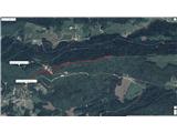
Ostrica is an indistinct peak of Paški Kozjak, a 10-kilometer-long, quite narrow and steep limestone ridge between the gorges of the Paka and Hud...
1 h |
 | Čemernica / Tschemernitzen - Arihova peč / Arichwand
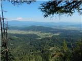
Arihova peč / Arichwand is a panoramic rocky cliff located near the Bleščeča planina / Rossalm pasture. A wooden hut stands on top of the cliff, ...
1 h 25 min |
 | Malenski Vrh - Malenski vrh
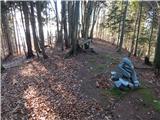
Malenski vrh is a 1,051-meter-high mountain located west of the settlement of Javorje. The summit features a small bench and a cairn, but the vie...
1 h 5 min |
 | Široko - Veliki vrh (above Lom) (direct way)
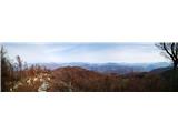
Veliki vrh is located on the northeastern part of the Banjška planota plateau, which rises above Čepovani dol, the Soča river valley, and the Idr...
1 h 30 min |
 | Zelovo - Orlove stine (western path)
Orlove stine is a panoramic peak above Peručko Lake. It lies southeast of the better-known Svilaja. From the top, there is a fine view toward the...
1 h 20 min |
 | Zelovo - Umac (at Svilaja)
Umac is a small indistinct peak located southeast of Svilaja. The summit is just 5 minutes from the road leading below Svilaja. At the top are ro...
1 h 30 min |
 | Planinska koča Promina - Čavnovka (Promina) (on footpath)
Čavnovka is the highest summit of Promina, a smaller range above the town of Drniš. There are two summits: the southern one features an antenna, ...
1 h |
 | Planinska koča Promina - Čavnovka (Promina) (on road)
Čavnovka is the highest summit of Promina, a smaller range above the town of Drniš. There are two summits: the southern one features an antenna, ...
1 h |
 | Zeller Kreuz - Teufelstein
Teufelstein is a 1,498-meter-high mountain in the Fischbacher Alpen group. At the summit there is a cross with a summit logbook, and slightly bel...
55 min |
 | Rašpor - Gomila (Čičarija)
Gomila is a scenic grassy summit in the Čičarija area, located in Croatian Istria. The summit is a waypoint on the Istrian Mountain Trail. A conc...
1 h 15 min |
 | Slavica - Velika Slavica
Velika Slavica is a lesser-known peak above the village of Slavica, which lies between Vrata and Delnice. The summit has a logbook box. From the ...
1 h |
 | Omar - Kolevrat
Kolevrat is a lesser-known peak situated above Klenovica. It lies near the path to Kolovratske stijene. From the grassy summit, which has a logbo...
1 h |
 | Podmeja - Homič
Homič is one of the peaks on the Prebold mountain trail, located northwest of the slightly higher and more famous Mrzlica. From the summit, where...
1 h |
 | Kugina kuća - Laktin vrh
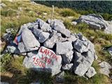
Laktin vrh is a panoramic grassy peak in Central Velebit, east of the main ridge. It is a checkpoint for HPO and the Velebit Circuit. From the su...
1 h 30 min |
 | Kugina kuća - Lisac
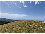
Lisac is a lesser-known peak in Central Velebit, south of Šatorina. The grassy summit with some rocks has a logbook and stamp from the Lički gors...
1 h |
 | Mala Učka - Suhi vrh (Učka)
Suhi vrh is a forested peak located south of the better-known Vojak. At the highest point of the peak there are rocks; slightly further south is ...
1 h 15 min |