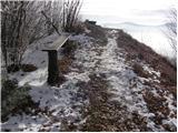
 | Topol - Polhograjska Grmada
Polhograjska Grmada is an 898 m high peak located in the heart of the Polhograjski Dolomites. From the summit, where there is a registration box ...
1 h 15 min |
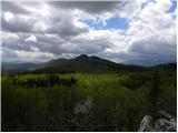
 | Zapotok - Kurešček
Kurešček is an 826 m high peak located south of Ig and southwest of Želimlje. From the summit, where a church stands, there is no view due to the...
45 min |
 | Pševo - Sveti Jošt above Kranj (Sodar way)
Sveti Jošt above Kranj is a hill located west of the slightly lower Šmarjetna gora. From the summit, where the Church of St Jošt stands alongside...
45 min |
 | Čepulje - Sveti Jošt above Kranj
Sveti Jošt above Kranj is a hill located west of the slightly lower Šmarjetna gora. From the summit, where the Church of St Jošt stands alongside...
45 min |
| Pševo - Sveti Jošt above Kranj (Sodarjeva pot, na klopca)
Sveti Jošt above Kranj is a hill located west of the slightly lower Šmarjetna gora. From the summit, where the Church of St Jošt stands alongside...
45 min |
| Pševo - Sveti Jošt above Kranj (Sodarjeva pot, past the chapel)
Sveti Jošt above Kranj is a hill located west of the slightly lower Šmarjetna gora. From the summit, where the Church of St Jošt stands alongside...
50 min |
 | Praproče - Polhograjska Gora (Sveti Lovrenc) (gentle path)
Polhograjska Gora, also known simply as Gora or Sveti Lovrenc, is an 824 m high hill northwest of Polhov Gradec. The summit, topped by the Church...
50 min |
 | Ljubljanica - Kožljek
Kožljek is a 788 m high peak located west of Koren, more precisely above the village of Samotorica. From the summit, where there are several benc...
45 min |
 | Preval Prosca - Koreno (gentle path)
Koreno (also known as Korena) is a 729 m high hill located north of Horjul. From the summit, which features a large cross, the church of St. Moho...
1 h 15 min |
 | Preval Prosca - Koreno (steep path)
Koreno (also known as Korena) is a 729 m high hill located north of Horjul. From the summit, which features a large cross, the church of St. Moho...
1 h |
 | Briše - Koreno
Koreno (also known as Korena) is a 729 m high hill located north of Horjul. From the summit, which features a large cross, the church of St. Moho...
50 min |
 | Gabrje - Limbarska gora (footpath)
Limbarska gora is located northeast of Moravče. From the summit, there is a beautiful view of the surrounding peaks, and in good weather, the Kam...
45 min |
 | Sv. Andrej - Sveti Ožbolt (above Zminec)
Sveti Ožbolt is situated on a panoramic rise in the north of the Polhograjski Dolomiti. There is a beautiful view toward the Škofjeloško hribovje...
1 h |
 | Kuren - Koča na Planini nad Vrhniko
Planina nad Vrhniko is for Vrhnika locals something like Šmarna gora for those from Ljubljana. It is 733 m high, reachable by several paths from ...
45 min |
 | Star maln - Koča na Planini nad Vrhniko
Planina nad Vrhniko is for Vrhnika locals something like Šmarna gora for those from Ljubljana. It is 733 m high, reachable by several paths from ...
1 h |
 | Katarija - Sveti Miklavž above Sava
The Church of St. Miklavž is situated on a panoramic hill south of Moravče. From the summit, there is a beautiful view toward the nearby Limbarsk...
45 min |
 | Križevska vas - Cicelj (via farm Buven)
Cicelj is a forest-covered peak located between Moravče and the village of Senožeti. From the summit, which has a bench and a logbook box, there ...
45 min |
 | Kuren - Ulovka
Ulovka is a peak between Zaplana and Zavetišče na Planini nad Vrhniko. From the summit, to which ski lifts run, there is a nice view to the north...
50 min |
 | Zazid - Jampršnik
Jampršnik is a little-known and even less visited peak located in the mountain chain southwest of Črni Kal. Despite its modest height, there is a...
1 h |
 | Selšček - Velika Špička
Velika Špička or Špičasto Stražišče is a peak located north of Slivnica. From the summit, which has a logbook box with a stamp, there is a nice v...
45 min |
 | Begunje - Velika Špička (via Cemarovnik)
Velika Špička or Špičasto Stražišče is a peak located north of Slivnica. From the summit, which has a logbook box with a stamp, there is a nice v...
1 h |
 | Begunje - Velika Špička
Velika Špička or Špičasto Stražišče is a peak located north of Slivnica. From the summit, which has a logbook box with a stamp, there is a nice v...
1 h |
 | Krnice - Dom v Gorah
The Dom v Gorah mountain hut is located east of Hrastnik, just a few meters below the 786 m high peak where the church of St. Jurij stands. From ...
1 h 5 min |
 | Marno - Dom v Gorah
The Dom v Gorah mountain hut is located east of Hrastnik, just a few meters below the 786 m high peak where the church of St. Jurij stands. From ...
1 h 15 min |
 | GEOSS - Slivna (Pivkelj)
Slivna, also known as Pivkelj (or Pivkelj turn), lies south of Limbarska gora. Pivkelj is the highest point of the Moravška planinska pot and at ...
1 h |
 | Pivka - Osojnica
Osojnica is a forested hill located west of Pivka. The summit features a logbook box, stamp, and bench, but offers no views....
1 h |
 | Rudijev dom na Donački gori - Donačka gora
Donačka gora is a peak located north of Rogatec. From the summit, which geographically belongs to the Karawanks, there is a nice view of the near...
45 min |
 | Dobrič - Gora Oljka
Gora Oljka is a hill located east of Šmartno ob Paki. On the summit stands the Church of the Holy Cross, built in the mid-18th century. Just a fe...
50 min |
 | Dobrič (Vedet) - Gora Oljka (via Brezovec)
Gora Oljka is a hill located east of Šmartno ob Paki. On the summit stands the Church of the Holy Cross, built in the mid-18th century. Just a fe...
50 min |
 | Gora - Trstelj
Trstelj is the highest peak in the ridge of Črni hribi. From the spacious summit, which has TV transmitters, the view is divided. From the north ...
50 min |
 | Mrzle doline - Sveti Peter
Sveti Peter is a partly forested peak in Suha Krajina above the village of Dvor. On the summit stands a small shelter (usually open on Sundays) a...
1 h 15 min |
 | Tržič - Kamnek (Radetzky way)
Kamnek (Kamnik on maps, also sometimes Kamnjek) is a panoramic peak above Tržič....
1 h |
 | Tržič (Slap) - Kamnek (via Ride)
Kamnek (Kamnik on maps, also sometimes Kamnjek) is a panoramic peak above Tržič....
55 min |
 | border crossing Lipica - Kokoš (steep way)
The Koča na Kokoši mountain hut is located on Jirmanec peak, just 5 minutes from the forested Kokoš. From the summit, situated south of Lokavsko ...
50 min |
| border crossing Lipica - Kokoš (by road)
The Koča na Kokoši mountain hut is located on Jirmanec peak, just 5 minutes from the forested Kokoš. From the summit, situated south of Lokavsko ...
1 h |
 | Lipica (Škibini) - Kokoš
The Koča na Kokoši mountain hut is located on Jirmanec peak, just 5 minutes from the forested Kokoš. From the summit, situated south of Lokavsko ...
50 min |
 | Bločice - Križna gora
Križna gora is a partly panoramic peak located above the villages of Sveta Ana and Podlož. From the summit, where the Church of the Holy Cross st...
1 h 15 min |
 | Leskovec - Obolno
Obolno is a 776-meter-high peak located southwest of the eponymous village. From the grassy summit, by which a radio club hut stands, there is a ...
1 h |
 | Mala Goričica - Obolno
Obolno is a 776-meter-high peak located southwest of the eponymous village. From the grassy summit, by which a radio club hut stands, there is a ...
1 h 10 min |
| Mala Goričica - Obolno (by road)
Obolno is a 776-meter-high peak located southwest of the eponymous village. From the grassy summit, by which a radio club hut stands, there is a ...
1 h 15 min |
 | Dule - Kamen vrh
Kamen Vrh is a panoramic hill located on the northern edge of Mala Gora. From the summit, surrounded by low bushes, there are fine views of parts...
45 min |
 | Podpeč - Kamen vrh
Kamen Vrh is a panoramic hill located on the northern edge of Mala Gora. From the summit, surrounded by low bushes, there are fine views of parts...
50 min |
 | Velike Lašče - Kamen vrh
Kamen Vrh is a panoramic hill located on the northern edge of Mala Gora. From the summit, surrounded by low bushes, there are fine views of parts...
1 h 15 min |
 | Ortnek - Grmada on Mala gora
Grmada (also Grmada above Ortnek) is an 887-meter-high peak located above the village of Vrh pri Poljanah in the Mala Gora range. Just a few mete...
1 h |
 | Col - Kovk
Kovk is a panoramic peak west of Col on an elongated ridge rising steeply above the Vipava Valley. From the summit cross, beautiful views extend ...
1 h |
 | Šober - Tojzlov vrh
Tojzlov vrh is a forested hill on the eastern part of Kozjak. On the summit stands a small stone NOB monument and, more recently, also a summit l...
1 h |
| Šober (Log) - Tojzlov vrh
Tojzlov vrh is a forested hill on the eastern part of Kozjak. On the summit stands a small stone NOB monument and, more recently, also a summit l...
50 min |
 | Sveta Trojica - Murovica
Murovica is a popular excursion point, accessible from the Posavje side, Domžale, or the Moravška Valley. On the summit there is a bench and a lo...
45 min |
 | Adergas - Štefanja gora (via benches)
Štefanja gora, where the Church of St. Stephen stands, is located above Cerklje na Gorenjskem. Just a few tens of meters below the summit lies th...
1 h |
 | Adergas - Štefanja gora (via šterna)
Štefanja gora, where the Church of St. Stephen stands, is located above Cerklje na Gorenjskem. Just a few tens of meters below the summit lies th...
1 h |
 | Olševek - Štefanja gora
Štefanja gora, where the Church of St. Stephen stands, is located above Cerklje na Gorenjskem. Just a few tens of meters below the summit lies th...
55 min |
 | Velesovo - Štefanja gora (via benches)
Štefanja gora, where the Church of St. Stephen stands, is located above Cerklje na Gorenjskem. Just a few tens of meters below the summit lies th...
1 h 10 min |
| Velesovo - Štefanja gora (via Šterna)
Štefanja gora, where the Church of St. Stephen stands, is located above Cerklje na Gorenjskem. Just a few tens of meters below the summit lies th...
1 h 10 min |
 | Mislinja - Črepič
Črepič is an 798-meter-high peak west of Mislinja. The summit is forested and offers no view, but there is an expansive panorama from a nearby me...
45 min |
 | Mekinje nad Stično - Pristava above Stična
Pristava nad Stično is a small village on a scenic rise north of Stična. Slightly above the village near the Partizanski dom lies a broad, panora...
1 h 5 min |
 | Mekinje nad Stično - Sveti Lambert
Sveti Lambert is located on an inconspicuous rise near the village of Pristava nad Stično. From the summit, once the site of a castle where Duche...
1 h 5 min |
 | Hotedršica - Medvedje Brdo
Medvedje Brdo is a small settlement located north of Hotedršica. The highest point of the village is a pleasant viewpoint on Šinkovcov grič (814 ...
1 h 15 min |
 | Rovte - Medvedje Brdo (via Kamnikov Grič)
Medvedje Brdo is a small settlement located north of Hotedršica. The highest point of the village is a pleasant viewpoint on Šinkovcov grič (814 ...
1 h 15 min |
 | Ljubljanica - Sveti Andrej (Planina above Horjul)
The Church of St. Andrew stands on a panoramic hill just above Planina nad Horjulom. From the church, built in 1659, there is a beautiful view of...
1 h 15 min |
 | Legastja - Sveti Florijan (Tehovec)
The Church of St. Florijan is a subsidiary church located in the village of Tehovec above Medvode. From the church, first mentioned in 1548, a ni...
50 min |
 | Mislinja - Časov vrh
Časov vrh (Časkov vrh on some maps) is a less prominent hill located between Fričev vrh and Črepič. Since the summit is forested, there is no vie...
1 h 15 min |
 | Mislinja - Sveti Vid (Završe)
The Church of St. Vitus, next to which there is also a small cemetery, is located in the middle of the dispersed settlement Završe. From the chur...
1 h 10 min |
 | Kropa - Sveti Primož in Felicijan (Jamnik)
The Church of St. Primož and Felicijan at Jamnik is located on a scenic grassy ridge rising between Kropa and Podblica. From the church or its ne...
1 h 10 min |
 | Češnjica pri Kropi - Sveti Primož in Felicijan (Jamnik)
The Church of St. Primož and Felicijan at Jamnik is located on a scenic grassy ridge rising between Kropa and Podblica. From the church or its ne...
1 h 15 min |
 | Kambreško - Globočak
Globočak is an 809 m high peak located in the Kanal Kolovrat range. From the summit, which has some remnants from the First World War, there is n...
50 min |
 | Beli Potok at Frankolovo - Lindek Castle
Lindek Castle, first mentioned in 1264, is located on Grajski hrib (Castle Hill), north of Frankolovo. From the summit, where only ruins of the f...
45 min |
 | Zavrh pri Trojanah - Reber
Reber is an 878 m high peak located southwest of Trojane. On the summit, which has a logbook box with a logbook and stamp, stands a wooden observ...
45 min |
 | Narin - Šilentabor
Šilentabor is a 751-meter-high peak just above the village of the same name. From the summit, near which there is a bench and a logbook box, ther...
1 h |
 | Krvavi Potok - Veliko Gradišče
Veliko Gradišče is a 742-meter-high peak south of the village Lokev on the Karst and east of Kokoš. From the summit, marked by a concrete boulder...
1 h |
 | Prelože pri Lokvi - Veliko Gradišče
Veliko Gradišče is a 742-meter-high peak south of the village Lokev on the Karst and east of Kokoš. From the summit, marked by a concrete boulder...
45 min |
 | Ortnek - Sveti Gregor on Slemena
Sveti Gregor is a settlement on the panoramic Slemena. At its center stands the parish church of St. Gregory the Great, nearby a large sports fie...
1 h 10 min |
 | Log - Pečke (steep path)
Pečke is an easily accessible peak that has seen fewer visitors lately, located north of the main Pohorje ridge. It gets more visits only on May ...
1 h |
 | Bašelj - Gradišče (Pustinjak)
Gradišče or Pustinjak (also Gradišče nad Bašljem) is an 871-meter-high peak located above the Belica stream, which lies below the 2,132-meter-hig...
45 min |
 | Velesovo - Apnišče (via Šterna)
Apnišče is a 740 m high mountain between Možjanca and Štefanja gora. It is the highest point of the Šenčur municipality. The forested summit offe...
1 h 10 min |
 | Leše - Volinjak (via Hermanko)
Volinjak (wrongly named Volinjek on some maps) is an 886-meter-high peak located between Mežica and Prevalje. From the summit, which has a summit...
1 h 5 min |
| Leše - Volinjak (via Prapar)
Volinjak (wrongly named Volinjek on some maps) is an 886-meter-high peak located between Mežica and Prevalje. From the summit, which has a summit...
1 h 5 min |
 | Rebrca / Rechberg - Rokov vrh / Rochusberg (via Bukovnik)
Rokov vrh is an 880-meter-high peak (817 m according to some sources), located between the settlements Suha/Zauchen, Rebrca/Rechberg, and Podkraj...
1 h |
 | Gorenja vas - Jermanca (Jermancov grič)
Jermanca (Jermancov grič on maps) is a panoramic hill above Gorenja vas. In good weather, the summit offers nice views of the peaks above Poljans...
55 min |
 | Moravče - Gorišca
Gorišca is a 698-meter-high peak located southwest of the Ušte - Žerenk mountain hut. The summit, which has a transmitter, offers no good views d...
1 h 15 min |
 | Podjuna / Jaunstein - Gora svete Eme (Junska gora) / Hemmaberg (detour of closed route)
Gora sv. Eme (Junska gora) / Hemmaberg is located south of the village Podjuna / Jaunstein. On the summit stands the church of St. Ema (Hema) Krš...
55 min |
| Globasnica / Globasnitz - Gora svete Eme (Junska gora) / Hemmaberg
Gora sv. Eme (Junska gora) / Hemmaberg is located south of the village Podjuna / Jaunstein. On the summit stands the church of St. Ema (Hema) Krš...
55 min |
 | Onek - Lovski vrh
Lovski vrh is an 830-meter-high peak situated above the settlements of Onek and Mačkovec in the Kočevje Municipality. From the top, which has sev...
45 min |
 | Škalske Cirkovce - Stropnik
Stropnik (862 m) and the slightly higher Stropnica (880 m) form a hill rising above Paka pri Velenju on one side and the settlements of Škalske C...
1 h |
 | Škalske Cirkovce - Stropnica (via Stropnik)
Stropnica (880 m) and slightly lower Stropnik (862 m) form a hill rising above Paka pri Velenju on one side and the settlements Škalske and Šmart...
1 h 10 min |
 | Škalske Cirkovce - Stropnica
Stropnica (880 m) and slightly lower Stropnik (862 m) form a hill rising above Paka pri Velenju on one side and the settlements Škalske and Šmart...
1 h |
 | Smiljan - Krčmar (Way of the Cross)
Krčmar is a 773-meter-high peak above Smiljan, known for the Nikola Tesla Memorial Center. There is a cross and an HPO stamp on the summit, which...
45 min |
 | Straßengel - Frauenkogel
Frauenkogel is a 683-meter-high hill in the western part of the Graz mountains in Steiermark.The hill is located not far northwest of Graz.On the...
1 h 10 min |
 | Straßengel - Frauenkogel (path no. 1)
Frauenkogel is a 683-meter-high hill in the western part of the Graz mountains in Steiermark.The hill is located not far northwest of Graz.On the...
45 min |
 | Radegunda (Žekovec) - Sveta Radegunda (Radegunda)
The Church of St. Radegunda stands on a wooded hill above the settlement of Radegunda....
1 h 15 min |