 | Zalog - Storžič (below Psica and through southwest groove)
Storžič is a 2132 m high mountain located in the western part of the Kamnik-Savinja Alps. From the summit, where there is a cross, a beautiful vi...
4 h 40 min |
| Zalog - Storžič (via Planina Javornik and through southwest groove)
Storžič is a 2132 m high mountain located in the western part of the Kamnik-Savinja Alps. From the summit, where there is a cross, a beautiful vi...
4 h 35 min |
 | Podbrdo - Črna prst
On the northern slope of the summit ridge of Črna prst, black soil is visible the feature after which the mountain is named. Črna prst is renown...
3 h 15 min |
 | Polje - Črna prst
On the northern slope of the summit ridge of Črna prst, black soil is visible the feature after which the mountain is named. Črna prst is renown...
3 h 45 min |
 | Polje - Črna prst (via Orožnova koča)
On the northern slope of the summit ridge of Črna prst, black soil is visible the feature after which the mountain is named. Črna prst is renown...
4 h |
 | Podbrdo - Črna prst (via Vrh Bače)
On the northern slope of the summit ridge of Črna prst, black soil is visible the feature after which the mountain is named. Črna prst is renown...
5 h 25 min |
 | Bohinjska Bistrica - Črna prst (via Orožnova koča)
On the northern slope of the summit ridge of Črna prst, black soil is visible the feature after which the mountain is named. Črna prst is renown...
3 h 40 min |
| Bohinjska Bistrica - Črna prst (via Planina za Črno goro)
On the northern slope of the summit ridge of Črna prst, black soil is visible the feature after which the mountain is named. Črna prst is renown...
4 h |
 | Tržič - Tolsti vrh
Tolsti vrh, located west of Storžič, is at 1715 metres also the highest peak of the Kriška gora range, which rises steeply above central Gorenjsk...
3 h 15 min |
 | Golnik - Tolsti vrh (via Kriška goro)
Tolsti vrh, located west of Storžič, is at 1715 metres also the highest peak of the Kriška gora range, which rises steeply above central Gorenjsk...
3 h 30 min |
 | Golnik - Tolsti vrh (via Ježa)
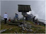
Tolsti vrh, located west of Storžič, is at 1715 metres also the highest peak of the Kriška gora range, which rises steeply above central Gorenjsk...
3 h 15 min |
 | Križe - Tolsti vrh (steep path over Kriška gora)
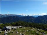
Tolsti vrh, located west of Storžič, is at 1715 metres also the highest peak of the Kriška gora range, which rises steeply above central Gorenjsk...
3 h 40 min |
| Križe - Tolsti vrh (easier path over Kriška gora)
Tolsti vrh, located west of Storžič, is at 1715 metres also the highest peak of the Kriška gora range, which rises steeply above central Gorenjsk...
3 h 45 min |
| Križe - Tolsti vrh (via Ježa)
Tolsti vrh, located west of Storžič, is at 1715 metres also the highest peak of the Kriška gora range, which rises steeply above central Gorenjsk...
3 h 30 min |
 | Tržič - Dobrča
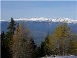
Dobrča is a 1634-metre mountain located between Begunje and Tržič. From the summit, which has a registration box with a stamp, the view opens onl...
3 h 10 min |
 | Luče - Velika Raduha (mimo Koče na Loki pod Raduho)
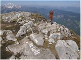
Velika Raduha, at an elevation of 2062 m, is the highest and westernmost peak in the Raduha ridge, a mountain range that rises steeply east of th...
4 h 40 min |
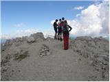 | Drežnica - Krn (south way)
Krn, at 2244 m, is the highest peak of the Krn mountain group, which rises steeply above the central part of the Soča River. From the summit, fea...
4 h 45 min |
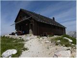 | Trenta - Zasavska koča na Prehodavcih
The Zasavska koča na Prehodavcih mountain hut is located on a panoramic rise above the Valley of the Triglav Lakes. From the hut, open in the sum...
4 h 15 min |
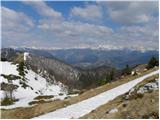 | Podbrdo - Možic
Možic is a 1,602 m high peak located west of Soriška Planina. At the very summit there is an old military bunker bearing the name of the peak and...
3 h 15 min |
| Podbrdo - Možic (via Lajnar)
Možic is a 1,602 m high peak located west of Soriška Planina. At the very summit there is an old military bunker bearing the name of the peak and...
3 h 25 min |
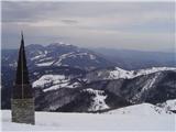 | Hudajužna - Porezen
Porezen is a 1,630 m high mountain situated between Davča and Baška Grapa. From the summit, where a large Partisan monument stands, a beautiful v...
3 h 15 min |
 | Podbrdo - Porezen
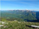
Porezen is a 1,630 m high mountain situated between Davča and Baška Grapa. From the summit, where a large Partisan monument stands, a beautiful v...
3 h 30 min |
| Podbrdo - Porezen (via Dom na Poreznu)
Porezen is a 1,630 m high mountain situated between Davča and Baška Grapa. From the summit, where a large Partisan monument stands, a beautiful v...
3 h 35 min |
 | Dolenji Novaki - Porezen
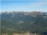
Porezen is a 1,630 m high mountain situated between Davča and Baška Grapa. From the summit, where a large Partisan monument stands, a beautiful v...
4 h |
 | Mače - Srednji vrh (via Kozjek and Dolga njiva)
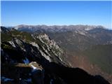
Srednji vrh is an 1853 m high mountain located east of Storžič. From the summit, which features a bench, registration box and stamp, there is a b...
3 h 35 min |
| Spodnja Kokra - Srednji vrh
Srednji vrh is an 1853 m high mountain located east of Storžič. From the summit, which features a bench, registration box and stamp, there is a b...
4 h 5 min |
| Mače - Srednji vrh (Mačenska pot and via Cjanovca)
Srednji vrh is an 1853 m high mountain located east of Storžič. From the summit, which features a bench, registration box and stamp, there is a b...
3 h 55 min |
| Mače - Srednji vrh (Mačenska pot and via Dolga njiva)
Srednji vrh is an 1853 m high mountain located east of Storžič. From the summit, which features a bench, registration box and stamp, there is a b...
3 h 40 min |
| Mače - Srednji vrh (via Kozjek and Cjanovca)
Srednji vrh is an 1853 m high mountain located east of Storžič. From the summit, which features a bench, registration box and stamp, there is a b...
4 h 10 min |
 | Stara Fužina - Pršivec (Direct way)
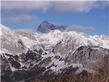
Pršivec is a panoramic mountain above Lake Bohinj. The view is extensive in all directions: Triglav and the surrounding mountains are clearly vis...
3 h 45 min |
 | Mače - Bašeljski vrh
Bašeljski vrh is a 1744-meter-high mountain located between Mali Grintovec and Storžič. From the summit, where there is a bench and a registratio...
3 h 15 min |
| Bašelj - Bašeljski vrh (via hospital Košuta)
Bašeljski vrh is a 1744-meter-high mountain located between Mali Grintovec and Storžič. From the summit, where there is a bench and a registratio...
3 h 25 min |
| Bašelj - Bašeljski vrh
Bašeljski vrh is a 1744-meter-high mountain located between Mali Grintovec and Storžič. From the summit, where there is a bench and a registratio...
3 h 15 min |
| Mače - Bašeljski vrh (via Kozjek)
Bašeljski vrh is a 1744-meter-high mountain located between Mali Grintovec and Storžič. From the summit, where there is a bench and a registratio...
3 h 30 min |
| Spodnja Kokra - Bašeljski vrh
Bašeljski vrh is a 1744-meter-high mountain located between Mali Grintovec and Storžič. From the summit, where there is a bench and a registratio...
4 h 40 min |
 | Kraljev hrib - Konj
Konj is an 1803 m high peak located between Velika Planina and Presedljaj. From the summit there is a beautiful view of the highest peaks of the ...
3 h 30 min |
 | Podbrdo - Slatnik (northwestern peak)
Slatnik is a panoramic mountain located west of the Soriška Planina ski resort. From its grassy summit there is a beautiful view of the Škofjeloš...
3 h 15 min |
 | Podbrdo - Slatnik (northwestern peak) (via Lajnar)
Slatnik is a panoramic mountain located west of the Soriška Planina ski resort. From its grassy summit there is a beautiful view of the Škofjeloš...
3 h 10 min |
 | Ribčev Laz - Rodica (via Čez Suho)
The mountain Rodica is located above Bohinj in the Lower Bohinj Mountains. From the summit there is a beautiful view over the Julian Alps and the...
4 h 15 min |
 | Tržič - Bela peč (via Potarje and Spodnja Konjščica)
The mountain, known mainly among climbers, is located north of Storžič on the slopes of Konjščica. From the summit there is a beautiful view of t...
3 h 55 min |
 | Mače - Mali Grintovec (via Bašeljski vrh)
Mali Grintovec is a panoramic mountain located east of Storžič. From the summit, which has a summit register box, stamp, and a pleasant bench, th...
4 h |
| Mače - Mali Grintovec (via Kozjek and Dolga njiva)
Mali Grintovec is a panoramic mountain located east of Storžič. From the summit, which has a summit register box, stamp, and a pleasant bench, th...
3 h 35 min |
| Mače - Mali Grintovec (Mačenska pot and via Dolga njiva)
Mali Grintovec is a panoramic mountain located east of Storžič. From the summit, which has a summit register box, stamp, and a pleasant bench, th...
3 h 40 min |
| Bašelj - Mali Grintovec (via Bašeljski vrh)
Mali Grintovec is a panoramic mountain located east of Storžič. From the summit, which has a summit register box, stamp, and a pleasant bench, th...
4 h |
| Bašelj - Mali Grintovec (via hospital Košuta and over Bašeljski vrh)
Mali Grintovec is a panoramic mountain located east of Storžič. From the summit, which has a summit register box, stamp, and a pleasant bench, th...
4 h 10 min |
| Spodnja Kokra - Mali Grintovec
Mali Grintovec is a panoramic mountain located east of Storžič. From the summit, which has a summit register box, stamp, and a pleasant bench, th...
4 h 45 min |
 | Mače - Mali Grintovec (via Dom na Kališču)
Mali Grintovec is a panoramic mountain located east of Storžič. From the summit, which has a summit register box, stamp, and a pleasant bench, th...
3 h 50 min |
| Bašelj - Mali Grintovec (via Dom na Kališču)
Mali Grintovec is a panoramic mountain located east of Storžič. From the summit, which has a summit register box, stamp, and a pleasant bench, th...
3 h 50 min |
| Bašelj - Mali Grintovec (via hospital Košuta and Dom na Kališču)
Mali Grintovec is a panoramic mountain located east of Storžič. From the summit, which has a summit register box, stamp, and a pleasant bench, th...
4 h |
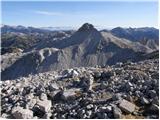 | Planina Polog - Batognica (via planina Sleme)
Batognica is a 2164 m high mountain that was the site of the so-called mine warfare during World War I. Remnants of the fighting between Italian ...
5 h 45 min |
| Drežnica - Batognica (south way)
Batognica is a 2164 m high mountain that was the site of the so-called mine warfare during World War I. Remnants of the fighting between Italian ...
4 h 50 min |
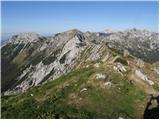 | Ukanc - Šija (via planina Zadnji Vogel)
Šija is located above the Vogel ski resort in the Lower Bohinj Mountains. From the summit, there is a nice view of the neighboring peaks in the s...
4 h 25 min |
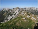 | Ukanc - Šija (via Žagarjev graben)
Šija is located above the Vogel ski resort in the Lower Bohinj Mountains. From the summit, there is a nice view of the neighboring peaks in the s...
4 h |
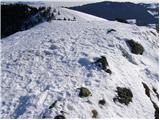 | Ljubenske Rastke - Komen
At 1684 meters, Komen is the highest peak in the Smrekovec mountain range, which borders between Styria and Carinthia. In good weather, the summi...
3 h 15 min |
 | Ljubno ob Savinji - Veliki Travnik (Turnovka)
Veliki Travnik, also known as Turnovka by the locals, is located on the western edge of the Smrekovec mountain range. From the summit, which has ...
4 h |
 | Spodnja Kokra - Cjanovca
Cjanovca is a peak east of Storžič and south of Srednji vrh. It is clearly visible from Kranj and its surroundings. The southern slope is bare, w...
3 h 50 min |
| Mače - Cjanovca (Mačenska pot and on SE ridge)
Cjanovca is a peak east of Storžič and south of Srednji vrh. It is clearly visible from Kranj and its surroundings. The southern slope is bare, w...
3 h 40 min |
| Mače - Cjanovca (over Kozjek and on SE ridge)
Cjanovca is a peak east of Storžič and south of Srednji vrh. It is clearly visible from Kranj and its surroundings. The southern slope is bare, w...
3 h 55 min |
| Mače - Cjanovca (Mačenska pot and via Dolga njiva)
Cjanovca is a peak east of Storžič and south of Srednji vrh. It is clearly visible from Kranj and its surroundings. The southern slope is bare, w...
3 h 35 min |
| Mače - Cjanovca (via Kozjek and Dolga njiva)
Cjanovca is a peak east of Storžič and south of Srednji vrh. It is clearly visible from Kranj and its surroundings. The southern slope is bare, w...
3 h 30 min |
 | Dovže - Črni vrh
Črni vrh is the highest peak of Pohorje. Because it is partly unvegetated, it offers a nice view toward Velika Kopa, Uršlja gora, and in the back...
3 h 45 min |
 | Zauchen - Hochobir (Ojstrc) (via Kunetov graben)
Ojstrc (Hochobir) is the highest peak of the smaller Obir range. It is located west of Železna Kapla (Eisenkappel) on the Austrian side of the Ka...
5 h 5 min |
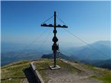 | Podkanja vas / Wildenstein - Hochobir (Ojstrc)
Ojstrc (Hochobir) is the highest peak of the smaller Obir range. It is located west of Železna Kapla (Eisenkappel) on the Austrian side of the Ka...
5 h |
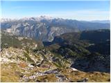 | Ukanc - Vogel (via planina Zadnji Vogel)
Many associate the name Vogel first with the Vogel ski resort near the eponymous peak. From the north, it is recognizable by its pyramidal shape,...
4 h 30 min |
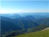 | Ukanc - Vogel (via Globoko)
Many associate the name Vogel first with the Vogel ski resort near the eponymous peak. From the north, it is recognizable by its pyramidal shape,...
4 h 15 min |
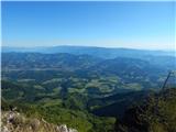 | Žerjav - Uršlja gora (Plešivec)
Uršlja gora, or Plešivec, is a panoramic mountain between Slovenj Gradec and Črna na Koroškem. At or just below the summit stands the Church of S...
3 h 15 min |
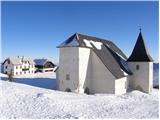 | Mežica - Uršlja gora (Plešivec) (via Sveti Lenart and Koča na Naravskih ledinah)
Uršlja gora, or Plešivec, is a panoramic mountain between Slovenj Gradec and Črna na Koroškem. At or just below the summit stands the Church of S...
5 h 30 min |
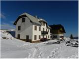 | Mežica - Uršlja gora (Plešivec) (via Sveti Lenart and over Kozji hrbet)
Uršlja gora, or Plešivec, is a panoramic mountain between Slovenj Gradec and Črna na Koroškem. At or just below the summit stands the Church of S...
5 h 15 min |
| Leše - Uršlja gora (Plešivec) (via Koča na Naravskih ledinah)
Uršlja gora, or Plešivec, is a panoramic mountain between Slovenj Gradec and Črna na Koroškem. At or just below the summit stands the Church of S...
4 h 25 min |
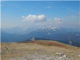 | Mežica - Petzen (Kordeschkopf) (Peca (Kordeževa glava)) (easy path)
Kordeževa glava, better known as Peca, is the highest peak of the Peca range. It is located on the border with Austria above the Mežiška dolina v...
5 h |
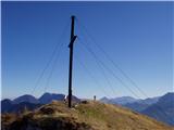 | Waidisch / Bajdiše - Ferlacher Horn / Grlovec
Grlovec/Ferlacher Horn is a panoramic mountain on which a large cross stands. From the top, there is a beautiful view of the Karawanks, parts of ...
3 h 35 min |
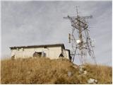 | Potoki - Stol (Julian Alps)
Stol (1673 m) is located in the longest ridge of the Julian Alps. The ridge measures 25 km, or 35 km if including the western part. From the summ...
4 h |
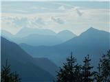 | Bistrica v Rožu / Feistritz im Rosental - Sinacher Gupf / Psinski vrh (east path)
Sinski vrh (mostly marked as Psinski vrh on maps) / Sinacher Gupf is a peak north of the main Karawanks ridge, more precisely north of Stol and V...
3 h 15 min |
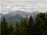 | Trnje / Dornach - Singerberg / Žingarica
Žingarica / Singerberg is a peak on the Austrian side of the Karawanks above the village of Slovenji Plajberk / Windisch Bleiberg. From the summi...
3 h 20 min |
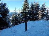 | Bistrica v Rožu / Feistritz im Rosental - Singerberg / Žingarica
Žingarica / Singerberg is a peak on the Austrian side of the Karawanks above the village of Slovenji Plajberk / Windisch Bleiberg. From the summi...
3 h 55 min |
 | Tržič - Šentanski vrh
Šentanski vrh, located in the Dobrča range just five minutes from the main peak, offers a nice view of the central Karawanks, the Storžič group, ...
3 h 15 min |
 | Glavaš - Dinara (past Martinova Košara and on western path)
Vrh Sinjal or Dinara (1831 m) is the highest peak in Croatia. From the summit, where there is a summit register and a cross, there is a nice view...
4 h 30 min |
| Glavaš - Dinara (past cotage Drago Grubać)
Vrh Sinjal or Dinara (1831 m) is the highest peak in Croatia. From the summit, where there is a summit register and a cross, there is a nice view...
4 h |
 | Žekovec - Boskovec (past Keber and Mozirska koča)
Boskovec is with 1587 m the highest peak of the Golte plateau. From the top on which a lookout tower stands, a view opens up on part of Kamnik Sa...
3 h 20 min |
 | Radegunda (Žekovec) - Boskovec (through Zagradiška puša and on path Severjeva pot)
Boskovec is with 1587 m the highest peak of the Golte plateau. From the top on which a lookout tower stands, a view opens up on part of Kamnik Sa...
3 h 10 min |
| Radegunda (Žekovec) - Boskovec (via Zagradiška puša and Hleviška planina)
Boskovec is with 1587 m the highest peak of the Golte plateau. From the top on which a lookout tower stands, a view opens up on part of Kamnik Sa...
3 h 15 min |
 | Globasnitz - Wackendorfer Spitze
Veška kopa, also known as Veški vrh or by its German name Wackendorfer Spitze, is the northernmost two-thousander in the Peca range. From its ind...
4 h 35 min |
 | Globasnitz - Feistritzer Spitze
Bistriška špica is a 2113 m high peak located on the Austrian side of Peca. From the summit, which features a cross, there is a fine view of the ...
5 h |
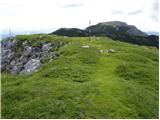 | Globasnitz - Končnikov vrh (Peca)
Končnikov vrh (German: Knieps) is a 2109 m high peak situated in the central part of Peca. From the grassy summit, there is a beautiful view of t...
5 h 45 min |
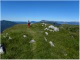 | Podrošt - Altemaver (Ratitovec)
Altemaver (Ratitovec), at 1,678 meters, is the highest peak of Ratitovec. From its grassy summit, there is a beautiful view of the Julian Alps, J...
3 h 20 min |
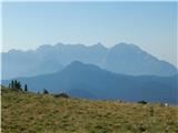 | Podkanja vas / Wildenstein - Kraguljše
Kraguljše is an 1828 m high peak situated in the Obir mountain range. From its spacious summit, which has a small wooden bench, beautiful views o...
4 h 10 min |
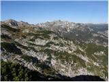 | Ukanc - Visoki Orlov rob (via Žagarjev graben)
Visoki Orlov rob is a 1,800-meter-high peak located right next to the upper station of the Šija single-chair lift. From the summit, which lies sl...
3 h 45 min |
 | Podbrdo - Slatnik (southeastern peak)
Slatnik (southeastern peak) is a panoramic mountain that rises steeply above Baška grapa on one side and descends more gently toward Soriška plan...
3 h 25 min |