 | Topol pri Medvodah (parkirišče za Grmado) - Polhograjska Grmada
Polhograjska Grmada is an 898 m high peak located in the heart of the Polhograjski Dolomites. From the summit, where there is a registration box ...
1 h 15 min |
 | Trnovec - Polhograjska Grmada
Polhograjska Grmada is an 898 m high peak located in the heart of the Polhograjski Dolomites. From the summit, where there is a registration box ...
1 h 15 min |
 | Trnovec (Legastja) - Sveti Jakob (južna pot)
The Church of St. James is located on a scenic hill north of the village of Topol pri Medvodah. From the summit, which features a registration bo...
1 h 10 min |
 | Trnovec (Legastja) - Sveti Jakob (north path)
The Church of St. James is located on a scenic hill north of the village of Topol pri Medvodah. From the summit, which features a registration bo...
1 h |
 | Pševo - Sveti Jošt above Kranj (Sodar way)
Sveti Jošt above Kranj is a hill located west of the slightly lower Šmarjetna gora. From the summit, where the Church of St Jošt stands alongside...
45 min |
 | Zabukovje - Sveti Jošt above Kranj
Sveti Jošt above Kranj is a hill located west of the slightly lower Šmarjetna gora. From the summit, where the Church of St Jošt stands alongside...
50 min |
| Pševo - Sveti Jošt above Kranj (Sodarjeva pot, na klopca)
Sveti Jošt above Kranj is a hill located west of the slightly lower Šmarjetna gora. From the summit, where the Church of St Jošt stands alongside...
45 min |
| Pševo - Sveti Jošt above Kranj (Sodarjeva pot, past the chapel)
Sveti Jošt above Kranj is a hill located west of the slightly lower Šmarjetna gora. From the summit, where the Church of St Jošt stands alongside...
50 min |
| Tičnica - Sveti Jošt above Kranj (Pot prijateljev Sv. Jošta, on stairs)
Sveti Jošt above Kranj is a hill located west of the slightly lower Šmarjetna gora. From the summit, where the Church of St Jošt stands alongside...
1 h 15 min |
| Tičnica - Sveti Jošt above Kranj (Pot prijateljev Sv. Jošta, na klopca)
Sveti Jošt above Kranj is a hill located west of the slightly lower Šmarjetna gora. From the summit, where the Church of St Jošt stands alongside...
1 h 15 min |
 | Slavkov dom na Golem brdu - Jeterbenk
Jeterbenk is a 774-meter-high peak located between the Slavkov dom hut on Golo Brdo and Katarina (the village of Topol). From the summit, where t...
1 h 15 min |
| Žlebe - Jeterbenk (western way)
Jeterbenk is a 774-meter-high peak located between the Slavkov dom hut on Golo Brdo and Katarina (the village of Topol). From the summit, where t...
1 h 15 min |
 | Žlebe - Jeterbenk (via Turnice)
Jeterbenk is a 774-meter-high peak located between the Slavkov dom hut on Golo Brdo and Katarina (the village of Topol). From the summit, where t...
1 h |
 | Žlebe - Jeterbenk (on ridge)
Jeterbenk is a 774-meter-high peak located between the Slavkov dom hut on Golo Brdo and Katarina (the village of Topol). From the summit, where t...
1 h 5 min |
 | Praproče - Polhograjska Gora (Sveti Lovrenc) (gentle path)
Polhograjska Gora, also known simply as Gora or Sveti Lovrenc, is an 824 m high hill northwest of Polhov Gradec. The summit, topped by the Church...
50 min |
 | Vrzdenec - Kožljek
Kožljek is a 788 m high peak located west of Koren, more precisely above the village of Samotorica. From the summit, where there are several benc...
1 h 5 min |
 | Ljubljanica - Kožljek
Kožljek is a 788 m high peak located west of Koren, more precisely above the village of Samotorica. From the summit, where there are several benc...
45 min |
 | Preval Prosca - Koreno (gentle path)
Koreno (also known as Korena) is a 729 m high hill located north of Horjul. From the summit, which features a large cross, the church of St. Moho...
1 h 15 min |
 | Preval Prosca - Koreno (steep path)
Koreno (also known as Korena) is a 729 m high hill located north of Horjul. From the summit, which features a large cross, the church of St. Moho...
1 h |
 | Briše - Koreno
Koreno (also known as Korena) is a 729 m high hill located north of Horjul. From the summit, which features a large cross, the church of St. Moho...
50 min |
 | Potoki - Ajdna
Ajdna is a peak with a nice view towards Stol, Jelovica, Pokljuka, and the Julian Alps. There is also a good view of part of the Upper Sava Valle...
1 h |
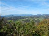 | Gabrje - Limbarska gora (footpath)
Limbarska gora is located northeast of Moravče. From the summit, there is a beautiful view of the surrounding peaks, and in good weather, the Kam...
45 min |
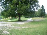 | Sv. Andrej - Sveti Ožbolt (above Zminec)
Sveti Ožbolt is situated on a panoramic rise in the north of the Polhograjski Dolomiti. There is a beautiful view toward the Škofjeloško hribovje...
1 h |
 | Dom na Boču - Boč (Senčna pot)
Boč is among the last peaks in the Karawanks before they transition over Donačka gora and Macelj into the Pannonian Plain. Boč has two approximat...
1 h |
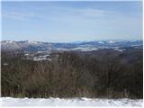 | Loščica - Vremščica
Vremščica is a mountain range stretching between Senožeče, Pivka and Divača. Its highest peak is Velika Vremščica. The view from the summit exten...
1 h 15 min |
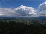 | Star maln - Koča na Planini nad Vrhniko
Planina nad Vrhniko is for Vrhnika locals something like Šmarna gora for those from Ljubljana. It is 733 m high, reachable by several paths from ...
1 h |
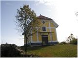 | Katarija - Sveti Miklavž above Sava
The Church of St. Miklavž is situated on a panoramic hill south of Moravče. From the summit, there is a beautiful view toward the nearby Limbarsk...
45 min |
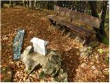 | Križevska vas - Cicelj (via farm Buven)
Cicelj is a forested peak that rises between the Moravče Valley and the Sava River, specifically between Moravče and the village of Senožeti. At ...
45 min |
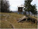 | Kuren - Ulovka
Ulovka is a peak between Zaplana and Zavetišče na Planini nad Vrhniko. From the summit, to which ski lifts run, there is a nice view to the north...
50 min |
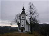 | Hotovlja - Bukov vrh
Bukov vrh, where the Church of Our Lady of Sorrows stands, is located in the northwestern part of Polhograjsko hribovje. From the summit, there a...
1 h 5 min |
 | Podgorje - Kojnik (steep path)
Kojnik is a partly forested peak located in the southern part of Podgorski Kras near the Slovenian-Croatian border. From the summit, which has a ...
1 h |
 | Selšček - Velika Špička
Velika Špička or Špičasto Stražišče is a peak located north of Slivnica. From the summit, which has a logbook box with a stamp, there is a nice v...
45 min |
 | Begunje pri Cerknici - Velika Špička (via Cemarovnik)
Velika Špička or Špičasto Stražišče is a peak located north of Slivnica. From the summit, which has a logbook box with a stamp, there is a nice v...
1 h |
 | Begunje pri Cerknici - Velika Špička
Velika Špička or Špičasto Stražišče is a peak located north of Slivnica. From the summit, which has a logbook box with a stamp, there is a nice v...
1 h |
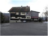 | Krnice - Dom v Gorah
The Dom v Gorah mountain hut is located east of Hrastnik, just a few meters below the 786 m high peak where the church of St. Jurij stands. From ...
1 h 5 min |
 | Marno - Dom v Gorah
The Dom v Gorah mountain hut is located east of Hrastnik, just a few meters below the 786 m high peak where the church of St. Jurij stands. From ...
1 h 15 min |
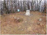 | Studeno - Gora (Sveti Lovrenc)
Gora, or Sveti Lovrenc, is a peak above Studeno, a village north of Postojna that serves as a suitable starting point for the ascent to this pano...
1 h 5 min |
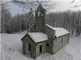 | Gorenje - Gora (Sveti Lovrenc)
Gora, or Sveti Lovrenc, is a peak above Studeno, a village north of Postojna that serves as a suitable starting point for the ascent to this pano...
1 h 15 min |
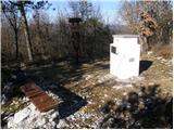 | Pivka - Osojnica
Osojnica is a forested hill located west of Pivka. The summit features a logbook box, stamp, and bench, but offers no views....
1 h |
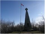 | Rudijev dom na Donački gori - Donačka gora
Donačka gora is a peak located north of Rogatec. From the summit, which geographically belongs to the Karawanks, there is a nice view of the near...
45 min |
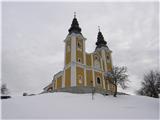 | Dobrič - Gora Oljka
Gora Oljka is a hill located east of Šmartno ob Paki. On the summit stands the Church of the Holy Cross, built in the mid-18th century. Just a fe...
50 min |
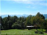 | Dobrič (Vedet) - Gora Oljka (via Brezovec)
Gora Oljka is a hill located east of Šmartno ob Paki. On the summit stands the Church of the Holy Cross, built in the mid-18th century. Just a fe...
50 min |
 | Matke - Golava
Golava is a peak located north of Mrzlica. From the summit, where there is a small bivouac (Blažev bivak), there is a fine view toward the aforem...
1 h 15 min |
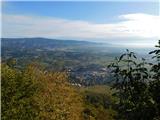 | Žička kartuzija - Skala
Skala (750 m) is a popular and scenic mountain area in the eastern part of Konjiška gora. From the summit, where tables, benches, and a registrat...
1 h 15 min |
 | Mrzle doline - Sveti Peter
Sveti Peter is a partly forested peak in Suha Krajina above the village of Dvor. On the summit stands a small shelter (usually open on Sundays) a...
1 h 15 min |
 | Komarna vas - Gače
Gače is a popular excursion spot for nature lovers and the only ski center in Dolenjska (SC Bela), offering pleasant skiing in winter and enjoyab...
1 h |
 | Trnovec (Legastja) - Rog
Rog is an 798-meter peak above the village of Topol, just 10 minutes from St. Katarina's Church. From the summit, where a large cross once stood,...
1 h 15 min |
 | Bločice - Križna gora
Križna gora is a partly panoramic peak located above the villages of Sveta Ana and Podlož. From the summit, where the Church of the Holy Cross st...
1 h 15 min |
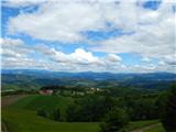 | Mala Goričica - Obolno (by road)
Obolno is a 776-meter-high peak located southwest of the eponymous village. From the grassy summit, by which a radio club hut stands, there is a ...
1 h 15 min |
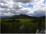 | Podgora - Kamen vrh
Kamen Vrh is a panoramic hill located on the northern edge of Mala Gora. From the summit, surrounded by low bushes, there are fine views of parts...
1 h |
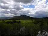 | Podpeč - Kamen vrh
Kamen Vrh is a panoramic hill located on the northern edge of Mala Gora. From the summit, surrounded by low bushes, there are fine views of parts...
50 min |
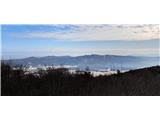 | Velike Lašče - Kamen vrh
Kamen Vrh is a panoramic hill located on the northern edge of Mala Gora. From the summit, surrounded by low bushes, there are fine views of parts...
1 h 15 min |
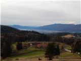 | Ortnek - Grmada on Mala gora
Grmada (also Grmada above Ortnek) is an 887-meter-high peak located above the village of Vrh pri Poljanah in the Mala Gora range. Just a few mete...
1 h |
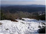 | Seljan - Stene svete Ane (gentle path)
Stene Svete Ane is a vegetated peak located near the Planinska Koča pri Sveti Ani on Mala Gora. A small observation tower stands on the summit, e...
1 h 5 min |
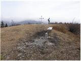 | Col - Kovk
Kovk is a panoramic peak west of Col on an elongated ridge rising steeply above the Vipava Valley. From the summit cross, beautiful views extend ...
1 h |
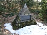 | Šober (Dobajev mlin) - Tojzlov vrh
Tojzlov vrh is a forested hill on the eastern part of Kozjak. On the summit stands a small stone NOB monument and, more recently, also a summit l...
50 min |
 | Šober (Perkova graba) - Tojzlov vrh
Tojzlov vrh is a forested hill on the eastern part of Kozjak. On the summit stands a small stone NOB monument and, more recently, also a summit l...
1 h |
| Šober (Zgornji Tepeh) - Tojzlov vrh
Tojzlov vrh is a forested hill on the eastern part of Kozjak. On the summit stands a small stone NOB monument and, more recently, also a summit l...
50 min |
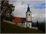 | Adergas - Štefanja gora (via benches)
Štefanja gora, where the Church of St. Stephen stands, is located above Cerklje na Gorenjskem. Just a few tens of meters below the summit lies th...
1 h |
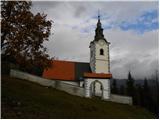 | Adergas - Štefanja gora (via šterna)
Štefanja gora, where the Church of St. Stephen stands, is located above Cerklje na Gorenjskem. Just a few tens of meters below the summit lies th...
1 h |
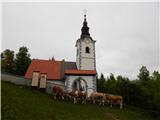 | Olševek - Štefanja gora
Štefanja gora, where the Church of St. Stephen stands, is located above Cerklje na Gorenjskem. Just a few tens of meters below the summit lies th...
55 min |
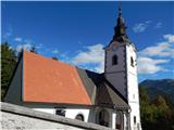 | Velesovo - Štefanja gora (via benches)
Štefanja gora, where the Church of St. Stephen stands, is located above Cerklje na Gorenjskem. Just a few tens of meters below the summit lies th...
1 h 10 min |
| Velesovo - Štefanja gora (via Šterna)
Štefanja gora, where the Church of St. Stephen stands, is located above Cerklje na Gorenjskem. Just a few tens of meters below the summit lies th...
1 h 10 min |
 | Borovec pri Kočevski Reki - Krempa
Krempa is a 944 m high mountain located in the central part of Borovška gora, a range that rises steeply above Zgornja Kolpska dolina. On the sum...
50 min |
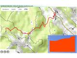 | Suhi Dol - Goli vrh (Official marked path)
Goli vrh (also Golni vrh on maps) is an indistinct, forest-covered peak above the dispersed settlement of Goli Vrh. There is no view from the sum...
1 h |
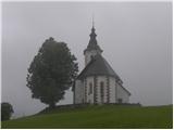 | Ljubljanica - Sveti Andrej (Planina above Horjul)
The Church of St. Andrew stands on a panoramic hill just above Planina nad Horjulom. From the church, built in 1659, there is a beautiful view of...
1 h 15 min |
 | Brod - Rudnica
Rudnica is a panoramic mountain located between the Lower and Upper Bohinj Valleys. From the summit, where there is a register box with a stamp a...
1 h 15 min |
| Savica - Rudnica
Rudnica is a panoramic mountain located between the Lower and Upper Bohinj Valleys. From the summit, where there is a register box with a stamp a...
1 h 15 min |
 | Mislinja - Časov vrh
Časov vrh (Časkov vrh on some maps) is a less prominent hill located between Fričev vrh and Črepič. Since the summit is forested, there is no vie...
1 h 15 min |
 | Mislinja - Sveti Vid (Završe)
The Church of St. Vitus, next to which there is also a small cemetery, is located in the middle of the dispersed settlement Završe. From the chur...
1 h 10 min |
 | Kropa - Sveti Primož in Felicijan (Jamnik)
The Church of St. Primož and Felicijan at Jamnik is located on a scenic grassy ridge rising between Kropa and Podblica. From the church or its ne...
1 h 10 min |
 | Rovte - Sveti Primož in Felicijan (Jamnik)
The Church of St. Primož and Felicijan at Jamnik is located on a scenic grassy ridge rising between Kropa and Podblica. From the church or its ne...
1 h 15 min |
 | Češnjica pri Kropi - Sveti Primož in Felicijan (Jamnik)
The Church of St. Primož and Felicijan at Jamnik is located on a scenic grassy ridge rising between Kropa and Podblica. From the church or its ne...
1 h 15 min |
 | Nemilje - Sveti Primož in Felicijan (Jamnik) (on marked path)
The Church of St. Primož and Felicijan at Jamnik is located on a scenic grassy ridge rising between Kropa and Podblica. From the church or its ne...
50 min |
 | Hunting sports association Vinska Gora - Ramšakov vrh
Ramšakov vrh is the highest point of the circular path around Vinska Gora. At the 970 m high summit, next to the benches, there is also a stamp b...
1 h |
 | Kambreško - Globočak
Globočak is an 809 m high peak located in the Kanal Kolovrat range. From the summit, which has some remnants from the First World War, there is n...
50 min |
 | Zavrh pri Trojanah - Reber
Reber is an 878 m high peak located southwest of Trojane. On the summit, which has a logbook box with a logbook and stamp, stands a wooden observ...
45 min |
 | Kolovrat - Reber
Reber is an 878 m high peak located southwest of Trojane. On the summit, which has a logbook box with a logbook and stamp, stands a wooden observ...
1 h |
 | Narin - Šilentabor
Šilentabor is a 751-meter-high peak just above the village of the same name. From the summit, near which there is a bench and a logbook box, ther...
1 h |
 | Krvavi Potok - Veliko Gradišče
Veliko Gradišče is a 742-meter-high peak south of the village Lokev on the Karst and east of Kokoš. From the summit, marked by a concrete boulder...
1 h |
 | Prelože pri Lokvi - Veliko Gradišče
Veliko Gradišče is a 742-meter-high peak south of the village Lokev on the Karst and east of Kokoš. From the summit, marked by a concrete boulder...
45 min |
 | Ortnek - Sveti Gregor on Slemena
Sveti Gregor is a settlement on the panoramic Slemena. At its center stands the parish church of St. Gregory the Great, nearby a large sports fie...
1 h 10 min |
| Ruše - Pečke ((partial hiking trail), classic approach)
Pečke is an easily accessible peak that has seen fewer visitors lately, located north of the main Pohorje ridge. It gets more visits only on May ...
1 h 15 min |
 | Log - Pečke (steep path)
Pečke is an easily accessible peak that has seen fewer visitors lately, located north of the main Pohorje ridge. It gets more visits only on May ...
1 h |
 | Bašelj - Gradišče (Pustinjak)
Gradišče or Pustinjak (also Gradišče nad Bašljem) is an 871-meter-high peak located above the Belica stream, which lies below the 2,132-meter-hig...
45 min |
 | Velesovo - Apnišče (via Šterna)
Apnišče is a 740 m high mountain between Možjanca and Štefanja gora. It is the highest point of the Šenčur municipality. The forested summit offe...
1 h 10 min |
 | Jereka - Vodnikov razglednik
Vodnikov razglednik is a 1,017-meter-high mountain located between Jereko and Koprivniki in Bohinj. From the summit, which features a large cross...
1 h 15 min |
 | Poljana - Volinjak (via Stovčnik)
Volinjak (wrongly named Volinjek on some maps) is an 886-meter-high peak located between Mežica and Prevalje. From the summit, which has a summit...
1 h 15 min |
| Leše - Volinjak (via Hermanko)
Volinjak (wrongly named Volinjek on some maps) is an 886-meter-high peak located between Mežica and Prevalje. From the summit, which has a summit...
1 h 5 min |
| Leše - Volinjak (via Prapar)
Volinjak (wrongly named Volinjek on some maps) is an 886-meter-high peak located between Mežica and Prevalje. From the summit, which has a summit...
1 h 5 min |
 | Mežica - Volinjak
Volinjak (wrongly named Volinjek on some maps) is an 886-meter-high peak located between Mežica and Prevalje. From the summit, which has a summit...
1 h 10 min |
 | Rebrca / Rechberg - Rokov vrh / Rochusberg (via Bukovnik)
Rokov vrh is an 880-meter-high peak (817 m according to some sources), located between the settlements Suha/Zauchen, Rebrca/Rechberg, and Podkraj...
1 h |
 | Gorenja vas - Jermanca (Jermancov grič)
Jermanca (Jermancov grič on maps) is a panoramic hill above Gorenja vas. In good weather, the summit offers nice views of the peaks above Poljans...
55 min |
 | Jazne (Lanišar) - Planinska koča Mrzl'k
The Planinska koča Mrzl'k mountain hut lies just a few meters below the Mrzlik summit. From the hut opens up a fine view of the neighboring Mrzli...
1 h 10 min |
 | Moravče - Gorišca
Gorišca is a 698-meter-high peak located southwest of the Ušte - Žerenk mountain hut. The summit, which has a transmitter, offers no good views d...
1 h 15 min |
 | Podjuna / Jaunstein - Gora svete Eme (Junska gora) / Hemmaberg (detour of closed route)
Gora sv. Eme (Junska gora) / Hemmaberg is located south of the village Podjuna / Jaunstein. On the summit stands the church of St. Ema (Hema) Krš...
55 min |
| Globasnica / Globasnitz - Gora svete Eme (Junska gora) / Hemmaberg
Gora sv. Eme (Junska gora) / Hemmaberg is located south of the village Podjuna / Jaunstein. On the summit stands the church of St. Ema (Hema) Krš...
55 min |
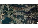 | Škale - Lubela (via hunting lodge)
Lubela is a hill near Velenje that rises to the north above the Šaleška Valley and belongs to the Šentviško Hills or the broader Graška Gora area...
1 h 15 min |
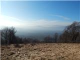 | Onek - Lovski vrh
Lovski vrh is an 830-meter-high peak situated above the settlements of Onek and Mačkovec in the Kočevje Municipality. From the top, which has sev...
45 min |
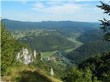 | Predgrad - Kozice
Kozice is a 741-meter-high peak with an RTV transmitter located above the left bank of the Kolpa River. From the viewpoint on the southern subpea...
1 h 15 min |
 | Jablance - Plešivec (Bohor)
Plešivec, known on some maps as Špic hrib, is a 915-meter peak on Bohor located southeast of Koča na Bohorju....
1 h 5 min |
 | Zreče (cemetery) - Golek
Golek is a 769-meter-high peak located northwest of Zreče. The summit has a logbook box with book and stamp, plus a bench; a short distance (a fe...
1 h 15 min |
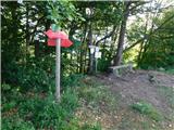 | Ljubnica - Golek (zgornja pot)
Golek is a 769-meter-high peak located northwest of Zreče. The summit has a logbook box with book and stamp, plus a bench; a short distance (a fe...
45 min |
| Ljubnica - Golek (spodnja pot)
Golek is a 769-meter-high peak located northwest of Zreče. The summit has a logbook box with book and stamp, plus a bench; a short distance (a fe...
1 h 15 min |
 | Škalske Cirkovce - Stropnik
Stropnik (862 m) and the slightly higher Stropnica (880 m) form a hill rising above Paka pri Velenju on one side and the settlements of Škalske C...
1 h |
 | Škalske Cirkovce - Stropnica (via Stropnik)
Stropnica (880 m) and slightly lower Stropnik (862 m) form a hill rising above Paka pri Velenju on one side and the settlements Škalske and Šmart...
1 h 10 min |
 | Škalske Cirkovce - Stropnica
Stropnica (880 m) and slightly lower Stropnik (862 m) form a hill rising above Paka pri Velenju on one side and the settlements Škalske and Šmart...
1 h |
 | Smiljan - Krčmar (Way of the Cross)
Krčmar is a 773-meter-high peak above Smiljan, known for the Nikola Tesla Memorial Center. There is a cross and an HPO stamp on the summit, which...
45 min |
 | Budaci - Velinac
Velinac is a panoramic peak in Central Velebit located above Karlobag. The summit is quite rocky and has a logbook and two stamps, one for HPO an...
1 h |
 | Radegunda (Žekovec) - Sveta Radegunda (Radegunda)
The Church of St. Radegunda stands on a wooded hill above the settlement of Radegunda....
1 h 15 min |
 | Rašpor - Gomila (Čičarija)
Gomila is a scenic grassy summit in the Čičarija area, located in Croatian Istria. The summit is a waypoint on the Istrian Mountain Trail. A conc...
1 h 15 min |