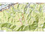
 | Pri Rupah - Mrežce (direct way)
Mrežce is a panoramic peak near Lipanski vrh, which is visible on the other side of the gully between the two peaks. Since the slopes towards Pok...
1 h 40 min |
 | Planina Zajavornik - Mrežce
Mrežce is a panoramic peak near Lipanski vrh, which is visible on the other side of the gully between the two peaks. Since the slopes towards Pok...
1 h 55 min |
 | Planina Zajavornik - Mrežce (gentle path)
Mrežce is a panoramic peak near Lipanski vrh, which is visible on the other side of the gully between the two peaks. Since the slopes towards Pok...
2 h |
 | Pri Rupah - Lipanski vrh
The panoramic Lipanski vrh is located above the Blejska koča on the Lipanca mountain pasture. From the summit, which drops steeply towards the Kr...
1 h 45 min |
 | Dom pod Storžičem - Tolsti vrh
Tolsti vrh, located west of Storžič, is at 1715 metres also the highest peak of the Kriška gora range, which rises steeply above central Gorenjsk...
2 h |
 | Sviščaki - Veliki Snežnik
Veliki Snežnik, at 1796 meters, is the highest peak in the nearby and distant surroundings, offering beautiful views over much of Slovenia and ne...
2 h 10 min |
 | Gašperjev hrib - Veliki Snežnik
Veliki Snežnik, at 1796 meters, is the highest peak in the nearby and distant surroundings, offering beautiful views over much of Slovenia and ne...
1 h 30 min |
 | Gašperjev hrib - Veliki Snežnik
Veliki Snežnik, at 1796 meters, is the highest peak in the nearby and distant surroundings, offering beautiful views over much of Slovenia and ne...
1 h 30 min |
 | Sviščaki - Veliki Snežnik (variant through forest)
Veliki Snežnik, at 1796 meters, is the highest peak in the nearby and distant surroundings, offering beautiful views over much of Slovenia and ne...
2 h |
| Sežanje - Veliki Snežnik
Veliki Snežnik, at 1796 meters, is the highest peak in the nearby and distant surroundings, offering beautiful views over much of Slovenia and ne...
1 h 40 min |
| Sviščaki - Veliki Snežnik (by road)
Veliki Snežnik, at 1796 meters, is the highest peak in the nearby and distant surroundings, offering beautiful views over much of Slovenia and ne...
2 h |
| Grda draga - Veliki Snežnik (via Mali Snežnik)
Veliki Snežnik, at 1796 meters, is the highest peak in the nearby and distant surroundings, offering beautiful views over much of Slovenia and ne...
1 h 55 min |
| Sviščaki - Veliki Snežnik (via Mali Snežnik)
Veliki Snežnik, at 1796 meters, is the highest peak in the nearby and distant surroundings, offering beautiful views over much of Slovenia and ne...
2 h 15 min |
 | Bistriška planina - Dobrča
Dobrča is a 1634-metre mountain located between Begunje and Tržič. From the summit, which has a registration box with a stamp, the view opens onl...
1 h 30 min |
 | Hibje - Dobrča (by road)
Dobrča is a 1634-metre mountain located between Begunje and Tržič. From the summit, which has a registration box with a stamp, the view opens onl...
1 h 45 min |
 | Črni Kal - Blegoš (by road, via hut)
Blegoš is a 1,562-metre-high mountain located between the Selška Sora and Poljanska Sora rivers. From the grassy summit, where there is a stamp a...
1 h 30 min |
 | Laze - Blegoš
Blegoš is a 1,562-metre-high mountain located between the Selška Sora and Poljanska Sora rivers. From the grassy summit, where there is a stamp a...
2 h |
 | Hunting cottage (Davča) - Porezen
Porezen is a 1,630 m high mountain situated between Davča and Baška Grapa. From the summit, where a large Partisan monument stands, a beautiful v...
1 h 45 min |
| Cimprovka (Davča) - Porezen (by road)
Porezen is a 1,630 m high mountain situated between Davča and Baška Grapa. From the summit, where a large Partisan monument stands, a beautiful v...
2 h 15 min |
 | Podhočar - Porezen
Porezen is a 1,630 m high mountain situated between Davča and Baška Grapa. From the summit, where a large Partisan monument stands, a beautiful v...
1 h 50 min |
 | Črnivec - Kranjska reber
Kranjska reber, also known as Vrh Kašne planine (1435 m), is a mountain of volcanic origin. From the summit, which has a registration box with a ...
1 h 30 min |
 | Križovec - Kahlkogel/Golica (mimo Koče na Golici)
Golica is an unvegetated peak located north of Jesenice. From the summit, where a registration box is placed, there is a fine view of the western...
2 h 10 min |
 | end of road on Vogar - Pršivec (direct way)
Pršivec is a panoramic mountain above Lake Bohinj. The view is extensive in all directions: Triglav and the surrounding mountains are clearly vis...
1 h 30 min |
 | Planina Blato - Pršivec
Pršivec is a panoramic mountain above Lake Bohinj. The view is extensive in all directions: Triglav and the surrounding mountains are clearly vis...
2 h 30 min |
| end of road on Vogar - Pršivec (via planina Viševnik)
Pršivec is a panoramic mountain above Lake Bohinj. The view is extensive in all directions: Triglav and the surrounding mountains are clearly vis...
2 h 20 min |
 | Planina Blato - Pršivec
Pršivec is a panoramic mountain above Lake Bohinj. The view is extensive in all directions: Triglav and the surrounding mountains are clearly vis...
2 h 30 min |
 | Jekarica - Bašeljski vrh
Bašeljski vrh is a 1744-meter-high mountain located between Mali Grintovec and Storžič. From the summit, where there is a bench and a registratio...
2 h 10 min |
 | Ravne - Frauenkogel/Dovška Baba (footpath)
Dovška Baba is a 1891-meter-high peak located on the border ridge between Slovenia and Austria. From the summit, which has a registration box and...
1 h 45 min |
| Ravne - Frauenkogel/Dovška Baba (by road)
Dovška Baba is a 1891-meter-high peak located on the border ridge between Slovenia and Austria. From the summit, which has a registration box and...
1 h 50 min |
 | Tinčkova koča - Srednji vrh (above Završnica) (via Smokuška planina)
Srednji vrh is a panoramic mountain covered in dwarf pine, located between Stol, Vrtača and Begunjščica. From the summit, which drops steeply to ...
2 h |
 | Planina Dol - Konj
Konj is an 1803 m high peak located between Velika Planina and Presedljaj. From the summit there is a beautiful view of the highest peaks of the ...
1 h 30 min |
 | Rateče - Ofen/Peč (by road)
Peč (also known as Tromeja; in Italian Monte Forno, in German Dreiländereck or Ofen) is a 1508 m high peak located at the tripoint between Sloven...
2 h |
 | Rateče - Ofen/Peč (footpath)
Peč (also known as Tromeja; in Italian Monte Forno, in German Dreiländereck or Ofen) is a 1508 m high peak located at the tripoint between Sloven...
1 h 40 min |
 | Fusine Laghi - Ofen/Peč
Peč (also known as Tromeja; in Italian Monte Forno, in German Dreiländereck or Ofen) is a 1508 m high peak located at the tripoint between Sloven...
2 h 15 min |
 | Rateče - Ofen/Peč (eastern path, past bivouac and on footpath)
Peč (also known as Tromeja; in Italian Monte Forno, in German Dreiländereck or Ofen) is a 1508 m high peak located at the tripoint between Sloven...
1 h 45 min |
| Rateče - Ofen/Peč (eastern path, past bivouac and on mule track)
Peč (also known as Tromeja; in Italian Monte Forno, in German Dreiländereck or Ofen) is a 1508 m high peak located at the tripoint between Sloven...
1 h 50 min |
 | Korensko sedlo - Ofen/Peč (on marked path)
Peč (also known as Tromeja; in Italian Monte Forno, in German Dreiländereck or Ofen) is a 1508 m high peak located at the tripoint between Sloven...
2 h |
 | Trögern - Virnikov Grintovec
Virnikov Grintovec is a 1654 m high mountain located north of Jezersko on the border ridge between Slovenia and Austria. From the summit, which h...
2 h 15 min |
 | Planina Zajavornik - Debeli vrh above Lipanca
Debeli vrh is a 1962 m high mountain located in the ridge that rises steeply above the Krma valley. From the summit, where a stamp is attached to...
2 h 30 min |
 | Dom pod Storžičem - Bela peč
The mountain, known mainly among climbers, is located north of Storžič on the slopes of Konjščica. From the summit there is a beautiful view of t...
2 h |
| Dom pod Storžičem - Bela peč (via Javorniški preval)
The mountain, known mainly among climbers, is located north of Storžič on the slopes of Konjščica. From the summit there is a beautiful view of t...
2 h 5 min |
 | Na kopiš - Bela peč (via Spodnja and Zgornja Konjščica)
The mountain, known mainly among climbers, is located north of Storžič on the slopes of Konjščica. From the summit there is a beautiful view of t...
2 h |
 | Ravne - Rosenkogel/Hruški vrh (direct way)
Hruški vrh is a 1776-metre-high mountain located between Dovška Baba and the lesser-known Klek. From the summit, where there is a small chapel de...
2 h |
 | Petrovo Brdo - Kobla
The summit is located in the Lower Bohinj Mountains between Črna prst and Soriška planina. Directly below it is a railway tunnel connecting Bohin...
2 h 15 min |
 | Bohinjsko sedlo - Kobla
The summit is located in the Lower Bohinj Mountains between Črna prst and Soriška planina. Directly below it is a railway tunnel connecting Bohin...
2 h 35 min |
 | Zgornja Sorica - Dravh
Dravh is a 1,547-metre-high peak situated between Sorica and Soriška Planina. From the unforested summit a beautiful view opens across the Škofja...
1 h 30 min |
 | Zgornja Sorica - Lajnar
Lajnar is a 1,549-metre-high mountain located north of Soriška Planina. From the summit, which is also the highest point of the ski resort, a bea...
1 h 40 min |
 | Petrovo Brdo - Lajnar
Lajnar is a 1,549-metre-high mountain located north of Soriška Planina. From the summit, which is also the highest point of the ski resort, a bea...
2 h |
 | Bohinjsko sedlo - Šavnik (by Lajnar)
Šavnik is a grassy peak situated between the ski resorts of Soriška Planina and Kobla. From the summit, which has a registration box with a stamp...
2 h |
 | Bohinjsko sedlo - Šavnik
Šavnik is a grassy peak situated between the ski resorts of Soriška Planina and Kobla. From the summit, which has a registration box with a stamp...
1 h 30 min |
 | Kramarica - Smrekovec (via Bukov stan)
Smrekovec is a mountain of volcanic origin on the eastern edge of the Smrekovec mountain range. The wide grassy summit features a pyramid with a ...
1 h 30 min |
| Kramarica - Smrekovec (by road)
Smrekovec is a mountain of volcanic origin on the eastern edge of the Smrekovec mountain range. The wide grassy summit features a pyramid with a ...
1 h 30 min |
| Ljubenske Rastke (Vrnivšek) - Smrekovec
Smrekovec is a mountain of volcanic origin on the eastern edge of the Smrekovec mountain range. The wide grassy summit features a pyramid with a ...
2 h |
 | Golte (Alpine garden) - Smrekovec
Smrekovec is a mountain of volcanic origin on the eastern edge of the Smrekovec mountain range. The wide grassy summit features a pyramid with a ...
2 h 30 min |
 | Dom na Smrekovcu - Komen (Direct way)
At 1684 meters, Komen is the highest peak in the Smrekovec mountain range, which borders between Styria and Carinthia. In good weather, the summi...
2 h |
 | Predmeja - Veliki Modrasovec
Veliki Modrasovec is located on the southern part of the Trnovski Forest near Predmeja. On the summit stands an old military building, which we m...
1 h 40 min |
| Predmeja (tunnels) - Veliki Modrasovec
Veliki Modrasovec is located on the southern part of the Trnovski Forest near Predmeja. On the summit stands an old military building, which we m...
1 h 55 min |
 | Koča Edmunda Čibeja v Tihi dolini - Mali Golak
Mali Golak is the highest peak in the Golaki group at 1495 meters above sea level and at the same time the highest point of the entire Trnovski g...
2 h |
 | Bevški vrh - Mali Golak
Mali Golak is the highest peak in the Golaki group at 1495 meters above sea level and at the same time the highest point of the entire Trnovski g...
1 h 35 min |
| Predmeja (Gorjanka) - Mali Golak
Mali Golak is the highest peak in the Golaki group at 1495 meters above sea level and at the same time the highest point of the entire Trnovski g...
2 h 25 min |
 | Gorenje pri Zrečah - Rogla
Rogla is a peak in the middle of the eponymous ski resort. The peak is forested with a small clearing on which stands a lookout tower. The tower ...
2 h 35 min |
 | Brneško sedlo - Velika Kopa
Velika Kopa is a 1542-meter-high peak located between Grmovškov dom and the nearby Mala Kopa. From the top, which is only 1 meter lower than the ...
1 h 50 min |
| Koča Planinc - Velika Kopa
Velika Kopa is a 1542-meter-high peak located between Grmovškov dom and the nearby Mala Kopa. From the top, which is only 1 meter lower than the ...
1 h 50 min |
 | Kozarnice - Srednji Golak (via Mali Golak)
Srednji Golak is located between Mali and Veliki Golak on the plateau of Trnovski gozd above Predmeja. The peak is covered with dwarf pines, and ...
1 h 50 min |
 | Grda draga - Mali Snežnik
Mali Snežnik is a peak on the western ridge of Snežnik. Covered with dwarf pines, the summit offers beautiful views of the neighboring Veliki Sne...
1 h 30 min |
| Sviščaki - Mali Snežnik
Mali Snežnik is a peak on the western ridge of Snežnik. Covered with dwarf pines, the summit offers beautiful views of the neighboring Veliki Sne...
1 h 50 min |
 | Ciganija - Uršlja gora (Plešivec) (winter way)
Uršlja gora, or Plešivec, is a panoramic mountain between Slovenj Gradec and Črna na Koroškem. At or just below the summit stands the Church of S...
2 h 30 min |
 | Koča na Naravskih ledinah - Uršlja gora (Plešivec)
Uršlja gora, or Plešivec, is a panoramic mountain between Slovenj Gradec and Črna na Koroškem. At or just below the summit stands the Church of S...
1 h 45 min |
 | Ciganija - Uršlja gora (Plešivec)
Uršlja gora, or Plešivec, is a panoramic mountain between Slovenj Gradec and Črna na Koroškem. At or just below the summit stands the Church of S...
2 h 15 min |
 | Coot Parking Lot - Monte Guarda/Skutnik
Skutnik is a peak situated north of the Učja River on the border with Italy. From the top, there is a beautiful view of the Kanin mountain group,...
2 h |
 | Planina Zapleč - Krasji vrh (via Koluji)
Krasji vrh is situated between Bovec and Kobarid on the Polovnik mountain ridge. At 1773 m it is also the highest peak of the mentioned ridge, so...
2 h |
| Planina Zapleč - Krasji vrh (via snežna jama)
Krasji vrh is situated between Bovec and Kobarid on the Polovnik mountain ridge. At 1773 m it is also the highest peak of the mentioned ridge, so...
2 h |
 | Rudnik v Topli - Mala Peca
Mala Peca is the peak above the Dom na Peci mountain hut on its eastern slopes. From the summit, where a panoramic sign stands, there is a nice v...
2 h 10 min |
 | Zadnji travnik - Govca (Olševa)
Govca is the highest peak of the Olševa range, rising above Koprivna, Solčava, and Remšenik (Remšenik/Remschenig is a valley on the Austrian side...
1 h 45 min |
 | Jezerski vrh - Kärntner Storschitz / Pristovški Storžič
Pristovški Storžič (Kärntner Storschitz) is an exceptionally panoramic peak above Jezersko. From it, there are fine views of the northern walls o...
1 h 50 min |
 | St. John the Baptist on Ojstrica - Huhnerkogel/Košenjak
Košenjak is located north of Dravograd and the Drava River on the border with neighbouring Austria. Access to Košenjak is possible on foot or by ...
1 h 30 min |
 | St. John the Baptist on Ojstrica - Huhnerkogel/Košenjak (via Bivak Piramida)
Košenjak is located north of Dravograd and the Drava River on the border with neighbouring Austria. Access to Košenjak is possible on foot or by ...
2 h |
 | Jezero Sobote / Stausee Soboth - Huhnerkogel/Košenjak (on marked path)
Košenjak is located north of Dravograd and the Drava River on the border with neighbouring Austria. Access to Košenjak is possible on foot or by ...
2 h |
 | Rifugio Pelizzo - Monte Mataiur/Matajur (via Ledina)
Matajur is a panoramic mountain located on the border between Slovenia and Italy. From the summit there is a beautiful view of Kobariški or Bregi...
2 h |
 | Avsa - Mrzli vrh (on Matajur) (old path)
Mrzli vrh is a 1358-meter-high peak located in the Matajur range. From the summit, where there is a panorama board and a summit register box with...
1 h 25 min |
 | Plajberški graben / Bleiberger Graben - Sinacher Gupf / Psinski vrh
Sinski vrh (mostly marked as Psinski vrh on maps) / Sinacher Gupf is a peak north of the main Karawanks ridge, more precisely north of Stol and V...
1 h 35 min |
 | Strugarjach / Strugarje - Sinacher Gupf / Psinski vrh
Sinski vrh (mostly marked as Psinski vrh on maps) / Sinacher Gupf is a peak north of the main Karawanks ridge, more precisely north of Stol and V...
1 h 30 min |
 | Windisch Bleiberg / Slovenji Plajberk - Singerberg / Žingarica
Žingarica / Singerberg is a peak on the Austrian side of the Karawanks above the village of Slovenji Plajberk / Windisch Bleiberg. From the summi...
2 h |
 | Slovenji Plajberk / Windisch Bleiberg - Singerberg / Žingarica (via saddle Albink / Halbingsattel)
Žingarica / Singerberg is a peak on the Austrian side of the Karawanks above the village of Slovenji Plajberk / Windisch Bleiberg. From the summi...
2 h 20 min |
| Plajberški graben / Bleiberger Graben - Singerberg / Žingarica
Žingarica / Singerberg is a peak on the Austrian side of the Karawanks above the village of Slovenji Plajberk / Windisch Bleiberg. From the summi...
2 h 20 min |
 | Bučan - Polna peč
Polna peč (also marked as Ravna peč on maps) is situated above the Ljubelj tunnel. From the somewhat precipitous summit there is a nice view of t...
1 h 30 min |
 | Platak - Snježnik (via grlo)
Snježnik is a panoramic mountain in the western part of Gorski Kotar. From the summit there is a beautiful view of the Kvarner islands, Rijeka ba...
1 h 30 min |
| Platak - Snježnik (via crest)
Snježnik is a panoramic mountain in the western part of Gorski Kotar. From the summit there is a beautiful view of the Kvarner islands, Rijeka ba...
1 h 30 min |
 | Bistriška planina - Šentanski vrh
Šentanski vrh, located in the Dobrča range just five minutes from the main peak, offers a nice view of the central Karawanks, the Storžič group, ...
1 h 35 min |
 | Ladinger Straße - Speikkogel (Saualpe)
Speikkogel is an indistinct peak in the long ridge of the Svinja mountain pasture / Saualpe. From the spacious summit there is a beautiful view o...
2 h 25 min |
| Ladinger Straße - Speikkogel (Saualpe) (via Offnerhütte)
Speikkogel is an indistinct peak in the long ridge of the Svinja mountain pasture / Saualpe. From the spacious summit there is a beautiful view o...
2 h 35 min |
| Ladinger Straße - Speikkogel (Saualpe) (via Zechhütte)
Speikkogel is an indistinct peak in the long ridge of the Svinja mountain pasture / Saualpe. From the spacious summit there is a beautiful view o...
2 h 20 min |
 | Ladinger Straße - Großer Sauofen (Saualpe)
Großer Sauofen is, due to its location and shorter precipitous southwestern wall, one of the more prominent peaks on the Svinja / Saualpe mountai...
2 h 30 min |
| Ladinger Straße - Großer Sauofen (Saualpe) (via Zechhütte)
Großer Sauofen is, due to its location and shorter precipitous southwestern wall, one of the more prominent peaks on the Svinja / Saualpe mountai...
2 h 25 min |
 | Koča na Starem vrhu - Mladi vrh (via Stari vrh)
Mladi vrh is the higher neighbor of the better-known Stari vrh, separated from it by a saddle. Covered in sparse beech forest, the summit offers ...
1 h 40 min |
 | Črni Kal - Mladi vrh (via Koprivnik)
Mladi vrh is the higher neighbor of the better-known Stari vrh, separated from it by a saddle. Covered in sparse beech forest, the summit offers ...
2 h 15 min |
| Preval - Mladi vrh
Mladi vrh is the higher neighbor of the better-known Stari vrh, separated from it by a saddle. Covered in sparse beech forest, the summit offers ...
2 h |
 | Pri Rupah - Okroglež
Okroglež is a peak covered with dwarf pines, located between Debela peč and Brda. From the summit, which has a stamp (no logbook), a nice view op...
1 h 55 min |
 | Bukovnik - Lanež
Lanež is a less distinct peak on the eastern part of Raduha. From the spacious summit a nice view opens on nearby Mala Raduha, Olševa, Peca, Uršl...
2 h 20 min |
 | Mangartska planina - Šober / Monte Sciober Grande (via Stože)
Šober / Monte Sciober Grande is a 1,845 m high peak located between the Remšendol Valley and Jezerska Valley. From the summit there is a fine vie...
2 h 20 min |
 | Prtovč - Gladki vrh (Ratitovec) (via Razor)
Gladki vrh (Ratitovec), at 1,667 meters, is the most visited peak in the Ratitovec range. From its bare summit, which features a panorama board, ...
1 h 35 min |
| Prtovč - Gladki vrh (Ratitovec) (via Po(v)den)
Gladki vrh (Ratitovec), at 1,667 meters, is the most visited peak in the Ratitovec range. From its bare summit, which features a panorama board, ...
1 h 35 min |
 | Ledine - Gladki vrh (Ratitovec) (via planina Klom)
Gladki vrh (Ratitovec), at 1,667 meters, is the most visited peak in the Ratitovec range. From its bare summit, which features a panorama board, ...
1 h 55 min |
| Ledine - Gladki vrh (Ratitovec) (via Kosmati vrh)
Gladki vrh (Ratitovec), at 1,667 meters, is the most visited peak in the Ratitovec range. From its bare summit, which features a panorama board, ...
2 h 10 min |
 | Prtovč - Altemaver (Ratitovec) (via Razor)
Altemaver (Ratitovec), at 1,678 meters, is the highest peak of Ratitovec. From its grassy summit, there is a beautiful view of the Julian Alps, J...
1 h 50 min |
| Prtovč - Altemaver (Ratitovec) (via Po(v)den)
Altemaver (Ratitovec), at 1,678 meters, is the highest peak of Ratitovec. From its grassy summit, there is a beautiful view of the Julian Alps, J...
1 h 50 min |
| Torka - Altemaver (Ratitovec)
Altemaver (Ratitovec), at 1,678 meters, is the highest peak of Ratitovec. From its grassy summit, there is a beautiful view of the Julian Alps, J...
1 h 35 min |
 | Zgornje Danje - Altemaver (Ratitovec)
Altemaver (Ratitovec), at 1,678 meters, is the highest peak of Ratitovec. From its grassy summit, there is a beautiful view of the Julian Alps, J...
1 h 45 min |
| Rotek - Altemaver (Ratitovec)
Altemaver (Ratitovec), at 1,678 meters, is the highest peak of Ratitovec. From its grassy summit, there is a beautiful view of the Julian Alps, J...
2 h 30 min |
 | Koprivna (Kumer) - Topitza
Topica, or Topitza in German, is a 1649-meter-high peak situated northeast of Železna Kapla. From the summit, where a cross stands, a nice view o...
2 h 10 min |
 | Krn - Mrzli vrh above Planina Pretovč
Mrzli vrh is a well-known battlefield from the First World War. Today, the peak is recognised as an open-air museum where numerous caverns, trenc...
1 h 30 min |
 | Zgornje Danje - Kremant (Ratitovec)
Kremant is a 1,654 m high peak located on the western part of Ratitovec. From the summit, where a stamp is attached to a metal pole, a nice view ...
1 h 45 min |
 | Soriška peč - Kremant (Ratitovec)
Kremant is a 1,654 m high peak located on the western part of Ratitovec. From the summit, where a stamp is attached to a metal pole, a nice view ...
2 h 30 min |
| Rotek - Kremant (Ratitovec)
Kremant is a 1,654 m high peak located on the western part of Ratitovec. From the summit, where a stamp is attached to a metal pole, a nice view ...
2 h 30 min |
 | Forni di Sopra - Clap Varmost
Clap Varmost is a panoramic peak situated north to northwest of Forni di Sopra. From the top, where a cross with a register box stands, a nice vi...
2 h |
 | Tuškov Grič - Medrce (by road)
Medrce is a 1,410-meter-high peak located between Porezen and Hum. From the summit, which features an old bunker, there are nice views of Kojca, ...
2 h 20 min |
 | Glashütten (Gasthof Almwirt) - Handalm
Handalm is a 1853-meter-high peak located north to northeast of the alpine pass Weinebene. From the grassy summit, which features small granite r...
2 h 30 min |
 | Hebalm (Gasthaus Zur Rehbockhütte) - Weberkogel
Weberkogel is a less prominent peak located north to northwest of the alpine pass Weinebene. On the 1805-meter-high summit stands a medium-sized ...
2 h 35 min |
 | Glashütten (Gasthof Almwirt) - Glashüttenkogel
Glashüttenkogel is a 1762-meter-high peak located west to northwest of Lonč / Deutschlandsberg. From the grassy summit, there is a fine view towa...
1 h 25 min |
 | Fusine Laghi - Monte Coppa
Kopa (Kopje on some maps), or Monte Coppa in Italian, is a 1496-meter-high peak on the Italian side of the Karawanks. The old Rapallo border once...
2 h |
 | Pod Peco (Koželj) / Koprein-Petzen (Koschiel) - Špičasti vrh / Spitzberg
Špičasti vrh / Spitzberg is a 1,551-meter-high peak located above the Maroldčeva planina / Maroldalm mountain pasture. Because the peak is locate...
2 h 30 min |
 | Rute (Zavrh) / Bärental - Mačenski vrh / Matschacher Gupf (via 668)
Mačenski vrh / Matschacher Gupf is a panoramic peak above Rož / Rosental. The peak has a summit register box with a logbook....
2 h 15 min |
| Rute (Zavrh) / Bärental - Mačenski vrh / Matschacher Gupf (over saddle Mrzla raven / Gipssattel)
Mačenski vrh / Matschacher Gupf is a panoramic peak above Rož / Rosental. The peak has a summit register box with a logbook....
2 h 15 min |
 | Iličev rovt / Illitsch Rauth - Kamnica (Komnica) / Ferlacher Spitze
Kamnica is a panoramic mountain on the Austrian side of the Karawanks, more precisely north of Kepa. From the summit, which has a cross, summit r...
1 h 35 min |
 | Zadnji travnik - Obel kamen (Olševa)
Obel kamen is a 1,911-meter-high peak located in the ridge of Olševa. On the summit is a border stone marked RS XXII 1; a cross and summit logboo...
2 h 15 min |
 | St. John the Baptist on Ojstrica - Kozji vrh (at Košenjak)
Kozji vrh is a 1,383-meter-high peak located above Pernice; it is also the highest peak in the Municipality of Muta....
1 h 35 min |
 | Bodenbauer - Kosmatica / Kosmatitza
Kosmatica / Kosmatitza is a 1,659-meter-high peak entirely on the Austrian side of the Karawanks, north of Vrtača. From the summit, which is part...
1 h 45 min |
 | Rehabilitation center St. Radegund at Graz - Schöckl (hiking path)
Schöckl, often also spelled Schöckel, is a 1,445-meter-high hill above St. Radegund near Graz and the southernmost of the popular peaks in the Gr...
2 h 15 min |
 | Parking Rote Wand (Tyrnau) - Rote Wand (via saddle Bucheben)
Rote Wand is a 1,505-meter-high mountain in the Graz Mountains in Styria, Austria. The name "Rote Wand" (red wall) comes from its southeast-facin...
2 h |
 | Glashütten - Steinmandl (Golica / Koralpe)
Steinmandl is a panoramic peak in the Golica/Koralpe range, where numerous stone cairns have been built....
2 h 25 min |
 | Mönichkirchen - Steinerne Stiege
Steinerne Stiege is a less prominent peak in the Wechsel range....
1 h 35 min |
| Mariensee - Steinerne Stiege (red trail)
Steinerne Stiege is a less prominent peak in the Wechsel range....
2 h 25 min |
 | Mönichkirchen - Niederwechsel (via Steinerne Stiege)
Niederwechsel is a panoramic peak in the Wechsel massif. From the summit, fine views extend far in all directions, since there are no higher peak...
2 h 25 min |
 | Pfaffensattel - Grazer Stuhleck
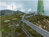
Grazer Stuhleck is a 1,635-meter-high peak located southwest of Stuhleck, the highest summit of the Fischbacher Alpen mountain group. Numerous wi...
2 h 15 min |
 | Pfaffensattel - Geiereck
Geiereck is a panoramic peak located northeast of the Roseggerhaus hut and southeast of the Geiereckalm alpine pasture....
2 h 30 min |
 | St. Vinzenz (St. Vinzenz) - Dreieckkogel
Dreieckkogel is a 1,528-meter-high peak in the Golica/Koralpe range, north of Sobota Lake/Stausee Soboth. At the summit there is a cairn with a s...
1 h 35 min |
 | Planinski dom Orlove stine - Svilaja (past Umac)
Svilaja is a 1509-meter grassy peak above Peručko Lake, north of the town of Sinj. The summit features a cross and a concrete pillar. From the to...
2 h |
 | Alpl (Zisleranger Weg) - Teufelstein
Teufelstein is a 1,498-meter-high mountain in the Fischbacher Alpen group. At the summit there is a cross with a summit logbook, and slightly bel...
2 h 20 min |
| Alpl (Waldschulle Alpl) - Teufelstein
Teufelstein is a 1,498-meter-high mountain in the Fischbacher Alpen group. At the summit there is a cross with a summit logbook, and slightly bel...
2 h 30 min |
 | Brandlucken - Plankogel
Plankogel is a 1531-meter-high mountain situated in the Almenland nature park. From the panoramic summit, where a cross stands, a beautiful view ...
2 h |
| Gasen - Plankogel (by learning trail)
Plankogel is a 1531-meter-high mountain situated in the Almenland nature park. From the panoramic summit, where a cross stands, a beautiful view ...
2 h 35 min |
 | Straßegg - Hochschlag
Hochschlag is a 1580-meter-high panoramic peak located in the Fischbacher Alpen mountain group. From the summit, where a cross and a summit regis...
1 h 45 min |
 | Niklasdorfgraben (parking lot Mugel) - Mugel
Mugel is a 1630 m high mountain on the Gleinalpe (Glinska planina) above the village of Niklasdorf in Styria.A cross stands on the summit, and th...
2 h |
 | Crossroads below Zvonik - Bitoraj
Bitoraj (also Veliki Bitoraj or Burni Bitoraj) is a 1,386-meter-high peak located south of the settlement Vrata. The peak is an HPO point. From t...
1 h 30 min |
 | Seebergsattel - Seeleiten
Seeleiten is a panoramic peak with a cross on the Aflenzer Staritzen ridge, which belongs to the Hochschwab mountain group....
1 h 30 min |
 | Kugina kuća - Šatorina
Šatorina is the highest peak in Central Velebit. A geodetic point is on the summit. The peak is a checkpoint for HPO and the Velebit Mountain Tra...
2 h 30 min |
 | Unternberg - Kampstein
Kampstein is a 1,467-meter-high mountain situated above the settlement of St. Corona am Wechsel. At the summit there is a cross and a few benches...
2 h |
 | St. Corona am Wechsel - Kampstein (past Kampsteiner Schwaig)
Kampstein is a 1,467-meter-high mountain situated above the settlement of St. Corona am Wechsel. At the summit there is a cross and a few benches...
2 h 5 min |