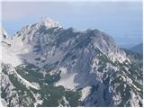
 | Dom v Dragi - Begunjščica (via Roblekov dom)
Begunjščica is a mountain range in the Karawanks east of Stol. Its highest peak is Veliki Vrh, which at over 2,000 m offers a fine view across ce...
4 h 20 min |
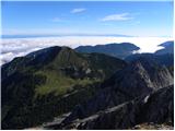 | Ljubelj - Hochstuhl/Stol (lower path)
Stol is, at 2,236 m, the highest peak in the Karawanks. From the summit, which has a registration box and stamp, a beautiful view opens onto the ...
4 h 50 min |
 | Tinčkova koča - Hochstuhl/Stol (via Smokuška planina)
Stol is, at 2,236 m, the highest peak in the Karawanks. From the summit, which has a registration box and stamp, a beautiful view opens onto the ...
4 h 15 min |
 | Dom Trilobit - Hochstuhl/Stol (via Rida (Medji dol))
Stol is, at 2,236 m, the highest peak in the Karawanks. From the summit, which has a registration box and stamp, a beautiful view opens onto the ...
4 h 30 min |
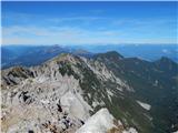 | Razpotje Vragovec - Hochstuhl/Stol (via Zabreška planina)
Stol is, at 2,236 m, the highest peak in the Karawanks. From the summit, which has a registration box and stamp, a beautiful view opens onto the ...
3 h |
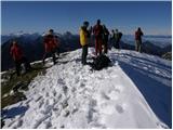 | Matizovec - Veliki vrh (Košuta)
Veliki Vrh, at 2,088 m, is the westernmost two-thousander in Slovenia's longest ridge, the Košuta. From the summit, which has a registration box ...
3 h 20 min |
| Globoka dolina - Veliki vrh (Košuta)
Veliki Vrh, at 2,088 m, is the westernmost two-thousander in Slovenia's longest ridge, the Košuta. From the summit, which has a registration box ...
3 h |
 | Podljubelj - Veliki vrh (Košuta) (via Matizovec)
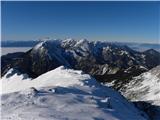
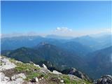
Veliki Vrh, at 2,088 m, is the westernmost two-thousander in Slovenia's longest ridge, the Košuta. From the summit, which has a registration box ...
4 h 15 min |
 | Povlje - Storžič (through southwest groove)
Storžič is a 2132 m high mountain located in the western part of the Kamnik-Savinja Alps. From the summit, where there is a cross, a beautiful vi...
4 h |
| Dom pod Storžičem - Storžič (through southwest groove)
Storžič is a 2132 m high mountain located in the western part of the Kamnik-Savinja Alps. From the summit, where there is a cross, a beautiful vi...
3 h 50 min |
 | Ravne - Črna prst (via Orožnova koča)
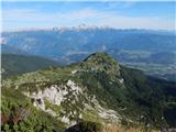
On the northern slope of the summit ridge of Črna prst, black soil is visible the feature after which the mountain is named. Črna prst is renown...
3 h 5 min |
 | Kocenpohar - Črna prst
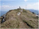
On the northern slope of the summit ridge of Črna prst, black soil is visible the feature after which the mountain is named. Črna prst is renown...
2 h 45 min |
| Ravne - Črna prst (via planina za Črno goro)
On the northern slope of the summit ridge of Črna prst, black soil is visible the feature after which the mountain is named. Črna prst is renown...
3 h 25 min |
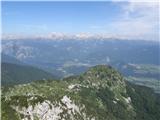 | Petrovo Brdo - Črna prst
On the northern slope of the summit ridge of Črna prst, black soil is visible the feature after which the mountain is named. Črna prst is renown...
4 h 40 min |
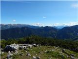 | Gozd - Tolsti vrh (steep path over Kriška gora)
Tolsti vrh, located west of Storžič, is at 1715 metres also the highest peak of the Kriška gora range, which rises steeply above central Gorenjsk...
2 h 45 min |
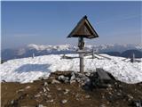 | Povlje - Tolsti vrh
Tolsti vrh, located west of Storžič, is at 1715 metres also the highest peak of the Kriška gora range, which rises steeply above central Gorenjsk...
2 h 45 min |
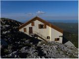 | Leskova dolina - Veliki Snežnik
Veliki Snežnik, at 1796 meters, is the highest peak in the nearby and distant surroundings, offering beautiful views over much of Slovenia and ne...
3 h 15 min |
 | Mašun - Veliki Snežnik
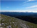
Veliki Snežnik, at 1796 meters, is the highest peak in the nearby and distant surroundings, offering beautiful views over much of Slovenia and ne...
4 h |
 | Brezje pri Tržiču - Dobrča (via koča na Dobrči)
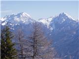
Dobrča is a 1634-metre mountain located between Begunje and Tržič. From the summit, which has a registration box with a stamp, the view opens onl...
3 h |
 | Zadnja vas - Dobrča
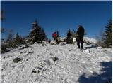
Dobrča is a 1634-metre mountain located between Begunje and Tržič. From the summit, which has a registration box with a stamp, the view opens onl...
3 h |
| Hudi Graben - Dobrča (via Koča na Dobrči)
Dobrča is a 1634-metre mountain located between Begunje and Tržič. From the summit, which has a registration box with a stamp, the view opens onl...
3 h |
 | Slatna - Dobrča
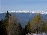
Dobrča is a 1634-metre mountain located between Begunje and Tržič. From the summit, which has a registration box with a stamp, the view opens onl...
3 h |
 | Begunje (Preska) - Dobrča
Dobrča is a 1634-metre mountain located between Begunje and Tržič. From the summit, which has a registration box with a stamp, the view opens onl...
3 h |
 | Brezje pri Tržiču - Dobrča (by road)
Dobrča is a 1634-metre mountain located between Begunje and Tržič. From the summit, which has a registration box with a stamp, the view opens onl...
2 h 45 min |
 | Radušnik - Velika Raduha
Velika Raduha, at an elevation of 2062 m, is the highest and westernmost peak in the Raduha ridge, a mountain range that rises steeply east of th...
3 h 10 min |
 | Planina Kosmačeve Rastke - Velika Raduha
Velika Raduha, at an elevation of 2062 m, is the highest and westernmost peak in the Raduha ridge, a mountain range that rises steeply east of th...
2 h 55 min |
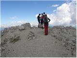 | Planina Kuhinja - Krn
Krn, at 2244 m, is the highest peak of the Krn mountain group, which rises steeply above the central part of the Soča River. From the summit, fea...
3 h 15 min |
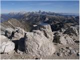 | Planina Kuhinja - Krn (via Krnska škrbina)
Krn, at 2244 m, is the highest peak of the Krn mountain group, which rises steeply above the central part of the Soča River. From the summit, fea...
3 h 30 min |
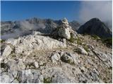 | Planina Blato - Mala Tičarica (via Štapce)
Mala Tičarica is a highly panoramic mountain above the Twin Triglav Lakes. From the summit there is a beautiful view toward the Koča pri Triglavs...
3 h 25 min |
| Tolminske Ravne - Tolminski Kuk (via Planina Kal)
Tolminski Kuk is the highest peak in the Bohinj-Tolmin mountains. The summit, equipped with a registration box, offers a very beautiful view. Fro...
4 h |
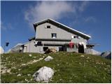 | Zadnjica - Pogačnikov dom na Kriških podih
The hut is located on the scenic ridge Griva on Kriški Podi above Trenta. The hut, open during the summer season, also has a large winter room. T...
4 h |
 | Zadnjica - Zasavska koča na Prehodavcih
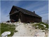
The Zasavska koča na Prehodavcih mountain hut is located on a panoramic rise above the Valley of the Triglav Lakes. From the hut, open in the sum...
4 h 15 min |
 | Dom Trilobit - Barentaler Kotschna/Struška
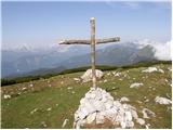
Struška is a smaller mountain range in the Karavanke ridge, located between Stol (specifically Belščica) and Golica. From Veliki vrh (1944 m), th...
3 h |
| Rute (Zavrh) / Bärental - Barentaler Kotschna/Struška (via Bärensattel)
Struška is a smaller mountain range in the Karavanke ridge, located between Stol (specifically Belščica) and Golica. From Veliki vrh (1944 m), th...
2 h 45 min |
 | Poče - Porezen (gentle path)
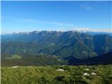
Porezen is a 1,630 m high mountain situated between Davča and Baška Grapa. From the summit, where a large Partisan monument stands, a beautiful v...
2 h 45 min |
 | Jesenica - Porezen
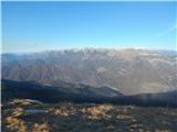
Porezen is a 1,630 m high mountain situated between Davča and Baška Grapa. From the summit, where a large Partisan monument stands, a beautiful v...
2 h 55 min |
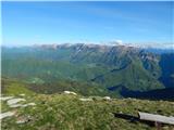 | Jesenica - Porezen (via Dom na Poreznu)
Porezen is a 1,630 m high mountain situated between Davča and Baška Grapa. From the summit, where a large Partisan monument stands, a beautiful v...
3 h |
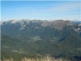 | Poče - Porezen (via Labinjske lehe)
Porezen is a 1,630 m high mountain situated between Davča and Baška Grapa. From the summit, where a large Partisan monument stands, a beautiful v...
3 h 15 min |
| Poče - Porezen (winter way)
Porezen is a 1,630 m high mountain situated between Davča and Baška Grapa. From the summit, where a large Partisan monument stands, a beautiful v...
3 h 25 min |
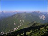 | Planina pod Golico (Betel) - Kahlkogel/Golica (via Suha saddle)
Golica is an unvegetated peak located north of Jesenice. From the summit, where a registration box is placed, there is a fine view of the western...
2 h 50 min |
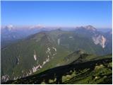 | Dom Pristava in Javorniški Rovt - Kahlkogel/Golica (mimo Koče na Golici)
Golica is an unvegetated peak located north of Jesenice. From the summit, where a registration box is placed, there is a fine view of the western...
2 h 55 min |
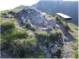 | MHE Zabukovec - Bašeljski vrh
Bašeljski vrh is a 1744-meter-high mountain located between Mali Grintovec and Storžič. From the summit, where there is a bench and a registratio...
3 h 10 min |
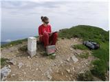 | Dovje - Frauenkogel/Dovška Baba
Dovška Baba is a 1891-meter-high peak located on the border ridge between Slovenia and Austria. From the summit, which has a registration box and...
3 h |
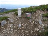 | Erjavčev rovt - Frauenkogel/Dovška Baba (via Brvog)
Dovška Baba is a 1891-meter-high peak located on the border ridge between Slovenia and Austria. From the summit, which has a registration box and...
2 h 45 min |
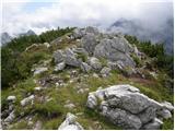 | Ljubelj - Srednji vrh (above Završnica) (via source of Završnica)
Srednji vrh is a panoramic mountain covered in dwarf pine, located between Stol, Vrtača and Begunjščica. From the summit, which drops steeply to ...
2 h 40 min |
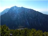 | Ljubelj - Srednji vrh (above Završnica) (on a slope of Vrtača)
Srednji vrh is a panoramic mountain covered in dwarf pine, located between Stol, Vrtača and Begunjščica. From the summit, which drops steeply to ...
2 h 40 min |
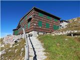 | Razpotje Vragovec - Prešernova koča na Stolu (via Zabreška planina)
The Prešernova koča na Stolu mountain hut is located just a few metres below the summit of the 2198 m high Mali Stol. From the hut or the nearby ...
2 h 45 min |
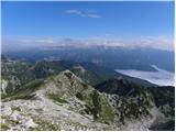 | Javorje - Rodica (marked way)
The mountain Rodica is located above Bohinj in the Lower Bohinj Mountains. From the summit there is a beautiful view over the Julian Alps and the...
2 h 45 min |
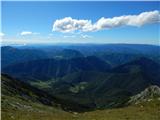 | Grant - Rodica
The mountain Rodica is located above Bohinj in the Lower Bohinj Mountains. From the summit there is a beautiful view over the Julian Alps and the...
3 h 30 min |
| Stržišče - Rodica
The mountain Rodica is located above Bohinj in the Lower Bohinj Mountains. From the summit there is a beautiful view over the Julian Alps and the...
4 h 15 min |
 | Markova raven - Vrh Korena (marked way)
Vrh Korena is located between Zvoh and Kalški greben near the Krvavec ski resort. The summit offers a beautiful view of the highest peaks in the ...
3 h 15 min |
 | Markova raven - Kalški greben (on marked path)
Kalški greben is a 2224 m high peak and the highest point of the ridge bearing the same name. From the summit, where there is a summit register a...
4 h 30 min |
 | Markova raven - Kompotela (marked way)
Kompotela is a peak near Mokrica and Vrh Korena. The grass- and dwarf pine-covered summit offers a beautiful view towards Grintovec, Skuta, Brana...
3 h |
 | Markova raven - Mokrica (marked way)
Mokrica is a panoramic peak east of Kompotela. The summit, partially covered with dwarf pines, has a summit logbook....
3 h 30 min |
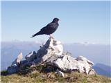 | Mojstrana - Sleme
The mountain is located between Mojstrana and Kukova špica. The summit is grassy and offers a very beautiful view towards Kukova špica. There is ...
4 h 15 min |
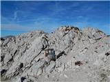 | Laško (obračališče nad vasjo) - Mali Grintovec (via Bašeljski vrh)
Mali Grintovec is a panoramic mountain located east of Storžič. From the summit, which has a summit register box, stamp, and a pleasant bench, th...
3 h 20 min |
| Jekarica - Mali Grintovec
Mali Grintovec is a panoramic mountain located east of Storžič. From the summit, which has a summit register box, stamp, and a pleasant bench, th...
2 h 55 min |
| MHE Zabukovec - Mali Grintovec
Mali Grintovec is a panoramic mountain located east of Storžič. From the summit, which has a summit register box, stamp, and a pleasant bench, th...
3 h 55 min |
| Laško (obračališče nad vasjo) - Mali Grintovec (via Dom na Kališču)
Mali Grintovec is a panoramic mountain located east of Storžič. From the summit, which has a summit register box, stamp, and a pleasant bench, th...
3 h 10 min |
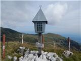 | Rosenbach - Rosenkogel/Hruški vrh
Hruški vrh is a 1776-metre-high mountain located between Dovška Baba and the lesser-known Klek. From the summit, where there is a small chapel de...
3 h 50 min |
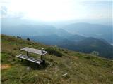 | Rosenbach - Rosenkogel/Hruški vrh (via Koprivnjak)
Hruški vrh is a 1776-metre-high mountain located between Dovška Baba and the lesser-known Klek. From the summit, where there is a small chapel de...
4 h |
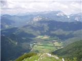 | Velacher Kotschna/Belska Kočna - Goli vrh
Goli vrh is a 1787 m high mountain situated between the Ravenska Kočna and Belska Kočna valleys. From the bare summit, which has a registration b...
2 h 45 min |
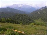 | Baumgartnerhof - Kresišče
Kresišče is an 1839 m high peak in the main ridge of the Karawanks, specifically between Kepa and Trupejevo poldne. From the summit, where a wood...
3 h |
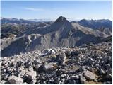 | Planina Kuhinja - Batognica (via jezero v Lužnici)
Batognica is a 2164 m high mountain that was the site of the so-called mine warfare during World War I. Remnants of the fighting between Italian ...
4 h |
| Krn - Batognica (via planina Sleme)
Batognica is a 2164 m high mountain that was the site of the so-called mine warfare during World War I. Remnants of the fighting between Italian ...
4 h 40 min |
 | Zavrzelno - Čukla
Čukla is located above the Bovec Basin on the slopes of Rombon. From the summit, where there is a pyramid (monument commemorating the capture of ...
3 h |
 | Koča pri izviru Soče - Vršič vrh
Vršič is a 1,737-metre-high mountain situated between the Poštarski dom hut and the Vršič pass. From the summit, where there is a registration bo...
2 h 40 min |
 | Koča pri izviru Soče - Sovna glava
Sovna Glava is a 1750-meter-high grassy peak situated between Prisank and the Vršič Pass. From the summit, there is a nice view of the peaks risi...
2 h 40 min |
 | Mojstrana - Vrtaški vrh
Vrtaški Vrh is a panoramic mountain above Vrata Valley. From the grassy peak, surrounded by dwarf pines, there is a nice view toward the neighbor...
3 h 40 min |
 | Baumgartnerhof - Mallestiger Mittagskogel
Ostra peč, known in German as Mallestiger Mittagskogel, is an 1801 m high mountain located on the northern side of the main Karawanks ridge. From...
3 h 15 min |
 | Dom Trilobit - Potoški Stol (via Rida)
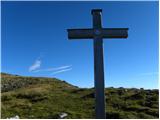
Potoški Stol is located between Stol and Vajnež on the border with Austria. A cross stands just a few metres below the grassy summit. The finest ...
4 h |
 | Javorje (Mala Črna) - Smrekovec (via Bukov stan)
Smrekovec is a mountain of volcanic origin on the eastern edge of the Smrekovec mountain range. The wide grassy summit features a pyramid with a ...
3 h 15 min |
| Javorje (Mala Črna) - Smrekovec (by road)
Smrekovec is a mountain of volcanic origin on the eastern edge of the Smrekovec mountain range. The wide grassy summit features a pyramid with a ...
3 h 15 min |
 | Valley of stream Žep - Veliki Travnik (Turnovka)
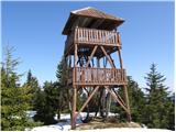
Veliki Travnik, also known as Turnovka by the locals, is located on the western edge of the Smrekovec mountain range. From the summit, which has ...
2 h 45 min |
 | Bistra - Veliki Travnik (Turnovka)
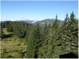
Veliki Travnik, also known as Turnovka by the locals, is located on the western edge of the Smrekovec mountain range. From the summit, which has ...
3 h 45 min |
 | Robanov kot - Strelovec
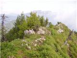
This scenic peak is situated between two Alpine valleys: Logarska dolina and Robanov kot. The view from the summit is most beautiful towards the ...
3 h |
 | Kurnikovo sedlo - Hochobir (Ojstrc) (footpath)
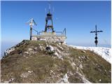
Ojstrc (Hochobir) is the highest peak of the smaller Obir range. It is located west of Železna Kapla (Eisenkappel) on the Austrian side of the Ka...
3 h 5 min |
| Zell-Schaida - Hochobir (Ojstrc)
Ojstrc (Hochobir) is the highest peak of the smaller Obir range. It is located west of Železna Kapla (Eisenkappel) on the Austrian side of the Ka...
3 h |
 | Tolminske Ravne - Vogel (on mule track)
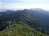
Many associate the name Vogel first with the Vogel ski resort near the eponymous peak. From the north, it is recognizable by its pyramidal shape,...
3 h 30 min |
| Tolminske Ravne - Vogel (on mule track and over Globoko)
Many associate the name Vogel first with the Vogel ski resort near the eponymous peak. From the north, it is recognizable by its pyramidal shape,...
4 h 15 min |
 | Poštarski dom pod Plešivcem - Uršlja gora (Plešivec) (via Kal)
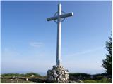
Uršlja gora, or Plešivec, is a panoramic mountain between Slovenj Gradec and Črna na Koroškem. At or just below the summit stands the Church of S...
2 h 45 min |
 | Ivarčko jezero - Uršlja gora (Plešivec) (Železarska pot)
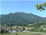
Uršlja gora, or Plešivec, is a panoramic mountain between Slovenj Gradec and Črna na Koroškem. At or just below the summit stands the Church of S...
2 h 45 min |
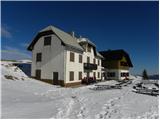 | Ivarčko jezero - Uršlja gora (Plešivec) (via Kozji hrbet)
Uršlja gora, or Plešivec, is a panoramic mountain between Slovenj Gradec and Črna na Koroškem. At or just below the summit stands the Church of S...
3 h |
 | Sveti Danijel (Zgornji Razbor) - Uršlja gora (Plešivec)
Uršlja gora, or Plešivec, is a panoramic mountain between Slovenj Gradec and Črna na Koroškem. At or just below the summit stands the Church of S...
3 h 15 min |
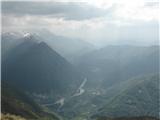 | Učja - Monte Guarda/Skutnik
Skutnik is a peak situated north of the Učja River on the border with Italy. From the top, there is a beautiful view of the Kanin mountain group,...
3 h 45 min |
 | Drežniške Ravne - Krasji vrh (via snežna jama)
Krasji vrh is situated between Bovec and Kobarid on the Polovnik mountain ridge. At 1773 m it is also the highest peak of the mentioned ridge, so...
3 h |
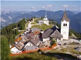 | Zajzera - Svete Višarje / Monte Lussari (by road)
Svete Višarje / Monte Lussari is a pilgrimage site for Slavs, Germans, and Romance peoples. Already in the 16th century, the mountain was called ...
3 h |
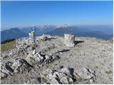 | Podpeca (Mitnek) - Petzen (Kordeschkopf) (Peca (Kordeževa glava)) (easy path)
Kordeževa glava, better known as Peca, is the highest peak of the Peca range. It is located on the border with Austria above the Mežiška dolina v...
4 h 15 min |
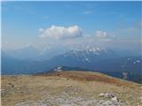 | Koča na Pikovem - Petzen (Kordeschkopf) (Peca (Kordeževa glava)) (via saddle Vrh šteng and on easy path)
Kordeževa glava, better known as Peca, is the highest peak of the Peca range. It is located on the border with Austria above the Mežiška dolina v...
4 h 15 min |
| Topla (Burjak) - Petzen (Kordeschkopf) (Peca (Kordeževa glava)) (via Mala Peca and on easy path)
Kordeževa glava, better known as Peca, is the highest peak of the Peca range. It is located on the border with Austria above the Mežiška dolina v...
4 h |
 | Podpeca (Helenski potok) - Mala Peca (via Mirjanca)
Mala Peca is the peak above the Dom na Peci mountain hut on its eastern slopes. From the summit, where a panoramic sign stands, there is a nice v...
3 h 20 min |
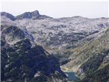 | Dom v Lepeni - Velika Baba
Velika Baba is the highest peak of the eastern ridge above Lepena valley. From the summit, which has a logbook, there are fine views of Krn and L...
4 h |
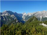 | Jasna - Ciprnik (via Mojčin dom)
A hidden yet scenic peak above the Kranjska Gora ski slopes. To the east are the Martuljek Mountains; on the other side, Jalovec, Ponce, and Mojs...
3 h |
| Kranjska Gora - Ciprnik (via Bedančev dom)
A hidden yet scenic peak above the Kranjska Gora ski slopes. To the east are the Martuljek Mountains; on the other side, Jalovec, Ponce, and Mojs...
2 h 55 min |
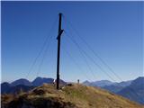 | Deutcher Peter / Dajčpeter - Ferlacher Horn / Grlovec
Grlovec/Ferlacher Horn is a panoramic mountain on which a large cross stands. From the top, there is a beautiful view of the Karawanks, parts of ...
3 h |
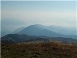 | Livek - Monte Mataiur/Matajur (stara pot)
Matajur is a panoramic mountain located on the border between Slovenia and Italy. From the summit there is a beautiful view of Kobariški or Bregi...
3 h |
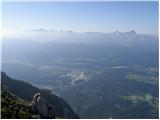 | Hermsberg - Dobratsch / Dobrač
Dobrač, or in German Dobratsch and also known as Villacher Alpen, is a 2166-meter-high mountain situated on the far eastern edge of the Gailtal A...
4 h |
| Bleiberg Kreuth (Wurzach) - Dobratsch / Dobrač
Dobrač, or in German Dobratsch and also known as Villacher Alpen, is a 2166-meter-high mountain situated on the far eastern edge of the Gailtal A...
4 h |
 | Zadnja vas - Šentanski vrh
Šentanski vrh, located in the Dobrča range just five minutes from the main peak, offers a nice view of the central Karawanks, the Storžič group, ...
3 h 5 min |
| Hudi Graben - Šentanski vrh (via Koča na Dobrči)
Šentanski vrh, located in the Dobrča range just five minutes from the main peak, offers a nice view of the central Karawanks, the Storžič group, ...
3 h 5 min |
| Slatna - Šentanski vrh
Šentanski vrh, located in the Dobrča range just five minutes from the main peak, offers a nice view of the central Karawanks, the Storžič group, ...
3 h 5 min |
 | Begunje (Preska) - Šentanski vrh
Šentanski vrh, located in the Dobrča range just five minutes from the main peak, offers a nice view of the central Karawanks, the Storžič group, ...
3 h 5 min |
| Brezje pri Tržiču - Šentanski vrh (by road)
Šentanski vrh, located in the Dobrča range just five minutes from the main peak, offers a nice view of the central Karawanks, the Storžič group, ...
2 h 50 min |
 | Brezje pri Tržiču - Šentanski vrh (on path Po robu and via Lešanska planina)
Šentanski vrh, located in the Dobrča range just five minutes from the main peak, offers a nice view of the central Karawanks, the Storžič group, ...
2 h 40 min |
 | Windische Hohe - Kobesnock
Kobesnock is a lesser-known peak west of the massive Dobrač range. From its summit, which features a cross, there are fine views of Dobrač, the l...
2 h 45 min |
 | Weissensee - Latschur (via Almspitz)
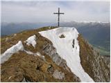
Latschur (2,236 m) is the highest peak in the eponymous mountain group. From the summit, which features a cross and a summit logbook box, there i...
4 h 15 min |
 | Weissensee - Almspitz (via Techendorfer Alm)
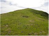
Almspitz (2,180 m) is a peak in the Latschur group. From its grassy summit, there are beautiful views of the Gailtal Alps, Carnic Alps, Julian Al...
4 h |
 | Libinjska kosa - Sveto brdo
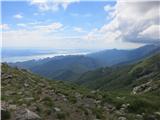
Sveto brdo (1,752 m) is the second-highest peak of Velebit. Located in the southeastern part of the range, it offers beautiful views of Velebit i...
3 h 20 min |
 | Goldberg - Jaukenstöckl
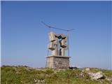
Jaukenstöckl is a 2209 m high peak on the western side of the panoramic Jauken ridge. From the summit, where a statue of the Virgin Mary stands, ...
3 h 45 min |
 | Goldberg - Jaukenhöhe
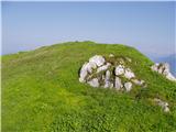
Jaukenhöhe is a little-visited peak in the Jauken ridge. It lies west of Torkofel, the highest point in the ridge at 2276 m. The grassy, steep su...
3 h 45 min |
 | Dom v Lepeni - Mali Šmohor
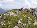
Mali Šmohor is a panoramic peak located southeast of Krnsko Jezero lake. From the summit, which has a logbook, there are nice views of nearby pea...
4 h |
 | Rosenbach - Kleiner Frauenkogel/Koprivnjak
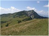
Koprivnjak (Mala Dovška Baba) is a 1754 m high peak on the Austrian side of the Karawanks. From the summit, where a cross and summit logbook stan...
3 h 30 min |
 | Cave del Predil - Šober / Monte Sciober Grande
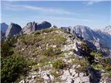
Šober / Monte Sciober Grande is a 1,845 m high peak located between the Remšendol Valley and Jezerska Valley. From the summit there is a fine vie...
2 h 45 min |
 | Rudenska grapa - Gladki vrh (Ratitovec)
Gladki vrh (Ratitovec), at 1,667 meters, is the most visited peak in the Ratitovec range. From its bare summit, which features a panorama board, ...
4 h |
 | Koča pri Savici - Kser
Kser is a less prominent peak in the ridge of the Spodnje Bohinjske gore, more precisely between Tolminski Kuk and Mahavšček. From the summit, wh...
4 h 30 min |
 | Montemaggiore - Punta di Montemaggiore
Breški Jalovec, or Punta di Montemaggiore in Italian, is a 1613-meter-high mountain located above the source of the Nadiža River, specifically on...
3 h |
 | Passo Tanamea - Punta di Montemaggiore
Breški Jalovec, or Punta di Montemaggiore in Italian, is a 1613-meter-high mountain located above the source of the Nadiža River, specifically on...
3 h 30 min |
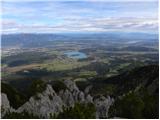 | Baumgartnerhof - Maloško poldne / Mallestiger Mittagskogel
Maloško poldne, or Mallestiger Mittagskogel in German, is a 1,823-meter-high peak on the border between Slovenia and Austria, precisely between T...
2 h 45 min |
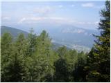 | Susalitch - Zajčnik
Zajčnik (also Blekova) is a 1746-meter-high peak situated northeast of Vošca. From the partly vegetated summit, which borders Slovenia and Austri...
3 h 35 min |
| Korpitch - Zajčnik
Zajčnik (also Blekova) is a 1746-meter-high peak situated northeast of Vošca. From the partly vegetated summit, which borders Slovenia and Austri...
3 h 35 min |
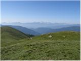 | Bad Kleinkirchheim - Wöllaner Nock
Wöllaner Nock is a 2145 m high peak located south of the ski area and the settlement Bad Kleinkirchheim. From the spacious summit, where a larger...
3 h 45 min |
| Bad Kleinkirchheim - Wöllaner Nock (by road)
Wöllaner Nock is a 2145 m high peak located south of the ski area and the settlement Bad Kleinkirchheim. From the spacious summit, where a larger...
4 h 15 min |
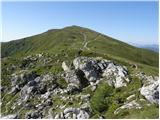 | Bad Kleinkirchheim - Kaiseburg
Kaiseburg is a panoramic peak located directly above the Bad Kleinkirchheim ski area. From the summit, where a cross stands, a beautiful view ope...
3 h 25 min |
 | Bad Kleinkirchheim - Kaiseburg (by road)
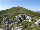
Kaiseburg is a panoramic peak located directly above the Bad Kleinkirchheim ski area. From the summit, where a cross stands, a beautiful view ope...
3 h 55 min |
 | Tolminske Ravne - Tolminski Migovec
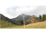
Tolminski Migovec is a 1881 m high mountain. Its western slope above the Tolminka valley is the steepest and most scenic. The southern slope is i...
2 h 45 min |
 | Parking Alpspitzbahn - Osterfelderkopf
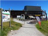
Osterfelderkopf is a 2033-meter-high peak in the Wetterstein mountain group. The peak is very well visited as it can be reached by the Alpitzbahn...
4 h 15 min |
 | Drežniške Ravne - Lopatnik
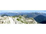
Lopatnik is an easily accessible two-thousander above the Zapleč pasture. Its diadem-shaped summit rises between the Vrata saddle and the Krnčica...
3 h |
 | Podrožca / Rosenbach - Kamnica (Komnica) / Ferlacher Spitze
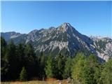
Kamnica is a panoramic mountain on the Austrian side of the Karawanks, more precisely north of Kepa. From the summit, which has a cross, summit r...
3 h 55 min |
| Čemernica / Tschemernitzen - Kamnica (Komnica) / Ferlacher Spitze
Kamnica is a panoramic mountain on the Austrian side of the Karawanks, more precisely north of Kepa. From the summit, which has a cross, summit r...
3 h 40 min |
 | Bottom cable car station Patscherkofelbahn - Patscherkofel (path 350 via Lanser Alm and Zirbenweg)
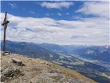
Patscherkofel is a broad and panoramic mountain rising above Innsbruck, the capital of the Austrian state of Tyrol. It is one of the most popular...
4 h |
 | Losenheim (Parkplatz am Schneeberg) - Klosterwappen (Schneeberg) (via Schauerstein)
Schneeberg, with its peaks Kaiserstein (2061 m) and Klosterwappen (2076 m), is the easternmost and at the same time the northernmost two-thousand...
4 h 15 min |
 | Losenheim (Parkplatz am Schneeberg) - Klosterwappen (Schneeberg) (past Witzanikreuz)
Schneeberg, with its peaks Kaiserstein (2061 m) and Klosterwappen (2076 m), is the easternmost and at the same time the northernmost two-thousand...
4 h 35 min |
 | Planina Zajzera - Krniška glavica / Jof di Sompdogna (path 639 and 652)
Krniška glavica (Jof di Sompdogna) is a 1,889-meter-high peak in the Western Julian Alps, north of Montaž. A cross stands on the panoramic summit...
3 h 10 min |
 | Pass Lius above Ligosullo - Tersadia (from Ligosullo)
Tersadia is a mountain in the heart of the Carnic Alps, just far enough from its higher neighbors to serve as an excellent vantage point, especia...
3 h |
 | Mariensee - Niederwechsel (red trail)
Niederwechsel is a panoramic peak in the Wechsel massif. From the summit, fine views extend far in all directions, since there are no higher peak...
3 h 15 min |
 | Rettenegg - Grazer Stuhleck (past Roseggerhaus)
Grazer Stuhleck is a 1,635-meter-high peak located southwest of Stuhleck, the highest summit of the Fischbacher Alpen mountain group. Numerous wi...
2 h 40 min |
| Rettenegg - Grazer Stuhleck (via Schwarzriegel)
Grazer Stuhleck is a 1,635-meter-high peak located southwest of Stuhleck, the highest summit of the Fischbacher Alpen mountain group. Numerous wi...
2 h 40 min |
 | Rettenegg - Geiereck (via Schwarzriegel)
Geiereck is a panoramic peak located northeast of the Roseggerhaus hut and southeast of the Geiereckalm alpine pasture....
2 h 55 min |
 | Rettenegg - Peter-Bergner-Warte (Pretul) (via Schwarzriegel)
The Peter-Bergner-Warte viewpoint is located on the 1,656-meter-high Pretul summit above the settlement of Rettenegg....
3 h 5 min |
 | Rettenegg - Amundsenhöhe (via Schwarzriegel)
Amundsenhöhe is a 1,666-meter-high panoramic peak in the Fischbacher Alpen mountain group. From the summit there is a nice view of the hill count...
3 h 20 min |
 | Hirschegg - Hirschegger Alm (southern peak) (via Saureishütte)
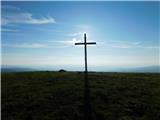
The southern peak in the Hirschegger Alm ridge is located west of the settlement of Hirschegg. From the summit, where a cross stands, a beautiful...
3 h 5 min |
 | Hirschegg - Hirschegger Alm (southern peak) (via Bernsteinhütte)
The southern peak in the Hirschegger Alm ridge is located west of the settlement of Hirschegg. From the summit, where a cross stands, a beautiful...
3 h |
 | Hirschegg - Hirschegger Alm (northern peak) (via Seinerkreuz)
Hirschegger Alm (northern peak) is a 1,871-meter-high peak in the Packalpe mountain group. From the grassy summit, a beautiful view opens up all ...
3 h |
| Hirschegg - Hirschegger Alm (northern peak) (via Bernsteinhütte)
Hirschegger Alm (northern peak) is a 1,871-meter-high peak in the Packalpe mountain group. From the grassy summit, a beautiful view opens up all ...
3 h 50 min |
 | Reichenfels (bridge over Labotnica / Lavant) - Peterer Riegel (via Höllgraben)
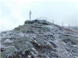
Peterer Riegel is a panoramic peak above the Peterer Sattel saddle. From the summit, where a cross stands and a bench sits below it, a beautiful ...
4 h 35 min |
 | Oberort - Messnerin
Messnerin is a 1,835-meter-high mountain in the Hochschwab group. From the panoramic summit, featuring a metal cross and a summit register box, t...
2 h 45 min |
| Oberort (parking lot Grüner See) - Messnerin (Kamplsteig)
Messnerin is a 1,835-meter-high mountain in the Hochschwab group. From the panoramic summit, featuring a metal cross and a summit register box, t...
3 h 30 min |
 | Losenheim (Parkplatz am Schneeberg) - Kaiserstein (Schneeberg) (via Schauerstein)
Kaiserstein is a 2061-meter-high peak in the Schneeberg mountain range. Due to its location, it is the northernmost and also easternmost two-thou...
4 h 3 min |
 | Unternberg - Arabichl (via Kampstein)
Arabichl is a panoramic peak situated above the eponymous ski lift. From the summit, a splendid view opens up of the Wechsel group, Stuhleck, and...
3 h 45 min |
| St. Corona am Wechsel - Arabichl
Arabichl is a panoramic peak situated above the eponymous ski lift. From the summit, a splendid view opens up of the Wechsel group, Stuhleck, and...
3 h 15 min |
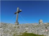 | Niederalpl Ort - Hohe Veitsch (via Sohlenalm)
Hohe Veitsch is the highest peak of the Veitsch mountain range, located in the eastern part of the Northern Limestone Alps. From the summit, a be...
3 h 40 min |
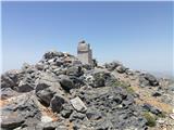 | Agion Pneuma (Avrakondes) - Spathi (Crete)
Spathi (Gr. Σπαθί) is at 2,148 m the highest mountain of the Dikti massif (Gr. Δικτή) on the Greek island of Crete. Among Crete's three massifs w...
4 h |
 | Ljubunčić - Velika Golija (Veliki vrh)
Velika Golija, or Veliki vrh, is the highest peak of Golija, a smaller range between Livanjsko and Glamočko poljes, near the town of Livno. The s...
3 h 30 min |
 | Aflenz Kurort (Bürgergraben) - Hochstein (at Mitteralm)
Hochstein is a scenic summit with a cross and summit register box in the Hochschwab mountain group, between Windgrube peak and the Mitteralm plat...
3 h 20 min |
 | Ferienheim - Leobner Mauer
Leobner Mauer is a 1,870-meter peak located west to southwest of the higher and better-known Hochturm peak. From the summit, there is a fine view...
3 h 10 min |
 | Kapellen - Windberg (northern path)
Windberg is a 1903-meter-high peak in the Schneealpe mountain group and, with its elevation, the highest peak of the group. From the summit, wher...
3 h 55 min |
| Kapellen - Windberg (southern path)
Windberg is a 1903-meter-high peak in the Schneealpe mountain group and, with its elevation, the highest peak of the group. From the summit, wher...
3 h 55 min |
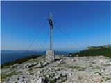 | Preiner Gscheid - Jakobskogel (Rax) (Göbl-Kühn-Steig)
Jakobskogel is a 1,737-meter-high peak in the Rax mountain group, located above the Ottohaus hut. From the summit, where a cross stands, beautifu...
3 h 40 min |
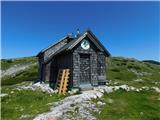 | Preiner Gscheid - Raxgmoahütte (Rax) (via Karl-Ludwig-Haus, Schlangenweg)
Raxgmoahütte is a hut owned by the Austrian mountain rescue service, open year-round as a bivouac or shelter. From the hut on top of a panoramic ...
3 h 5 min |
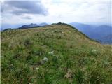 | Passo Tanamea - Lanževica / Punta Lausciovizza
Lanževica (Italian Punta Lausciovizza) is a 1625-meter-high, less prominent peak with a cairn on top. It lies on the Italian section of the longe...
2 h 50 min |