 | Dvor - Polhograjska Grmada (Dvor - Grmada - Belica)
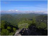
Polhograjska Grmada is an 898 m high peak located in the heart of the Polhograjski Dolomites. From the summit, where there is a registration box ...
2 h 10 min |
 | Dvor - Polhograjska Grmada (via Mala Grmada)
Polhograjska Grmada is an 898 m high peak located in the heart of the Polhograjski Dolomites. From the summit, where there is a registration box ...
1 h 45 min |
 | Preval - Polhograjska Grmada
Polhograjska Grmada is an 898 m high peak located in the heart of the Polhograjski Dolomites. From the summit, where there is a registration box ...
2 h 45 min |
 | Gabrje - Polhograjska Grmada
Polhograjska Grmada is an 898 m high peak located in the heart of the Polhograjski Dolomites. From the summit, where there is a registration box ...
2 h 20 min |
 | Dvor - Polhograjska Grmada
Polhograjska Grmada is an 898 m high peak located in the heart of the Polhograjski Dolomites. From the summit, where there is a registration box ...
1 h 45 min |
 | Polhov Gradec - Tošč (via Grmada)
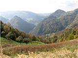
Tošč, which became the highest peak of the Polhov Gradec Hills decades ago when the Yugoslav army lowered Pasja ravan by 9 metres, is located nor...
2 h 30 min |
 | Polhov Gradec - Tošč (via Mačkov graben)
Tošč, which became the highest peak of the Polhov Gradec Hills decades ago when the Yugoslav army lowered Pasja ravan by 9 metres, is located nor...
1 h 50 min |
 | Petačev graben - Tošč (via Sveta Jedert)
Tošč, which became the highest peak of the Polhov Gradec Hills decades ago when the Yugoslav army lowered Pasja ravan by 9 metres, is located nor...
1 h 50 min |
 | Škofja Loka (Vincarje) - Lubnik (ridge path)
Lubnik is a 1025 m high mountain that rises steeply west of Škofja Loka. From the summit, where a mountain hut stands, there is a beautiful view ...
2 h 15 min |
 | Škofja Loka - Lubnik (via Stari grad)
Lubnik is a 1025 m high mountain that rises steeply west of Škofja Loka. From the summit, where a mountain hut stands, there is a beautiful view ...
2 h 15 min |
| Škofja Loka - Lubnik (via Luža)
Lubnik is a 1025 m high mountain that rises steeply west of Škofja Loka. From the summit, where a mountain hut stands, there is a beautiful view ...
2 h |
 | Praprotno - Lubnik
Lubnik is a 1025 m high mountain that rises steeply west of Škofja Loka. From the summit, where a mountain hut stands, there is a beautiful view ...
2 h 15 min |
 | Pirman - Kurešček
Kurešček is an 826 m high peak located south of Ig and southwest of Želimlje. From the summit, where a church stands, there is no view due to the...
1 h 45 min |
| Želimlje - Kurešček
Kurešček is an 826 m high peak located south of Ig and southwest of Želimlje. From the summit, where a church stands, there is no view due to the...
1 h 50 min |
 | Preserje - Krim
Krim is a 1,107-metre-high mountain rising south of the Ljubljana Marsh. From the summit, where a mountain hut and several transmitters stand, th...
2 h 20 min |
 | Strahomer - Krim (via Strmec)
Krim is a 1,107-metre-high mountain rising south of the Ljubljana Marsh. From the summit, where a mountain hut and several transmitters stand, th...
2 h 10 min |
| Strahomer - Krim (via Kramarca)
Krim is a 1,107-metre-high mountain rising south of the Ljubljana Marsh. From the summit, where a mountain hut and several transmitters stand, th...
2 h 10 min |
 | Dom v Iškem Vintgarju - Krim
Krim is a 1,107-metre-high mountain rising south of the Ljubljana Marsh. From the summit, where a mountain hut and several transmitters stand, th...
2 h 15 min |
 | Vrbljene - Krim
Krim is a 1,107-metre-high mountain rising south of the Ljubljana Marsh. From the summit, where a mountain hut and several transmitters stand, th...
2 h 15 min |
| Tomišelj - Krim
Krim is a 1,107-metre-high mountain rising south of the Ljubljana Marsh. From the summit, where a mountain hut and several transmitters stand, th...
2 h 15 min |
| Jezero - Krim (via homestead Špelin)
Krim is a 1,107-metre-high mountain rising south of the Ljubljana Marsh. From the summit, where a mountain hut and several transmitters stand, th...
2 h 20 min |
 | Dolenja Brezovica - Krim
Krim is a 1,107-metre-high mountain rising south of the Ljubljana Marsh. From the summit, where a mountain hut and several transmitters stand, th...
2 h 10 min |
 | Iška - Krim
Krim is a 1,107-metre-high mountain rising south of the Ljubljana Marsh. From the summit, where a mountain hut and several transmitters stand, th...
2 h 10 min |
 | Zgornja Besnica (Podrovnik) - Sveti Jošt above Kranj (via Gaber)
Sveti Jošt above Kranj is a hill located west of the slightly lower Šmarjetna gora. From the summit, where the Church of St Jošt stands alongside...
2 h 30 min |
 | Sora - Osolnik (by road)
Osolnik is an 858-metre-high mountain located south of Škofja Loka and west of Medvode. From the summit, where the Church of St Mohor and Fortuna...
1 h 40 min |
 | Sora - Osolnik (via Hom)
Osolnik is an 858-metre-high mountain located south of Škofja Loka and west of Medvode. From the summit, where the Church of St Mohor and Fortuna...
1 h 50 min |
 | Puštal - Osolnik
Osolnik is an 858-metre-high mountain located south of Škofja Loka and west of Medvode. From the summit, where the Church of St Mohor and Fortuna...
2 h 15 min |
 | Sora - Osolnik (on footpath)
Osolnik is an 858-metre-high mountain located south of Škofja Loka and west of Medvode. From the summit, where the Church of St Mohor and Fortuna...
1 h 35 min |
| Puštal (Na Dobravi) - Osolnik
Osolnik is an 858-metre-high mountain located south of Škofja Loka and west of Medvode. From the summit, where the Church of St Mohor and Fortuna...
2 h |
 | Briše - Polhograjska Gora (Sveti Lovrenc) (gentle path)
Polhograjska Gora, also known simply as Gora or Sveti Lovrenc, is an 824 m high hill northwest of Polhov Gradec. The summit, topped by the Church...
1 h 35 min |
 | Loke - Krvavica (via Zajčeva koča)
Krvavica is a 909-metre-high peak located east of Čemšeniška planina. From the summit, which drops steeply on all sides, there is a beautiful vie...
2 h 10 min |
 | Vrčice - Mirna gora (via Škrilj)
Mirna gora is a 1047 m high, forested peak located on the southeastern edge of Kočevski rog. From the summit, which has a summit register and sta...
2 h 10 min |
| Vrčice - Mirna gora (via Planina)
Mirna gora is a 1047 m high, forested peak located on the southeastern edge of Kočevski rog. From the summit, which has a summit register and sta...
2 h 10 min |
 | Hotovlja - Pasja ravan
Pasja ravan is the second-highest peak in the Polhograjsko hribovje. A few decades ago, at 1029 meters, it was the highest, but in the second hal...
1 h 45 min |
 | Selski most - Babji zob (via Kupljenik)
Babji zob is a viewpoint above the village of Kupljenik near Bled. The precipitous peak, which has a registration box, offers a beautiful view of...
2 h 40 min |
 | Puštal (Na Dobravi) - Sveti Ožbolt (above Zminec)
Sveti Ožbolt is situated on a panoramic rise in the north of the Polhograjski Dolomiti. There is a beautiful view toward the Škofjeloško hribovje...
2 h 15 min |
 | Rakovica - Archangel Gabriel (Planica)
Planica is an 824-meter-high peak located north of Škofja Loka, more precisely between Križna gora and Planica. From the summit, where the church...
2 h 30 min |
 | Škofja Loka - Archangel Gabriel (Planica)
Planica is an 824-meter-high peak located north of Škofja Loka, more precisely between Križna gora and Planica. From the summit, where the church...
2 h 5 min |
 | Žiri - Vrh Svetih Treh Kraljev
The Church of the Holy Three Kings stands on a panoramic hill above the village of Vrh Svetih Treh Kraljev. The summit features a panorama board ...
2 h 30 min |
 | Marija Reka (Strgar) - Mrzlica (permanently closed path)
In recent years, Mrzlica has become an extremely popular excursion spot, especially for visitors from Savinjska valley and Zasavje. At 1,122 mete...
2 h 30 min |
 | Matke - Mrzlica (via Počivalnik)
In recent years, Mrzlica has become an extremely popular excursion spot, especially for visitors from Savinjska valley and Zasavje. At 1,122 mete...
2 h 30 min |
 | Trbovlje - Mrzlica
In recent years, Mrzlica has become an extremely popular excursion spot, especially for visitors from Savinjska valley and Zasavje. At 1,122 mete...
2 h 30 min |
| Podmrzlica, Matke - Mrzlica
In recent years, Mrzlica has become an extremely popular excursion spot, especially for visitors from Savinjska valley and Zasavje. At 1,122 mete...
1 h 45 min |
 | Matke - Mrzlica (past Kočet and on logging trail)
In recent years, Mrzlica has become an extremely popular excursion spot, especially for visitors from Savinjska valley and Zasavje. At 1,122 mete...
2 h 40 min |
| Matke - Mrzlica (via Kočet and Kriška planina)
In recent years, Mrzlica has become an extremely popular excursion spot, especially for visitors from Savinjska valley and Zasavje. At 1,122 mete...
2 h 50 min |
 | Kamnica - Cicelj (via farm Buven)
Cicelj is a forest-covered peak located between Moravče and the village of Senožeti. From the summit, which has a bench and a logbook box, there ...
1 h 45 min |
 | Kamnica - Cicelj
Cicelj is a forest-covered peak located between Moravče and the village of Senožeti. From the summit, which has a bench and a logbook box, there ...
1 h 40 min |
 | Stomaž - Mala gora
Mala gora is a plateau on the slope of Čavna. At 1034 meters' altitude, there is a hut. Mala gora is known for its flowers that are unique to thi...
2 h |
 | Vrtovin - Mala gora
Mala gora is a plateau on the slope of Čavna. At 1034 meters' altitude, there is a hut. Mala gora is known for its flowers that are unique to thi...
2 h 20 min |
 | Gabrje - Trdinov vrh
Trdinov vrh (1178 m) is the highest point in the Gorjanci range, across which the state border between Slovenia and Croatia runs. Although the su...
2 h 15 min |
 | Gradišče - Kremžarjev vrh
Kremžarjev vrh is the westernmost thousand-meter peak on Pohorje. It is located northeast of Slovenj Gradec. From the summit, which has a logbook...
1 h 55 min |
| Slovenj Gradec - Kremžarjev vrh
Kremžarjev vrh is the westernmost thousand-meter peak on Pohorje. It is located northeast of Slovenj Gradec. From the summit, which has a logbook...
2 h 15 min |
 | Jelševica - Črni vrh (Čemšeniška planina)
Črni vrh is the highest peak of Čemšeniška planina and, at 1,204 m, the second-highest peak in Posavsko hribovje. The summit has a logbook box bu...
2 h 45 min |
 | Dolina Zaplaninščice - Črni vrh (Čemšeniška planina)
Črni vrh is the highest peak of Čemšeniška planina and, at 1,204 m, the second-highest peak in Posavsko hribovje. The summit has a logbook box bu...
2 h 30 min |
 | Prešnica - Slavnik
Slavnik is a panoramic mountain rising south of Kozina and west of Podgorje. Podgorje is a suitable starting village for the ascent. At the summ...
2 h |
 | Moravče - Slivna (Pivkelj)
Slivna, also known as Pivkelj (or Pivkelj turn), lies south of Limbarska gora. Pivkelj is the highest point of the Moravška planinska pot and at ...
2 h 30 min |
| Kandrše (Trata) - Slivna (Pivkelj) (via Sveti Florjan)
Slivna, also known as Pivkelj (or Pivkelj turn), lies south of Limbarska gora. Pivkelj is the highest point of the Moravška planinska pot and at ...
2 h 20 min |
 | Jamce - Sinji vrh (eastern path via Škraplje)
Sinji vrh is a panoramic mountain between Col, Ajdovščina, and Predmeja. It offers views across much of western Slovenia (the sea on clear days)....
2 h 55 min |
 | Trpčane - Koča na Kozleku
The Koča na Kozleku mountain hut is situated southwest of Ilirska Bistrica, just a few meters below the summit of Kozlek. From the summit, there ...
1 h 45 min |
| Jablanica - Koča na Kozleku
The Koča na Kozleku mountain hut is situated southwest of Ilirska Bistrica, just a few meters below the summit of Kozlek. From the summit, there ...
1 h 45 min |
 | Cerkno - Bevkov vrh
Bevkov vrh, a control point on the Slovenian Mountain Trail, is located between Cerkno and Spodnja Idrija. The peak is forested, but the stamp is...
2 h 50 min |
 | Ledinica - Sivka
Sivka is a forested peak located west of Žiri and north of Idrija. At the summit there is a stamp for the Slovenian Mountain Trail and a logbook ...
1 h 50 min |
| Žiri - Sivka
Sivka is a forested peak located west of Žiri and north of Idrija. At the summit there is a stamp for the Slovenian Mountain Trail and a logbook ...
2 h |
 | Žiri - Sivka (via Vrsnik)
Sivka is a forested peak located west of Žiri and north of Idrija. At the summit there is a stamp for the Slovenian Mountain Trail and a logbook ...
2 h 30 min |
 | Idrija - Hleviška planina (hunting path)
Hleviška planina (also Hleviške planine) is a slightly vegetated but still very panoramic peak. From the summit, the home mountain of Idrija, the...
1 h 45 min |
 | Divje jezero - Hleviška planina (via Prižnica)
Hleviška planina (also Hleviške planine) is a slightly vegetated but still very panoramic peak. From the summit, the home mountain of Idrija, the...
2 h 30 min |
 | Idrija - Hleviška planina (via Kodrov rovt)
Hleviška planina (also Hleviške planine) is a slightly vegetated but still very panoramic peak. From the summit, the home mountain of Idrija, the...
2 h |
 | Spodnja Idrija - Jelenk (easy way)
Jelenk is a mountain between the valley of the Idrijca River, above which it rises steeply, and the valley of the Kanomljica River. From the summ...
2 h |
 | Brzika - Donačka gora
Donačka gora is a peak located north of Rogatec. From the summit, which geographically belongs to the Karawanks, there is a nice view of the near...
1 h 45 min |
| Stoperce - Donačka gora
Donačka gora is a peak located north of Rogatec. From the summit, which geographically belongs to the Karawanks, there is a nice view of the near...
2 h 5 min |
| Sveti Jurij - Donačka gora (western path)
Donačka gora is a peak located north of Rogatec. From the summit, which geographically belongs to the Karawanks, there is a nice view of the near...
1 h 35 min |
 | Prebold - Golava
Golava is a peak located north of Mrzlica. From the summit, where there is a small bivouac (Blažev bivak), there is a fine view toward the aforem...
1 h 45 min |
 | Zabukovica - Gozdnik
Gozdnik is a hill that rises steeply above the village of Zabukovica. There is no view from the summit due to the forest, but a bivouac has been ...
2 h 5 min |
 | Pongrac (Hostage cemetery) - Gozdnik (past Petelinov vrh)
Gozdnik is a hill that rises steeply above the village of Zabukovica. There is no view from the summit due to the forest, but a bivouac has been ...
2 h |
| Pongrac (Hostage cemetery) - Gozdnik (past Mali Gozdnik)
Gozdnik is a hill that rises steeply above the village of Zabukovica. There is no view from the summit due to the forest, but a bivouac has been ...
2 h 5 min |
 | Liboje - Malič
Malič is a 936-meter-high peak situated between Celje and Laško, more precisely above Spodnja Rečica. From the summit, which has a transmitter, b...
2 h |
| Spodnja Rečica - Malič (via Tolsto)
Malič is a 936-meter-high peak situated between Celje and Laško, more precisely above Spodnja Rečica. From the summit, which has a transmitter, b...
2 h 15 min |
| Zgornja Rečica (church of Blessed Anton Martin Slomšek) - Malič
Malič is a 936-meter-high peak situated between Celje and Laško, more precisely above Spodnja Rečica. From the summit, which has a transmitter, b...
2 h 20 min |
 | Hayrack (Laška vas - Pečovje) - Tolsti vrh above Celjska koča (via chapel at Mary and on CPP)
Tolsti vrh (also recorded as Tovsti vrh in some sources) is situated above the Celjska koča ski area. The summit has a logbook box and stamp, but...
1 h 35 min |
 | Zvodno - Tolsti vrh above Celjska koča (via Marija)
Tolsti vrh (also recorded as Tovsti vrh in some sources) is situated above the Celjska koča ski area. The summit has a logbook box and stamp, but...
1 h 40 min |
| Zvodno - Tolsti vrh above Celjska koča (via Srebotnik on CPP)
Tolsti vrh (also recorded as Tovsti vrh in some sources) is situated above the Celjska koča ski area. The summit has a logbook box and stamp, but...
2 h 15 min |
| Hayrack (Laška vas - Pečovje) - Tolsti vrh above Celjska koča (via Srebotnik on CPP)
Tolsti vrh (also recorded as Tovsti vrh in some sources) is situated above the Celjska koča ski area. The summit has a logbook box and stamp, but...
2 h 15 min |
 | Slovenske Konjice - Stolpnik (via castle)
Stolpnik, at 1012 meters, is the highest peak of Konjiška gora, a range stretching southwest from Slovenske Konjice. A 25-meter-high observation ...
2 h 15 min |
 | Slovenske Konjice - Stolpnik (Zmajčkova pot)
Stolpnik, at 1012 meters, is the highest peak of Konjiška gora, a range stretching southwest from Slovenske Konjice. A 25-meter-high observation ...
1 h 45 min |
 | Žička kartuzija - Stolpnik (via Krniški rob)
Stolpnik, at 1012 meters, is the highest peak of Konjiška gora, a range stretching southwest from Slovenske Konjice. A 25-meter-high observation ...
2 h 30 min |
 | Stranice - Stolpnik (via Grofov štant)
Stolpnik, at 1012 meters, is the highest peak of Konjiška gora, a range stretching southwest from Slovenske Konjice. A 25-meter-high observation ...
2 h 25 min |
 | Stranice - Stolpnik (via hunting cottage Štepih)
Stolpnik, at 1012 meters, is the highest peak of Konjiška gora, a range stretching southwest from Slovenske Konjice. A 25-meter-high observation ...
2 h 15 min |
| Spodnje Stranice (graves of hundred hostages) - Stolpnik (via hunting cottage Štepih)
Stolpnik, at 1012 meters, is the highest peak of Konjiška gora, a range stretching southwest from Slovenske Konjice. A 25-meter-high observation ...
2 h |
| Spodnje Stranice (graves of hundred hostages) - Stolpnik (via Grofov štant)
Stolpnik, at 1012 meters, is the highest peak of Konjiška gora, a range stretching southwest from Slovenske Konjice. A 25-meter-high observation ...
2 h 10 min |
 | Frankolovo - Stolpnik
Stolpnik, at 1012 meters, is the highest peak of Konjiška gora, a range stretching southwest from Slovenske Konjice. A 25-meter-high observation ...
2 h 30 min |
 | Žička kartuzija - Stolpnik (via Sojek and Vratca)
Stolpnik, at 1012 meters, is the highest peak of Konjiška gora, a range stretching southwest from Slovenske Konjice. A 25-meter-high observation ...
2 h 10 min |
| Žička kartuzija - Stolpnik (via Tri križi and Vratca)
Stolpnik, at 1012 meters, is the highest peak of Konjiška gora, a range stretching southwest from Slovenske Konjice. A 25-meter-high observation ...
2 h 15 min |
 | Jablance - Skalica (Bohor) (via Koča na Bohorju and Veliki Javornik)
Skalica is a lesser-known peak on the western part of Bohor. From the summit, which has a logbook box, there is a nice view to the south and west...
2 h 50 min |
| Podgorje ob Sevnični (Kurja vas) - Skalica (Bohor)
Skalica is a lesser-known peak on the western part of Bohor. From the summit, which has a logbook box, there is a nice view to the south and west...
2 h 20 min |
 | Jablance - Veliki Javornik (Bohor) (via Koprivnik)
Veliki Javornik, at 1023 meters, is the highest peak of Bohor. Although the summit is unvegetated and there are no higher hills nearby, there is ...
2 h |
 | Kozje - Veliki Javornik (Bohor) (via Koprivnik)
Veliki Javornik, at 1023 meters, is the highest peak of Bohor. Although the summit is unvegetated and there are no higher hills nearby, there is ...
2 h 45 min |
 | Jablance - Veliki Javornik (Bohor) (via Koča na Bohorju)
Veliki Javornik, at 1023 meters, is the highest peak of Bohor. Although the summit is unvegetated and there are no higher hills nearby, there is ...
1 h 50 min |
| Podgorje ob Sevnični (Kurja vas) - Veliki Javornik (Bohor)
Veliki Javornik, at 1023 meters, is the highest peak of Bohor. Although the summit is unvegetated and there are no higher hills nearby, there is ...
2 h 40 min |
 | Log - Mariborski razglednik (Cigelnica)
Mariborski razglednik (Cigelnica) is a 1,147-meter-high peak located by the Mariborsko Pohorje ski resort. A lookout tower on the summit offers m...
2 h 50 min |
| Pivola (Reka) - Mariborski razglednik (Cigelnica) (via Petkovo sedlo)
Mariborski razglednik (Cigelnica) is a 1,147-meter-high peak located by the Mariborsko Pohorje ski resort. A lookout tower on the summit offers m...
2 h 40 min |
 | Lašče - Sveti Peter
Sveti Peter is a partly forested peak in Suha Krajina above the village of Dvor. On the summit stands a small shelter (usually open on Sundays) a...
1 h 45 min |
 | Zagrad - Nebeška gora
Nebeška gora is the highest peak of the Radeče ob Savi municipality. At the summit there is a logbook, stamp, luck bell, and some benchesall plac...
2 h 10 min |
 | Potok (Mostni graben) - Tolsti vrh (Dobrovlje) (via Dom na Farbanci)
Tolsti vrh, together with Šentjoški vrh (1,077 m), is the highest peak of the Dobroveljska planota plateau. From the summit, which has a logbook ...
2 h 50 min |
 | Kopačnica - Ermanovec
Ermanovec is a 1,026-meter-high peak situated between Cerkno and Gorenja vas, more precisely above Sovodenj and Trebija. Just a few steps from th...
1 h 40 min |
 | Hotavlje - Ermanovec (via Slajka)
Ermanovec is a 1,026-meter-high peak situated between Cerkno and Gorenja vas, more precisely above Sovodenj and Trebija. Just a few steps from th...
2 h 40 min |
 | Trebija - Ermanovec
Ermanovec is a 1,026-meter-high peak situated between Cerkno and Gorenja vas, more precisely above Sovodenj and Trebija. Just a few steps from th...
2 h |
 | Cerkno - Ermanovec (via Kladje)
Ermanovec is a 1,026-meter-high peak situated between Cerkno and Gorenja vas, more precisely above Sovodenj and Trebija. Just a few steps from th...
2 h 55 min |
 | Ribnica (Lepovče) - Stene svete Ane
Stene Svete Ane is a vegetated peak located near the Planinska Koča pri Sveti Ani on Mala Gora. A small observation tower stands on the summit, e...
1 h 35 min |
 | Ernejčkov graben - Sivka
Sivka is a grassy peak at the far western end of Polhograjsko hribovje. On clear days, it offers breathtaking views from Snežnik across Javorniki...
2 h |
 | Kočevje - Mestni vrh (Grajska way)
Mestni vrh is a 1034 m high mountain located east of the Koča pri Jelenovem studencu hut. The summit, where there is a logbox with a stamp, offer...
1 h 40 min |
 | Kočevje - Livoldski vrh (Grajska way)
Livoldski vrh is a forest-covered hill located on the southeastern part of Stojna. The summit has a logbox and stamp....
1 h 45 min |
 | Kočevje - Požgani hrib (Kalan way)
Požgani hrib is a 1009 m high peak located in the heart of the extensive forests of Stojna. Mostly overgrown by forest, it offers only limited vi...
2 h |
| Kočevje - Požgani hrib (Grajska way)
Požgani hrib is a 1009 m high peak located in the heart of the extensive forests of Stojna. Mostly overgrown by forest, it offers only limited vi...
1 h 50 min |
 | Hrastnik - Klobuk (via Ravne)
Klobuk is a scenic peak located northeast of Hrastnik. From the summit, which has a logbox and stamp, there are fine views of the valley and surr...
2 h 25 min |
| Dol pri Hrastniku - Klobuk
Klobuk is a scenic peak located northeast of Hrastnik. From the summit, which has a logbox and stamp, there are fine views of the valley and surr...
2 h 10 min |
 | Hrastnik - Kal (Kalski hrib) (via Klobuk)
Kal (Kalski hrib) is a 985 m high peak located between the better-known Mrzlica and the lesser-known Klobuk. From the summit, where there is a be...
2 h 25 min |
| Hrastnik - Kal (Kalski hrib) (via Ravne)
Kal (Kalski hrib) is a 985 m high peak located between the better-known Mrzlica and the lesser-known Klobuk. From the summit, where there is a be...
2 h 25 min |
 | Dol pri Hrastniku - Kal (Kalski hrib)
Kal (Kalski hrib) is a 985 m high peak located between the better-known Mrzlica and the lesser-known Klobuk. From the summit, where there is a be...
2 h 10 min |
| Hrastnik - Kal (Kalski hrib) (via Blate)
Kal (Kalski hrib) is a 985 m high peak located between the better-known Mrzlica and the lesser-known Klobuk. From the summit, where there is a be...
2 h 20 min |
 | Bresternica (spodnji Rušnik) - Žavcarjev vrh
Žavcarjev vrh is a 915 m high mountain located north of the Drava River on the slopes of Kozjak. Since the summit is completely forested, there i...
1 h 40 min |
 | Jelovec - Žavcarjev vrh
Žavcarjev vrh is a 915 m high mountain located north of the Drava River on the slopes of Kozjak. Since the summit is completely forested, there i...
2 h 25 min |
 | Socka - Špicasti vrh (Kislica)
Špicasti vrh, also known as Kislica (name of a small ridge south of Mala gora and the settlement Vitanje), is a 994 m hill between Vojnik and Str...
2 h 15 min |
 | Trbovlje - Sveta planina (Partizanski vrh)
Sveta planina, also Partizanski vrh, is a 1,011-meter-high mountain located between Čemšeniška planina and Mrzlica. From the summit, where there ...
2 h |
 | Loke - Sveta planina (Partizanski vrh)
Sveta planina, also Partizanski vrh, is a 1,011-meter-high mountain located between Čemšeniška planina and Mrzlica. From the summit, where there ...
2 h 25 min |
 | Radlje ob Dravi - Kapunar / Kapunerkogel
Kapunar is a 1,051-meter-high peak above Radlje ob Dravi. Just below the summit stands an old customs post and border guardhouse, now used by ama...
2 h 15 min |
 | Radlje ob Dravi - Kapunar / Kapunerkogel (via Župank)
Kapunar is a 1,051-meter-high peak above Radlje ob Dravi. Just below the summit stands an old customs post and border guardhouse, now used by ama...
2 h 30 min |
| Radlje ob Dravi - Kapunar / Kapunerkogel (via old castle)
Kapunar is a 1,051-meter-high peak above Radlje ob Dravi. Just below the summit stands an old customs post and border guardhouse, now used by ama...
2 h 30 min |
 | Zazid - Golič (via Lipnik)
Golič is a grassy ridge extending from Kojnik to the Slovenian-Croatian border and continuing as the Žbevnica ridge on the Croatian side. Due to ...
2 h 30 min |
 | Zazid - Golič (via Kojnik)
Golič is a grassy ridge extending from Kojnik to the Slovenian-Croatian border and continuing as the Žbevnica ridge on the Croatian side. Due to ...
2 h 30 min |
 | Hotavlje - Štor (via Slajka)
Štor is a 1005 m high peak located directly above the Koča na Ermanovcu hut. The summit itself is forested, but from a meadow just a few dozen me...
2 h 50 min |
| Hotavlje - Štor (by road)
Štor is a 1005 m high peak located directly above the Koča na Ermanovcu hut. The summit itself is forested, but from a meadow just a few dozen me...
2 h 15 min |
| Cerkno - Štor (via Kladje)
Štor is a 1005 m high peak located directly above the Koča na Ermanovcu hut. The summit itself is forested, but from a meadow just a few dozen me...
2 h 40 min |
| Cerkno - Štor (via Planina pri Cerknem)
Štor is a 1005 m high peak located directly above the Koča na Ermanovcu hut. The summit itself is forested, but from a meadow just a few dozen me...
2 h 45 min |
| Trebija - Štor (via Ermanovec)
Štor is a 1005 m high peak located directly above the Koča na Ermanovcu hut. The summit itself is forested, but from a meadow just a few dozen me...
2 h 20 min |
 | Zgornja Besnica (Podrovnik) - Sveti Mohor (Zabrekve)
The Church of St. Mohor is located on a 952 m high hill between Zgornja Besnica and Selci. From the church or its nearby surroundings, there is a...
1 h 45 min |
 | Rakovica - Špičasti hrib
Špičasti hrib (known as Špičasti vrh on maps) is an 837-meter-high hill located west of Sveti Jošt above Kranj. The summit, which has a few bench...
2 h 20 min |
 | Zazid - Kavčič (via Lipnik)
Kavčič is a grassy peak located above the village Rakitovec on the Slovenian-Croatian border. From the summit, where two crosses stand with a sum...
2 h 30 min |
 | Zazid - Nadglavinjak (via Lipnik)
Nadglavinjak is a lesser-known peak located southeast of Golič. From its indistinct grassy summit, nice views open up on Slavnik, Čičarija, Žbevn...
2 h 10 min |
 | Cerkno - Veliki vrh (Lajše)
Veliki vrh is an almost 900-meter-high elevation rising south of Cerkno. From the summit, which features several television and radio transmitter...
2 h |
| Kopačnica - Veliki vrh (Lajše)
Veliki vrh is an almost 900-meter-high elevation rising south of Cerkno. From the summit, which features several television and radio transmitter...
2 h 50 min |
 | Cerkno - Škofje
Škofje is a 973-meter-high peak located above the villages of Čeplez, Planina pri Cerknem, and Podpleče. The summit itself, marked by a small con...
1 h 45 min |
| Kopačnica - Škofje (via valley of Podkovščica)
Škofje is a 973-meter-high peak located above the villages of Čeplez, Planina pri Cerknem, and Podpleče. The summit itself, marked by a small con...
2 h 45 min |
 | Ledinica - Loncmanova Sivka (Mrzli Vrh)
Loncmanova Sivka is a panoramic peak above the village Mrzli Vrh near Žiri. From the bare summit, on clear days, there are views of Golaki, Škofj...
1 h 35 min |
 | Žiri - Loncmanova Sivka (Mrzli Vrh)
Loncmanova Sivka is a panoramic peak above the village Mrzli Vrh near Žiri. From the bare summit, on clear days, there are views of Golaki, Škofj...
1 h 40 min |
 | Žiri - Loncmanova Sivka (Mrzli Vrh) (via Vrsnik)
Loncmanova Sivka is a panoramic peak above the village Mrzli Vrh near Žiri. From the bare summit, on clear days, there are views of Golaki, Škofj...
2 h 40 min |
 | Rakitnica - Bela stena
Bela stena (also known simply as Stene) is a scenic viewpoint west of Dolenja vas in the Ribniška valley, more precisely above Zadolje village. F...
2 h 10 min |
 | Rakitnica - Rezinski vrh
Rezinski vrh is a 1231 m high mountain located amid the vast forests of Velika gora. The summit has a logbook box and stamp nearby, but offers no...
2 h 40 min |
 | Vinska Gora - Ramšakov vrh (easy path)
Ramšakov vrh is the highest point of the circular path around Vinska Gora. At the 970 m high summit, next to the benches, there is also a stamp b...
2 h |
 | Vinska Gora - Ramšakov vrh (via farm Vodošek)
Ramšakov vrh is the highest point of the circular path around Vinska Gora. At the 970 m high summit, next to the benches, there is also a stamp b...
2 h |
 | Beli Potok at Frankolovo - Stenica
Stenica is a 1091-meter-high peak located between Vitanje, Stranice, and Frankolovo. The summit, which features a stamp, logbook, and bench with ...
1 h 45 min |
 | Mlinše - Pleše (via Zasavska Sveta gora)
Pleše is an 866-meter-high peak situated between the Marela ski slope and Zasavska Sveta gora. From the summit, which features a NOB monument, th...
2 h 30 min |
| Krače - Pleše
Pleše is an 866-meter-high peak situated between the Marela ski slope and Zasavska Sveta gora. From the summit, which features a NOB monument, th...
1 h 45 min |
 | Braslovško jezero - Grmada (Dobrovlje)
Grmada is a 898 m high, forest-covered peak located on the southeastern part of the Dobroveljska planota plateau. From the summit, where there is...
2 h 25 min |
| Letuš - Grmada (Dobrovlje)
Grmada is a 898 m high, forest-covered peak located on the southeastern part of the Dobroveljska planota plateau. From the summit, where there is...
2 h 25 min |
| Žovneško jezero - Grmada (Dobrovlje)
Grmada is a 898 m high, forest-covered peak located on the southeastern part of the Dobroveljska planota plateau. From the summit, where there is...
2 h 5 min |
 | Zagreb (Šestine) - Sljeme (path HPD (path 52))
Sljeme, at 1,033 m, is the highest peak of Medvednica, a mountain rising north of Zagreb. The view from the summit, which features a TV transmitt...
2 h 15 min |
 | Matrafuered - Kékestető (pot modri križ)
Mátra is a hill range located 70 km east of Budapest. It hosts Hungary's two highest peaks: Kékes/Kekes at 1,014 m, the highest point in Hungary,...
2 h |
 | Matrafuered - Kékestető (Marijina pot)
Mátra is a hill range located 70 km east of Budapest. It hosts Hungary's two highest peaks: Kékes/Kekes at 1,014 m, the highest point in Hungary,...
2 h |
 | Matrafüred - Kékestető (red path via Peresberc in Negyeshatar)
Mátra is a hill range located 70 km east of Budapest. It hosts Hungary's two highest peaks: Kékes/Kekes at 1,014 m, the highest point in Hungary,...
2 h 45 min |
 | Matrafüred - Kékestető (pot modri trikotnik)
Mátra is a hill range located 70 km east of Budapest. It hosts Hungary's two highest peaks: Kékes/Kekes at 1,014 m, the highest point in Hungary,...
2 h |
 | Matrafüred - Kékestető (zelena pot)
Mátra is a hill range located 70 km east of Budapest. It hosts Hungary's two highest peaks: Kékes/Kekes at 1,014 m, the highest point in Hungary,...
2 h 15 min |
 | Gorenja vas - Javorč (via Jermanca)
Javorč is a 901-meter-high peak located northeast of Žiri. The summit, featuring a logbox with a logbook, lies at the edge of a larger clearing, ...
2 h |
 | Lesično - Oslica (Bohor)
Oslica is one of Bohor's peaks, located in the eastern part of the range. Unlike some higher Bohor peaks such as Veliki Javornik, Koprivnik, Debe...
1 h 45 min |
 | Kozje - Oslica (Bohor) (via Vetrnik)
Oslica is one of Bohor's peaks, located in the eastern part of the range. Unlike some higher Bohor peaks such as Veliki Javornik, Koprivnik, Debe...
2 h 10 min |
 | Lesično - Debeli vrh (Bohor)
Debeli vrh is a 921-meter-high peak on Bohor between Veliki Koprivnik and Oslica. Covered in dense forest, it offers no views. A marked hiking tr...
1 h 45 min |
 | Kozje - Debeli vrh (Bohor) (via Vetrnik)
Debeli vrh is a 921-meter-high peak on Bohor between Veliki Koprivnik and Oslica. Covered in dense forest, it offers no views. A marked hiking tr...
2 h 35 min |
 | Jablance - Debeli vrh (Bohor)
Debeli vrh is a 921-meter-high peak on Bohor between Veliki Koprivnik and Oslica. Covered in dense forest, it offers no views. A marked hiking tr...
1 h 35 min |
 | Lovrenc na Pohorju - Hlebov vrh (Rdeči Breg)
Rdeči breg stretches between the Radoljna gorge to the east, the Drava to the north, and the Velka stream to the east. It is separated from the m...
2 h 10 min |
 | Podvelka - Hlebov vrh (Rdeči Breg) (via Viltužnik)
Rdeči breg stretches between the Radoljna gorge to the east, the Drava to the north, and the Velka stream to the east. It is separated from the m...
2 h |
 | Lovrenc na Pohorju - Hlebov vrh (Rdeči Breg) (via Povh and Brabar)
Rdeči breg stretches between the Radoljna gorge to the east, the Drava to the north, and the Velka stream to the east. It is separated from the m...
2 h 30 min |
| Janževski Vrh (Uran) - Hlebov vrh (Rdeči Breg) (via Brabar)
Rdeči breg stretches between the Radoljna gorge to the east, the Drava to the north, and the Velka stream to the east. It is separated from the m...
1 h 40 min |
| Puščava - Hlebov vrh (Rdeči Breg)
Rdeči breg stretches between the Radoljna gorge to the east, the Drava to the north, and the Velka stream to the east. It is separated from the m...
2 h 55 min |
| Lovrenc na Pohorju - Hlebov vrh (Rdeči Breg) (via Kapus)
Rdeči breg stretches between the Radoljna gorge to the east, the Drava to the north, and the Velka stream to the east. It is separated from the m...
2 h 40 min |
| HE Ožbalt - Hlebov vrh (Rdeči Breg)
Rdeči breg stretches between the Radoljna gorge to the east, the Drava to the north, and the Velka stream to the east. It is separated from the m...
2 h 50 min |
 | Hunting cottage Budanje - Podrta gora above Ajdovščina
Podrta gora above Ajdovščina, also Podrta gora above Šturje, is a mountain rising above the Vipava Valley. Some time ago, a large piece of wall b...
1 h 35 min |
 | Dolina Sopote (Zagrad) - Sveta Marija (Ključevica)
The Church of St. Mary is located on a hill called Ključevica, which rises 1,067 meters above sea level. From the partly vegetated summit, there ...
2 h 35 min |
 | Kočevje - Ledenik
Ledenik, at 1,072 meters, is the highest peak of Stojna, a forested ridge situated between Kočevje and Kočevska Reka. On the summit there is a lo...
2 h 15 min |
 | Terme Topolšica - Lomek (Lom)
Lom, with its highest peak Lomek (884 m), is a karst hill located above the tourist and health resort of Topolšica. From the summit there is an e...
1 h 50 min |
 | Terme Topolšica - Lomek (Lom) (hunting path)
Lom, with its highest peak Lomek (884 m), is a karst hill located above the tourist and health resort of Topolšica. From the summit there is an e...
1 h 50 min |
 | Rovte - Bela peč (Podbliška gora)
Bela peč is situated on the edge of Jelovica above the village Podblica. From the top of the cliff a beautiful view opens up towards the mentione...
2 h 45 min |
 | Paka pri Velenju - Visoko
Visoko is an easily accessible grassy plateau located south of Paški Kozjak. The summit features a monument to the fallen fighters of the 14th Di...
1 h 45 min |
 | Ledinica - Planinska koča Mrzl'k
The Planinska koča Mrzl'k mountain hut lies just a few meters below the Mrzlik summit. From the hut opens up a fine view of the neighboring Mrzli...
1 h 45 min |
| Žiri - Planinska koča Mrzl'k
The Planinska koča Mrzl'k mountain hut lies just a few meters below the Mrzlik summit. From the hut opens up a fine view of the neighboring Mrzli...
2 h |
 | Ledinica - Planinska koča Mrzl'k (via Jarčja Dolina)
The Planinska koča Mrzl'k mountain hut lies just a few meters below the Mrzlik summit. From the hut opens up a fine view of the neighboring Mrzli...
1 h 45 min |
 | Ravne na Koroškem - Šteharski vrh (Šteharnikov vrh)
Šteharski vrh (also Šteharnikov vrh or Črneška gora) is a 1,018 m high mountain located in the southeastern part of the Strojna range, between th...
1 h 45 min |
| Dravograd lake - Šteharski vrh (Šteharnikov vrh)
Šteharski vrh (also Šteharnikov vrh or Črneška gora) is a 1,018 m high mountain located in the southeastern part of the Strojna range, between th...
2 h 15 min |
 | Muta (Spodnja Muta) - Bricnik
Bricnik is a 1,017-meter-high peak located in the Kozjak hills above Muta. On the forested summit there is a logbox with logbook and stamp (the K...
1 h 50 min |
 | Radlje ob Dravi - Bricnik
Bricnik is a 1,017-meter-high peak located in the Kozjak hills above Muta. On the forested summit there is a logbox with logbook and stamp (the K...
2 h 30 min |
| Radlje ob Dravi - Bricnik (via Zavetišče Onuk - Glavar)
Bricnik is a 1,017-meter-high peak located in the Kozjak hills above Muta. On the forested summit there is a logbox with logbook and stamp (the K...
2 h 55 min |
| Dolina Radeljskega potoka (Razdevšek) - Bricnik
Bricnik is a 1,017-meter-high peak located in the Kozjak hills above Muta. On the forested summit there is a logbox with logbook and stamp (the K...
2 h 20 min |
| Dolina Radeljskega potoka (Razdevšek) - Bricnik (via Zavetišče Onuk - Glavar)
Bricnik is a 1,017-meter-high peak located in the Kozjak hills above Muta. On the forested summit there is a logbox with logbook and stamp (the K...
2 h 45 min |
 | Volča - Malenski vrh
Malenski vrh is a 1,051-meter-high mountain located west of the settlement of Javorje. The summit features a small bench and a cairn, but the vie...
1 h 45 min |
 | Brezno - Sveti Pankracij (Radelca) (by Remšniški potok)
The Church of St. Pankracij on Radelca is located at an altitude of 900 meters, directly on the border ridge between Slovenia and Austria. The or...
2 h 50 min |
 | Dravograd (Meža) - Golarjev vrh
Golarjev vrh is an 843-meter-high forested peak located south to southeast of Cvitrško sedlo, which lies between Otiški vrh and Sveti Danijel....
1 h 50 min |
 | Rein - Mühlbacher Kogel (Hunting path / Jägersteig)
Mühlbacher Kogel is a 1,050 m high mountain in the western part of the Graz Mountains in Styria.It is located above the Mühlbacher Hütte hut.From...
2 h 10 min |
 | Rein - Mühlbacher Kogel (via Hochstein)
Mühlbacher Kogel is a 1,050 m high mountain in the western part of the Graz Mountains in Styria.It is located above the Mühlbacher Hütte hut.From...
2 h 30 min |
 | Hotavlje - Vrhovski grič (via Slajka)
Vrhovski Grič is a panoramic hill along the marked trail from Trebija to Ermanovec. From the grassy summit there is a fine view of the surroundin...
2 h 30 min |
 | Trebija - Vrhovski grič
Vrhovski Grič is a panoramic hill along the marked trail from Trebija to Ermanovec. From the grassy summit there is a fine view of the surroundin...
1 h 35 min |
| Trebija - Vrhovski grič (via Sveti Pavel)
Vrhovski Grič is a panoramic hill along the marked trail from Trebija to Ermanovec. From the grassy summit there is a fine view of the surroundin...
1 h 45 min |
 | Zia - Dikeos (Kos)
Dikeos (846 m) is the highest mountain on Kos Island, the third-largest island in the Dodecanese in the southeastern Aegean Sea in Greece (after ...
1 h 50 min |
 | Velem - Irrotkő / Geschriebenstein (path blue plus)
Irrotkő is the highest peak of the Kőszeg Mountains (Kőszegi Hegység) and also the highest peak of western Hungary and the Austrian federal state...
1 h 45 min |
 | Rechnitz (Badesee) - Irrotkő / Geschriebenstein
Irrotkő is the highest peak of the Kőszeg Mountains (Kőszegi Hegység) and also the highest peak of western Hungary and the Austrian federal state...
2 h 30 min |
 | Lockenhaus - Irrotkő / Geschriebenstein (via Weidriegel)
Irrotkő is the highest peak of the Kőszeg Mountains (Kőszegi Hegység) and also the highest peak of western Hungary and the Austrian federal state...
2 h 45 min |
| Lockenhaus - Irrotkő / Geschriebenstein (through Marchgraben)
Irrotkő is the highest peak of the Kőszeg Mountains (Kőszegi Hegység) and also the highest peak of western Hungary and the Austrian federal state...
2 h 40 min |
 | Hotavlje - Špik (Vranškov grič)
Špik (also marked as Vranškov grič on maps) is a 908 m high mountain west of Hotavlje. The summit lies in forest, but a grassy subpeak offers fin...
1 h 35 min |
 | Ožbalt - Sršenov vrh
Sršenov vrh is a 963-meter-high peak located in the Kozjak hills, more precisely between Ožbalt and Zgornja Kapla. The summit itself offers no sp...
2 h 45 min |
 | Puščava - Klančnik (Glančnik)
Klančnik (Glančnik on some maps) is an 877-meter-high peak situated above the right bank of the Drava River, just a few minutes' walk from the Hu...
2 h 15 min |
| Lovrenc na Pohorju - Klančnik (Glančnik) (via Kapus)
Klančnik (Glančnik on some maps) is an 877-meter-high peak situated above the right bank of the Drava River, just a few minutes' walk from the Hu...
2 h |
 | Lovrenc na Pohorju - Klančnik (Glančnik) (via Povh, Brabar and Hudej)
Klančnik (Glančnik on some maps) is an 877-meter-high peak situated above the right bank of the Drava River, just a few minutes' walk from the Hu...
2 h 25 min |
| Janževski Vrh (Uran) - Klančnik (Glančnik) (via Sveti Ignacij)
Klančnik (Glančnik on some maps) is an 877-meter-high peak situated above the right bank of the Drava River, just a few minutes' walk from the Hu...
2 h |
| HE Ožbalt - Klančnik (Glančnik)
Klančnik (Glančnik on some maps) is an 877-meter-high peak situated above the right bank of the Drava River, just a few minutes' walk from the Hu...
2 h 10 min |
| Podvelka - Klančnik (Glančnik) (via Sveti Ignacij)
Klančnik (Glančnik on some maps) is an 877-meter-high peak situated above the right bank of the Drava River, just a few minutes' walk from the Hu...
2 h 30 min |
 | Deutschfeistritz - Schartnerkogel (on road)
Schartnerkogel is a 931-meter-high hill above the town Deutschfeistritz (Nemška Bistrica) in the western part of the Graz Mountains. A cross stan...
2 h |
 | Frohnleiten - Gschwendt (Gschwendtberg)
Gschwendt or Gschwendtberg is a 1,000-meter-high hill above the town of Frohnleiten in the eastern part of the Graz Mountains. Gschwendt has two ...
1 h 45 min |
 | Log - Ledinekov kogel
Ledinekov kogel is a 1,182-meter-high peak located north of Mariborska koča. Just below the summit there is a fenced area with a radar tower....
2 h 40 min |
 | Pivola (Reka) - Ledinekov kogel (eastern path)
Ledinekov kogel is a 1,182-meter-high peak located north of Mariborska koča. Just below the summit there is a fenced area with a radar tower....
2 h 40 min |
| Pivola (Reka) - Ledinekov kogel (western path)
Ledinekov kogel is a 1,182-meter-high peak located north of Mariborska koča. Just below the summit there is a fenced area with a radar tower....
2 h 45 min |
 | Stubenbergsee - Kulm (via Kulmkögerl)
Kulm is a 975-meter-high panoramic peak located west of the town of Weiz. From the summit, where several sacred structures stand, a beautiful vie...
2 h |
 | Frohnleiten - Haneggkogel (panoramic path)
Haneggkogel is a 1089-meter-high hill above the town of Frohnleiten in the northwestern part of the Graz Mountains.On the summit stands a cross a...
2 h |
 | Laufnitzdorf - Schiffall
Schiffall is a 1,221 m high peak in the Graz Mountains. Together with the neighboring Kreuzkogel, it rises above the middle Mur Valley north of F...
2 h 15 min |
 | Rechnitz (Badesee) - Großer Hirschenstein
Großer Hirschenstein is an 862-meter-high peak located west of the slightly higher Geschriebenstein / Írott-kő, the highest point in the Austrian...
2 h |
 | Vuzenica - Sedovnikov vrh
Sedovnikov vrh is a forest-covered peak situated above Požarski jarek, in close proximity to the marked path from Vuzenica to Koča Planinc....
2 h 35 min |
 | Selnica ob Dravi - Kranjčeva pečina
Kranjčeva pečina is located above the Kranjc homestead in the Kozjak range. A logbook box is on the panoramic cliff, with views mainly towards th...
2 h 10 min |
 | Podgorje ob Sevnični (Kurja vas) - Ješivec
Ješivec (also Ješivc) is a 934-meter-high peak in Posavsko hribovje, from which a beautiful view opens up mainly to the south and west, while for...
2 h 45 min |
 | Prebold - Strtnik (Strnik) (via Tolsti vrh)
Strtnik or Strnik is an 845-meter-high mountain situated between Reška planina and Tolsti vrh. The peak is a point on the Prebold mountain trail....
1 h 55 min |
 | Podgorje ob Sevnični (Kurja vas) - Zaloška gora
Zaloška gora is a 930-meter-high panoramic peak on Bohor, from which a beautiful view opens up towards the east, south and partly west, while to ...
1 h 55 min |
 | Marija Reka (Koritnikov most) - Homič (on logging trail)
Homič is one of the peaks on the Prebold mountain trail, located northwest of the slightly higher and more famous Mrzlica. From the summit, where...
2 h 30 min |
| Marija Reka (Koritnikov most) - Homič (via Kriška planina)
Homič is one of the peaks on the Prebold mountain trail, located northwest of the slightly higher and more famous Mrzlica. From the summit, where...
2 h 40 min |
| Trbovlje - Homič
Homič is one of the peaks on the Prebold mountain trail, located northwest of the slightly higher and more famous Mrzlica. From the summit, where...
2 h 15 min |
| Matke - Homič (past Kočet and on logging trail)
Homič is one of the peaks on the Prebold mountain trail, located northwest of the slightly higher and more famous Mrzlica. From the summit, where...
2 h 25 min |
| Matke - Homič (via Kočet and Kriška planina)
Homič is one of the peaks on the Prebold mountain trail, located northwest of the slightly higher and more famous Mrzlica. From the summit, where...
2 h 35 min |